

Narela
Encyclopedia
Narela sub-city is a tehsil
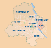
, located in the North West Delhi
district of NCT of Delhi, and forms the border of the Delhi
state with Haryana
. Situated just off the Grand Trunk Road
, its location made it an important market town for the surrounding areas, during 19th century, which it still retains. It was developed as the third mega sub-city project of Delhi Development Authority
(DDA) in the urban extension project of Delhi, after Rohini Sub City
and Dwarka Sub City
.and covering an area of 9866 ha
. The 'Narela Industrial Area', started developing in early 1980s and is today one of the important such complexes in Delhi.
It is one of 12 zones of the Municipal Corporation of Delhi
(MCD) and one the three administrative divisions or subdistricts of the North West Delhi
district, along with Saraswati Vihar
and Model Town.
 Sarai Narela was important sarai
(caravan rest house) on the historic and ever busy Grand Trunk Road
, that stretched all the way to Lahore
and Kabul
and the lifeline of the empire and important trade route. Even in 13th century, during the days of Delhi Sultanate
, Narela often became an encampment point, for marching or retreating armies from Delhi. Subsequently, during the Mughal era
, The Narela Sarai also finds mention in Jahangirnama, the official autobiography of Mughal Emperor, Jahangir
(1569-1609), as he mentions staying at the sarai, during his travels ca. 1605.
There is a famous pond (Talaab) in Narela and it remained full of water all the times. These days it has dried up and has been acquired by the DDA. From this pond some coins of the time of Mohammad Shah Rangila have been found.
On January 16, 1757 in the years preceding the Battle of Panipat (1761), the Maratha Army lead by Antaji Mankeshwar, fought with an advance column of Ahmad Shah Abdali's army near Narela, and repulsed it.
In mid-19th century, Narela was a tehsil
and flourishing market town, and at 31.2 km was the nearest town to capital Delhi, and where people from neighbouring villages flocked to buy provisions and sell their agricultural produce and its Narela Mandi (agricultural market), a tradition which continues to date. By early 20th century, it was a municipal town and a Civil Hospital was established by the District Board in 1913. After the World War I
in 1919, Narela was declared a notified area
by Delhi administration, earmarked for future development.
In 1860-61, the North-Western Provinces
education system was abolished in Delhi, and Punjab education system was introduced with opening of schools at Narela, Najafgarh
, Mehrauli
and their suburbs, several schools were opened here in the coming decades. The Hailey-Rifah-i-Am School was founded here in 1918, by Rifah-i-Am Society formed by local residents under the patronage of Lala Mussadi Lal, a noted social reformer. By 1920-21, the society was running one middle school in Narela and two primary schools in Alipur and Kanjhawala
and supported rural schools in Delhi Province. Swami Omanand Saraswati, a local a zamindar and numberdar of villages, founded of Kanya Gurukul in Narela by donating his 70 acres (280,000 m2) of land at village.
. In 1961, Narela was incorporated into Municipal Corporation of Delhi
zone.
Narela Market was regularized in 1959, under the Bombay Agricultural Produce Marketing Act, 1939 , and in the 1960s, it had a jurisdictional radius of 5 miles, yet produce from at least 40 villages was brought into the market, despite octroi
charges, thus the effective transactional radius was about 15 miles. Thereafter under the Delhi Agricultural Produce Marketing Act, 1976, the first marketing committee of Narela was established by the Administrator of Delhi.
In 1978, Delhi Industrial Development Corporation (DSIDC) started the development of 612 acres of land at Narela for establishing the industrial complex. The first phase saw the development of 1800 plots, the remaining 70 acres is earmarked for the next phase. The Industries Department, Govt. of Delhi in 2005, launched a scheme to convert built up plots of 350 square metres, within the complex from Lease Hold
to Free Hold.
border in the North, Western Yamuna Canal in the West, GT Karnal road in the East and Badli-Auchandi Marg in the South East.
About 1000 ha land already acquired. More than 8000 residential flats of different categories have been constructed. About 1000 flats allotted to Delhi Police. About 900 plots of different sizes have been developed for alternative allotment/auction. Facility sites provided in Sector A7 & A8. IAMR complex of Planning Commission, GOI in 16 acres plot in Sector A7 functional. 200 bedded Raja Harish Chander Govt. Hospital in Sector A7 completed. Recreational club site has been proposed for development in sector A7.
Land allotted for DTC terminal. Land allotted for Fire station. Land for 80 m and 100 m roads from G.T. Karnal road (NH - 1) to Bawana industrial area has been acquired. Land proposed for National Science Park. Land for Integrated Freight Complex has been acquired.
Lok Sabha
constituency, prior to it, Narela remained a 1966-93, a Delhi Metropolitan Council segment, with the same constituency. After the delimitation of 2008, Narela (Nerela) is now an Assembly segment within the North West Delhi
Lok Sabha constituency.Presently Jaswant Singh of Congress I is the incumbent MLA from Narela constituency of Delhi Assembly, after the Delhi state assembly elections, 2008
.
The office of Sub Divisional Magistrate (SDM) (Narela), the head of Narela subdivision of North West Delhi
district, is situated Block Development Officer (BDO) Office complex, at near by Alipur, which is within the subdivision, along with Sub Registrar Office.
Sunrise at 07:12 and Sunset at 17:30. It's light
Latitude. 28.85°, Longitude. 77.1°
(11.5 km) and Rāi (14.8 km)
Narela (NUR) is a station of Indian Railways
. The nearest airport is Indira Gandhi International Airport
(DEL), in Delhi at the distance of 42.2 km, while the Mundka
station of Delhi Metro
rail is the nearest station, though Narela sub city is part of the Delhi Metro's Master Plan Phase IV, currently underway.
, Barwala, Bawana
, Bhorgarh, Budan Pur Bijapur, Daryapur Kalan, Fatehpur Jat, Bajeet Pur Thakran, Garhi Khasro, Gogha, Hamid Pur, Harevli, Hiranki, Holambi Kalan, Holambi Khurd, Ibrahimpur, Iradat Nagar (Naya Bans), Jhangola, Jind Pur, Katewra, Khampur, Khera Khurd
, Kulakpur, Kureni, Lampur, Libas Pur
, Mamur Pur, Mohamad Pur, Ramjan Pur, Mukhmail Pur, Mungesh Pur, Nangal Thakran
, Nangli Poona, Narela, Palla, Pansali, Pehlad Pur Bangar
, Pooth Khurd
, Quadi Pur, Rajapur Kalan, Samai Pur, Sannoth, Shahabad Daulat Pur, Shahpur Garhi, Singhu, Siras Pur
, Sultan Pur Dabas, Sunger Pur Ilaka Shahdara, Sungerpur Ilaka Delhi, Tajpur Kalan, Tehri Daulat Pur, Tiggi Pur, Tikri Khurd.
Tehsil
A Tehsil or Tahsil/Tahasil , also known as Taluk and Mandal, is an administrative division of some country/countries of South Asia....
, located in the North West Delhi
North West Delhi
North West Delhi is an administrative district of the National Capital Territory of Delhi in India.-Geography:North West Delhi is bounded by the Yamuna River on the northeast, and by the districts of North Delhi to the east and southeast, West Delhi to the south, Jhajjar District of Haryana state...
district of NCT of Delhi, and forms the border of the Delhi
Delhi
Delhi , officially National Capital Territory of Delhi , is the largest metropolis by area and the second-largest by population in India, next to Mumbai. It is the eighth largest metropolis in the world by population with 16,753,265 inhabitants in the Territory at the 2011 Census...
state with Haryana
Haryana
Haryana is a state in India. Historically, it has been a part of the Kuru region in North India. The name Haryana is found mentioned in the 12th century AD by the apabhramsha writer Vibudh Shridhar . It is bordered by Punjab and Himachal Pradesh to the north, and by Rajasthan to the west and south...
. Situated just off the Grand Trunk Road
Grand Trunk Road
The Grand Trunk Road also formerly known as Uttarapatha, Shah Rah-e-Azam or Sadak-e-Azam or Badshahi Sadak is one of South Asia's oldest and longest major roads...
, its location made it an important market town for the surrounding areas, during 19th century, which it still retains. It was developed as the third mega sub-city project of Delhi Development Authority
Delhi Development Authority
The Delhi Development Authority was created in 1955 under the provisions of the Delhi Development Act "to promote and secure the development of Delhi".-History:...
(DDA) in the urban extension project of Delhi, after Rohini Sub City
Rohini Sub City
Rohini रोहिणी is a 30-year-old residential sub city in North West Delhi in India. Rohini is second largest sub city in Asia after Dwarka Sub City in South West Delhi. It was the first mega sub-city project of Delhi Development Authority in the urban extension of Delhi, started in 1980s to provide...
and Dwarka Sub City
Dwarka Sub City
Dwarka is a sub city, located in the South West Delhi district of the National Capital Territory of Delhi. It is named after the legendary Dwaraka Kingdom. It is a short distance away from Gurgaon which is a major hub for large corporations in the country and about 10 Kms away from Indira Gandhi...
.and covering an area of 9866 ha
Hectare
The hectare is a metric unit of area defined as 10,000 square metres , and primarily used in the measurement of land. In 1795, when the metric system was introduced, the are was defined as being 100 square metres and the hectare was thus 100 ares or 1/100 km2...
. The 'Narela Industrial Area', started developing in early 1980s and is today one of the important such complexes in Delhi.
It is one of 12 zones of the Municipal Corporation of Delhi
Municipal Corporation of Delhi
The Municipal Corporation of Delhi is a municipal corporation, an autonomous body that governs 9 Districts of Delhi, in the state of Delhi, India. It is one of three municipal corporations in the National Capital Territory of Delhi, the others being New Delhi Municipal Council, and Delhi...
(MCD) and one the three administrative divisions or subdistricts of the North West Delhi
North West Delhi
North West Delhi is an administrative district of the National Capital Territory of Delhi in India.-Geography:North West Delhi is bounded by the Yamuna River on the northeast, and by the districts of North Delhi to the east and southeast, West Delhi to the south, Jhajjar District of Haryana state...
district, along with Saraswati Vihar
Saraswati Vihar
Saraswati Vihar is a posh locality in North West area of New Delhi. It is one the three administrative divisions of the North West Delhi district, along with Narela and Model Town.-Etymology:...
and Model Town.
History
There is a site in Narela Near Bhorgarh which dates back to the civilization of Harappa (Indus Valley Civilization). A Mound has been found with archaeological eveidence of painted gray ware pottery and other things.Sarai
-Places:*Saraj , an historic estate in Resen built by Ahmed Niyazi Bey*Bal-Sarai, a village in Amritsar District of Punjab, India*Sarai , the capital city of the Golden Horde*Saraj municipality, a municipality in Greater Skopje, Republic of Macedonia...
(caravan rest house) on the historic and ever busy Grand Trunk Road
Grand Trunk Road
The Grand Trunk Road also formerly known as Uttarapatha, Shah Rah-e-Azam or Sadak-e-Azam or Badshahi Sadak is one of South Asia's oldest and longest major roads...
, that stretched all the way to Lahore
Lahore
Lahore is the capital of the Pakistani province of Punjab and the second largest city in the country. With a rich and fabulous history dating back to over a thousand years ago, Lahore is no doubt Pakistan's cultural capital. One of the most densely populated cities in the world, Lahore remains a...
and Kabul
Kabul
Kabul , spelt Caubul in some classic literatures, is the capital and largest city of Afghanistan. It is also the capital of the Kabul Province, located in the eastern section of Afghanistan...
and the lifeline of the empire and important trade route. Even in 13th century, during the days of Delhi Sultanate
Delhi Sultanate
The Delhi Sultanate is a term used to cover five short-lived, Delhi based kingdoms or sultanates, of Turkic origin in medieval India. The sultanates ruled from Delhi between 1206 and 1526, when the last was replaced by the Mughal dynasty...
, Narela often became an encampment point, for marching or retreating armies from Delhi. Subsequently, during the Mughal era
Mughal era
The Mughal era is a historic period of the Mughal Empire in South Asia . It ran from the early 15th century to a point in the early 18th century when the Mughal Emperors' power had dwindled...
, The Narela Sarai also finds mention in Jahangirnama, the official autobiography of Mughal Emperor, Jahangir
Jahangir
Jahangir was the ruler of the Mughal Empire from 1605 until his death. The name Jahangir is from Persian جهانگیر,meaning "Conqueror of the World"...
(1569-1609), as he mentions staying at the sarai, during his travels ca. 1605.
There is a famous pond (Talaab) in Narela and it remained full of water all the times. These days it has dried up and has been acquired by the DDA. From this pond some coins of the time of Mohammad Shah Rangila have been found.
On January 16, 1757 in the years preceding the Battle of Panipat (1761), the Maratha Army lead by Antaji Mankeshwar, fought with an advance column of Ahmad Shah Abdali's army near Narela, and repulsed it.
In mid-19th century, Narela was a tehsil
Tehsil
A Tehsil or Tahsil/Tahasil , also known as Taluk and Mandal, is an administrative division of some country/countries of South Asia....
and flourishing market town, and at 31.2 km was the nearest town to capital Delhi, and where people from neighbouring villages flocked to buy provisions and sell their agricultural produce and its Narela Mandi (agricultural market), a tradition which continues to date. By early 20th century, it was a municipal town and a Civil Hospital was established by the District Board in 1913. After the World War I
World War I
World War I , which was predominantly called the World War or the Great War from its occurrence until 1939, and the First World War or World War I thereafter, was a major war centred in Europe that began on 28 July 1914 and lasted until 11 November 1918...
in 1919, Narela was declared a notified area
Notified area
In urban planning, a notified area is any land area earmarked by legal provision for future development. The term is used in the Hindi belt region of North India....
by Delhi administration, earmarked for future development.
In 1860-61, the North-Western Provinces
North-Western Provinces
The North-Western Provinces was an administrative region in British India which succeeded the Ceded and Conquered Provinces and existed in one form or another from 1836 until 1902, when it became the Agra Province within the United Provinces of Agra and Oudh .-Area:The province included all...
education system was abolished in Delhi, and Punjab education system was introduced with opening of schools at Narela, Najafgarh
Najafgarh
Najafgarh is located at the outskirts of the southwestern part of New Delhi, India.It has a mixture of Rural and Urban population from New Delhi and Haryana.-Overview:...
, Mehrauli
Mehrauli
Mehrauli is a neighbourhood in the South West district of Delhi in India. It represents a constituency in the legislative assembly of Delhi. The area is located close to Gurgaon.-History:...
and their suburbs, several schools were opened here in the coming decades. The Hailey-Rifah-i-Am School was founded here in 1918, by Rifah-i-Am Society formed by local residents under the patronage of Lala Mussadi Lal, a noted social reformer. By 1920-21, the society was running one middle school in Narela and two primary schools in Alipur and Kanjhawala
Kanjhawala
Kanjhawala is a census town in North West district in the Indian state of Delhi.-Demographics: India census, Kanjhawala had a population of 8700. Males constitute 54% of the population and females 46%. Kanjhawala has an average literacy rate of 66%, higher than the national average of 59.5%: male...
and supported rural schools in Delhi Province. Swami Omanand Saraswati, a local a zamindar and numberdar of villages, founded of Kanya Gurukul in Narela by donating his 70 acres (280,000 m2) of land at village.
Post-independence
After independence, Narela was still a satellite township of Delhi, separated from the built-up area of the Delhi city by several miles of green area. It functioned under separate local bodies, though soon it was to be part of the Metropolitan District of Delhi. Over the years, its population-density grew rapidly as Delhi saw a large influx of population as the result of partitionPartition of India
The Partition of India was the partition of British India on the basis of religious demographics that led to the creation of the sovereign states of the Dominion of Pakistan and the Union of India on 14 and 15...
. In 1961, Narela was incorporated into Municipal Corporation of Delhi
Municipal Corporation of Delhi
The Municipal Corporation of Delhi is a municipal corporation, an autonomous body that governs 9 Districts of Delhi, in the state of Delhi, India. It is one of three municipal corporations in the National Capital Territory of Delhi, the others being New Delhi Municipal Council, and Delhi...
zone.
Narela Market was regularized in 1959, under the Bombay Agricultural Produce Marketing Act, 1939 , and in the 1960s, it had a jurisdictional radius of 5 miles, yet produce from at least 40 villages was brought into the market, despite octroi
Octroi
Octroi is a local tax collected on various articles brought into a district for consumption.-Antiquity:Octroi taxes have a respectable antiquity, being known in Roman times as vectigalia...
charges, thus the effective transactional radius was about 15 miles. Thereafter under the Delhi Agricultural Produce Marketing Act, 1976, the first marketing committee of Narela was established by the Administrator of Delhi.
In 1978, Delhi Industrial Development Corporation (DSIDC) started the development of 612 acres of land at Narela for establishing the industrial complex. The first phase saw the development of 1800 plots, the remaining 70 acres is earmarked for the next phase. The Industries Department, Govt. of Delhi in 2005, launched a scheme to convert built up plots of 350 square metres, within the complex from Lease Hold
Leasehold estate
A leasehold estate is an ownership of a temporary right to land or property in which a lessee or a tenant holds rights of real property by some form of title from a lessor or landlord....
to Free Hold.
Urban extension project
The project area is bounded by the Delhi-HaryanaHaryana
Haryana is a state in India. Historically, it has been a part of the Kuru region in North India. The name Haryana is found mentioned in the 12th century AD by the apabhramsha writer Vibudh Shridhar . It is bordered by Punjab and Himachal Pradesh to the north, and by Rajasthan to the west and south...
border in the North, Western Yamuna Canal in the West, GT Karnal road in the East and Badli-Auchandi Marg in the South East.
About 1000 ha land already acquired. More than 8000 residential flats of different categories have been constructed. About 1000 flats allotted to Delhi Police. About 900 plots of different sizes have been developed for alternative allotment/auction. Facility sites provided in Sector A7 & A8. IAMR complex of Planning Commission, GOI in 16 acres plot in Sector A7 functional. 200 bedded Raja Harish Chander Govt. Hospital in Sector A7 completed. Recreational club site has been proposed for development in sector A7.
Land allotted for DTC terminal. Land allotted for Fire station. Land for 80 m and 100 m roads from G.T. Karnal road (NH - 1) to Bawana industrial area has been acquired. Land proposed for National Science Park. Land for Integrated Freight Complex has been acquired.
Administration
From 1993-2008, it was Delhi Legislative Assembly segment within the East DelhiEast Delhi (Lok Sabha constituency)
East Delhi Lok Sabha constituency is one of the 7 Lok Sabha constituencies in the Indian National Capital Territory of Delhi. This constituency came into existence in 1966...
Lok Sabha
Lok Sabha
The Lok Sabha or House of the People is the lower house of the Parliament of India. Members of the Lok Sabha are elected by direct election under universal adult suffrage. As of 2009, there have been fifteen Lok Sabhas elected by the people of India...
constituency, prior to it, Narela remained a 1966-93, a Delhi Metropolitan Council segment, with the same constituency. After the delimitation of 2008, Narela (Nerela) is now an Assembly segment within the North West Delhi
North West Delhi (Lok Sabha constituency)
North West Delhi Lok Sabha constituency is one of the 7 Lok Sabha constituencies in the Indian National Capital Territory of Delhi. This constituency came into existence in 2008 as a part of the implementation of the recommendations of the Delimitation Commission of India constituted in 2002...
Lok Sabha constituency.Presently Jaswant Singh of Congress I is the incumbent MLA from Narela constituency of Delhi Assembly, after the Delhi state assembly elections, 2008
Delhi state assembly elections, 2008
The Delhi state assembly elections 2008, which were held in November 2008 for Legislative Assembly of Delhi, led to the formation of Sheila Dixit's government of Indian National Congress.-November '2008:-External links:* *...
.
The office of Sub Divisional Magistrate (SDM) (Narela), the head of Narela subdivision of North West Delhi
North West Delhi
North West Delhi is an administrative district of the National Capital Territory of Delhi in India.-Geography:North West Delhi is bounded by the Yamuna River on the northeast, and by the districts of North Delhi to the east and southeast, West Delhi to the south, Jhajjar District of Haryana state...
district, is situated Block Development Officer (BDO) Office complex, at near by Alipur, which is within the subdivision, along with Sub Registrar Office.
Geography
Timezone in Narela is Asia/CalcuttaSunrise at 07:12 and Sunset at 17:30. It's light
Latitude. 28.85°, Longitude. 77.1°
Demographics
The total population of Narela, as per the 2001 Census is 501511. Of this, 0 are Scheduled Tribes (STs) and 99446 are Scheduled Caste (SC). The sex ratio of the population in Narela is 788 females per 1000 males.The literacy rate in the city is 78.46 per cent, 85.93 for males and 68.88 for females.Accessibility
Its nearby towns are Alipur (9.9 km), Mukmelpur (10 km), BawanaBawana
Bawana is a census town in North West district in the state of Delhi, India.-Overview:Originally a Jat village in North West of Delhi, India.It's a constituency in Delhi vidhan sabha.Since 1993 when Delhi vidhan sabha was re-constituted Bawana constituency has been reserved for SC and since then...
(11.5 km) and Rāi (14.8 km)
Narela (NUR) is a station of Indian Railways
Indian Railways
Indian Railways , abbreviated as IR , is a departmental undertaking of Government of India, which owns and operates most of India's rail transport. It is overseen by the Ministry of Railways of the Government of India....
. The nearest airport is Indira Gandhi International Airport
Indira Gandhi International Airport
Indira Gandhi International Airport is the primary international airport of the National Capital Region of Delhi, India, situated in West Delhi, 16 km southwest of New Delhi city centre. Named after Indira Gandhi, the former Prime Minister of India, it is the busiest airport in India in...
(DEL), in Delhi at the distance of 42.2 km, while the Mundka
Mundka (Delhi Metro)
Mundka is a station on the Green Line of the Delhi Metro. It is an elevated station and was inaugurated on April 2, 2010.It is the terminus of the Green Line. The station is located in the Mundka locality of North West Delhi district, Delhi....
station of Delhi Metro
Delhi Metro
Delhi Metro is a rapid transit system serving Delhi, Gurgaon, Noida and Ghaziabad in the National Capital Region of India. It is one of the largest metro networks in the world. The network consists of six lines with a total length of with 142 stations of which 35 are underground...
rail is the nearest station, though Narela sub city is part of the Delhi Metro's Master Plan Phase IV, currently underway.
Areas in Narela Sub division
Akbarpur Majra, Alipur, Auchandi, Badli, Bajitpur Thakran, Bakhtawar Pur, Bakholi, BanknerBankner
Bankner is a census town in North West district in the state of Delhi, India.-Demographics: India census, Bankner had a population of 21,085. Males constitute 55% of the population and females 45%. Bankner has an average literacy rate of 64%, higher than the national average of 59.5%; with 61% of...
, Barwala, Bawana
Bawana
Bawana is a census town in North West district in the state of Delhi, India.-Overview:Originally a Jat village in North West of Delhi, India.It's a constituency in Delhi vidhan sabha.Since 1993 when Delhi vidhan sabha was re-constituted Bawana constituency has been reserved for SC and since then...
, Bhorgarh, Budan Pur Bijapur, Daryapur Kalan, Fatehpur Jat, Bajeet Pur Thakran, Garhi Khasro, Gogha, Hamid Pur, Harevli, Hiranki, Holambi Kalan, Holambi Khurd, Ibrahimpur, Iradat Nagar (Naya Bans), Jhangola, Jind Pur, Katewra, Khampur, Khera Khurd
Khera Khurd
Khera Khurd is a census town in North West district in the Indian state of Delhi.-Demographics: India census, Khera Khurd had a population of 8813. Males constitute 56% of the population and females 44%. In Khera Khurd, 13% of the population is under 6 years of age.-References:...
, Kulakpur, Kureni, Lampur, Libas Pur
Libas Pur
Libas Pur is a census town in North West district in the Indian state of Delhi.-Demographics: India census, Libas Pur had a population of 27,935. Males constitute 56% of the population and females 44%. Libas Pur has an average literacy rate of 64%, higher than the national average of 59.5%: male...
, Mamur Pur, Mohamad Pur, Ramjan Pur, Mukhmail Pur, Mungesh Pur, Nangal Thakran
Nangal Thakran
Nangal Thakran is a census town in North West district in the Indian state of Delhi.-Demographics: India census, Nangal Thakran had a population of 3558. Males constitute 54% of the population and females 46%. Nangal Thakran has an average literacy rate of 1%, higher than the national average of...
, Nangli Poona, Narela, Palla, Pansali, Pehlad Pur Bangar
Pehlad Pur Bangar
Pehlad Pur Bangar is a census town in North West district in the Indian state of Delhi.-Demographics: India census, Pehlad Pur Bangar had a population of 10,548. Males constitute 56% of the population and females 44%. Pehlad Pur Bangar has an average literacy rate of 69%, higher than the national...
, Pooth Khurd
Pooth Khurd
Pooth Khurd is a census town in North West district in the Indian state of Delhi.It's basically a Jat village in the north-west region of Delhi, dominated by the Dabas gotra....
, Quadi Pur, Rajapur Kalan, Samai Pur, Sannoth, Shahabad Daulat Pur, Shahpur Garhi, Singhu, Siras Pur
Siras Pur
Siras Pur is a census town in North West district in the Indian state of Delhi.-Demographics: India census, Siras Pur had a population of 14,558. Males constitute 56% of the population and females 44%. Siras Pur has an average literacy rate of 65%, higher than the national average of 59.5%: male...
, Sultan Pur Dabas, Sunger Pur Ilaka Shahdara, Sungerpur Ilaka Delhi, Tajpur Kalan, Tehri Daulat Pur, Tiggi Pur, Tikri Khurd.
External links
- Narela subdivision in map of North West Delhi District at Government of DelhiGovernment of DelhiThe Government of Delhi is the supreme governing authority of the Indian national capital territory of Delhi and its 9 districts. It consists of an executive, led by the Lieutenant Governor of Delhi, a judiciary and a legislative...
website - Narela at wikimapiaWikimapiaWikiMapia is a privately owned, online map and satellite imaging resource that combines Google Maps with a wiki system, allowing users to add information, in the form of a note, to any location on Earth. Users may currently use this information for free...