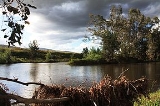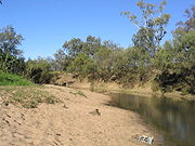
Namoi River
Encyclopedia


Darling River
The Darling River is the third longest river in Australia, measuring from its source in northern New South Wales to its confluence with the Murray River at Wentworth, New South Wales. Including its longest contiguous tributaries it is long, making it the longest river system in Australia.The...
in inland New South Wales
New South Wales
New South Wales is a state of :Australia, located in the east of the country. It is bordered by Queensland, Victoria and South Australia to the north, south and west respectively. To the east, the state is bordered by the Tasman Sea, which forms part of the Pacific Ocean. New South Wales...
, Australia
Australia
Australia , officially the Commonwealth of Australia, is a country in the Southern Hemisphere comprising the mainland of the Australian continent, the island of Tasmania, and numerous smaller islands in the Indian and Pacific Oceans. It is the world's sixth-largest country by total area...
.
Course
The headwaters of the Namoi, including the Macdonald RiverMacdonald River (Bendemeer)
There are two rivers named Macdonald River in New South Wales, Australia. See Macdonald RiverThe Macdonald River in northern New South Wales is the headwater of the Namoi River. It rises east of Niangala on the western slopes of the Great Dividing Range on the Northern Tablelands, New South Wales...
, the Peel River, the Cockburn River
Cockburn River
The Cockburn River is a river in New South Wales, Australia.The Cockburn River rises near Woolbrook, New South Wales in the southern New England tablelands. It drains the western side of the Great Dividing Range...
and the Manilla River
Manilla River
The Manilla River is a tributary of the Namoi River in northern New South Wales, Australia. Despite the name, it is officially classified as a stream by the Geographical Names Board of New South Wales....
, rise on the western slopes of the Great Dividing Range
Great Dividing Range
The Great Dividing Range, or the Eastern Highlands, is Australia's most substantial mountain range and the third longest in the world. The range stretches more than 3,500 km from Dauan Island off the northeastern tip of Queensland, running the entire length of the eastern coastline through...
on the Northern Tablelands, New South Wales
Northern Tablelands, New South Wales
The Northern Tablelands, also known as the New England Tableland, is a plateau and a region of the Great Dividing Range in northern New South Wales, Australia. It includes the New England Range, the narrow highlands area of the New England region, stretching from the Moonbi Range in the south to...
. Other smaller tributaries include Cobrabald River
Cobrabald River
The Cobrabald River is a river on the Northern Tablelands of New South Wales, Australia. The headwaters of the river rise in high country on the western slopes of the Great Dividing Range about 3.2 kilometres south east of Branga Swamp and 50 kilometres south of Walcha.It flows generally north...
, Coxs Creek, Maules Creek, Mooki River
Mooki River
The Mooki River is a river in northern New South Wales, Australia.The Mooki River is the main river of the western half of the Liverpool Plains. Its headwaters rise on the northern slopes of the Liverpool Range and Coolah Tops, and flow northwards....
and Bundock Creek. It rises east of Niangala
Niangala, New South Wales
Niangala is a village located on the south-eastern edge of the Northern Tablelands area of New South Wales, Australia. It is on the Moonbi Range which is part of the Great Dividing Range, at approximately above sea level. The village is in Walcha parish in Parry County...
and flows generally north west after its confluence with its major tributary, the Cobrabald River
Cobrabald River
The Cobrabald River is a river on the Northern Tablelands of New South Wales, Australia. The headwaters of the river rise in high country on the western slopes of the Great Dividing Range about 3.2 kilometres south east of Branga Swamp and 50 kilometres south of Walcha.It flows generally north...
, then passes through the villages of Woolbrook
Woolbrook, New South Wales
Woolbrook is a village in the New England region of New South Wales, Australia. The nearest town, Walcha is 29 km to the east of Woolbrook. At the 2006 census, Woolbrook had a population of 220....
and Bendemeer
Bendemeer, New South Wales
Bendemeer is a village of 485 people on the Macdonald River in the New England region of New South Wales, Australia. It is situated at the junction of the New England and Oxley Highways.- History :...
. It continues to flow westward to where it changes name to the Namoi River at Boundary Creek just east of where the river enters Warrabah National Park
Warrabah National Park
Warrabah is a national park in New South Wales, Australia, 371 km north of Sydney. It is situated west of Kingstown and east of Split Rock Dam....
.
The Namoi flows past Manilla and joins the Manilla River
Manilla River
The Manilla River is a tributary of the Namoi River in northern New South Wales, Australia. Despite the name, it is officially classified as a stream by the Geographical Names Board of New South Wales....
near the town. After passing into Keepit Dam it joins the Peel River
Peel River (New South Wales)
The Peel River is a river in New South Wales, Australia. It is part of the Murray-Darling Basin.The Peel rises on the northern slopes of the Liverpool Range south of the village of Nundle. It flows generally north and west through the foothills of the Great Dividing Range, through Woolomin and...
below before passing by Carroll, then joining the Mooki River
Mooki River
The Mooki River is a river in northern New South Wales, Australia.The Mooki River is the main river of the western half of the Liverpool Plains. Its headwaters rise on the northern slopes of the Liverpool Range and Coolah Tops, and flow northwards....
near Gunnedah on the Liverpool Plains
Liverpool Plains
The Liverpool Plains is a geographical area and Local Government Area in the North West Slopes, New South Wales.The Shire was formed on 17 March 2004 by the amalgamation of Quirindi Shire with parts of three other shires: Parry, Murrurundi and Gunnedah.- Main towns :* Quirindi* Ardglen*...
. From here it flows north-westwards past Boggabri, Narrabri, Wee Waa and Burren Junction
Burren Junction, New South Wales
Burren Junction is a New South Wales village 51 km west of Wee Waa, on the Kamilaroi Highway to Walgett. The name is from the local Aboriginal word for boomerang or 'big creek'...
and eventually joins the Barwon River
Barwon River (New South Wales)
The Barwon River flows through New South Wales, virtually as a continuation of the Macintyre River / Border Rivers system, before joining with the Culgoa River to form the Darling River...
, near the town of Walgett.
History
Allan Cunningham a botanist-explorer, in 1827 became the first white man to explore the Namoi. Cunningham, named this river 'Mitchell' after a surgeon in Sydney who was dismissed from Government Service because he refused to attend the flogging of a convict at Hyde Park barracks. Various meanings of the name have included: the Kamilaroi 'ngamu' for 'breast'; Aboriginal for ‘forked stick’; ‘meeting of the waters’ or Namoi (Nammoy) the native name for a species of acacia.Keepit Dam
Keepit Dam
Keepit Dam is a water storage dam on the Namoi River in New South Wales, Australia. Keepit Dam retains water from the Namoi River 13 kilometres upstream of its junction with the Peel River for flood control and irrigation. It is also used for local recreation, fishing and water skiing...
near Gunnedah is an important dam
Dam
A dam is a barrier that impounds water or underground streams. Dams generally serve the primary purpose of retaining water, while other structures such as floodgates or levees are used to manage or prevent water flow into specific land regions. Hydropower and pumped-storage hydroelectricity are...
for flood control and irrigation. The floodplains of the lower Namoi around Wee Waa are an important area for growing cotton
Cotton
Cotton is a soft, fluffy staple fiber that grows in a boll, or protective capsule, around the seeds of cotton plants of the genus Gossypium. The fiber is almost pure cellulose. The botanical purpose of cotton fiber is to aid in seed dispersal....
which is irrigated using water from the dam.
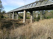
The Namoi River Road Bridge, which was built at Manilla in 1886, has been placed on the Register of the National Estate
Register of the National Estate
The Register of the National Estate is a listing of natural and cultural heritage places in Australia. The listing was initially compiled between 1976 and 2003 by the Australian Heritage Commission. The register is now maintained by the Australian Heritage Council...
. This bridge has eleven metal lattice truss spans and is one of the longest six or seven metal truss bridges completed in Australia by that time.
Fauna
The Namoi supports a wide range of fish and crustaceans, which include Murray codMurray Cod
The Murray cod is a large Australian predatory freshwater fish of the Maccullochella genus and the Percichthyidae family. Although the species is a called cod in the vernacular, it is not related to the northern hemisphere marine cod species...
, yellowbelly
Golden perch
The golden perch, Macquaria ambigua, is an Australian native freshwater fish, primarily of the Murray-Darling river system. It is not a true perch of the genus Perca....
, Silver Perch
Silver Perch
Silver perch is a medium sized freshwater fish endemic to the Murray-Darling river system in south-eastern Australia. The scientific name comes from an aboriginal name for the species recorded by Major Mitchell on his 1832 expedition. It is not a perch, being a grunter in the family Terapontidae...
, catfish
Catfish
Catfishes are a diverse group of ray-finned fish. Named for their prominent barbels, which resemble a cat's whiskers, catfish range in size and behavior from the heaviest and longest, the Mekong giant catfish from Southeast Asia and the second longest, the wels catfish of Eurasia, to detritivores...
(Tandanus tandanus) as well as yabbies (Cherax destructor). "Crawbob" is a regional name and may be called a "yabby
Common yabby
The common yabby, Cherax destructor, is an Australian freshwater crustacean in the Parastacidae family. It is listed as a vulnerable species of crayfish by the World Conservation Union , though the validity of this listing is questionable; wild yabby populations remain strong, and have expanded...
" elsewhere in the state.
Murray cod in the Namoi grow to a very large size, with fish of forty kilograms or larger being not uncommon. European carp and extensive irrigation practices have had adverse impact on the native fish population over the last forty years, and restocking programs have been undertaken, mainly by volunteers, to ensure the survival of the native fish population.
The Namoi River Snapping Turtle
Namoi River Snapping Turtle
The Namoi River snapping turtle or Bell's turtle , is a species of turtle in the Chelidae family.It is endemic to the upper reaches of the Namoi, Gwydir and Macdonald Rivers on the North West Slopes , Australia.-External links:* Tortoise & Freshwater Turtle Specialist Group 1996. . Downloaded...
or Bell's turtle (Elseya belli) is a species of turtle found only in the upper reaches of the Namoi River, Gwydir
Gwydir River
The Gwydir River is a large inland river in the northern part of the Australian state of New South Wales which is part of the Murray-Darling Basin. The river has two main tributaries—the Horton River and the Rocky River...
and Macdonald Rivers
Macdonald River (Bendemeer)
There are two rivers named Macdonald River in New South Wales, Australia. See Macdonald RiverThe Macdonald River in northern New South Wales is the headwater of the Namoi River. It rises east of Niangala on the western slopes of the Great Dividing Range on the Northern Tablelands, New South Wales...
on the North West Slopes of NSW Australia
Australia
Australia , officially the Commonwealth of Australia, is a country in the Southern Hemisphere comprising the mainland of the Australian continent, the island of Tasmania, and numerous smaller islands in the Indian and Pacific Oceans. It is the world's sixth-largest country by total area...
.
The Platypus
Platypus
The platypus is a semi-aquatic mammal endemic to eastern Australia, including Tasmania. Together with the four species of echidna, it is one of the five extant species of monotremes, the only mammals that lay eggs instead of giving birth to live young...
(Ornithorhynchus anatinus) is found in this river and can often be seen around Warrabah National Park, east of Manilla

