

Mungo River, Cameroon
Encyclopedia
The Mungo River is a large river in Cameroon
that drains the mountains in the southern portion of the Cameroon line
of active and extinct volcanoes.
The river is 150 kilometres (93.2 mi) long, rising in the Rumpi Hills
and swelled by tributaries from Mount Kupe and the Bakossi mountains. The river is navigable south of Mundame
for about 100 kilometres (62.1 mi) as it flows through the coastal plain before entering mangrove swamps
, where it splits into numerous small channels that empty into the Cameroon estuary complex
.
The estuary, which is also fed rivers such as the Wouri
and Dibamba
, in turn discharges into the Gulf of Guinea
at Douala Point.
The tidal wave in the bay travels as far as 40 kilometres (24.9 mi) up the river. In this section of the river, large flats and sand banks are exposed at low tide.
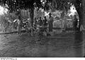
A European visitor said of the lower reaches of the river in 1896: "The banks of the Mungo are magnificently covered with forests ... and everything here teems with life. One can see sea eagles, herons, smakes and monkeys, as well as multicolored parrots on the trees, while on the surface of the water there dance butterflies and dragonflies the size of sparrows. Now and then one hears the trumpeting of elephants, the cry of predators, and the melancholy and monotonous honking of the iguana." He noted that about 35 kilometres (21.7 mi) from the mouth of the river the forest began to be cleared for cultivation of plantains, cocoyams, corn and sugar cane.
 A Swede named Knut Knutson lived for some years in the upper Mungo valley at a time when the Germans were asserting their claim over the area as a colony.
He provides an interesting if somewhat fanciful account of traditions that a "Biaffra" tribe, based on the upper Mungo, once ruled an extensive kingdom stretching as far north as Lake Chad
and south to the Congo River
.
Another early European exploration of the river was undertaken by the Polish explorer Stefan Szolc-Rogozinski
in 1883. He was hoping to establish a free colony for Polish emigrants.
Towards the end of 1884, after the Germans had established a post at Douala
, they ran into trouble with the local Duala
chiefs who were encouraged by the British to resist German attempts to open direct trade with the interior.
The leader on the Mungo river was King Bell
, who maintained a blockade for some months but eventually was forced to yield due to disunity among his people and the power of an armed steamboat.
Later, the Bell's regained control for a while when the Germans turned their attention to the Sanaga River
.
When the German
colony of Kamerun
was partitioned after World War I
, the Mungo River formed part of the boundary between the French
and British
colonies that assumed control.
The border also divided the different peoples of the river valley, including the Bakossi people
, although they continued to maintain close relations across the river.
Downstream, near the coast, the Duala and Mungo people
were similarly divided.
A bridge over the river collapsed in 2004. As of December 2006, work on construction of a replacement bridge was still in progress, and road traffic was meanwhile depending on a floating bridge, or barge.
The ecology of the estuary is under threat from growing pollution from industry, farming and households, threatening both fish yields and human health.
Cameroon
Cameroon, officially the Republic of Cameroon , is a country in west Central Africa. It is bordered by Nigeria to the west; Chad to the northeast; the Central African Republic to the east; and Equatorial Guinea, Gabon, and the Republic of the Congo to the south. Cameroon's coastline lies on the...
that drains the mountains in the southern portion of the Cameroon line
Cameroon line
The Cameroon line is a chain of volcanoes.It includes islands in the Gulf of Guinea and mountains that extend along the border region of eastern Nigeria and western Cameroon, from Mount Cameroon on the Gulf of Guinea north and east towards Lake Chad....
of active and extinct volcanoes.
Course
The Mungo river has a catchment area of 4200 square kilometres (1,621.6 sq mi).The river is 150 kilometres (93.2 mi) long, rising in the Rumpi Hills
Rumpi Hills
The Rumpi Hills in the Southwest Region of Cameroon are about north of Mount Cameroon, and include the Rumpi Hills Wildlife Reserve.The Rumpi Hills cover about in an area of Precambrian metamorphic and intrusive rocks cut by Cainozoic intrusive complexes and widely overlain by volcanoes from the...
and swelled by tributaries from Mount Kupe and the Bakossi mountains. The river is navigable south of Mundame
Mundame
Mundame or Moundamé is a community in Cameroon, in the Southwest Region, about from the Mungo River.The river is navigable south of Mundame for about as it flows through the coastal plain before entering mangrove swamps, where it splits into numerous small channels that empty into the Cameroon...
for about 100 kilometres (62.1 mi) as it flows through the coastal plain before entering mangrove swamps
Central African mangroves
The Central African mangroves ecoregion consists of the largest area of mangrove swamp in Africa, located on the coasts of West Africa, mainly in Nigeria.-Location and description:...
, where it splits into numerous small channels that empty into the Cameroon estuary complex
Wouri estuary
The Wouri estuary, or Cameroon estuary is a large tidal estuary in Cameroon where several rivers come together, emptying into the Bight of Biafra. Douala, the largest city in Cameroon, is at the mouth of the Wouri River where it enters the estuary...
.
The estuary, which is also fed rivers such as the Wouri
Wouri River
The Wouri is a river in Cameroon. The river is formed at the confluence of the rivers Nkam and Makombé, northeast of the city of Yabassi. The Wouri then flows about southeast to the Wouri estuary at Douala, the chief port and industrial city in the southwestern part of Cameroon on the Gulf of...
and Dibamba
Dibamba River
The Dibamba River is in the Littoral Region of southern Cameroon, emptying into the Cameroon estuary near the city of Doula.-Location:The Dibamba river has a length of and a catchment area of...
, in turn discharges into the Gulf of Guinea
Gulf of Guinea
The Gulf of Guinea is the northeasternmost part of the tropical Atlantic Ocean between Cape Lopez in Gabon, north and west to Cape Palmas in Liberia. The intersection of the Equator and Prime Meridian is in the gulf....
at Douala Point.
The tidal wave in the bay travels as far as 40 kilometres (24.9 mi) up the river. In this section of the river, large flats and sand banks are exposed at low tide.
A European visitor said of the lower reaches of the river in 1896: "The banks of the Mungo are magnificently covered with forests ... and everything here teems with life. One can see sea eagles, herons, smakes and monkeys, as well as multicolored parrots on the trees, while on the surface of the water there dance butterflies and dragonflies the size of sparrows. Now and then one hears the trumpeting of elephants, the cry of predators, and the melancholy and monotonous honking of the iguana." He noted that about 35 kilometres (21.7 mi) from the mouth of the river the forest began to be cleared for cultivation of plantains, cocoyams, corn and sugar cane.
History
He provides an interesting if somewhat fanciful account of traditions that a "Biaffra" tribe, based on the upper Mungo, once ruled an extensive kingdom stretching as far north as Lake Chad
Lake Chad
Lake Chad is a historically large, shallow, endorheic lake in Africa, whose size has varied over the centuries. According to the Global Resource Information Database of the United Nations Environment Programme, it shrank as much as 95% from about 1963 to 1998; yet it also states that "the 2007 ...
and south to the Congo River
Congo River
The Congo River is a river in Africa, and is the deepest river in the world, with measured depths in excess of . It is the second largest river in the world by volume of water discharged, though it has only one-fifth the volume of the world's largest river, the Amazon...
.
Another early European exploration of the river was undertaken by the Polish explorer Stefan Szolc-Rogozinski
Stefan Szolc-Rogoziński
Stefan Szolc-Rogoziński was a Polish explorer of Africa. He was planning to create a Polish colony in Cameroon....
in 1883. He was hoping to establish a free colony for Polish emigrants.
Towards the end of 1884, after the Germans had established a post at Douala
Douala
Douala is the largest city in Cameroon and the capital of Cameroon's Littoral Province. Home to Cameroon's largest port and its major international airport, Douala International Airport, it is the commercial capital of the country...
, they ran into trouble with the local Duala
Duala people
The Duala are an ethnic group of Cameroon. They primarily inhabit the littoral region to the coast and form a portion of the Sawa, or Cameroonian coastal peoples...
chiefs who were encouraged by the British to resist German attempts to open direct trade with the interior.
The leader on the Mungo river was King Bell
Ndumbe Lobe Bell
Ndumbé Lobé Bell or King Bell was a leader of the Duala people in Southern Cameroon during the period when the Germans established their colony of Kamerun...
, who maintained a blockade for some months but eventually was forced to yield due to disunity among his people and the power of an armed steamboat.
Later, the Bell's regained control for a while when the Germans turned their attention to the Sanaga River
Sanaga River
The Sanaga River is a river of South Province, Cameroon, Centre Province, Cameroon, and West Province, Cameroon. Its length is 890 kilometers.The Sanaga River forms a boundary between two tropical moist forest ecoregions...
.
When the German
German Empire
The German Empire refers to Germany during the "Second Reich" period from the unification of Germany and proclamation of Wilhelm I as German Emperor on 18 January 1871, to 1918, when it became a federal republic after defeat in World War I and the abdication of the Emperor, Wilhelm II.The German...
colony of Kamerun
Kamerun
German Cameroon was a West African colony of the German Empire from 1884 to 1916 in the region of today's Republic of Cameroon.-History:-1800s:...
was partitioned after World War I
World War I
World War I , which was predominantly called the World War or the Great War from its occurrence until 1939, and the First World War or World War I thereafter, was a major war centred in Europe that began on 28 July 1914 and lasted until 11 November 1918...
, the Mungo River formed part of the boundary between the French
French colonial empire
The French colonial empire was the set of territories outside Europe that were under French rule primarily from the 17th century to the late 1960s. In the 19th and 20th centuries, the colonial empire of France was the second-largest in the world behind the British Empire. The French colonial empire...
and British
British Empire
The British Empire comprised the dominions, colonies, protectorates, mandates and other territories ruled or administered by the United Kingdom. It originated with the overseas colonies and trading posts established by England in the late 16th and early 17th centuries. At its height, it was the...
colonies that assumed control.
The border also divided the different peoples of the river valley, including the Bakossi people
Bakossi people
The Koose people live on the western and eastern slopes of Mount Mwanenguba and Mount Kupe in the Bakossi Mountains of Cameroon...
, although they continued to maintain close relations across the river.
Downstream, near the coast, the Duala and Mungo people
Mungo people
The Mungo is an ethnic group of the Republic of Cameroon. Along with the other coastal peoples, they belong to the Sawa ethnic groups. The Mungo have historically been dominated by the Duala people, and the two groups share similar cultures, histories, and claims of origin.-History and...
were similarly divided.
Recent times
Today, the river forms the boundary between the Littoral and the Southwest regions of Cameroon.A bridge over the river collapsed in 2004. As of December 2006, work on construction of a replacement bridge was still in progress, and road traffic was meanwhile depending on a floating bridge, or barge.
The ecology of the estuary is under threat from growing pollution from industry, farming and households, threatening both fish yields and human health.