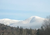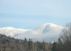
Mount Eisenhower
Encyclopedia

Presidential Range
The Presidential Range is a mountain range located in the White Mountains of the U.S. state of New Hampshire. Containing the highest peaks of the Whites, its most notable summits are named for American Presidents, followed by prominent public figures of the 18th and 19th centuries.Mt...
in the White Mountains
White Mountains (New Hampshire)
The White Mountains are a mountain range covering about a quarter of the state of New Hampshire and a small portion of western Maine in the United States. Part of the Appalachian Mountains, they are considered the most rugged mountains in New England...
of New Hampshire
New Hampshire
New Hampshire is a state in the New England region of the northeastern United States of America. The state was named after the southern English county of Hampshire. It is bordered by Massachusetts to the south, Vermont to the west, Maine and the Atlantic Ocean to the east, and the Canadian...
approximately 4780 ft (1,456.9 m) high. Named after President
President of the United States
The President of the United States of America is the head of state and head of government of the United States. The president leads the executive branch of the federal government and is the commander-in-chief of the United States Armed Forces....
Dwight D. Eisenhower
Dwight D. Eisenhower
Dwight David "Ike" Eisenhower was the 34th President of the United States, from 1953 until 1961. He was a five-star general in the United States Army...
, its summit offers a 360° view of New Hampshire's mountains. It is inaccessible by road.
The Crawford Path, carrying the Appalachian Trail
Appalachian Trail
The Appalachian National Scenic Trail, generally known as the Appalachian Trail or simply the AT, is a marked hiking trail in the eastern United States extending between Springer Mountain in Georgia and Mount Katahdin in Maine. It is approximately long...
, crosses the mountain near its summit. It separates from the summit loop trail at 4400 feet (1,341.1 m), 0.3 mi (0.482802 km) south of the summit, and rejoins it 0.3 mi (0.482802 km) northeast of the summit, having made a net elevation gain of about 40 feet (12.2 m) and reached a maximum on Eisenhower of about 4520 feet (1,377.7 m).
The shortest trail route to the summit of Eisenhower is from a parking lot on Mount Clinton Road, to its westnorthwest
Boxing the compass
Boxing the compass is the action of naming all thirty-two points of the compass in clockwise order. Such names are formed by the initials of the cardinal directions and their intermediate ordinal directions, and are very handy to refer to a heading in a general or colloquial fashion, without...
, via primarily the Edmands Path. Several routes are available from points more or less southwest of it on Route 302
U.S. Route 302
U.S. Route 302 is a spur of U.S. Route 2. It currently runs 171 miles north from Portland, Maine, at U.S. Route 1, to Montpelier, Vermont, at US 2...
; the most used of these (probably roughly equal in popularity to the Edmands route) is via the Crawford Path, starting from a parking lot on Mount Clinton Road, very near 302 and just north of the Highland Center
Highland center
*Highland Center, Indiana*Hollywood and Highland Center*Highland Center serving the High Huts of the White Mountains...
in the Crawford Notch
Crawford Notch
Crawford Notch is the steep and narrow gorge of the Saco River in the White Mountains of New Hampshire, located almost entirely within the town of Hart's Location...
area. Mount Monroe
Mount Monroe
Mount Monroe is the highest peak south of Mount Washington in the Presidential Range of New Hampshire. It is the fourth highest mountain on the 4000 footers list for New Hampshire. The Lakes of the Clouds, and its AMC hut, lie nestled at the col between Mount Monroe and neighboring Mount...
lies on the ridge northeast of Mt. Eisenhower, and Mount Pierce
Mount Pierce
Hills and mountains named Pierce, some of them after Franklin Pierce , 14th president of the United States:* Pierce Pond Mountain, Maine* Pierce Peak * Pierce Peak...
to the southwest. All three of these peaks are included on the peak-bagging list of four-thousand footers
Four-thousand footers
The term Four-Thousand Footers refers to a group of forty-eight mountains in New Hampshire at least 4,000 feet above sea level...
in New Hampshire. Mount Franklin
Mount Franklin (New Hampshire)
Mount Franklin is a mountain located in Coos County, New Hampshire. The mountain is named after Benjamin Franklin, and is part of the Presidential Range of the White Mountains. Note that Ben Franklin was not a president. Mount Franklin is flanked to the northeast by Mount Monroe, and to the...
, an "unofficial" peak (not prominent
Topographic prominence
In topography, prominence, also known as autonomous height, relative height, shoulder drop , or prime factor , categorizes the height of the mountain's or hill's summit by the elevation between it and the lowest contour line encircling it and no higher summit...
enough to be included in the list), lies between Mount Eisenhower and Mount Monroe.

