

Mount Carleton Provincial Park
Encyclopedia
Provincial park
A provincial park is a park under the management of a provincial or territorial government in Canada.While provincial parks are not the same as national parks, their workings are very similar...
in the Province of New Brunswick
New Brunswick
New Brunswick is one of Canada's three Maritime provinces and is the only province in the federation that is constitutionally bilingual . The provincial capital is Fredericton and Saint John is the most populous city. Greater Moncton is the largest Census Metropolitan Area...
, Canada
Canada
Canada is a North American country consisting of ten provinces and three territories. Located in the northern part of the continent, it extends from the Atlantic Ocean in the east to the Pacific Ocean in the west, and northward into the Arctic Ocean...
. Encompassing 174 km² in the remote highlands of north-central New Brunswick
New Brunswick
New Brunswick is one of Canada's three Maritime provinces and is the only province in the federation that is constitutionally bilingual . The provincial capital is Fredericton and Saint John is the most populous city. Greater Moncton is the largest Census Metropolitan Area...
, the park's dominant natural features include the highest peak in the Maritimes
Maritimes
The Maritime provinces, also called the Maritimes or the Canadian Maritimes, is a region of Eastern Canada consisting of three provinces, New Brunswick, Nova Scotia, and Prince Edward Island. On the Atlantic coast, the Maritimes are a subregion of Atlantic Canada, which also includes the...
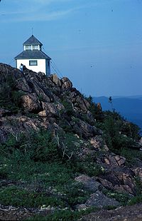
, Mount Carleton
Mount Carleton
Mount Carleton, in Mount Carleton Provincial Park, is the highest elevation in the Canadian province of New Brunswick, and is also the highest peak in the Canadian Maritime Provinces. It is one of the highlights of the Canadian portion of the International Appalachian Trail...
, and several large freshwater lakes (Nictau Lake, Little Nictau Lake, Bathurst Lake, and the Nepisiguit Lakes). Located at the headwaters of the Nepisiguit River
Nepisiguit River
The Nepisiguit River is a major river in New Brunswick, Canada. The source of the river lies north of the Christmas Mountains, in the rugged terrain between Mount Carleton, and Big Bald Mountain . The river enters the sea at the city of Bathurst, New Brunswick, on the Bay of Chaleur...
and the Tobique River
Tobique River
The Tobique River is a river in northwestern New Brunswick, Canada. The river rises from Nictau Lake in Mount Carleton Provincial Park and flows for 148 kilometres to its confluence with the Saint John River near Perth-Andover....
, the lakes offered a convenient portage route between the Nepisiguit and St. John River watersheds. The Canadian portion of the International Appalachian Trail
International Appalachian Trail
The International Appalachian Trail is a hiking trail which runs from the northern terminus of the Appalachian Trail at Mount Katahdin, Maine, through New Brunswick, to the Gaspé Peninsula of Quebec, after which it takes bridge crossings to Nova Scotia and Prince Edward Island, a ferry ride to...
passes through the park.
The mountains in the park are erosional remnants of resistant igneous rocks that remained after an ancient Mesozoic
Mesozoic
The Mesozoic era is an interval of geological time from about 250 million years ago to about 65 million years ago. It is often referred to as the age of reptiles because reptiles, namely dinosaurs, were the dominant terrestrial and marine vertebrates of the time...
peneplain
Peneplain
A peneplain is a low-relief plain representing the final stage of fluvial erosion during times of extended tectonic stability. The existence of peneplains, and peneplanation as a geomorphological process, is not without controversy, due to a lack of contemporary examples and uncertainty in...
surface was uplifted in the Cenozoic
Cenozoic
The Cenozoic era is the current and most recent of the three Phanerozoic geological eras and covers the period from 65.5 mya to the present. The era began in the wake of the Cretaceous–Tertiary extinction event at the end of the Cretaceous that saw the demise of the last non-avian dinosaurs and...
to form a plateau
Plateau
In geology and earth science, a plateau , also called a high plain or tableland, is an area of highland, usually consisting of relatively flat terrain. A highly eroded plateau is called a dissected plateau...
, and subsequently dissected via millions of years of erosion by wind, water and glacial ice.