
Morvern
Encyclopedia
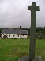
Morvern is a peninsula
in south west Lochaber
, on the west coast of Scotland
. The name is derived from the Gaelic
A' Mhorbhairne (the Sea-Gap). The highest point is the summit of the Corbett
Creach Bheinn
which reaches 2800 feet (853.4 m) in elevation.
Morvern is approximately 250 square miles (647.5 km²) with a current population of about 320.
takes to be from Cineal Bhaodain, that is that lands of the Cenél Báetáin, a division of the Cenél Loairn named after Báetán, a putative great-grandson of Loarn mac Eirc. The Senchus fer n-Alban
states that "Baotan has twenty houses".
The ruined Ardtornish Castle
was in the possession of Somerled
in the 12th century and then the Lords of the Isles, whose ownership was recalled in a poem of the same name by Sir Walter Scott. Kinlochaline Castle
was once the seat of the MacInnes clan. It was largely destroyed by the army of Oliver Cromwell
and restored in 1890.
Before the Highland clearances
the population of Morvern was about 2500.
The history of the parish of Morvern in the nineteenth century has been detailed in Philip Gaskell's Morvern Transformed.
Some residents of St Kilda
were relocated to Lochaline
, the main village of Morvern, when the island was evacuated in 1930.
. Rahoy has a deer farm
supported by Highlands and Islands Enterprise
. The Morvern Community Development Company (MCDC), the local development trust
, was established in 1999. It aims to provide increased employment opportunities, particularly for the young, and to create a wind energy project. In 2010 it was announced that MCDC would receive support for a full-time development worker from Highlands and Islands Enterprise
.
The closure of the silica mine at Lochaline was announced in December 2008, with the loss of 11 jobs.
Ardtornish
, one of the largest estates in the area, received planning permission in 2010 for a new "township" of 20 houses at Achabeag, two miles west of Lochaline.
Peninsula
A peninsula is a piece of land that is bordered by water on three sides but connected to mainland. In many Germanic and Celtic languages and also in Baltic, Slavic and Hungarian, peninsulas are called "half-islands"....
in south west Lochaber
Lochaber
District of Lochaber 1975 to 1996Highland council area shown as one of the council areas of ScotlandLochaber is one of the 16 ward management areas of the Highland Council of Scotland and one of eight former local government districts of the two-tier Highland region...
, on the west coast of Scotland
Scotland
Scotland is a country that is part of the United Kingdom. Occupying the northern third of the island of Great Britain, it shares a border with England to the south and is bounded by the North Sea to the east, the Atlantic Ocean to the north and west, and the North Channel and Irish Sea to the...
. The name is derived from the Gaelic
Scottish Gaelic language
Scottish Gaelic is a Celtic language native to Scotland. A member of the Goidelic branch of the Celtic languages, Scottish Gaelic, like Modern Irish and Manx, developed out of Middle Irish, and thus descends ultimately from Primitive Irish....
A' Mhorbhairne (the Sea-Gap). The highest point is the summit of the Corbett
Hill lists in the British Isles
The mountains and hills of Great Britain, and to a lesser extent Ireland, are the subject of a considerable number of lists that categorise them by height, topographic prominence, or other criteria. They are commonly used as a basis for peak bagging, whereby hillwalkers attempt to reach all the...
Creach Bheinn
Creach Bheinn
Note: There are other mountains in Scotland with the same name. This article is about the most prominent.Creach Bheinn is a prominent mountain in the Ardgour area in the west of Scotland...
which reaches 2800 feet (853.4 m) in elevation.
Morvern is approximately 250 square miles (647.5 km²) with a current population of about 320.
History
Morvern was formerly known as Kinelvadon, which William J. WatsonWilliam J. Watson
Professor William J. Watson was a toponymist, one of the greatest Scottish scholars of the 20th century, and was the first scholar to place the study of Scottish place names on a firm linguistic basis....
takes to be from Cineal Bhaodain, that is that lands of the Cenél Báetáin, a division of the Cenél Loairn named after Báetán, a putative great-grandson of Loarn mac Eirc. The Senchus fer n-Alban
Senchus fer n-Alban
The Senchus Fer n-Alban is an Old Irish medieval text, believed to have been compiled in the 10th century. It may have been derived from earlier documents of the 7th century which are presumed to have been written in Latin...
states that "Baotan has twenty houses".
The ruined Ardtornish Castle
Ardtornish Castle
Ardtornish Castle is situated in the grounds of the Ardtornish estate in Morvern, on the west coast of Scotland. It stands at the seaward end of a promontory which extends in a southerly direction into the Sound of Mull, approximately a mile south-east of the village of Lochaline, Highland...
was in the possession of Somerled
Somerled
Somerled was a military and political leader of the Scottish Isles in the 12th century who was known in Gaelic as rí Innse Gall . His father was Gillebride...
in the 12th century and then the Lords of the Isles, whose ownership was recalled in a poem of the same name by Sir Walter Scott. Kinlochaline Castle
Kinlochaline Castle
Kinlochaline Castle is a 12th century Scottish fortress on the Ardtornish estate in Morvern in the Highland council area. It is also known as Caisteal an Ime because a Lady of Clan MacInnes, Dubh Chal , is said to have paid the builder with butter equal to the volume of the...
was once the seat of the MacInnes clan. It was largely destroyed by the army of Oliver Cromwell
Oliver Cromwell
Oliver Cromwell was an English military and political leader who overthrew the English monarchy and temporarily turned England into a republican Commonwealth, and served as Lord Protector of England, Scotland, and Ireland....
and restored in 1890.
Before the Highland clearances
Highland Clearances
The Highland Clearances were forced displacements of the population of the Scottish Highlands during the 18th and 19th centuries. They led to mass emigration to the sea coast, the Scottish Lowlands, and the North American colonies...
the population of Morvern was about 2500.
The history of the parish of Morvern in the nineteenth century has been detailed in Philip Gaskell's Morvern Transformed.
Some residents of St Kilda
St Kilda, Scotland
St Kilda is an isolated archipelago west-northwest of North Uist in the North Atlantic Ocean. It contains the westernmost islands of the Outer Hebrides of Scotland. The largest island is Hirta, whose sea cliffs are the highest in the United Kingdom and three other islands , were also used for...
were relocated to Lochaline
Lochaline
Lochaline is the main village in Morvern. It is situated at the mouth of Loch Aline, on the northern shore. Lochaline is connected with Fishnish on the Isle of Mull by ferry....
, the main village of Morvern, when the island was evacuated in 1930.
Present day
Ferries depart from Lochaline, at 56°32′12"N 05°46′29"W, to the Isle of MullIsle of Mull
The Isle of Mull or simply Mull is the second largest island of the Inner Hebrides, off the west coast of Scotland in the council area of Argyll and Bute....
. Rahoy has a deer farm
Deer farm
A deer farm is a fenced piece of land suitable for grazing that is populated with deer raised for the purpose of hunting tourism or as livestock. Similar species such as elk, moose and even reindeer may be farmed in this method as well, sometimes on the same land...
supported by Highlands and Islands Enterprise
Highlands and Islands Enterprise
Highlands and Islands Enterprise is the Scottish Government's economic and community development agency for a diverse region which covers more than half of Scotland and is home to around 450,000 people....
. The Morvern Community Development Company (MCDC), the local development trust
Development trust
Development Trusts are organisations which operate in the United Kingdom that are:*community based, owned and led*engaged in the economic, environmental and social regeneration of a defined area or community...
, was established in 1999. It aims to provide increased employment opportunities, particularly for the young, and to create a wind energy project. In 2010 it was announced that MCDC would receive support for a full-time development worker from Highlands and Islands Enterprise
Highlands and Islands Enterprise
Highlands and Islands Enterprise is the Scottish Government's economic and community development agency for a diverse region which covers more than half of Scotland and is home to around 450,000 people....
.
The closure of the silica mine at Lochaline was announced in December 2008, with the loss of 11 jobs.
Ardtornish
Ardtornish
Ardtornish is a Highland estate in Scotland located in, Morven, Lochaber. Ardtornish House is famous for its gardens and the estate is the location of the ruined Ardtornish Castle and the still-inhabited Kinlochaline Castle.-History:...
, one of the largest estates in the area, received planning permission in 2010 for a new "township" of 20 houses at Achabeag, two miles west of Lochaline.