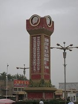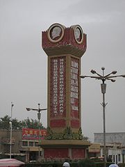
Minfeng
Encyclopedia

Town (China)
When referring to political divisions of China, town is the standard English translation of the Chinese 鎮 . It is a fourth-level administrative unit, i.e...
in Minfeng County
Minfeng County
The Minfeng County is a county within the Xinjiang Uyghur Autonomous Region and is under the administration of the Khotan Prefecture. It contains an area of 56,726 km2. According to the 2002 census, it has a population of 30,000....
, Xinjiang Uygur Autonomous Region
Xinjiang
Xinjiang is an autonomous region of the People's Republic of China. It is the largest Chinese administrative division and spans over 1.6 million km2...
, China.
It is the county seat of Minfeng County
Minfeng County
The Minfeng County is a county within the Xinjiang Uyghur Autonomous Region and is under the administration of the Khotan Prefecture. It contains an area of 56,726 km2. According to the 2002 census, it has a population of 30,000....
, and therefore is commonly referred to as Minfeng, and is labeled so on less detailed maps.
Geography
Niya is located on China National Highway 315China National Highway 315
China National Highway 315 is a highway in China that runs west from Xining, Qinghai towards Kashi, Xinjiang. It is 3063 kilometres in length.- Route and distance:...
, which is the main Ruoqiang
Ruoqiang County
Ruoqiang is a county of the Xinjiang Uyghur Autonomous Region in Western China and is under the administration of the Bayingolin Mongol Autonomous Prefecture...
-Hotan road along the southern edge of the Tarim Basin
Tarim Basin
The Tarim Basin is a large endorheic basin occupying an area of about . It is located in the Xinjiang Uyghur Autonomous Region in China's far west. Its northern boundary is the Tian Shan mountain range and its southern is the Kunlun Mountains on the northern edge of the Tibetan Plateau. The...
.
It is situated 120 km east of Keriya
Keriya
Keriya Town or Mugala Town , is a town in Keriya County, Xinjiang Uygur Autonomous Region, China, on the old Southern Silk Road. As the commercial and administrative centre of Keriya County, it is about 166 km east of Khotan, 80 km east of Qira, and 120 km west of Niya...
, and about 330 km west of Qiemo (Cherchen). Human habitation in the area is possible because of the Niya River, fed by the snows and glaciers of the Kunlun
Kunlun Mountains
The Kunlun Mountains are one of the longest mountain chains in Asia, extending more than 3,000 km. In the broadest sense, it forms the northern edge of the Tibetan Plateau south of the Tarim Basin and the Gansu Corridor and continues east south of the Wei River to end at the North China Plain.The...
.
Niya is a small town of about 10,000 people with a small market, shops, many restaurants, and a hotel.
History
Ancient NiyaNiya (Tarim Basin)
The Ruins of Niya is an archaeological site located about north of modern Minfeng Town on the southern edge of the Tarim Basin in modern-day Xinjiang, China. Numerous ancient archaeological artifacts have been uncovered at the site....
was known as Ronglu 戎盧 during the Han Dynasties (206 BCE - 222 CE) and, according to the Hanshu Chapter 96A, was said to have had "240 households, 610 individuals with 300 persons able to bear arms" during the Former Han Dynasty (206 BCE - 23 CE). It is situated about 115 km north of the modern town of Minfeng. Numerous Buddhist scriptures, sculptures, mummies and other precious archeological finds have been made in the region. The remains of more than seventy buildings have been discovered scattered over an area of some 45 km2. It was located on the southern branch of the Silk Road
Silk Road
The Silk Road or Silk Route refers to a historical network of interlinking trade routes across the Afro-Eurasian landmass that connected East, South, and Western Asia with the Mediterranean and European world, as well as parts of North and East Africa...
.

