
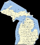
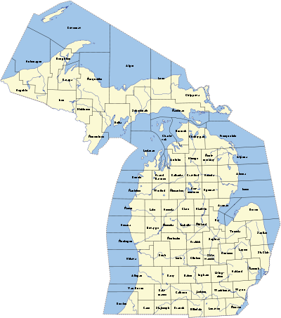
Michigan census statistical areas
Encyclopedia
The United States Census Bureau
has defined 5 Combined Statistical Area
s (CSAs), 15 Metropolitan Statistical Areas (MSAs), and 18 Micropolitan Statistical Areas (μSAs) in the State of Michigan. The following table describes these areas with the following information:
United States Census Bureau
The United States Census Bureau is the government agency that is responsible for the United States Census. It also gathers other national demographic and economic data...
has defined 5 Combined Statistical Area
Combined Statistical Area
The United States Office of Management and Budget defines micropolitan and metropolitan statistical areas. Metropolitan and micropolitan statistical areas consist of one or more counties...
s (CSAs), 15 Metropolitan Statistical Areas (MSAs), and 18 Micropolitan Statistical Areas (μSAs) in the State of Michigan. The following table describes these areas with the following information:
- The name of the Combined Statistical Area (CSA), if any.
- The population of the CSA as of the 2010 United States Census.
- The name of the Core Based Statistical AreaCore based statistical areaA Core Based Statistical Area is a U.S. geographic area defined by the Office of Management and Budget based around an urban center of at least 10,000 people and adjacent areas that are socioeconomically tied to the urban center by commuting. Areas defined on the basis of these standards applied...
(CBSA). - The population of the CBSA as of the 2010 United States Census.
- The name of the countyCounty (United States)In the United States, a county is a geographic subdivision of a state , usually assigned some governmental authority. The term "county" is used in 48 of the 50 states; Louisiana is divided into parishes and Alaska into boroughs. Parishes and boroughs are called "county-equivalents" by the U.S...
. - The population of the county as of the 2010 United States Census.
| Census Statistical Areas | ||
|---|---|---|
 |
 |
 |
| Combined Statistical Area | 2010 Pop | Core Based Statistical Area | 2010 Pop | County | 2010 Pop |
|---|---|---|---|---|---|
| Detroit-Ann Arbor-Flint, MI CSA Metro Detroit The Detroit metropolitan area, often referred to as Metro Detroit, is the metropolitan area located in Southeast Michigan centered on the city of Detroit which shares an international border with Windsor, Ontario. The Detroit metropolitan area is the second largest U.S. metropolitan area... |
5,218,852 | Detroit-Warren-Livonia, MI MSA | 4,296,250 | Wayne County, Michigan Wayne County, Michigan -History:Wayne County was one of the first counties formed when the Northwest Territory was organized. It was named for the American general "Mad Anthony" Wayne. It originally encompassed the entire area of the Lower Peninsula of Michigan, as well as small sections that are now part of northern... |
1,820,584 |
| Oakland County, Michigan Oakland County, Michigan -Demographics:As of the 2010 Census, there were 1,202,362 people, 471,115 households, and 315,175 families residing in the county. The population density as of the 2000 census was 1,369 people per square mile . There were 492,006 housing units at an average density of 564 per square mile... |
1,202,362 | ||||
| Macomb County, Michigan Macomb County, Michigan -Demographics:As of the census of 2000, there were 788,149 people, 309,203 households, and 210,876 families residing in the county. The population density was 1,640 people per square mile . There were 320,276 housing units at an average density of 667 per square mile... |
840,978 | ||||
| Livingston County, Michigan Livingston County, Michigan -Demographics:As of the census of 2000, there were 156,951 people, 55,384 households, and 43,531 families residing in the county. The population density was 276 people per square mile . There were 58,919 housing units at an average density of 104 per square mile... |
180,967 | ||||
| St. Clair County, Michigan St. Clair County, Michigan -Interstates:* I-69 enters the county from the west, coming from Lansing and Flint, terminating at the approach to the Blue Water Bridge in Port Huron.... |
163,040 | ||||
| Lapeer County, Michigan Lapeer County, Michigan -Demographics:As of the census of 2000, there were 87,904 people, 30,729 households, and 23,876 families residing in the county. The population density was 134 people per square mile . There were 32,732 housing units at an average density of 50 per square mile... |
88,319 | ||||
| Flint, MI MSA | 425,790 | Genesee County, Michigan Genesee County, Michigan -Interstates:* I-69* I-75* I-475-Michigan State Trunklines:* M-13* M-15* M-21* M-54* M-57-Demographics:As of the census of 2000, there were 436,141 people, 169,825 households, and 115,990 families residing in the county. The population density was 682 people per square mile . There were 183,630... |
425,790 | ||
| Ann Arbor, MI MSA | 344,791 | Washtenaw County, Michigan Washtenaw County, Michigan Washtenaw County is a county in the U.S. state of Michigan. As of the 2010 census, the population was 344,791. Its county seat is Ann Arbor. The United States Office of Management and Budget defines the county as part of the Detroit–Warren–Flint Combined Statistical Area... |
344,791 | ||
| Monroe, MI MSA | 152,021 | Monroe County, Michigan Monroe County, Michigan Monroe County is a county in the U.S. state of Michigan. According to the U.S. Census Bureau, the 2010 population is 152,021. The largest city and county seat is Monroe. The U.S. Census Bureau defines all of Monroe County as conterminous with the Monroe Metropolitan Area... |
152,021 | ||
| Grand Rapids-Muskegon-Holland, MI CSA Grand Rapids metropolitan area The metropolitan area surrounds the central city of Grand Rapids, Michigan.Frederik Meijer Gardens & Sculpture Park is located in the outskirts of Grand Rapids,the Grand Rapids Art Museum, and the DeVos Place Convention Center both in downtown Grand Rapids.... |
1,321,557 | Grand Rapids-Wyoming, MI MSA | 774,160 | Kent County, Michigan Kent County, Michigan -Air Service:*Commercial air service to Grand Rapids is provided by Gerald R. Ford International Airport . Previously named Kent County International Airport, it holds Grand Rapids' mark in modern history with the United States' first regularly scheduled airline service, beginning July 31, 1926,... |
602,622 |
| Ionia County, Michigan Ionia County, Michigan -Demographics:As of the census of 2000, there were 61,518 people, 20,606 households, and 15,145 families residing in the county. The population density was 107 people per square mile . There were 22,006 housing units at an average density of 38 per square mile... |
63,905 | ||||
| Barry County, Michigan Barry County, Michigan -Highways:* M-37* M-43* M-50* M-66* M-78* M-79* M-89* M-179-Demographics:As of the 2000 census, there were 56,755 people, 21,035 households, and 15,986 families residing in the county. The population density was 102 people per square mile . There were 23,876 housing units at an average density of... |
59,173 | ||||
| Newaygo County, Michigan Newaygo County, Michigan Newaygo County is a county in the U.S. state of Michigan. It is part of the Grand Rapids–Wyoming, MI, Metropolitan Statistical Area. As of the 2010 census, the population was 48,460. The county seat is White Cloud. Newaygo County was either named for an Ojibwe leader who signed the Saginaw... |
48,460 | ||||
| Holland-Grand Haven, MI MSA | 263,801 | Ottawa County, Michigan Ottawa County, Michigan -Demographics:As of the census of 2000, there were 238,314 people, 81,662 households, and 61,328 families residing in the county. The population density was 421 people per square mile . There were 86,856 housing units at an average density of 154 per square mile... |
263,801 | ||
| Muskegon-Norton Shores, MI MSA | 172,188 | Muskegon County, Michigan Muskegon County, Michigan -Demographics:As of the census of 2000, there were 170,200 people, 63,330 households, and 44,267 families residing in the county. The population density was 334 people per square mile . There were 68,556 housing units at an average density of 135 per square mile... |
172,188 | ||
| Allegan, MI μSA | 111,408 | Allegan County, Michigan Allegan County, Michigan -Interstates:* I-196* I-196 Business Loop serves the city of Holland.-US highways:* US-31* US-131-Michigan State Trunklines:* M-40* M-89* M-179* M-222-Allegan County Intercounty Highways:* A-2* A-37* A-42* A-45-Demographics:... |
111,408 | ||
| Lansing-East Lansing-Owosso, MI CSA | 534,684 | Lansing-East Lansing, MI MSA | 464,036 | Ingham County, Michigan Ingham County, Michigan -Demographics:As of the census of 2000, there were 279,320 people, 108,593 households, and 63,744 families residing in the county. The population density was 500 people per square mile . There were 115,056 housing units at an average density of 206 per square mile... |
280,895 |
| Eaton County, Michigan Eaton County, Michigan Eaton County is a county in the U.S. state of Michigan. As of the 2010 census, the population was 107,759. The county seat is Charlotte. Eaton County was named for John Eaton, who was Secretary of War under U.S. President Andrew Jackson, making it one of Michigan's Cabinet counties... |
107,759 | ||||
| Clinton County, Michigan Clinton County, Michigan -Demographics:As of the census of 2000, there were 64,753 people, 23,653 households, and 17,976 families residing in the county. The population density was 113 people per square mile . There were 24,630 housing units at an average density of 43 per square mile... |
75,382 | ||||
| Owosso, MI μSA | 70,648 | Shiawassee County, Michigan Shiawassee County, Michigan -Transportation:-Demographics:As of the census of 2000, there were 71,687 people, 26,896 households, and 19,849 families residing in the county. The population density was 133 people per square mile . There were 29,087 housing units at an average density of 54 per square mile... |
70,648 | ||
| primary census statistical area | 326,589 | Kalamazoo-Portage, MI MSA | 326,589 | Kalamazoo County, Michigan Kalamazoo County, Michigan -Air Service:*The Kalamazoo & Battle Creek Metro Area is served by Kalamazoo/Battle Creek International Airport.-Interstates:* I-94* I-94 Business Loop-US highways:* US-131* BUS US 131-Michigan State Trunklines:* M-43* M-89* M-96... |
250,331 |
| Van Buren County, Michigan Van Buren County, Michigan -Parks, preserves, natural areas:* Dunes Parkway, an 84 acre preserve of dunes in Covert Township* Jeptha Lake Fen Preserve, a 49 acre preserve in Columbia Township... |
76,258 | ||||
| Saginaw-Bay City-Saginaw Township North, MI CSA Saginaw, Michigan Saginaw is a city in the U.S. state of Michigan and the seat of Saginaw County. The city of Saginaw was once a thriving lumber town and manufacturing center. Saginaw and Saginaw County lie in the Flint/Tri-Cities region of Michigan... |
307,940 | Saginaw-Saginaw Township North, MI MSA | 200,169 | Saginaw County, Michigan Saginaw County, Michigan -Demographics:As of the census of 2000, there were 210,039 people, 80,430 households, and 55,818 families residing in the county. The population density was 260 people per square mile . There were 85,505 housing units at an average density of 106 per square mile... |
200,169 |
| Bay City, MI MSA | 107,771 | Bay County, Michigan Bay County, Michigan -Demographics:As of the 2000 census, there were 110,157 people, 43,930 households, and 30,048 families residing in the county. The population density was 248 people per square mile . There were 46,423 housing units at an average density of 104 per square mile... |
107,771 | ||
| primary census statistical area | 160,248 | Jackson, MI MSA | 160,248 | Jackson County, Michigan Jackson County, Michigan As of the census of 2000, there were 158,422 people, 58,168 households, and 40,833 families residing in the county. The population density was 224 people per square mile . There were 62,906 housing units at an average density of 89/sq mi... |
160,248 |
| primary census statistical area | 156,813 | Niles-Benton Harbor, MI MSA | 156,813 | Berrien County, Michigan Berrien County, Michigan Berrien County is a county located in the extreme southwest of the U.S. state of Michigan. It is included in the Niles-Benton Harbor, Michigan Metropolitan Statistical Area. As of the 2010 census, the population was 156,813. The county seat is St. Joseph.... |
156,813 |
| primary census statistical area | 143,372 | Traverse City, MI μSA | 143,372 | Grand Traverse County, Michigan Grand Traverse County, Michigan -Air service:*Grand Traverse County is served by Cherry Capital Airport, which is located near Traverse City.-Demographics:As of the census of 2000, there were 77,654 people, 30,396 households, and 20,730 families residing in the county. The population density was 167 people per square mile . ... |
86,986 |
| Leelanau County, Michigan Leelanau County, Michigan -History:The county's name is said to be a Native American word meaning "delight of life", but it is a neologism made up by Indian agent and ethnographer Henry Schoolcraft, who sometimes gave the name "Leelinau" to Native American women in his tales. He created many faux Indian place names in... |
21,708 | ||||
| Benzie County, Michigan Benzie County, Michigan -Demographics:As of the 2000 census, there were 15,998 people, 6,500 households, and 4,595 families residing in the county. The population density was 50 people per square mile . There were 10,312 housing units at an average density of 32 per square mile... |
17,525 | ||||
| Kalkaska County, Michigan Kalkaska County, Michigan -Demographics:As of the census of 2000, there were 16,571 people, 6,428 households, and 4,634 families residing in the county. The population density was 30 people per square mile . There were 10,822 housing units at an average density of 19 per square mile... |
17,153 | ||||
| primary census statistical area | 136,146 | Battle Creek, MI MSA | 136,146 | Calhoun County, Michigan Calhoun County, Michigan -Interstates:* I-69* I-94* I-194* I-94 Business Loop serves the city of Albion.* I-94 Business Loop serves the city of Battle Creek.* I-94 Business Loop serves the city of Marshall.-Michigan State Trunklines:* M-37* M-60* M-66* M-78* M-89* M-96* M-99... |
136,146 |
| primary census statistical area | 99,892 | Adrian, MI μSA | 99,892 | Lenawee County, Michigan Lenawee County, Michigan -Demographics:As of the census of 2000, there were 98,890 people, 35,930 households, and 26,049 families residing in the county. The population density was 132 people per square mile . There were 39,769 housing units at an average density of 53 per square mile... |
99,892 |
| primary census statistical area | 83,629 | Midland, MI μSA | 83,629 | Midland County, Michigan Midland County, Michigan -Demographics:As of the census of 2000, there were 82,874 people, 31,769 households, and 22,683 families residing in the county. The population density was 159 people per square mile . There were 33,796 housing units at an average density of 65 per square mile... |
83,629 |
| primary census statistical area | 70,311 | Mount Pleasant, MI μSA | 70,311 | Isabella County, Michigan Isabella County, Michigan -Demographics:As of the census of 2000, there were 63,351 people, 22,425 households, and 13,006 families residing in the county. The population density was 110 people per square mile . There were 24,528 housing units at an average density of 43 per square mile... |
70,311 |
| primary census statistical area | 67,077 | Marquette, MI μSA | 67,077 | Marquette County, Michigan Marquette County, Michigan -National protected areas:* Hiawatha National Forest * Huron National Wildlife Refuge* Ottawa National Forest -University:Northern Michigan University is a four-year university, established in 1899, located in Marquette, Michigan, on Michigan's Upper Peninsula... |
67,077 |
| primary census statistical area | 61,295 | Sturgis, MI μSA | 61,295 | St. Joseph County, Michigan St. Joseph County, Michigan -Demographics:As of the census of 2000, there were 62,422 people, 23,381 households, and 16,600 families residing in the county. The population density was 124 people per square mile . There were 26,503 housing units at an average density of 53 per square mile... |
61,295 |
| South Bend-Elkhart-Mishawaka, IN-MI CSA | 563,834 |
South Bend-Mishawaka, IN-MI MSA | 319,224 |
St. Joseph County, Indiana St. Joseph County, Indiana As of the census of 2000, there were 265,559 people, 100,743 households, and 66,792 families residing in the county. The population density was 581 people per square mile . There were 107,013 housing units at an average density of 234 per square mile... |
266,931 |
| Cass County, Michigan Cass County, Michigan Cass County is a county in the U.S. state of Michigan. As of the 2000 census, the population was 51,104. It is part of the South Bend–Mishawaka, IN-MI, Metropolitan Statistical Area which has a total population of 316,663 and is sometimes considered part of Greater Michiana... |
52,293 | ||||
| Elkhart-Goshen, IN MSA | 197,559 | Elkhart County, Indiana Elkhart County, Indiana Elkhart County is a county in the U.S. state of Indiana. Much of the county is in the Elkhart-Goshen Metropolitan Statistical Area, which in turn is part of the South Bend-Elkhart-Mishawaka Combined Statistical Area... |
197,559 | ||
| Plymouth, IN μSA | 47,051 | Marshall County, Indiana Marshall County, Indiana As of the census of 2000, there were 45,128 people, 16,519 households, and 12,191 families residing in the county. The population density was 102 people per square mile . There were 18,099 housing units at an average density of 41 per square mile... |
47,051 | ||
| primary census statistical area | 47,584 | Cadillac, MI μSA | 47,584 | Wexford County, Michigan Wexford County, Michigan -Tourism:There are many attractions and hot spots in Wexford county to check out. The Manistee National Forest is a great recreation site. The Manistee River is great for fisherman, kayakers and canoers, and other outdoor lovers.-Demographics:... |
32,735 |
| Missaukee County, Michigan Missaukee County, Michigan -Demographics:As of the census of 2000, there were 14,478 people, 5,450 households, and 4,043 families residing in the county. The population density was 26 people per square mile . There were 8,621 housing units at an average density of 15 per square mile... |
14,849 | ||||
| primary census statistical area | 45,248 | Coldwater, MI μSA | 45,248 | Branch County, Michigan Branch County, Michigan -Demographics:As of the 2000 census, there were 45,787 people, 16,349 households, and 11,575 families residing in the county. The population density was 90 people per square mile . There were 19,822 housing units at an average density of 39 per square mile... |
45,248 |
| primary census statistical area | 42,798 | Big Rapids, MI μSA | 42,798 | Mecosta County, Michigan Mecosta County, Michigan Mecosta County is a county in the U.S. state of Michigan. The county is named after Chief Mecosta, the leader of the Potawatomi Native American tribe that once traveled the local waterways in search of fish and game. Chief Mecosta was one of the signers the Treaty of Washington in 1836. The easily... |
42,798 |
| primary census statistical area | 42,476 | Alma, MI μSA | 42,476 | Gratiot County, Michigan Gratiot County, Michigan -US Highways:* US-127 routes north to I-75 and south to Lansing.* BUS US-127 is a loop route through downtown Alma.* BUS US-127 is a loop route through downtown Ithaca.* BUS US-127 is a loop route through downtown St. Louis.... |
42,476 |
| primary census statistical area | 38,784 | Houghton, MI μSA | 38,784 | Houghton County, Michigan Houghton County, Michigan -National protected areas:* Keweenaw National Historical Park * Ottawa National Forest -Demographics:As of the census of 2000, there were 36,016 people, 13,793 households, and 8,137 families residing in the county. The population density was 36 people per square mile . There were 17,748 housing... |
36,628 |
| Keweenaw County, Michigan Keweenaw County, Michigan -Demographics:As of the census of 2000, there were 2,301 people, 998 households, and 604 families residing in the county. The population density was 4 people per square mile . There were 2,327 housing units at an average density of 4 per square mile... |
2,156 | ||||
| primary census statistical area | 38,520 | Sault Ste. Marie, MI μSA | 38,520 | Chippewa County, Michigan Chippewa County, Michigan -National protected areas:* Harbor Island National Wildlife Refuge* Hiawatha National Forest * Whitefish Point Unit of the Seney National Wildlife Refuge-Demographics:... |
38,520 |
| primary census statistical area | 37,069 | Escanaba, MI μSA | 37,069 | Delta County, Michigan Delta County, Michigan -Demographics:As of the census of 2000, there were 38,520 people, 15,836 households, and 10,689 families residing in the county. The population density was 33 people per square mile . There were 19,223 housing units at an average density of 16 per square mile... |
37,069 |
| primary census statistical area | 29,598 | Alpena, MI μSA | 29,598 | Alpena County, Michigan Alpena County, Michigan Alpena County is a county in the U.S. state of Michigan. As of the 2010 census, the population was 29,598. The county seat is Alpena. It is considered to be part of Northern Michigan.It was founded originally in 1840 as Anomickee County... |
29,598 |
| primary census statistical area | 30,591 |
Iron Mountain, MI-WI μSA | 30,591 |
Dickinson County, Michigan Dickinson County, Michigan -Demographics:As of the census of 2000, there were 27,472 people, 11,386 households, and 7,583 families residing in the county. The population density was 36 people per square mile . There were 13,702 housing units at an average density of 18 per square mile... |
26,168 |
| Florence County, Wisconsin Florence County, Wisconsin Florence County is a county located in the U.S. state of Wisconsin. As of 2000, the population was 5,088. Its county seat is Florence.Florence County is part of the Iron Mountain, MI–WI Micropolitan Statistical Area.-Geography:According to the U.S... |
4,423 | ||||
| primary census statistical area | 65,778 |
Marinette, WI-MI μSA | 65,778 |
Marinette County, Wisconsin Marinette County, Wisconsin Marinette County is a county located in the U.S. state of Wisconsin. As of 2000, the population was 43,384. Its county seat is Marinette.Marinette County is part of the Marinette, WI–MI Micropolitan Statistical Area.-Geography:According to the U.S... |
41,749 |
| Menominee County, Michigan Menominee County, Michigan -Demographics:As of the census of 2000, there were 25,326 people, 10,529 households, and 7,001 families residing in the county. The population density was 24 people per square mile . There were 13,639 housing units at an average density of 13 per square mile... |
24,029 | ||||
| none | Montcalm County, Michigan Montcalm County, Michigan -Michigan State Highways:* M-46* M-57* M-66* M-82* M-91-Demographics:As of the census of 2000, there were 61,266 people, 22,079 households, and 16,183 families residing in the county. The population density was 86 people per square mile . There were 25,900 housing units at an average density... |
63,342 | |||
| Tuscola County, Michigan Tuscola County, Michigan -Highways:* M-15* M-24* M-25* M-46* M-81* M-138-Demographics:As of the census of 2000, there were 58,266 people, 21,454 households, and 15,983 families residing in the county. The population density was 72 people per square mile . There were 23,378 housing units at an average density of 29 per... |
55,729 | ||||
| Hillsdale County, Michigan Hillsdale County, Michigan -Demographics:As of the census of 2000, there were 46,527 people, 17,335 households, and 12,550 families residing in the county. The population density was 78 people per square mile . There were 20,189 housing units at an average density of 34 per square mile... |
46,688 | ||||
| Sanilac County, Michigan Sanilac County, Michigan -Highways:* M-19* M-25* M-46* M-53* M-81* M-90-History:Sanilac County was probably named for a Wyandot chief named Sanilac. See List of Michigan county name etymologies.... |
43,114 | ||||
| Huron County, Michigan Huron County, Michigan -Highways:* M-19* M-25* M-53* M-142-Demographics:As of the census of 2000, there were 36,079 people, 14,597 households, and 10,144 families residing in the county. The population density was 43 people per square mile . There were 20,430 housing units at an average density of 24 per square mile... |
33,118 | ||||
| Emmet County, Michigan Emmet County, Michigan Emmet County is a county in the U.S. state of Michigan. As of the 2000 census, the population was 31,437. The county seat is Petoskey.The county was formed April 1, 1840, from Mackinac County. It was first named Tonedagana County and renamed Emmet County on March 8, 1843... |
32,694 | ||||
| Clare County, Michigan Clare County, Michigan - Demographics :As of the census of 2000, there were 31,252 people, 12,686 households, and 8,753 families residing in the county. The population density was 55 people per square mile . There were 22,229 housing units at an average density of 39 per square mile... |
30,926 | ||||
| Mason County, Michigan Mason County, Michigan Mason County is a county in the U.S. state of Michigan. As of the 2010 census, the population was 28,705. The county seat is Ludington.-History:... |
28,705 | ||||
| Oceana County, Michigan Oceana County, Michigan -US highways:* US-31* US 31 Business Route is a spur serving downtown Hart.* US 31 Business Route loops through downtown Pentwater, returning to mainline US-31 at both ends.-Michigan State Trunklines:* M-20* M-120-Intercounty Highways:*B-15... |
26,570 | ||||
| Cheboygan County, Michigan Cheboygan County, Michigan -Commercial Airline:There are no commercial airline airports in Cheboygan County but the nearest ones are Alpena County Regional Airport, Chippewa County International Airport , and Cherry Capital Airport... |
26,152 | ||||
| Charlevoix County, Michigan Charlevoix County, Michigan -Airports:*Beaver Island is served by two airlines:**Welke Airport**Beaver Island Airport-Ferry service:*Beaver Island Boat Company maintains a regular auto ferry from Charlevoix:*The Ironton Ferry at Ironton, Michigan crosses the south arm of Lake Charlevoix... |
25,949 | ||||
| Iosco County, Michigan Iosco County, Michigan -Demographics:As of the census of 2000, there were 27,339 people, 11,727 households, and 7,857 families residing in the county. The population density was 50 people per square mile . There were 20,432 housing units at an average density of 37 per square mile... |
25,887 | ||||
| Gladwin County, Michigan Gladwin County, Michigan -Demographics:As of the census of 2000, there were 26,023 people, 10,561 households, and 7,614 families residing in the county. The population density was 51 people per square mile . There were 16,828 housing units at an average density of 33 per square mile... |
25,692 | ||||
| Manistee County, Michigan Manistee County, Michigan -Demographics:As of the census of 2000, there were 24,527 people, 9,860 households, and 6,714 families residing in the county. The population density was 45 people per square mile . There were 14,272 housing units at an average density of 26 per square mile... |
24,733 | ||||
| Roscommon County, Michigan Roscommon County, Michigan -Local attractions and activities:The community is centered in the area of two very large lakes, in the middle of large state forests. Wildlife are nearby, including bear, deer, eagles, Kirtland's Warblers, and turkeys. Local attractions and activities include:... |
24,449 | ||||
| Otsego County, Michigan Otsego County, Michigan -Demographics:As of the census of 2000, there were 23,301 people, 8,995 households, and 6,539 families residing in the county. The population density was 45 people per square mile . There were 13,375 housing units at an average density of 26 per square mile... |
24,164 | ||||
| Antrim County, Michigan Antrim County, Michigan -History:Antrim County was formed in 1863. In 1950 its population was 10,721. The county seat was originally located in Elk Rapids, but was moved to Bellaire in 1904 after 25 years of litigation.-Demographics:... |
23,580 | ||||
| Osceola County, Michigan Osceola County, Michigan -Demographics:As of the census of 2000, there were 23,197 people, 8,861 households, and 6,415 families residing in the county. The population density was 41 people per square mile . There were 12,853 housing units at an average density of 23 per square mile... |
23,528 | ||||
| Ogemaw County, Michigan Ogemaw County, Michigan -Demographics:As of the census of 2000, there were 21,645 people, 8,842 households, and 6,189 families residing in the county. The population density was 38 people per square mile . There were 15,404 housing units at an average density of 27 per square mile... |
21,699 | ||||
| Gogebic County, Michigan Gogebic County, Michigan -Demographics:As of the census of 2000, there were 17,370 people, 7,425 households, and 4,581 families residing in the county. The population density was 16 people per square mile . There were 10,839 housing units at an average density of 10 per square mile... |
16,427 | ||||
| Arenac County, Michigan Arenac County, Michigan -Demographics:As of the 2000 census, there were 17,269 people, 6,710 households, and 4,717 families residing in the county. The population density was 47 people per square mile . There were 9,563 housing units at an average density of 26 per square mile... |
15,899 | ||||
| Crawford County, Michigan Crawford County, Michigan See also: List of counties bordering eight counties-Demographics:As of the census of 2000, there were 14,273 people, 5,625 households, and 4,038 families residing in the county. The population density was 26 people per square mile . There were 10,042 housing units at an average density of 18 per... |
14,074 | ||||
| Presque Isle County, Michigan Presque Isle County, Michigan Presque Isle County is a county in the U.S. state of Michigan. As of the 2000 census, the population was 14,411. The county seat is Rogers City.... |
13,376 | ||||
| Iron County, Michigan Iron County, Michigan -Demographics:As of the census of 2000, there were 13,138 people, 5,748 households, and 3,615 families residing in the county. The population density was 11 people per square mile . There were 8,772 housing units at an average density of 8 per square mile... |
11,817 | ||||
| Lake County, Michigan Lake County, Michigan -Highways:* US 10* M-37-Demographics:As of the census of 2000, there were 11,333 people, 4,704 households, and 3,052 families residing in the county. The population density was 20 people per square mile . There were 13,498 housing units at an average density of 24 per square mile... |
11,539 | ||||
| Mackinac County, Michigan Mackinac County, Michigan -Local Airports:*Mackinac County Airport *Mackinac Island Airport -Airline service:The nearest airports with scheduled passenger service are:*Chippewa County International Airport in Sault Ste... |
11,113 | ||||
| Alcona County, Michigan Alcona County, Michigan Alcona County is a county of the U.S. state of Michigan. As of the 2000 census, the population is 11,719. Its county seat is Harrisville. Alphabetically it is the first county in Michigan, as its flag states "First of the 83".-History:... |
10,942 | ||||
| Montmorency County, Michigan Montmorency County, Michigan -Michigan State trunklines:* M-32* M-33-Michigan State trunkline business loops:* Business M-32 is short, disconnected route in the village of Hillman.-Montmorency County intercounty highways:* F-01* F-21-Demographics:... |
9,765 | ||||
| Alger County, Michigan Alger County, Michigan Alger County is a county in the U.S. state of Michigan. As of the 2010 census, the population was 9,601. Its county seat is Munising. The Pictured Rocks National Lakeshore is located within the county.-History:... |
9,601 | ||||
| Baraga County, Michigan Baraga County, Michigan -National protected areas:* Keweenaw National Historical Park * Ottawa National Forest -Demographics:As of the 2000 census, there were 8,746 people, 3,353 households, and 2,223 families residing in the county. The population density was 10 people per square mile . There were 4,631 housing units... |
8,860 | ||||
| Oscoda County, Michigan Oscoda County, Michigan See also: List of counties bordering eight counties-Demographics:As of the census of 2000, there were 9,418 people, 3,921 households, and 2,717 families residing in the county. The population density was 17 people per square mile . There were 8,690 housing units at an average density of 15 per... |
8,640 | ||||
| Schoolcraft County, Michigan Schoolcraft County, Michigan -National protected areas:* Hiawatha National Forest * Seney National Wildlife Refuge-Demographics:As of the census of 2000, there were 8,903 people, 3,606 households, and 2,498 families residing in the county. The population density was 8 people per square mile . There were 5,700 housing units... |
8,485 | ||||
| Ontonagon County, Michigan Ontonagon County, Michigan -National protected areas:* Keweenaw National Historical Park * Ottawa National Forest -Demographics:As of the census of 2000, there were 7,818 people, 3,456 households, and 2,225 families residing in the county. The population density was 6 people per square mile . There were 5,404 housing units... |
6,780 | ||||
| Luce County, Michigan Luce County, Michigan -Government:The county government operates the jail, maintains rural roads, operates themajor local courts, keeps files of deeds and mortgages, maintains vital records, administers... |
6,631 | ||||
See also
- State of Michigan
- Demographics of Michigan
- Geography of MichiganGeography of MichiganMichigan consists of two peninsulas that lie between 82°30' to about 90°30' west longitude, and are separated by the Straits of Mackinac, and some nearby islands...
- List of Michigan-related topics
- United StatesUnited StatesThe United States of America is a federal constitutional republic comprising fifty states and a federal district...
- United States Census BureauUnited States Census BureauThe United States Census Bureau is the government agency that is responsible for the United States Census. It also gathers other national demographic and economic data...
- Table of United States Combined Statistical AreasTable of United States Combined Statistical Areasthumb|An enlargeable map of the 125 [[Combined Statistical Area]]s of the [[United States]]The United States Office of Management and Budget has defined 125 Combined Statistical Areas for the United States of America...
(CSA) - Table of United States Core Based Statistical Areas (CBSA)
- Table of United States Metropolitan Statistical AreasTable of United States Metropolitan Statistical Areasthumb|An enlargeable map of the 942 [[Core Based Statistical Area]]s of the [[United States]]. The 367 [[Metropolitan Statistical Area]]s are shown in red....
(MSA) - Table of United States Micropolitan Statistical AreasTable of United States Micropolitan Statistical Areasthumb|An enlargeable map of the 942 [[Core Based Statistical Area]]s of the [[United States]]. The 576 [[Micropolitan Statistical Area]]s are shown in blue....
(μSA) - Table of United States primary census statistical areas (PCSA)
- Table of United States Combined Statistical Areas
- United States Census Bureau