

Michigan Heritage Route
Encyclopedia
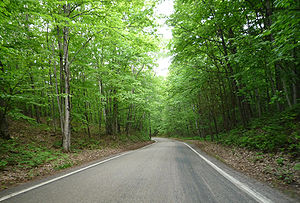
Michigan Heritage Route is a designation for roads in Michigan
. The designation was created by the state legislature in 1993.
The program emphasizes cooperation among local residents, government officials, landowners and interested groups to preserve unique scenic, historic or recreational highways.
Michigan
Michigan is a U.S. state located in the Great Lakes Region of the United States of America. The name Michigan is the French form of the Ojibwa word mishigamaa, meaning "large water" or "large lake"....
. The designation was created by the state legislature in 1993.
The program emphasizes cooperation among local residents, government officials, landowners and interested groups to preserve unique scenic, historic or recreational highways.
Scenic Heritage Routes
- M-119M-119 (Michigan highway)The current highway was designated in 1979, replacing the former route of M-131; the routing has remained unchanged since. This section of highway had been part of M-13 on July 1, 1919, when the state trunkline highway system debuted...
along the Lake MichiganLake MichiganLake Michigan is one of the five Great Lakes of North America and the only one located entirely within the United States. It is the second largest of the Great Lakes by volume and the third largest by surface area, after Lake Superior and Lake Huron...
shore on northwest edge of the Lower PeninsulaLower Peninsula of MichiganThe Lower Peninsula of Michigan is the southern of the two major landmasses of the U.S. state of Michigan. It is surrounded by water on all sides except its southern border, which it shares with Ohio and Indiana. Geographically, the Lower Peninsula has a recognizable shape that many people...
. - US 41U.S. Route 41 in MichiganUS Highway 41 is a part of the United States Numbered Highway System that runs from Miami, Florida, to the Upper Peninsula of the US state of Michigan. In Michigan, it is a state trunkline highway that enters the state via the Interstate Bridge between Marinette, Wisconsin, and Menominee,...
in the Keweenaw region of the northwestern Upper PeninsulaUpper Peninsula of MichiganThe Upper Peninsula of Michigan is the northern of the two major land masses that make up the U.S. state of Michigan. It is commonly referred to as the Upper Peninsula, the U.P., or Upper Michigan. It is also known as the land "above the Bridge" linking the two peninsulas. The peninsula is bounded...
. - M-123M-123 (Michigan highway)M-123 is a state trunkline highway in the eastern Upper Peninsula of the U.S. state of Michigan. It is one of only a few highways in Michigan that curve around and form a U-shape. In fact, M-123 has three intersections with only two state trunklines. It meets M-28 twice as a result of its U-shaped...
in the eastern counties of the Upper Peninsula. - M-22M-22 (Michigan highway)M-22 is a state trunkline highway in the US state of Michigan. It is long and follows the Lake Michigan shoreline of the Leelanau Peninsula, making up a portion of the Lake Michigan Circle Tour. It also passes through the Sleeping Bear Dunes National Lakeshore...
along the Lake Michigan shore in the northwest of the Lower Peninsula. - M-37M-37 (Michigan highway)M-37 is a north–south state trunkline highway in the US state of Michigan. The southern terminus is near the border between Kalamazoo and Calhoun counties at exit 92 of Interstate 94 southwest of Battle Creek. The northern terminus is at the Mission Point Light on Old Mission Point in Grand...
along the Old Mission Peninsula north of Traverse CityTraverse City, MichiganTraverse City is a city in the U.S. state of Michigan. It is the county seat of Grand Traverse County, although a small portion extends into Leelanau County. It is the largest city in the 21-county Northern Michigan region. The population was 14,674 at the 2010 census, with 143,372 in the Traverse...
.
Historic Heritage Routes
- M-125M-125 (Michigan highway)M-125 Connector is a connector route running through Erie. It connects I-75 with M-125. It is a four lane divided highway for its entire length, named "Summit Street" in Erie. It is known internally to the Michigan Department of Transportation as "Connector 2"...
through MonroeMonroe, MichiganMonroe is a city in the U.S. state of Michigan. The population was 20,733 at the 2010 census. It is the largest city and county seat of Monroe County. The city is bordered on the south by Monroe Charter Township, but both are politically independent. The city is located approximately 14 miles ...
in the southeast of the Lower Peninsula. - M-25M-25 (Michigan highway)M-25 is a state trunkline highway in the US state of Michigan. The route follows an arc-like shape closely along the Lake Huron shore of the Thumb in the eastern Lower Peninsula between Port Huron and Bay City. It serves the lakeshore resorts along Lake Huron and Saginaw Bay and generally lies...
through Bay CityBay City, MichiganBay City is a city in the U.S. state of Michigan located near the base of the Saginaw Bay on Lake Huron. As of the 2010 census, the city's population was 34,932, and is the principal city of the Bay City Metropolitan Statistical Area, which is included in the Saginaw-Bay City-Saginaw Township North...
. - US 2U.S. Route 2 in MichiganUS Highway 2 is a component of the United States Numbered Highway System that connects Everett, Washington, to the Upper Peninsula of the US state of Michigan, with a separate segment that runs from Rouses Point, New York, to Houlton, Maine...
in Iron CountyIron County, Michigan-Demographics:As of the census of 2000, there were 13,138 people, 5,748 households, and 3,615 families residing in the county. The population density was 11 people per square mile . There were 8,772 housing units at an average density of 8 per square mile...
in the western of the Upper Peninsula. - Marshall Territorial Road (Interstate 94Interstate 94Interstate 94 is the northernmost east–west Interstate Highway, connecting the Great Lakes and Intermountain regions of the United States. I-94's western terminus is in Billings, Montana at a junction with Interstate 90; its eastern terminus is the U.S...
Business Loop) through MarshallMarshall, MichiganMarshall is a city located in the U.S. state of Michigan. It is part of the Battle Creek, Michigan Metropolitan Statistical Area. As of the 2000 census, the city population was 7,459. It is the county seat of Calhoun County...
. - US 12U.S. Route 12 in MichiganUS Highway 12 is a US Highway that runs from Aberdeen, Washington to Detroit, Michigan. In the US state of Michigan it runs for . Previous to the creation of Interstate Highways in Michigan, US 12 ran along Michigan Avenue between Kalamazoo and Detroit, a highway corridor now served by I-94...
from New BuffaloNew Buffalo, MichiganNew Buffalo is a city in Berrien County in the U.S. state of Michigan. The population was 2,200 at the 2000 census. This city is within New Buffalo Township, but is politically autonomous.-Geography:...
to DetroitDetroit, MichiganDetroit is the major city among the primary cultural, financial, and transportation centers in the Metro Detroit area, a region of 5.2 million people. As the seat of Wayne County, the city of Detroit is the largest city in the U.S. state of Michigan and serves as a major port on the Detroit River...
, which includes the following segments previously designated:- US 12 (Michigan Avenue) through SalineSaline, MichiganSaline is a city in Washtenaw County in the U.S. state of Michigan. As of the 2010 census, the city population was 8,810.The city is popular for its annual Celtic Festival, which attracts people from all over the United States and its sister cities Brecon, Wales and Lindenberg, Germany...
. - US 12 in ClintonClinton, Lenawee County, MichiganClinton is a village in Lenawee County in the Irish Hills area of the U.S. state of Michigan. The population was 2,336 at the 2010 census. The village is located within Clinton Township....
and Clinton TownshipClinton Township, Lenawee County, MichiganClinton Township is a civil township of Lenawee County in the U.S. state of Michigan. The population was 3,624 at the 2000 census. The village of Clinton is located within the township....
in Lenawee CountyLenawee County, Michigan-Demographics:As of the census of 2000, there were 98,890 people, 35,930 households, and 26,049 families residing in the county. The population density was 132 people per square mile . There were 39,769 housing units at an average density of 53 per square mile...
.
- US 12 (Michigan Avenue) through Saline
Recreation Heritage Routes
- M-15M-15 (Michigan highway)M-15 is a north–south state trunkline highway in the US state of Michigan. The southern terminus is a junction with US Highway 24 just south of Clarkston on the northwestern edge of the Detroit metropolitan area. The trunkline is a recreational route running north and northwest to the...
from OrtonvilleOrtonville, MichiganOrtonville is a village in north Oakland County in the U.S. state of Michigan. The village is within Brandon Township, although some development near the village lies within adjacent Groveland Township...
in Oakland CountyOakland County, Michigan-Demographics:As of the 2010 Census, there were 1,202,362 people, 471,115 households, and 315,175 families residing in the county. The population density as of the 2000 census was 1,369 people per square mile . There were 492,006 housing units at an average density of 564 per square mile...
north to Bay CityBay City, MichiganBay City is a city in the U.S. state of Michigan located near the base of the Saginaw Bay on Lake Huron. As of the 2010 census, the city's population was 34,932, and is the principal city of the Bay City Metropolitan Statistical Area, which is included in the Saginaw-Bay City-Saginaw Township North...
. - M-179M-179 (Michigan highway)M-179 is a state trunkline highway in the western potion of the US state of Michigan. It runs from US Highway 131 at exit 61 outside of Bradley to M-43 just west of Hastings in the Lower Peninsula. The highway crosses through forest land and provides access to state recreational areas...
(Chief Noonday Trail) from HastingsHastings, MichiganHastings is a city in the U.S. state of Michigan, the county seat of Barry County as well as the county's only city. The population was 7,095 at the 2000 census. The city borders Hastings Charter Township on the north, east, and south, and Rutland Charter Township on the west...
in Barry CountyBarry County, Michigan-Highways:* M-37* M-43* M-50* M-66* M-78* M-79* M-89* M-179-Demographics:As of the 2000 census, there were 56,755 people, 21,035 households, and 15,986 families residing in the county. The population density was 102 people per square mile . There were 23,876 housing units at an average density of...
to Bradley in Allegan CountyAllegan County, Michigan-Interstates:* I-196* I-196 Business Loop serves the city of Holland.-US highways:* US-31* US-131-Michigan State Trunklines:* M-40* M-89* M-179* M-222-Allegan County Intercounty Highways:* A-2* A-37* A-42* A-45-Demographics:...
. - M-1M-1 (Michigan highway)M-1, commonly known as Woodward Avenue, named for Augustus B. Woodward, is a north–south state trunkline in the US state of Michigan. Until a few years ago, the northern terminus of M-1 was at BL I-75 and BUS US 24 in Bloomfield Township between the city limits of Bloomfield Hills and...
(Woodward Avenue) from downtown DetroitDetroit, MichiganDetroit is the major city among the primary cultural, financial, and transportation centers in the Metro Detroit area, a region of 5.2 million people. As the seat of Wayne County, the city of Detroit is the largest city in the U.S. state of Michigan and serves as a major port on the Detroit River...
north to downtown PontiacPontiac, MichiganPontiac is a city in the U.S. state of Michigan named after the Ottawa Chief Pontiac, located within the Detroit metropolitan area. As of the 2010 census, the city had a total population of 59,515. It is the county seat of Oakland County...
. - I-69Interstate 69 in MichiganInterstate 69 is a part of the Interstate Highway System that currently runs from Indianapolis, Indiana, to the US–Canadian border at Port Huron, Michigan. In Michigan, it is a state trunkline highway that enters the state south of Coldwater and passes through the cities of Lansing and Flint...
from the IndianaIndianaIndiana is a US state, admitted to the United States as the 19th on December 11, 1816. It is located in the Midwestern United States and Great Lakes Region. With 6,483,802 residents, the state is ranked 15th in population and 16th in population density. Indiana is ranked 38th in land area and is...
state line to the CalhounCalhoun County, Michigan-Interstates:* I-69* I-94* I-194* I-94 Business Loop serves the city of Albion.* I-94 Business Loop serves the city of Battle Creek.* I-94 Business Loop serves the city of Marshall.-Michigan State Trunklines:* M-37* M-60* M-66* M-78* M-89* M-96* M-99...
-EatonEaton County, MichiganEaton County is a county in the U.S. state of Michigan. As of the 2010 census, the population was 107,759. The county seat is Charlotte. Eaton County was named for John Eaton, who was Secretary of War under U.S. President Andrew Jackson, making it one of Michigan's Cabinet counties...
county line. - US 23U.S. Route 23 in MichiganUS Highway 23 is a United States Numbered Highway that runs from Jacksonville, Florida to Mackinaw City, Michigan. In the US state of Michigan, it is a major north–south state trunkline highway that runs through the Lower Peninsula...
from StandishStandish, MichiganStandish is a city in the U.S. state of Michigan. As of the 2000 census, the city population was 1,581. It is the county seat of Arenac County.The town was platted by John D. Standish in 1871...
to Mackinaw CityMackinaw City, MichiganMackinaw City is a village in Emmet and Cheboygan counties in the U.S. state of Michigan. At the 2000 census the population was 859. The name "Mackinaw City" is a bit of a misnomer as it is actually a village...
. - M-35M-35 (Michigan highway)M-35 is a state trunkline highway in the Upper Peninsula of the US state of Michigan. Running for in a general north–south direction, it connects the cities of Menominee, Escanaba and Negaunee. The southern section of M-35 in Menominee and Delta counties carries two additional designations...
from GladstoneGladstone, MichiganGladstone is a city in Delta County in the U.S. state of Michigan. First settled in 1877, Gladstone's original name was Saunders Point. The population was 5,032 at the 2000 census....
in Delta CountyDelta County, Michigan-Demographics:As of the census of 2000, there were 38,520 people, 15,836 households, and 10,689 families residing in the county. The population density was 33 people per square mile . There were 19,223 housing units at an average density of 16 per square mile...
south to MenomineeMenominee, MichiganMenominee is a city in the Upper Peninsula of the U.S. state of Michigan. As of the 2000 census, the city population was 9,131. It is the county seat of Menominee County. Menominee is the fourth-largest city in the Upper Peninsula, behind Marquette, Sault Ste. Marie, and Escanaba...
.