
Ortonville, Michigan
Encyclopedia
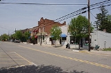
Ortonville is a village in north Oakland County
in the U.S. state
of Michigan
. The village is within Brandon Township
, although some development near the village lies within adjacent Groveland Township
. The population was 1,442 at the 2010 census.
and Flint
.
According to the census
of 2010 the population of the village of Ortonville is 1,422. The population of Brandon Township is 15,175, and nearby Groveland Township is 5,476.
Surrounding towns include Goodrich
to the north, Oxford
to the east, Clarkston
to the south, and Holly
to the west.
. Students are mostly Brandon and Groveland Township
residents with a few from surrounding areas of northern Clarkston and eastern Oxford. Brandon High School is the home of the Blackhawks. The athletic teams compete in the Flint Metro League
.
The schools in the district are:
of 2000, there were 1,535 people, 537 households, and 400 families residing in the village. The population density
was 1,546.2 per square mile (598.7/km²). There were 572 housing units at an average density of 576.2 per square mile (223.1/km²). The racial makeup of the village was 98.24% White, 0.07% African American, 0.46% Native American, 0.39% Asian, 0.46% from other races
, and 0.39% from two or more races. Hispanic or Latino of any race were 1.69% of the population.
There were 537 households out of which 45.8% had children under the age of 18 living with them, 56.2% were married couples
living together, 14.7% had a female householder with no husband present, and 25.5% were non-families. 22.5% of all households were made up of individuals and 7.4% had someone living alone who was 65 years of age or older. The average household size was 2.81 and the average family size was 3.29.
In the village the population was spread out with 32.4% under the age of 18, 7.3% from 18 to 24, 35.5% from 25 to 44, 17.5% from 45 to 64, and 7.3% who were 65 years of age or older. The median age was 33 years. For every 100 females there were 93.6 males. For every 100 females age 18 and over, there were 87.0 males.
The median income for a household in the village was $60,972, and the median income for a family was $72,443. Males had a median income of $59,083 versus $31,250 for females. The per capita income
for the village was $24,110. About 3.3% of families and 4.8% of the population were below the poverty line, including 4.0% of those under age 18 and 5.2% of those age 65 or over.
Oakland County, Michigan
-Demographics:As of the 2010 Census, there were 1,202,362 people, 471,115 households, and 315,175 families residing in the county. The population density as of the 2000 census was 1,369 people per square mile . There were 492,006 housing units at an average density of 564 per square mile...
in the U.S. state
U.S. state
A U.S. state is any one of the 50 federated states of the United States of America that share sovereignty with the federal government. Because of this shared sovereignty, an American is a citizen both of the federal entity and of his or her state of domicile. Four states use the official title of...
of Michigan
Michigan
Michigan is a U.S. state located in the Great Lakes Region of the United States of America. The name Michigan is the French form of the Ojibwa word mishigamaa, meaning "large water" or "large lake"....
. The village is within Brandon Township
Brandon Township, Michigan
Brandon Charter Township is a charter township of Oakland County in the U.S. state of Michigan. The village of Ortonville is within the township, although some development near the village lies within adjacent Groveland Township. The population was 15,175 at the 2010 census.-Geography:According...
, although some development near the village lies within adjacent Groveland Township
Groveland Township, Michigan
Groveland Township is a civil township of Oakland County in the U.S. state of Michigan. The population was 5,476 at the 2010 census.- Communities :...
. The population was 1,442 at the 2010 census.
Overview
Ortonville, a northern rural village in Oakland County, was founded in 1848 by Amos Orton, who built a dam across Kearsley Creek to furnish water power for his sawmill. The town was platted in 1866 and incorporated as a village in 1902. It is located about halfway between PontiacPontiac, Michigan
Pontiac is a city in the U.S. state of Michigan named after the Ottawa Chief Pontiac, located within the Detroit metropolitan area. As of the 2010 census, the city had a total population of 59,515. It is the county seat of Oakland County...
and Flint
Flint, Michigan
Flint is a city in the U.S. state of Michigan and is located along the Flint River, northwest of Detroit. The U.S. Census Bureau reports the 2010 population to be placed at 102,434, making Flint the seventh largest city in Michigan. It is the county seat of Genesee County which lies in the...
.
According to the census
Census
A census is the procedure of systematically acquiring and recording information about the members of a given population. It is a regularly occurring and official count of a particular population. The term is used mostly in connection with national population and housing censuses; other common...
of 2010 the population of the village of Ortonville is 1,422. The population of Brandon Township is 15,175, and nearby Groveland Township is 5,476.
Surrounding towns include Goodrich
Goodrich, Michigan
Goodrich is a village in Genesee County in the U.S. state of Michigan. The population was 1,353 at the 2000 census. The village is a suburb of Flint located within Atlas Township.-Geography:...
to the north, Oxford
Oxford, Michigan
Oxford is a village in Oakland County in the U.S. state of Michigan. The population was 3,436 at the 2010 census. The village is located within Oxford Charter Township. The village occupies one square mile and is both politically and geographically a part of the township. The village calls itself...
to the east, Clarkston
Clarkston, Michigan
Clarkston, known officially by the name City of the Village of Clarkston, is a small city located within Independence Charter Township in Oakland County in the U.S. state of Michigan. The population was 882 at the 2010 census.-Overview:...
to the south, and Holly
Holly, Michigan
Holly is a village in north Oakland County in the U.S. state of Michigan. The population was 6,086 at the 2010 census. The village is located within Holly Township. It is about south of Flint and northwest of Detroit.- Demographics :...
to the west.
Public school system
Ortonville's primary public schools are Brandon Schools, in Brandon TownshipBrandon Township, Michigan
Brandon Charter Township is a charter township of Oakland County in the U.S. state of Michigan. The village of Ortonville is within the township, although some development near the village lies within adjacent Groveland Township. The population was 15,175 at the 2010 census.-Geography:According...
. Students are mostly Brandon and Groveland Township
Groveland Township, Michigan
Groveland Township is a civil township of Oakland County in the U.S. state of Michigan. The population was 5,476 at the 2010 census.- Communities :...
residents with a few from surrounding areas of northern Clarkston and eastern Oxford. Brandon High School is the home of the Blackhawks. The athletic teams compete in the Flint Metro League
Flint Metro League
Flint Metro League is a high school sports league in the Flint area of Michigan. It is currently composed of ten high schools.-History:In 1968, six Flint area schools formed a new league to play against schools of similar size and to cut down on travel for some schools...
.
The schools in the district are:
- Brandon High School (grades 9–12)
- Brandon Middle School (grades 7 & 8)
- Brandon Fletcher Intermediate School (grades 5 & 6)
- Oakwood Elementary (grades K–4)
- Harvey Swanson Elementary (grades K–4)
- Belle Ann Elementary (grades K–4)
- H.T. Burt Lifelong Learning Center
- Brandon Alternative High School
Demographics
As of the censusCensus
A census is the procedure of systematically acquiring and recording information about the members of a given population. It is a regularly occurring and official count of a particular population. The term is used mostly in connection with national population and housing censuses; other common...
of 2000, there were 1,535 people, 537 households, and 400 families residing in the village. The population density
Population density
Population density is a measurement of population per unit area or unit volume. It is frequently applied to living organisms, and particularly to humans...
was 1,546.2 per square mile (598.7/km²). There were 572 housing units at an average density of 576.2 per square mile (223.1/km²). The racial makeup of the village was 98.24% White, 0.07% African American, 0.46% Native American, 0.39% Asian, 0.46% from other races
Race (United States Census)
Race and ethnicity in the United States Census, as defined by the Federal Office of Management and Budget and the United States Census Bureau, are self-identification data items in which residents choose the race or races with which they most closely identify, and indicate whether or not they are...
, and 0.39% from two or more races. Hispanic or Latino of any race were 1.69% of the population.
There were 537 households out of which 45.8% had children under the age of 18 living with them, 56.2% were married couples
Marriage
Marriage is a social union or legal contract between people that creates kinship. It is an institution in which interpersonal relationships, usually intimate and sexual, are acknowledged in a variety of ways, depending on the culture or subculture in which it is found...
living together, 14.7% had a female householder with no husband present, and 25.5% were non-families. 22.5% of all households were made up of individuals and 7.4% had someone living alone who was 65 years of age or older. The average household size was 2.81 and the average family size was 3.29.
In the village the population was spread out with 32.4% under the age of 18, 7.3% from 18 to 24, 35.5% from 25 to 44, 17.5% from 45 to 64, and 7.3% who were 65 years of age or older. The median age was 33 years. For every 100 females there were 93.6 males. For every 100 females age 18 and over, there were 87.0 males.
The median income for a household in the village was $60,972, and the median income for a family was $72,443. Males had a median income of $59,083 versus $31,250 for females. The per capita income
Per capita income
Per capita income or income per person is a measure of mean income within an economic aggregate, such as a country or city. It is calculated by taking a measure of all sources of income in the aggregate and dividing it by the total population...
for the village was $24,110. About 3.3% of families and 4.8% of the population were below the poverty line, including 4.0% of those under age 18 and 5.2% of those age 65 or over.