
Maryland Route 298
Encyclopedia
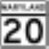
Maryland Route 298 is a state highway
in the U.S. state
of Maryland
. The state highway runs 20.14 miles (32.4 km) from MD 20
in Fairlee
east to MD 291
near Chesterville
. MD 298 is a C-shaped highway that connects Fairlee, MD 213
, and Millington
with several villages in central Kent County
, including Worton
, Lynch
, and Still Pond
. The state highway also provides a bypass of Chestertown
between the western and eastern parts of the county. MD 298 was built from Fairlee to MD 292
near Still Pond around 1930. The highway was extended eastward to MD 566
east of Still Pond in the mid 1950s, to MD 213 in the early 1960s, and to MD 291 in the late 1980s.
(Melitota Road). The state highway crosses a tributary of Mills Branch and passes through Hanesville, where the highway intersects Hanesville Road and its name changes to Lambs Meadow Road. MD 298 curves to the east and passes through the community of Butlertown just north of Worton, where the highway intersects MD 297
(Worton Road) and passes Kent County High School.
MD 298 continues northeast through farmland, passing just to the north of Lynch, where the highway meets the northern end of MD 561
(Hassengers Corner Road) and encounters a loop of old alignment, MD 864 (Old Lynch Road). The state highway bypasses the village of Still Pond, intersecting MD 292 (Still Pond Road) to the south and MD 566 (Stillpond Harmony Road) to the east. MD 298 continues east to an intersection with MD 213 (Augustine Herman Highway) northeast of Kennedyville
. The state highway continues southeast as Browntown Road, crossing the Chestertown Branch of the Northern Line of the Maryland and Delaware Railroad
. At Morgnec Road west of Chesterville, MD 298 turns east onto Old Morgnec Road and then south onto Cherry Lane. The state highway reaches its eastern terminus at MD 291 (River Road) southwest of Chesterville.
.
{|class=wikitable
!Location
!Mile
!Intersection
!Notes
|-
|rowspan=2|Fairlee
|0.00
|
|Western terminus
|-
|0.40
|Old Fairlee Road
|Old alignment of MD 20
|-
|Melitota
|3.66
|
|
|-
|Worton
|7.39
|
|
|-
|rowspan=3|Lynch
|9.43
|
|
|-
|9.45
|
|rowspan=2|MD 856 is unsigned; old alignment of MD 298
|-
|9.53
|
|-
|rowspan=2|Still Pond
|10.99
|
|
|-
|12.31
|
|
|-
|
|14.91
|
|
|-
|rowspan=3|Chesterville
|18.58
|Morgnec Road west
|rowspan=2|Former MD 447
|-
|18.95
|Morgnec Road east
|-
|20.14
|
|Eastern terminus
State highway
State highway, state road or state route can refer to one of three related concepts, two of them related to a state or provincial government in a country that is divided into states or provinces :#A...
in the U.S. state
U.S. state
A U.S. state is any one of the 50 federated states of the United States of America that share sovereignty with the federal government. Because of this shared sovereignty, an American is a citizen both of the federal entity and of his or her state of domicile. Four states use the official title of...
of Maryland
Maryland
Maryland is a U.S. state located in the Mid Atlantic region of the United States, bordering Virginia, West Virginia, and the District of Columbia to its south and west; Pennsylvania to its north; and Delaware to its east...
. The state highway runs 20.14 miles (32.4 km) from MD 20
Maryland Route 20
Maryland Route 20 is a state highway in the U.S. state of Maryland. The state highway runs from Beach Road and Lawton Avenue in Rock Hall east to MD 291 in Chestertown. MD 20, which connects Chestertown with several villages in western Kent County, was designated one of the original state roads...
in Fairlee
Fairlee, Maryland
Fairlee, Maryland is an unincorporated community in Kent County, Maryland, United States.-References:...
east to MD 291
Maryland Route 291
Maryland Route 291 is a state highway in the U.S. state of Maryland. The state highway runs from MD 20 in Chestertown east to the Delaware state line east of Millington, where the highway continues east as Delaware Route 6...
near Chesterville
Chesterville, Maryland
Chesterville is an unincorporated community in Kent County, Maryland, United States.-References:...
. MD 298 is a C-shaped highway that connects Fairlee, MD 213
Maryland Route 213
Maryland Route 213 is a state highway located on the Eastern Shore of Maryland in the United States. The route runs from Maryland Route 662 in Wye Mills, Queen Anne's County north to the Pennsylvania border in Cecil County, where it continues into that state as Pennsylvania Route 841...
, and Millington
Millington, Maryland
Millington is a town in Kent and Queen Anne's counties in the U.S. state of Maryland. The population was 416 at the 2000 census.-Geography:Millington is located at ....
with several villages in central Kent County
Kent County, Maryland
Kent County is a county located in the U.S. state of Maryland, on its Eastern Shore. It was named for the county of Kent in England. Its county seat is Chestertown. In 2010, the county population was 20,197...
, including Worton
Worton, Maryland
Worton is an unincorporated community in Kent County, Maryland, United States.-References:...
, Lynch
Lynch, Maryland
Lynch is an unincorporated community in Kent County, Maryland, United States.-References:...
, and Still Pond
Still Pond, Maryland
Still Pond is an unincorporated community in Kent County, Maryland, United States. Much of the community is included in the Still Pond Historic District and it is notable as the first place in Maryland that women gained the right to vote.-Notable residents:...
. The state highway also provides a bypass of Chestertown
Chestertown, Maryland
Chestertown is a town in Kent County, Maryland, United States. The population was 4,746 at the 2000 census. It is the county seat of Kent County. The ZIP code is 21620 and the area codes are 410 and 443...
between the western and eastern parts of the county. MD 298 was built from Fairlee to MD 292
Maryland Route 292
Maryland Route 292 is a state highway in the U.S. state of Maryland. The state highway runs from MD 298 near Still Pond north to Betterton, which is located where the Sassafras River flows into the Chesapeake Bay in northern Kent County. MD 292 was constructed between MD 213 and Betterton in...
near Still Pond around 1930. The highway was extended eastward to MD 566
Maryland Route 566
Maryland Route 566 is a state highway in the U.S. state of Maryland. Known as Stillpond Harmony Road, the state highway runs from MD 292 in Still Pond east to MD 298 near Still Pond in northern Kent County. MD 566 was constructed from Still Pond east to MD 298's intersection with MD 213 in the...
east of Still Pond in the mid 1950s, to MD 213 in the early 1960s, and to MD 291 in the late 1980s.
Route description
MD 298 begins at an oblique intersection with MD 20 (Rock Hall Road) just south of the village of Fairlee. The state highway heads north as Fairlee Road, a two-lane highway that passes through the village, intersecting Old Fairlee Road, the old alignment of MD 20. MD 298 heads northeast through a mix of farmland and forest to the hamlet of Melitota, where the highway meets the northern end of MD 514Maryland Route 514
Maryland Route 514 is a state highway in the U.S. state of Maryland. The state highway runs from MD 20 in Chestertown north to MD 298 in Melitota...
(Melitota Road). The state highway crosses a tributary of Mills Branch and passes through Hanesville, where the highway intersects Hanesville Road and its name changes to Lambs Meadow Road. MD 298 curves to the east and passes through the community of Butlertown just north of Worton, where the highway intersects MD 297
Maryland Route 297
Maryland Route 297 is a state highway in the U.S. state of Maryland. Known as Worton Road, the state highway runs from MD 213 in Chestertown north to MD 298 in Worton in central Kent County. MD 297 was constructed in the late 1920s...
(Worton Road) and passes Kent County High School.
MD 298 continues northeast through farmland, passing just to the north of Lynch, where the highway meets the northern end of MD 561
Maryland Route 561
Maryland Route 561 is a state highway in the U.S. state of Maryland. Known as Hassengers Corner Road, the state highway runs from MD 213 at Hassengers Corner north to MD 298 in Lynch in central Kent County...
(Hassengers Corner Road) and encounters a loop of old alignment, MD 864 (Old Lynch Road). The state highway bypasses the village of Still Pond, intersecting MD 292 (Still Pond Road) to the south and MD 566 (Stillpond Harmony Road) to the east. MD 298 continues east to an intersection with MD 213 (Augustine Herman Highway) northeast of Kennedyville
Kennedyville, Maryland
Kennedyville is an unincorporated community in Kent County, Maryland, United States.-References:...
. The state highway continues southeast as Browntown Road, crossing the Chestertown Branch of the Northern Line of the Maryland and Delaware Railroad
Maryland and Delaware Railroad
The Maryland and Delaware Railroad Company is a Class III short-line railroad, formed in 1977 to operate several branch lines of the former Penn Central Railroad in both Maryland and Delaware. These branches were omitted from the system plan for Conrail in 1976 and would have been discontinued...
. At Morgnec Road west of Chesterville, MD 298 turns east onto Old Morgnec Road and then south onto Cherry Lane. The state highway reaches its eastern terminus at MD 291 (River Road) southwest of Chesterville.
History
MD 298 was paved in 1929 and 1930 from MD 20 in Fairlee to MD 292 south of Still Pond. The next segment of modern MD 298 to be constructed was from the present intersection with MD 566 near Still Pond to U.S. Route 213 (now MD 213). That segment was constructed as part of MD 566 around 1946. The section between MD 292 and MD 566 was constructed starting in 1952; MD 298 was extended east to MD 566 in 1956. MD 298 assumed the portion of MD 566 east to US 213 in 1963. MD 298 was extended on its western end to its present intersection with MD 20 when MD 20 bypassed Fairlee in 1956. The final extension of MD 298 occurred around 1989 when the highway was extended south from MD 213 over Browntown Road, Old Morgnec Road, and Cherry Lane to MD 291.Junction list
The entire route is in Kent CountyKent County, Maryland
Kent County is a county located in the U.S. state of Maryland, on its Eastern Shore. It was named for the county of Kent in England. Its county seat is Chestertown. In 2010, the county population was 20,197...
.
{|class=wikitable
!Location
!Mile
!Intersection
!Notes
|-
|rowspan=2|Fairlee
Fairlee, Maryland
Fairlee, Maryland is an unincorporated community in Kent County, Maryland, United States.-References:...
|0.00
|
|Western terminus
|-
|0.40
|Old Fairlee Road
|Old alignment of MD 20
|-
|Melitota
|3.66
|
|
|-
|Worton
Worton, Maryland
Worton is an unincorporated community in Kent County, Maryland, United States.-References:...
|7.39
|
|
|-
|rowspan=3|Lynch
Lynch, Maryland
Lynch is an unincorporated community in Kent County, Maryland, United States.-References:...
|9.43
|
|
|-
|9.45
|
|rowspan=2|MD 856 is unsigned; old alignment of MD 298
|-
|9.53
|
|-
|rowspan=2|Still Pond
Still Pond, Maryland
Still Pond is an unincorporated community in Kent County, Maryland, United States. Much of the community is included in the Still Pond Historic District and it is notable as the first place in Maryland that women gained the right to vote.-Notable residents:...
|10.99
|
|
|-
|12.31
|
|
|-
|
|14.91
|
|
|-
|rowspan=3|Chesterville
Chesterville, Maryland
Chesterville is an unincorporated community in Kent County, Maryland, United States.-References:...
|18.58
|Morgnec Road west
|rowspan=2|Former MD 447
|-
|18.95
|Morgnec Road east
|-
|20.14
|
|Eastern terminus