
Maryland Route 297
Encyclopedia
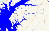
Maryland Route 297 is a state highway
in the U.S. state
of Maryland
. Known as Worton Road, the state highway runs 3.59 miles (5.8 km) from MD 213
in Chestertown
north to MD 298
in Worton
in central Kent County
. MD 297 was constructed in the late 1920s. The state highway extended northwest to the village of Newtown between the mid 1940s and mid 1990s.
s, heads north through a mix of farmland and industrial properties, paralleling the Chestertown Branch of the Northern Line of the Maryland and Delaware Railroad
. MD 297 passes through the unincorporated community of Worton, where the highway crosses the rail line. The state highway continues north, passing Worton Regional Park before reaching its northern terminus at MD 298 (Lambs Meadow Road) just west of Kent County High School in the hamlet of Butlertown.
.
{| class=wikitable
!Location
!Mile
!Destinations
!Notes
|-
|Chestertown
|0.00
|
|Southern terminus
|-
|rowspan=2|Worton
|rowspan=2|3.59
|
|rowspan=2|Northern terminus; Smithville Road is former MD 297
|-
|Smithville Road north
State highway
State highway, state road or state route can refer to one of three related concepts, two of them related to a state or provincial government in a country that is divided into states or provinces :#A...
in the U.S. state
U.S. state
A U.S. state is any one of the 50 federated states of the United States of America that share sovereignty with the federal government. Because of this shared sovereignty, an American is a citizen both of the federal entity and of his or her state of domicile. Four states use the official title of...
of Maryland
Maryland
Maryland is a U.S. state located in the Mid Atlantic region of the United States, bordering Virginia, West Virginia, and the District of Columbia to its south and west; Pennsylvania to its north; and Delaware to its east...
. Known as Worton Road, the state highway runs 3.59 miles (5.8 km) from MD 213
Maryland Route 213
Maryland Route 213 is a state highway located on the Eastern Shore of Maryland in the United States. The route runs from Maryland Route 662 in Wye Mills, Queen Anne's County north to the Pennsylvania border in Cecil County, where it continues into that state as Pennsylvania Route 841...
in Chestertown
Chestertown, Maryland
Chestertown is a town in Kent County, Maryland, United States. The population was 4,746 at the 2000 census. It is the county seat of Kent County. The ZIP code is 21620 and the area codes are 410 and 443...
north to MD 298
Maryland Route 298
Maryland Route 298 is a state highway in the U.S. state of Maryland. The state highway runs from MD 20 in Fairlee east to MD 291 near Chesterville. MD 298 is a C-shaped highway that connects Fairlee, MD 213, and Millington with several villages in central Kent County, including Worton, Lynch,...
in Worton
Worton, Maryland
Worton is an unincorporated community in Kent County, Maryland, United States.-References:...
in central Kent County
Kent County, Maryland
Kent County is a county located in the U.S. state of Maryland, on its Eastern Shore. It was named for the county of Kent in England. Its county seat is Chestertown. In 2010, the county population was 20,197...
. MD 297 was constructed in the late 1920s. The state highway extended northwest to the village of Newtown between the mid 1940s and mid 1990s.
Route description
MD 297 begins at MD 213 (Augustine Herman Highway) at the northern end of a developed area north of Chestertown. The two-lane state highway, which parallels a natural ridge that serves as the boundary for multiple drainage basinDrainage basin
A drainage basin is an extent or an area of land where surface water from rain and melting snow or ice converges to a single point, usually the exit of the basin, where the waters join another waterbody, such as a river, lake, reservoir, estuary, wetland, sea, or ocean...
s, heads north through a mix of farmland and industrial properties, paralleling the Chestertown Branch of the Northern Line of the Maryland and Delaware Railroad
Maryland and Delaware Railroad
The Maryland and Delaware Railroad Company is a Class III short-line railroad, formed in 1977 to operate several branch lines of the former Penn Central Railroad in both Maryland and Delaware. These branches were omitted from the system plan for Conrail in 1976 and would have been discontinued...
. MD 297 passes through the unincorporated community of Worton, where the highway crosses the rail line. The state highway continues north, passing Worton Regional Park before reaching its northern terminus at MD 298 (Lambs Meadow Road) just west of Kent County High School in the hamlet of Butlertown.
History
Following the completion of the Kent County Rail Road, Worton was settled where Worton Road intersects the modern Maryland and Delaware Railroad. MD 297 was paved starting in 1926. A small piece of highway north of U.S. Route 213 (now MD 213) was completed in 1927; the remainder of the highway to MD 298 was completed in 1928. By 1946, MD 297 was extended north along Smithville Road to the village of Newtown. The extension to Newtown was removed from the state highway system around 1995.Junction list
The entire route is in Kent CountyKent County, Maryland
Kent County is a county located in the U.S. state of Maryland, on its Eastern Shore. It was named for the county of Kent in England. Its county seat is Chestertown. In 2010, the county population was 20,197...
.
{| class=wikitable
!Location
!Mile
!Destinations
!Notes
|-
|Chestertown
Chestertown, Maryland
Chestertown is a town in Kent County, Maryland, United States. The population was 4,746 at the 2000 census. It is the county seat of Kent County. The ZIP code is 21620 and the area codes are 410 and 443...
|0.00
|
|Southern terminus
|-
|rowspan=2|Worton
Worton, Maryland
Worton is an unincorporated community in Kent County, Maryland, United States.-References:...
|rowspan=2|3.59
|
|rowspan=2|Northern terminus; Smithville Road is former MD 297
|-
|Smithville Road north