
.gif)
M-553 (Michigan highway)
Encyclopedia
M-553 is a north–south state trunkline highway
in the Upper Peninsula
of the US state of Michigan
. The trunkline was originally Marquette County
Road 553. It is the main highway connection between the US 41
/M-28
corridor and both the Sawyer International Airport
and Gwinn
.
M-553 was given its number based on the county road it replaced. It was designated in 1998 and extended through the City of Marquette in 2005. The highway is related to M-554
which was decommissioned and turned over to the city in the state route swap that extended M-553.
and the west gate of the former K. I. Sawyer Air Force Base
. M-553 reaches CR 480 at the "Crossroads" area of Marquette County just north of the Sands Plains. There it passes into hilly, wooded terrain. It descends a steep curve alongside the Marquette Mountain Ski Area before crossing the Carp River
.
 On the south side of the City of Marquette
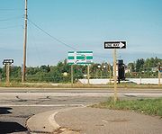
, M-553 takes McClellan Ave, a four-lane boulevard divided by a center turn lane. The northern terminus of M-553 is a signalized intersection along the Marquette Bypass portion of US 41/M-28, a four-lane divided expressway
that bypasses downtown Marquette. The intersection is designed as a "Michigan Left
". Traffic wishing to make a left turn at the intersection must instead use a median cross-over lane to complete the turn.
Rationalization plan, County Road 553 was transferred to state jurisdiction on October 1, 1998. The Michigan Department of Transportation
designated the highway M-553 based on the former county designation. A portion of CR 553 was numbered M-554
but not signed. The highway designation stopped at the intersection with M-554 and McClellan Ave in the City of Marquette
until 2005.
In 2005, the City of Marquette agreed to a "route swap" with MDOT. This swap placed former BUS US 41
and M-554 under city jurisdiction in exchange for the extension of M-553 to its current northern terminus at the Marquette Bypass. M-553 was extended northward along McClellan Ave. MDOT has initiated a speed study to determine what speed limits should apply on the extension. The McClellan Ave portion of M-553 was placed under a temporary traffic control order leaving the 35 mi/h limit in place. A school zone
may be placed near the Superior HIlls Elementary school. MDOT has started construction of a new 20-space commuter parking lot at the southern terminus of M-553 at M-35 on August 11, 2008 with an expected completion date of August 30, 2008. This is part of an effort to offer expanded ride-sharing opportunities in Marquette County.

Michigan Highway System
The Michigan State Trunkline Highway System is made up of all the highways designated as Interstates, U.S. Highways and State Highways in the US state of Michigan. The system is maintained by the Michigan Department of Transportation and comprises of trunklines in all 83 counties of Michigan on...
in the Upper Peninsula
Upper Peninsula of Michigan
The Upper Peninsula of Michigan is the northern of the two major land masses that make up the U.S. state of Michigan. It is commonly referred to as the Upper Peninsula, the U.P., or Upper Michigan. It is also known as the land "above the Bridge" linking the two peninsulas. The peninsula is bounded...
of the US state of Michigan
Michigan
Michigan is a U.S. state located in the Great Lakes Region of the United States of America. The name Michigan is the French form of the Ojibwa word mishigamaa, meaning "large water" or "large lake"....
. The trunkline was originally Marquette County
Marquette County, Michigan
-National protected areas:* Hiawatha National Forest * Huron National Wildlife Refuge* Ottawa National Forest -University:Northern Michigan University is a four-year university, established in 1899, located in Marquette, Michigan, on Michigan's Upper Peninsula...
Road 553. It is the main highway connection between the US 41
U.S. Route 41 in Michigan
US Highway 41 is a part of the United States Numbered Highway System that runs from Miami, Florida, to the Upper Peninsula of the US state of Michigan. In Michigan, it is a state trunkline highway that enters the state via the Interstate Bridge between Marinette, Wisconsin, and Menominee,...
/M-28
M-28 (Michigan highway)
M-28 is an east–west state trunkline highway that almost completely traverses the Upper Peninsula in the U.S. state of Michigan, from Wakefield to near Sault Ste. Marie in Bruce Township...
corridor and both the Sawyer International Airport
Sawyer International Airport
Sawyer International Airport is a public airport located south of the central business district of Marquette, a city in Marquette County, Michigan, United States. The airport is publicly owned by Marquette County....
and Gwinn
Gwinn, Michigan
Gwinn is an unincorporated community in Marquette County in the U.S. state of Michigan. The community is in Forsyth Township at on M-35 near the forks of the east and middle branches of the Escanaba River. Gwinn is a census-designated place for statistical purposes, and the CDP includes the...
.
M-553 was given its number based on the county road it replaced. It was designated in 1998 and extended through the City of Marquette in 2005. The highway is related to M-554
M-554 (Michigan highway)
M-554 was a short unsigned state trunkline highway in the US state of Michigan in the city of Marquette. This highway was transferred to the City of Marquette on October 10, 2005 in the same "route swap" that extended M-553 and decommissioned BUS US 41...
which was decommissioned and turned over to the city in the state route swap that extended M-553.
Route description
M-553 begins as a two-lane rural highway east of Gwinn in the New Swanzy neighborhood. From there it runs north through the Sands Plains, past M-94M-94 (Michigan highway)
M-94 is a state trunkline in the Upper Peninsula of the US state of Michigan. It runs for from K. I. Sawyer to Manistique. The highway is part of the Lake Superior Circle Tour during a concurrency with M-28. M-94 crosses the Siphon Bridge in Manistique, unique for the fact that the bridge roadway...
and the west gate of the former K. I. Sawyer Air Force Base
K. I. Sawyer Air Force Base
K. I. Sawyer Air Force Base is a decommissioned U.S. Air Force base in Marquette County, Michigan, south of the city of Marquette. The base, near the center of Michigan's Upper Peninsula, closed in 1995. The county airport, Sawyer International, now occupies a portion of the base and has scheduled...
. M-553 reaches CR 480 at the "Crossroads" area of Marquette County just north of the Sands Plains. There it passes into hilly, wooded terrain. It descends a steep curve alongside the Marquette Mountain Ski Area before crossing the Carp River
Carp River (Marquette County)
Carp River is a river in Marquette County in the U.S. state of Michigan. The Carp River is formed by the outflow of Deer Lake in Ishpeming Township north of Ishpeming at in the Upper Peninsula....
.
Marquette, Michigan
Marquette is a city in the U.S. state of Michigan and the county seat of Marquette County. The population was 21,355 at the 2010 census, making it the most populated city of the Upper Peninsula. Marquette is a major port on Lake Superior, primarily for shipping iron ore and is the home of Northern...
, M-553 takes McClellan Ave, a four-lane boulevard divided by a center turn lane. The northern terminus of M-553 is a signalized intersection along the Marquette Bypass portion of US 41/M-28, a four-lane divided expressway
Limited-access road
A limited-access road known by various terms worldwide, including limited-access highway, dual-carriageway and expressway, is a highway or arterial road for high-speed traffic which has many or most characteristics of a controlled-access highway , including limited or no access to adjacent...
that bypasses downtown Marquette. The intersection is designed as a "Michigan Left
Michigan left
A Michigan left is an at-grade intersection design which replaces each left turn with a permutation of a U-turn and a right turn. The design was given the name due to its frequent use along Michigan roads and highways since the late 1960s. In other contexts, the intersection is called a median...
". Traffic wishing to make a left turn at the intersection must instead use a median cross-over lane to complete the turn.
History
As part of Governor Engler'sJohn Engler
John Mathias Engler is an American politician and a member of the Republican Party. He served as the 46th Governor of Michigan from 1991 to 2003....
Rationalization plan, County Road 553 was transferred to state jurisdiction on October 1, 1998. The Michigan Department of Transportation
Michigan Department of Transportation
The Michigan Department of Transportation is a constitutional government agency in the US state of Michigan. The primary purpose of MDOT is to maintain the Michigan State Trunkline Highway System which includes all Interstate, US and state highways in Michigan with the exception of the Mackinac...
designated the highway M-553 based on the former county designation. A portion of CR 553 was numbered M-554
M-554 (Michigan highway)
M-554 was a short unsigned state trunkline highway in the US state of Michigan in the city of Marquette. This highway was transferred to the City of Marquette on October 10, 2005 in the same "route swap" that extended M-553 and decommissioned BUS US 41...
but not signed. The highway designation stopped at the intersection with M-554 and McClellan Ave in the City of Marquette
Marquette, Michigan
Marquette is a city in the U.S. state of Michigan and the county seat of Marquette County. The population was 21,355 at the 2010 census, making it the most populated city of the Upper Peninsula. Marquette is a major port on Lake Superior, primarily for shipping iron ore and is the home of Northern...
until 2005.
In 2005, the City of Marquette agreed to a "route swap" with MDOT. This swap placed former BUS US 41
U.S. Route 41 Business (Marquette, Michigan)
US Highway 41 Business Route was a state trunkline highway that served as a business loop off US 41 in the US state of Michigan through the City of Marquette along Washington and Front streets. Jurisdiction over the two streets was transferred to the City as part of a route swap that resulted...
and M-554 under city jurisdiction in exchange for the extension of M-553 to its current northern terminus at the Marquette Bypass. M-553 was extended northward along McClellan Ave. MDOT has initiated a speed study to determine what speed limits should apply on the extension. The McClellan Ave portion of M-553 was placed under a temporary traffic control order leaving the 35 mi/h limit in place. A school zone
School zone
A school zone refers to an area on a street near a school or near a crosswalk leading to a school that has a likely presence of younger pedestrians. School zones generally have a reduced speed limit during certain hours.-Fines:...
may be placed near the Superior HIlls Elementary school. MDOT has started construction of a new 20-space commuter parking lot at the southern terminus of M-553 at M-35 on August 11, 2008 with an expected completion date of August 30, 2008. This is part of an effort to offer expanded ride-sharing opportunities in Marquette County.
Major intersections