
London Outer Orbital Path
Encyclopedia
The London Outer Orbital Path — more usually the "London LOOP" — is a 240 km (149.1 mi) signed walk along public footpaths, and through parks, woods and fields around the edge of Outer London
, England
, described as "the M25
for walkers". The walk begins at Erith
on the south bank of the River Thames
and passes clockwise through Crayford
, Petts Wood
, Coulsdon
, Kingston upon Thames
, Uxbridge
, Elstree
, Cockfosters
, Chingford
and Upminster Bridge
before ending at Purfleet
, almost directly across the Thames from its starting point.
in 1990. It was given an official launch at the House of Lords in 1993. The first section was opened on May 3, 1996, with a ceremony on Farthing Downs
, Coulsdon
. Other sections followed at the rate of two or three per year as signs were installed and leaflets for individual sections published, the route becoming fully walkable in 2001. Following the election of Ken Livingstone
as Mayor of London
, the London Loop became one of his key routes, along with its sister route, the Capital Ring
.
, the "green" group in north-west London, and the "yellow" group in north-east London. Each of the 24 sections links public transport nodes, though they vary greatly in length, from 6.1 km (section 14) to 16.8 km (section 16). The guidebook by David Sharp adds together some of the shorter walks among the 24 to give 15 approximately equal stages, designed to be day walks. The table below shows the correspondence between the official sections and Sharp's sometimes longer walks.
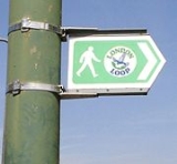
Signposts, waymarks
and information boards direct the walker along the route. In countryside locations the waymarks consist mostly of a simple white disc mounted on a wooden post, with a directional arrow and flying kestrel
logo in blue and text in green. However, local authorities are responsible for funding these signs, so the quality varies from one borough to the next, with some sections not signed at all. The 54-mile blue route from Erith to Kingston is maintained by the Downlands Countryside Management Project
, a joint initiative by several councils, and is complete with signs and information boards, in addition to maps available from Tourist Information Centres.
There is no way to cross the river between Purfleet and Erith to complete the loop, although there was once a ferry to Erith which was mainly used by pilgrim
s on their way to Canterbury
.
Outer London
Outer London is the name for the group of London Boroughs that form a ring around Inner London.These were areas that were not part of the County of London and became formally part of Greater London in 1965...
, England
England
England is a country that is part of the United Kingdom. It shares land borders with Scotland to the north and Wales to the west; the Irish Sea is to the north west, the Celtic Sea to the south west, with the North Sea to the east and the English Channel to the south separating it from continental...
, described as "the M25
M25 motorway
The M25 motorway, or London Orbital, is a orbital motorway that almost encircles Greater London, England, in the United Kingdom. The motorway was first mooted early in the 20th century. A few sections, based on the now abandoned London Ringways plan, were constructed in the early 1970s and it ...
for walkers". The walk begins at Erith
Erith
Erith is a district of southeast London on the River Thames. Erith's town centre has undergone a series of modernisations since 1961.-Pre-medieval:...
on the south bank of the River Thames
River Thames
The River Thames flows through southern England. It is the longest river entirely in England and the second longest in the United Kingdom. While it is best known because its lower reaches flow through central London, the river flows alongside several other towns and cities, including Oxford,...
and passes clockwise through Crayford
Crayford
Crayford is a town and electoral ward in the London Borough of Bexley that was an important bridging point in Roman times across the River Cray, a tributary of the River Darent, which is itself a tributary of the River Thames.-History:...
, Petts Wood
Petts Wood
-History:The name appeared first in 1577 as "the wood of the Pett family", who were shipbuilders and leased the wood as a source of timbers. William Willett, a campaigner for daylight saving time, lived in nearby Chislehurst for most of his life, and is commemorated by a memorial sundial in the...
, Coulsdon
Coulsdon
Coulsdon is a town on the southernmost boundary of the London Borough of Croydon. It is surrounded by the Metropolitan Green Belt of the Farthing Down, Coulsdon Common and Kenley Common...
, Kingston upon Thames
Kingston upon Thames
Kingston upon Thames is the principal settlement of the Royal Borough of Kingston upon Thames in southwest London. It was the ancient market town where Saxon kings were crowned and is now a suburb situated south west of Charing Cross. It is one of the major metropolitan centres identified in the...
, Uxbridge
Uxbridge
Uxbridge is a large town located in north west London, England and is the administrative headquarters of the London Borough of Hillingdon. It forms part of the ceremonial county of Greater London. It is located west-northwest of Charing Cross and is one of the major metropolitan centres...
, Elstree
Elstree
Elstree is a village in the Hertsmere borough of Hertfordshire on the A5 road, about 10 miles north of London. In 2001, its population was 4,765, and forms part of the civil parish of Elstree and Borehamwood, originally known simply as Elstree....
, Cockfosters
Cockfosters
Cockfosters is a suburb of North London, lying partly in the London Borough of Enfield and partly in the London Borough of Barnet. The counties of Hertfordshire and Middlesex respectively are still used in postal addresses.The name has been recorded as far back as 1524, and is thought to be either...
, Chingford
Chingford
Chingford is a district of north east London, bordering on Enfield and Edmonton to the west, Woodford to the east, Walthamstow and Stratford to the south and Essex to the north. It is situated northeast of Charing Cross and forms part of the London Borough of Waltham Forest...
and Upminster Bridge
Upminster Bridge
Upminster Bridge is a crossing of the River Ingrebourne carrying the A124 road between the suburbs of Hornchurch and Upminster in northeast London, England. The bridge is known to have existed since at least 1375...
before ending at Purfleet
Purfleet
Purfleet is a place in the Thurrock unitary authority in Essex, England. It is situated south of the A13 road on the River Thames and within the easterly bounds of the M25 motorway but just outside the Greater London boundary. It was within the traditional Church of England parish of West Thurrock...
, almost directly across the Thames from its starting point.
History
The walk was first proposed at a meeting between ramblers and the Countryside CommissionCountryside Commission
The Countryside Commission was a statutory body in England and Wales, and later in England only...
in 1990. It was given an official launch at the House of Lords in 1993. The first section was opened on May 3, 1996, with a ceremony on Farthing Downs
Farthing Downs
Farthing Downs is an open space in Coulsdon in the London Borough of Croydon. Together with New Hill to the south-east, it is owned and managed by the Corporation of London. It is also part of the Farthing Downs and Happy Valley Site of Special Scientific Interest, notified in 1975. Happy Valley is...
, Coulsdon
Coulsdon
Coulsdon is a town on the southernmost boundary of the London Borough of Croydon. It is surrounded by the Metropolitan Green Belt of the Farthing Down, Coulsdon Common and Kenley Common...
. Other sections followed at the rate of two or three per year as signs were installed and leaflets for individual sections published, the route becoming fully walkable in 2001. Following the election of Ken Livingstone
Ken Livingstone
Kenneth Robert "Ken" Livingstone is an English politician who is currently a member of the centrist to centre-left Labour Party...
as Mayor of London
Mayor of London
The Mayor of London is an elected politician who, along with the London Assembly of 25 members, is accountable for the strategic government of Greater London. Conservative Boris Johnson has held the position since 4 May 2008...
, the London Loop became one of his key routes, along with its sister route, the Capital Ring
Capital Ring
The Capital Ring is a strategic walking route that is being promoted by London's 33 local councils, led by the City of London Corporation in partnership with the Greater London Authority and its functional body for regional transport, Transport for London, through which much of the funding is...
.
Route
The route is divided into 24 sections in three groups: the "blue" group in South LondonSouth London
South London is the southern part of London, England, United Kingdom.According to the 2011 official Boundary Commission for England definition, South London includes the London boroughs of Bexley, Bromley, Croydon, Greenwich, Kingston, Lambeth, Lewisham, Merton, Southwark, Sutton and...
, the "green" group in north-west London, and the "yellow" group in north-east London. Each of the 24 sections links public transport nodes, though they vary greatly in length, from 6.1 km (section 14) to 16.8 km (section 16). The guidebook by David Sharp adds together some of the shorter walks among the 24 to give 15 approximately equal stages, designed to be day walks. The table below shows the correspondence between the official sections and Sharp's sometimes longer walks.
Signposts, waymarks
Waymarking
Waymarking is an activity where people locate and log interesting locations around the world, usually with a GPS receiver and a digital camera. Waymarking differs from geocaching in that there is no physical container to locate at the given coordinates. Waymarking identifies points of interest for...
and information boards direct the walker along the route. In countryside locations the waymarks consist mostly of a simple white disc mounted on a wooden post, with a directional arrow and flying kestrel
Common Kestrel
The Common Kestrel is a bird of prey species belonging to the kestrel group of the falcon family Falconidae. It is also known as the European Kestrel, Eurasian Kestrel, or Old World Kestrel. In Britain, where no other brown falcon occurs, it is generally just called "the kestrel".This species...
logo in blue and text in green. However, local authorities are responsible for funding these signs, so the quality varies from one borough to the next, with some sections not signed at all. The 54-mile blue route from Erith to Kingston is maintained by the Downlands Countryside Management Project
Downlands Countryside Management Project
The Downlands Countryside Management Project established in 1988 is a partnership between six London and Surrey local authorities set up to manage an area of countryside of 130 km² across the south of Outer London....
, a joint initiative by several councils, and is complete with signs and information boards, in addition to maps available from Tourist Information Centres.
There is no way to cross the river between Purfleet and Erith to complete the loop, although there was once a ferry to Erith which was mainly used by pilgrim
Pilgrim
A pilgrim is a traveler who is on a journey to a holy place. Typically, this is a physical journeying to some place of special significance to the adherent of a particular religious belief system...
s on their way to Canterbury
Canterbury
Canterbury is a historic English cathedral city, which lies at the heart of the City of Canterbury, a district of Kent in South East England. It lies on the River Stour....
.
| Section | Start coordinates | Start | Sharp |
|---|---|---|---|
| 1 | 51.483144°N 0.177975°W | Erith Erith Erith is a district of southeast London on the River Thames. Erith's town centre has undergone a series of modernisations since 1961.-Pre-medieval:... |
1 |
| 2 | 51.441233°N 0.148956°W | Old Bexley | 2 |
| 3 | 51.393209°N 0.069081°W | Petts Wood Petts Wood -History:The name appeared first in 1577 as "the wood of the Pett family", who were shipbuilders and leased the wood as a source of timbers. William Willett, a campaigner for daylight saving time, lived in nearby Chislehurst for most of his life, and is commemorated by a memorial sundial in the... |
3 |
| 4 | 51.370944°N 0.004860°W | West Wickham Common West Wickham West Wickham is a place in the London Borough of Bromley, England. It is 10.3 miles south east of Charing Cross. West Wickham history dates back to early settlements existing since 1068, although the name `Wickham` is an indication of an earlier Anglo-Saxon settlement... |
4 |
| 5 | 51.319035°N 0.063420°W | Hamsey Green Hamsey Green Hamsey Green is a place on the plateau of the North Downs between the villages of Sanderstead to the north and Warlingham to the south. It is split almost across the centre east and west with the southern part in the Tandridge district of Surrey... |
5 |
| 6 | 51.315728°N 0.136744°W | Coulsdon South Coulsdon Coulsdon is a town on the southernmost boundary of the London Borough of Croydon. It is surrounded by the Metropolitan Green Belt of the Farthing Down, Coulsdon Common and Kenley Common... |
5 |
| 7 | 51.332148°N 0.209290°W | Banstead Downs Banstead Downs Banstead Downs is a Site of Special Scientific Interest in Surrey, England . It covers . To the west is the A217 and to east is the B2218. The town to the north is Sutton; whilst Banstead lies to the south... |
6 |
| 8 | 51.351650°N 0.250176°W | Ewell Ewell Ewell is a village in the borough of Epsom and Ewell in Surrey, close to the southern boundary of Greater London. It is located 14 miles south-south-west of Charing Cross and forms part of the suburbia that surrounds Greater London. Despite its growing population it is still referred to as a... |
6 |
| 9 | 51.411854°N 0.308274°W | Kingston Bridge Kingston Bridge, London Kingston Bridge is a road bridge at Kingston upon Thames in London, England, carrying the A308 across the River Thames. It joins the town centre of Kingston in the Royal Borough of Kingston upon Thames, to Hampton Court Park, Bushy Park, and the village of Hampton Wick in the London Borough of... |
7 |
| 10 | 51.469927°N 0.409793°W | Hatton Cross | 8 |
| 11 | 51.505117°N 0.418654°W | Hayes Hayes, Hillingdon Hayes is a town in the London Borough of Hillingdon, West London. It is a suburban development situated west of Charing Cross. Hayes was developed in the late 19th and 20th centuries as an industrial locality to which residential districts were later added in order to house factory workers... |
8 |
| 12 | 51.550933°N 0.483414°W | Uxbridge Uxbridge Uxbridge is a large town located in north west London, England and is the administrative headquarters of the London Borough of Hillingdon. It forms part of the ceremonial county of Greater London. It is located west-northwest of Charing Cross and is one of the major metropolitan centres... |
9 |
| 13 | 51.610477°N 0.498761°W | Harefield Harefield Harefield is a village in the London Borough of Hillingdon in northwest London, England. It is situated on top of a hill, northwest of Charing Cross, near the Greater London boundary with Buckinghamshire to the west and Hertfordshire to the north... |
9 |
| 14 | 51.623932°N 0.427529°W | Moor Park Moor Park, Hertfordshire Moor Park Estate is a private residential estate in north-west London. The area borders Northwood, London and is part of the affluent suburb of Ruislip. It takes its name from Moor Park, a country house which was originally built in 1678–9 for James, Duke of Monmouth, and was reconstructed... |
10 |
| 15 | 51.610702°N 0.380326°W | Hatch End Hatch End Hatch End is a place in the London Borough of Harrow, located north west of Charing Cross in Central London. The suburb is part of the Pinner post town.-Attractions:... |
10 |
| 16 | 51.653365°N 0.281950°W | Elstree Elstree Elstree is a village in the Hertsmere borough of Hertfordshire on the A5 road, about 10 miles north of London. In 2001, its population was 4,765, and forms part of the civil parish of Elstree and Borehamwood, originally known simply as Elstree.... |
11 |
| 17 | 51.652244°N 0.148998°W | Cockfosters Cockfosters Cockfosters is a suburb of North London, lying partly in the London Borough of Enfield and partly in the London Borough of Barnet. The counties of Hertfordshire and Middlesex respectively are still used in postal addresses.The name has been recorded as far back as 1524, and is thought to be either... |
12 |
| 18 | 51.668264°N 0.028316°W | Enfield Lock Enfield Lock Enfield Lock is an area in the London Borough of Enfield, North London. It is approximately located east of the Hertford Road between Turkey Street and the Holmesdale Tunnel overpass, to the River Lee Navigation, including the Enfield Island Village. The locality gains its name from the lock on the... |
13 |
| 19 | 51.634306°N 0.012118°W | Chingford Chingford Chingford is a district of north east London, bordering on Enfield and Edmonton to the west, Woodford to the east, Walthamstow and Stratford to the south and Essex to the north. It is situated northeast of Charing Cross and forms part of the London Borough of Waltham Forest... |
13 |
| 20 | 51.621468°N 0.078004°W | Chigwell Chigwell Chigwell is a civil parish and town in the Epping Forest district of Essex. It is located 11.6 miles north east of Charing Cross. It is served by two London Underground stations and has a London area code.-Etymology:According to P. H... |
14 |
| 21 | 51.616860°N 0.183245°W | Havering-atte-Bower Havering-atte-Bower Havering-atte-Bower is a village and outlying settlement of the London Borough of Havering, located 15 miles northeast of Charing Cross and close to the Greater London boundary. It was one of three former parishes whose area comprised the historic Royal Liberty of Havering... |
14 |
| 22 | 51.593421°N 0.234098°W | Harold Wood Harold Wood Harold Wood is a place in the London Borough of Havering, east London, England.It is a suburban development situated east-northeeast of Charing Cross... |
15 |
| 23 | 51.559197°N 0.236748°W | Upminster Bridge Upminster Bridge Upminster Bridge is a crossing of the River Ingrebourne carrying the A124 road between the suburbs of Hornchurch and Upminster in northeast London, England. The bridge is known to have existed since at least 1375... |
15 |
| 24 | 51.516886°N 0.191433°W | Rainham Rainham, London Rainham is a suburban town in northeast London, England, and part of the London Borough of Havering. Located east of Charing Cross, it is one of the locally important district centres identified in the London Plan and is surrounded by a residential area, which has grown from the historic village,... |
15 |