
London Buses route 22
Encyclopedia
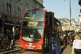
London Buses route 22 is a Transport for London
contracted bus route in London
, United Kingdom. The service is currently contracted to Go-Ahead London
.
(Lea Bridge station
) and Elephant & Castle via Clapton, Hackney
, Dalston
, Kingsland Road, Shoreditch
. London Bridge
and Borough
. Quite soon after on 26 July 1909 it was extended to Leyton
(Bakers Arms) with a Sunday extension to Epping Forest
(Warren Wood House) via Whipps Cross
and Woodford replacing route 9
.
London's motor bus routes were very "fluid" in the early days of operation and often worked on a "trial and error basis", consequently on 28 October 1909 the 22 was changed again to work as a daily route between Tulse Hill
and Leyton (Bakers Arms) via Effra Road, Brixton Road, Kennington Park Road and Elephant & Castle with a Monday - Saturday extension to Whipps Cross. On 3 January 1910, it was cut back again to work Clapton (Lea Bridge Station) to Tulse Hill. The Sunday service to Epping Forest appeared again in March 1910 but the Monday - Saturday service was cut back to run from Hackney Station to Elephant & Castle.
As from 6 April 1911, the 22 was withdrawn between Bank and Elephant & Castle, being replaced by new route 35 over that section. At the same time it was extended to Putney Station
via Cheapside
, Holborn
, Piccadilly
, Kings Road
and Putney Bridge
, thereby becoming the 22 we know today. The daily extension to Homerton
(Clapton Park Tavern) commenced soon after on 12 June 1911, but the route was withdrawn throughout on Sundays on 8 October 1911 for just over three years until 8 November 1914, when it became daily once again.
The connection with route 35 became clear once again as from 6 August 1916, when the 22 was diverted daily at Putney Bridge to run to Putney Common (Cricketers), but withdrawn on Sundays between Lower Clapton and Homerton being extended to Chingford
(Royal Forest Hotel) via Leyton
and Walthamstow
, replacing the 35A on that day. This change was very short lived and the 22 reverted back to being a daily Putney Common to Homerton route as from 2 October 1916 and from that time onwards it became a very stable operation.
On 1 December 1924, a new system of route numbering on London Buses came into force under The London Traffic Act of 1924. This made the Metropolitan Police
responsible for bus operation and route numbering in London. The new system was designed to make route numbering easier to understand for the travelling public.
For route 22, shortworkings between Tottenham Court Road and Putney were numbered 22A, shortworkings between Tottenham Court Road and Homerton were numbered 22B and shortworkings between Piccadilly Circus and Homerton were numbered 22C. The plain 22 route number being used for journeys for the whole length of the route from Putney Common to Homerton. By 30 June 1925, these had been reduced to 22 Putney Common to Homerton and 22A Piccadilly Circus - Homerton. This situation remained until 3 October 1934, when the newly constituted London Passenger Transport Board
instituted its own numbering system, which generally re-instated the situation previous to December 1924, in this case, leaving just the plain 22 to work Putney Common - Homerton.
As part of the reshaping plan of London's Buses which had been proceeding since 1966, increasing numbers of routes were converted to one-person-operation. As from 28 October 1972, part of the 22 allocaton was converted to one-person-operation in the form of new route 22A between Clapton Park Estate and Liverpool Street Station
. It had in fact been intended to number this route "128", but opposition from the 22 crews resulted in it being given the 22A number at the last minute.
Transport for London
Transport for London is the local government body responsible for most aspects of the transport system in Greater London in England. Its role is to implement the transport strategy and to manage transport services across London...
contracted bus route in London
London
London is the capital city of :England and the :United Kingdom, the largest metropolitan area in the United Kingdom, and the largest urban zone in the European Union by most measures. Located on the River Thames, London has been a major settlement for two millennia, its history going back to its...
, United Kingdom. The service is currently contracted to Go-Ahead London
Go-Ahead London
Go-Ahead London is the trading name used collectively for the London bus operations of the Go-Ahead Group. The name first appeared in August 2008, before which the company had traded under separate names and brands...
.
History
The 22 bus route started operation on 17 May 1909, as a daily route between ClaptonLower Clapton
Lower Clapton is a district within the London Borough of Hackney.It is immediately adjacent to central Hackney - bounded, roughly, by the western side of Hackney Downs , the Lea Valley , Clifden Road and the Lea Bridge Road...
(Lea Bridge station
Lea Bridge railway station
Lea Bridge is a closed railway station on the line between Stratford and Tottenham Hale stations. The station was located on the north side of Lea Bridge Road close to the junction of that road with Argall Way and Orient Way in the London Borough of Waltham Forest, north-east London .The station...
) and Elephant & Castle via Clapton, Hackney
Hackney Central
Hackney Central is the central district of the London Borough of Hackney in London, England. It comprises the area roughly surrounding, and extending north from Mare Street. It is situated north east of Charing Cross...
, Dalston
Dalston
Dalston is a district of north-east London, England, located in the London Borough of Hackney. It is situated northeast of Charing Cross. The area is identified in the London Plan as one of 35 major centres in Greater London...
, Kingsland Road, Shoreditch
Shoreditch
Shoreditch is an area of London within the London Borough of Hackney in England. It is a built-up part of the inner city immediately to the north of the City of London, located east-northeast of Charing Cross.-Etymology:...
. London Bridge
London Bridge
London Bridge is a bridge over the River Thames, connecting the City of London and Southwark, in central London. Situated between Cannon Street Railway Bridge and Tower Bridge, it forms the western end of the Pool of London...
and Borough
Borough
A borough is an administrative division in various countries. In principle, the term borough designates a self-governing township although, in practice, official use of the term varies widely....
. Quite soon after on 26 July 1909 it was extended to Leyton
Leyton
Leyton is an area of north-east London and part of the London Borough of Waltham Forest, located north east of Charing Cross. It borders Walthamstow and Leytonstone; Stratford in Newham; and Homerton and Lower Clapton in the London Borough of Hackney....
(Bakers Arms) with a Sunday extension to Epping Forest
Epping Forest
Epping Forest is an area of ancient woodland in south-east England, straddling the border between north-east Greater London and Essex. It is a former royal forest, and is managed by the City of London Corporation....
(Warren Wood House) via Whipps Cross
Whipps Cross
Whipps Cross is an area of the London Borough of Waltham Forest in London, England. It is most famous for Whipps Cross University Hospital.-The environs:...
and Woodford replacing route 9
London Buses route 9
London Buses route 9 is a Transport for London contracted bus route in London, England, United Kingdom. The regular service on route 9 is currently contracted to London United...
.
London's motor bus routes were very "fluid" in the early days of operation and often worked on a "trial and error basis", consequently on 28 October 1909 the 22 was changed again to work as a daily route between Tulse Hill
Tulse Hill
Tulse Hill is a district in the London Borough of Lambeth in South London, England. It lies to the south of Brixton, east of Brixton Hill, north of West Norwood and west of West Dulwich.-History:...
and Leyton (Bakers Arms) via Effra Road, Brixton Road, Kennington Park Road and Elephant & Castle with a Monday - Saturday extension to Whipps Cross. On 3 January 1910, it was cut back again to work Clapton (Lea Bridge Station) to Tulse Hill. The Sunday service to Epping Forest appeared again in March 1910 but the Monday - Saturday service was cut back to run from Hackney Station to Elephant & Castle.
As from 6 April 1911, the 22 was withdrawn between Bank and Elephant & Castle, being replaced by new route 35 over that section. At the same time it was extended to Putney Station
Putney railway station
Putney railway station is in Putney in the London Borough of Wandsworth, in south London, and is on the boundary of Travelcard Zone 2 and Zone 3. The station and all trains serving it are operated by South West Trains...
via Cheapside
Cheapside
Cheapside is a street in the City of London that links Newgate Street with the junction of Queen Victoria Street and Mansion House Street. To the east is Mansion House, the Bank of England, and the major road junction above Bank tube station. To the west is St. Paul's Cathedral, St...
, Holborn
Holborn
Holborn is an area of Central London. Holborn is also the name of the area's principal east-west street, running as High Holborn from St Giles's High Street to Gray's Inn Road and then on to Holborn Viaduct...
, Piccadilly
Piccadilly
Piccadilly is a major street in central London, running from Hyde Park Corner in the west to Piccadilly Circus in the east. It is completely within the city of Westminster. The street is part of the A4 road, London's second most important western artery. St...
, Kings Road
Kings Road
King's Road or Kings Road, known popularly as The King's Road or The KR, is a major, well-known street stretching through Chelsea and Fulham, both in west London, England...
and Putney Bridge
Putney Bridge
Putney Bridge is a bridge crossing of the River Thames in west London, linking Putney on the south side with Fulham to the north. Putney Bridge tube station is located near the north side of the bridge.-History:...
, thereby becoming the 22 we know today. The daily extension to Homerton
Homerton
Homerton is a place in the London Borough of Hackney. It is bordered to the west by Hackney Central, to the north by Lower Clapton, in the east by Hackney Wick, Leyton and by South Hackney to the south.-Origins:...
(Clapton Park Tavern) commenced soon after on 12 June 1911, but the route was withdrawn throughout on Sundays on 8 October 1911 for just over three years until 8 November 1914, when it became daily once again.
The connection with route 35 became clear once again as from 6 August 1916, when the 22 was diverted daily at Putney Bridge to run to Putney Common (Cricketers), but withdrawn on Sundays between Lower Clapton and Homerton being extended to Chingford
Chingford
Chingford is a district of north east London, bordering on Enfield and Edmonton to the west, Woodford to the east, Walthamstow and Stratford to the south and Essex to the north. It is situated northeast of Charing Cross and forms part of the London Borough of Waltham Forest...
(Royal Forest Hotel) via Leyton
Leyton
Leyton is an area of north-east London and part of the London Borough of Waltham Forest, located north east of Charing Cross. It borders Walthamstow and Leytonstone; Stratford in Newham; and Homerton and Lower Clapton in the London Borough of Hackney....
and Walthamstow
Walthamstow
Walthamstow is a district of northeast London, England, located in the London Borough of Waltham Forest. It is situated north-east of Charing Cross...
, replacing the 35A on that day. This change was very short lived and the 22 reverted back to being a daily Putney Common to Homerton route as from 2 October 1916 and from that time onwards it became a very stable operation.
On 1 December 1924, a new system of route numbering on London Buses came into force under The London Traffic Act of 1924. This made the Metropolitan Police
Metropolitan police
Metropolitan Police is a generic title for the municipal police force for a major metropolitan area, and it may be part of the official title of the force...
responsible for bus operation and route numbering in London. The new system was designed to make route numbering easier to understand for the travelling public.
For route 22, shortworkings between Tottenham Court Road and Putney were numbered 22A, shortworkings between Tottenham Court Road and Homerton were numbered 22B and shortworkings between Piccadilly Circus and Homerton were numbered 22C. The plain 22 route number being used for journeys for the whole length of the route from Putney Common to Homerton. By 30 June 1925, these had been reduced to 22 Putney Common to Homerton and 22A Piccadilly Circus - Homerton. This situation remained until 3 October 1934, when the newly constituted London Passenger Transport Board
London Passenger Transport Board
The London Passenger Transport Board was the organisation responsible for public transport in London, UK, and its environs from 1933 to 1948...
instituted its own numbering system, which generally re-instated the situation previous to December 1924, in this case, leaving just the plain 22 to work Putney Common - Homerton.
As part of the reshaping plan of London's Buses which had been proceeding since 1966, increasing numbers of routes were converted to one-person-operation. As from 28 October 1972, part of the 22 allocaton was converted to one-person-operation in the form of new route 22A between Clapton Park Estate and Liverpool Street Station
Liverpool Street station
Liverpool Street railway station, also known as London Liverpool Street or simply Liverpool Street, is both a central London railway terminus and a connected London Underground station in the north-eastern corner of the City of London, England...
. It had in fact been intended to number this route "128", but opposition from the 22 crews resulted in it being given the 22A number at the last minute.
Current route
- Piccadilly Circus StationPiccadilly Circus tube stationPiccadilly Circus tube station is the London Underground station located directly beneath Piccadilly Circus itself, with entrances at every corner...
- Green Park StationGreen Park tube stationGreen Park tube station is a London Underground station located on the north side of Green Park, close to the intersection of Piccadilly and the pedestrian Queen's Walk...
- Hyde Park Corner StationHyde Park Corner tube stationHyde Park Corner is a London Underground station near Hyde Park Corner in Hyde Park. It is in Travelcard Zone 1, between Knightsbridge and Green Park on the Piccadilly Line.-History:...
- KnightsbridgeKnightsbridgeKnightsbridge is a road which gives its name to an exclusive district lying to the west of central London. The road runs along the south side of Hyde Park, west from Hyde Park Corner, spanning the City of Westminster and the Royal Borough of Kensington and Chelsea...
- Sloane Square StationSloane Square tube stationSloane Square is a London Underground station in Sloane Square, in the Chelsea district of The Royal Borough of Kensington and Chelsea. It is served by the District and Circle Lines and is between South Kensington and Victoria. It is in Travelcard Zone 1....
- ChelseaChelsea, LondonChelsea is an area of West London, England, bounded to the south by the River Thames, where its frontage runs from Chelsea Bridge along the Chelsea Embankment, Cheyne Walk, Lots Road and Chelsea Harbour. Its eastern boundary was once defined by the River Westbourne, which is now in a pipe above...
- Putney Bridge ApproachPutney BridgePutney Bridge is a bridge crossing of the River Thames in west London, linking Putney on the south side with Fulham to the north. Putney Bridge tube station is located near the north side of the bridge.-History:...
for Putney Bridge StationPutney Bridge tube stationPutney Bridge is a London Underground station on the branch of the District Line. It is between and stations and is in Zone 2. The station is located in the south of Fulham, adjacent to Fulham High Street and New Kings Road and is a short distance from the north end of Putney Bridge from which... - PutneyPutneyPutney is a district in south-west London, England, located in the London Borough of Wandsworth. It is situated south-west of Charing Cross. The area is identified in the London Plan as one of 35 major centres in Greater London....
Church - Putney Common Spencer Arms