
London Buses route 176
Encyclopedia
London Buses route 176 is a Transport for London
contracted bus route in London
, United Kingdom
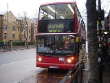
. The service is currently contracted to Arriva London
.
, joining the existing route at Forest Hill
as far as Elephant & Castle. There were then two routes, 176 and 176A, the 176 continuing via Westminster Bridge
to the Victoria Embankment
, one of the major termini for south east London tram routes. However the trams only stopped there because that was as far as they were allowed to go, and it was soon realised that extending the buses further into central London
would benefit passengers. Incidentally, the 176 is the only one of the original Victoria Embankment routes still to serve central London under its original number! Meanwhile the 176A went via Southwark Bridge to Mansion House Station (along with the 95 which came up from Tooting Broadway), again not a terribly clever terminus, the route being abandoned in the September 1982 bus cuts.
The 176 was then diverted via Waterloo
, Trafalgar Square
, Tottenham Court Road
, Marylebone
and Edgware Road to Willesden
, being extended into Lewisham
for some years, albeit losing its Saturday service (it never had a Sunday service). The eastern terminus later settled down as Forest Hill.
By the 1970s it had settled into being a Monday to Friday route between Willesden Garage and Forest Hill (East Dulwich evenings). In the mid 1970s the route gained Routemasters, one of the last central London routes to lose RTs
in favour of the RMs.
Leyland Titans
, initially in crew mode, were introduced from Walworth garage in 1984, together with a Saturday only 185A (Lewisham - Elephant & Castle) which replaced the short 185 buses that at the time had run between Camberwell and Lewisham during Saturday shopping hours and that provided some compensation for the lack of a Saturday service on the 176.
The 176 was re-structured in 1987. The service north of Tottenham Court Road Station
was withdrawn, buses running instead to Oxford Circus
. The section to Willesden transferred to new route 172, but that did not last long. A Saturday service between East Dulwich and Oxford Circus, and a Sunday service between East Dulwich and Waterloo, were also introduced at this time.
The south end was altered to run to Penge on a daily basis from 14/08/88, replacing the most heavily used section of route 12 south of Dulwich Plough. The end of the route at Penge Pawleyne Arms had previously been an intermediate turning point for buses on the 12, 75 and 194 routes. This had ceased when the roads used for a convenient turnaround were closed. (194 buses turning in Penge now carry the destination Penge High Street and turn at the Crooked Billet). Despite the road closures it was decided to make the Pawlene Arms the terminus for the route. Most drivers travel the considerable distance to the Robin Hood to turn their buses safely.
London & Country won the 176 from 10 November 1990, and obtained a batch of East Lancs bodied Volvo Citybuses. Under Cowie Group ownership, these operations passed to the new Kentish Bus-controlled LondonLinks unit. The 176 was split between Beddington Farm and Walworth garages, the latter also operating the 78 and 188. However, expiry of the lease at Walworth prompted a shuffling of routes in which the 176 and 188 moved to fellow Cowie subsidiary South London Transport's Norwood garage, together with the 36 East Lancs bodied Citybuses. These were then replaced with Northern Counties-bodied Leyland Olympian
s acquired from Kentish Bus, who had used them on routes 22A and 22B (now 242).
The Sunday service was extended to Aldwych in 1989 and finally reached Oxford Circus in 1994.
The section between Aldwych and Oxford Circus passes through the heart of London's Theatreland close to most of the main theatres and the Cinemas of Leicester Square, making it a particularly useful service for tourists.
The night service N176 was the first to be renumbered when TfL started to re-market them as 24-hour routes where possible, becoming part of route 176.
Transport for London announced on 22 December 2008 that from 3 January 2009 the route would be withdrawn between Oxford Circus and Tottenham Court Road to allow Andrew Borde Street to be closed and used as a work site for the upgrade of Tottenham Court Road tube station and the construction of the Crossrail
station. In January 2010, Transport for London claimed this shortening of route 176 as part of its implementation of the Mayor's request to reduce the bus flow in Oxford Street by 10% in each of 2009 and 2010.
Transport for London
Transport for London is the local government body responsible for most aspects of the transport system in Greater London in England. Its role is to implement the transport strategy and to manage transport services across London...
contracted bus route in London
London
London is the capital city of :England and the :United Kingdom, the largest metropolitan area in the United Kingdom, and the largest urban zone in the European Union by most measures. Located on the River Thames, London has been a major settlement for two millennia, its history going back to its...
, United Kingdom
United Kingdom
The United Kingdom of Great Britain and Northern IrelandIn the United Kingdom and Dependencies, other languages have been officially recognised as legitimate autochthonous languages under the European Charter for Regional or Minority Languages...
. The service is currently contracted to Arriva London
Arriva London
Arriva London is a division of Arriva which operates bus services in London, UK. It is made up of many previous bus operators including previously independent Grey Green...
.
History
The 176 route itself was one of the tram replacement routes, initially running from CatfordCatford
Catford is a district in south London, England, located in the London Borough of Lewisham. It is situated south-east of Charing Cross. The area is identified in the London Plan as one of 35 major centres in Greater London.-Architecture:...
, joining the existing route at Forest Hill
Forest Hill, London
Forest Hill is a district of south London, England, located in the London Borough of Lewisham. It situated between Dulwich and Sydenham. The area has enjoyed extensive investment since plans to extend the East London Line to Forest Hill were unveiled in 2004....
as far as Elephant & Castle. There were then two routes, 176 and 176A, the 176 continuing via Westminster Bridge
Westminster Bridge
Westminster Bridge is a road and foot traffic bridge over the River Thames between Westminster on the north side and Lambeth on the south side, in London, England....
to the Victoria Embankment
Victoria Embankment
The Victoria Embankment is part of the Thames Embankment, a road and river walk along the north bank of the River Thames in London. Victoria Embankment extends from the City of Westminster into the City of London.-Construction:...
, one of the major termini for south east London tram routes. However the trams only stopped there because that was as far as they were allowed to go, and it was soon realised that extending the buses further into central London
Central London
Central London is the innermost part of London, England. There is no official or commonly accepted definition of its area, but its characteristics are understood to include a high density built environment, high land values, an elevated daytime population and a concentration of regionally,...
would benefit passengers. Incidentally, the 176 is the only one of the original Victoria Embankment routes still to serve central London under its original number! Meanwhile the 176A went via Southwark Bridge to Mansion House Station (along with the 95 which came up from Tooting Broadway), again not a terribly clever terminus, the route being abandoned in the September 1982 bus cuts.
The 176 was then diverted via Waterloo
Waterloo station
Waterloo station, also known as London Waterloo, is a central London railway terminus and London Underground complex. The station is owned and operated by Network Rail and is close to the South Bank of the River Thames, and in Travelcard Zone 1....
, Trafalgar Square
Trafalgar Square
Trafalgar Square is a public space and tourist attraction in central London, England, United Kingdom. At its centre is Nelson's Column, which is guarded by four lion statues at its base. There are a number of statues and sculptures in the square, with one plinth displaying changing pieces of...
, Tottenham Court Road
Tottenham Court Road
Tottenham Court Road is a major road in central London, United Kingdom, running from St Giles Circus north to Euston Road, near the border of the City of Westminster and the London Borough of Camden, a distance of about three-quarters of a mile...
, Marylebone
Marylebone
Marylebone is an affluent inner-city area of central London, located within the City of Westminster. It is sometimes written as St. Marylebone or Mary-le-bone....
and Edgware Road to Willesden
Willesden
Willesden is an area in North West London which forms part of the London Borough of Brent. It is situated 5 miles north west of Charing Cross...
, being extended into Lewisham
Lewisham
Lewisham is a district in South London, England, located in the London Borough of Lewisham. It is situated south-east of Charing Cross. The area is identified in the London Plan as one of 35 major centres in Greater London.-History:...
for some years, albeit losing its Saturday service (it never had a Sunday service). The eastern terminus later settled down as Forest Hill.
By the 1970s it had settled into being a Monday to Friday route between Willesden Garage and Forest Hill (East Dulwich evenings). In the mid 1970s the route gained Routemasters, one of the last central London routes to lose RTs
AEC Regent III RT
The AEC Regent III RT was a variant of the AEC Regent III. It was a double-decker bus produced jointly between AEC and London Transport. It was the standard red London bus during the 1950s.-Prototype:...
in favour of the RMs.
Leyland Titans
Leyland Titan (B15)
The Leyland Titan was a model of double-decker bus produced by the Leyland Truck & Bus division of British Leyland from 1977 until 1984, almost exclusively for London Transport.-Development:...
, initially in crew mode, were introduced from Walworth garage in 1984, together with a Saturday only 185A (Lewisham - Elephant & Castle) which replaced the short 185 buses that at the time had run between Camberwell and Lewisham during Saturday shopping hours and that provided some compensation for the lack of a Saturday service on the 176.
The 176 was re-structured in 1987. The service north of Tottenham Court Road Station
Tottenham Court Road tube station
Tottenham Court Road is a London Underground station in central London. It is an interchange between the Central line and the branch of the Northern line.On the Central line it is between and , and on the Northern line it is between and...
was withdrawn, buses running instead to Oxford Circus
Oxford Circus
Oxford Circus is the area of London at the busy intersection of Regent Street and Oxford Street, in the West End. It is served by Oxford Circus tube station, which is directly beneath the junction itself.- History :...
. The section to Willesden transferred to new route 172, but that did not last long. A Saturday service between East Dulwich and Oxford Circus, and a Sunday service between East Dulwich and Waterloo, were also introduced at this time.
The south end was altered to run to Penge on a daily basis from 14/08/88, replacing the most heavily used section of route 12 south of Dulwich Plough. The end of the route at Penge Pawleyne Arms had previously been an intermediate turning point for buses on the 12, 75 and 194 routes. This had ceased when the roads used for a convenient turnaround were closed. (194 buses turning in Penge now carry the destination Penge High Street and turn at the Crooked Billet). Despite the road closures it was decided to make the Pawlene Arms the terminus for the route. Most drivers travel the considerable distance to the Robin Hood to turn their buses safely.
London & Country won the 176 from 10 November 1990, and obtained a batch of East Lancs bodied Volvo Citybuses. Under Cowie Group ownership, these operations passed to the new Kentish Bus-controlled LondonLinks unit. The 176 was split between Beddington Farm and Walworth garages, the latter also operating the 78 and 188. However, expiry of the lease at Walworth prompted a shuffling of routes in which the 176 and 188 moved to fellow Cowie subsidiary South London Transport's Norwood garage, together with the 36 East Lancs bodied Citybuses. These were then replaced with Northern Counties-bodied Leyland Olympian
Leyland Olympian
The Leyland Olympian was a double-decker bus built by British Leyland/Leyland Bus in the United Kingdom from 1980 to 1993. It was the last Leyland bus model in production before the demise of Leyland Bus.-Construction:...
s acquired from Kentish Bus, who had used them on routes 22A and 22B (now 242).
The Sunday service was extended to Aldwych in 1989 and finally reached Oxford Circus in 1994.
The section between Aldwych and Oxford Circus passes through the heart of London's Theatreland close to most of the main theatres and the Cinemas of Leicester Square, making it a particularly useful service for tourists.
The night service N176 was the first to be renumbered when TfL started to re-market them as 24-hour routes where possible, becoming part of route 176.
Transport for London announced on 22 December 2008 that from 3 January 2009 the route would be withdrawn between Oxford Circus and Tottenham Court Road to allow Andrew Borde Street to be closed and used as a work site for the upgrade of Tottenham Court Road tube station and the construction of the Crossrail
Crossrail
Crossrail is a project to build a major new railway link under central London. The name refers to the first of two routes which are the responsibility of Crossrail Ltd. It is based on an entirely new east-west tunnel with a central section from to Liverpool Street station...
station. In January 2010, Transport for London claimed this shortening of route 176 as part of its implementation of the Mayor's request to reduce the bus flow in Oxford Street by 10% in each of 2009 and 2010.
Current route
- PengePengePenge is a suburb of London in the London Borough of Bromley. It is located south east of Charing Cross.-History:Penge was once a small town, which was recorded under the name Penceat in a Saxon deed dating from 957...
Pawleyne Arms - Croydon Road
- High Street
- Penge West StationPenge West railway stationPenge West railway station is in the London Borough of Bromley in south London. The station is operated by London Overground, with London Overground and Southern trains serving the station. First Capital Connect and some Southern services pass through the station. It is located in Travelcard Zone...
- Crystal Palace Park Road
- Lawrie Park RoadSydenhamSydenham is an area and electoral ward in the London Borough of Lewisham; although some streets towards Crystal Palace Park, Forest Hill and Penge are outside the ward and in the London Borough of Bromley, and some streets off Sydenham Hill are in the London Borough of Southwark. Sydenham was in...
- Westwood HillSydenhamSydenham is an area and electoral ward in the London Borough of Lewisham; although some streets towards Crystal Palace Park, Forest Hill and Penge are outside the ward and in the London Borough of Bromley, and some streets off Sydenham Hill are in the London Borough of Southwark. Sydenham was in...
- SydenhamSydenhamSydenham is an area and electoral ward in the London Borough of Lewisham; although some streets towards Crystal Palace Park, Forest Hill and Penge are outside the ward and in the London Borough of Bromley, and some streets off Sydenham Hill are in the London Borough of Southwark. Sydenham was in...
Cobb's Corner (for Sydenham Station) - KirkdaleSydenhamSydenham is an area and electoral ward in the London Borough of Lewisham; although some streets towards Crystal Palace Park, Forest Hill and Penge are outside the ward and in the London Borough of Bromley, and some streets off Sydenham Hill are in the London Borough of Southwark. Sydenham was in...
- Dartmouth Road
- Forest Hill StationForest Hill railway stationForest Hill railway station is situated in Forest Hill, part of the London Borough of Lewisham. The station is located on the South Circular Road ....
- London RoadForest Hill, LondonForest Hill is a district of south London, England, located in the London Borough of Lewisham. It situated between Dulwich and Sydenham. The area has enjoyed extensive investment since plans to extend the East London Line to Forest Hill were unveiled in 2004....
- Horniman MuseumHorniman MuseumThe Horniman Museum is a museum in Forest Hill, South London, England. Commissioned in 1898, it opened in 1901 and was designed by Charles Harrison Townsend in the Arts and Crafts style....
- London RoadDulwichDulwich is an area of South London, England. The settlement is mostly in the London Borough of Southwark with parts in the London Borough of Lambeth...
- Lordship LaneLordship Lane (Dulwich)Lordship Lane is an ancient thoroughfare, once rural, in East Dulwich, a suburb of the London Borough of Southwark in southeast London, England, and forms part of the A2216.It runs north-south from Goose Green to Wood Vale...
- Grove ValeEast DulwichEast Dulwich is a district of South London, England in the London Borough of Southwark. It forms the eastern one third of Dulwich, with the Dulwich Wood area, Dulwich Village and West Dulwich to its South and West making up the remaining two thirds...
- East Dulwich StationEast Dulwich railway stationEast Dulwich railway station is in the London Borough of Southwark in East Dulwich, south London. The station, and the trains which serve it are operated by Southern, and it is in Travelcard Zone 2. It is now inside the Oyster PAYG scheme and is not part of the planned extension to the London...
- Dog Kennel HillEast DulwichEast Dulwich is a district of South London, England in the London Borough of Southwark. It forms the eastern one third of Dulwich, with the Dulwich Wood area, Dulwich Village and West Dulwich to its South and West making up the remaining two thirds...
- Grove LaneEast DulwichEast Dulwich is a district of South London, England in the London Borough of Southwark. It forms the eastern one third of Dulwich, with the Dulwich Wood area, Dulwich Village and West Dulwich to its South and West making up the remaining two thirds...
- Champion ParkDenmark HillDenmark Hill is an area and road in the London Borough of Southwark. The road forms part of the A215; north of Camberwell Green it becomes Camberwell Road; south of Red Post Hill it becomes Herne Hill. Its postcode is SE5. Nearby streets whose names refer to different aspects of the same...
- Denmark Hill StationDenmark Hill railway stationDenmark Hill railway station is a railway station in the London Borough of Southwark in London, England, on the Inner South London Line. The station is managed by Southeastern and is served by trains of that company and Southern. It is in Travelcard Zone 2. It is located on Champion Park in the...
- Champion ParkDenmark HillDenmark Hill is an area and road in the London Borough of Southwark. The road forms part of the A215; north of Camberwell Green it becomes Camberwell Road; south of Red Post Hill it becomes Herne Hill. Its postcode is SE5. Nearby streets whose names refer to different aspects of the same...
- Denmark HillDenmark HillDenmark Hill is an area and road in the London Borough of Southwark. The road forms part of the A215; north of Camberwell Green it becomes Camberwell Road; south of Red Post Hill it becomes Herne Hill. Its postcode is SE5. Nearby streets whose names refer to different aspects of the same...
- Camberwell GreenCamberwell GreenCamberwell Green is a small area of common land in Camberwell, South London. It lies at the intersection of Camberwell Road and Camberwell New Road/Camberwell Church Street. At the North-East of the green is Camberwell Magistrate's Court, and at the North West is a home for the elderly...
- Camberwell Road
- WalworthWalworth, LondonWalworth is an inner-city district in the London Borough of Southwark. Walworth probably derives its name from the Old English "Wealhworth" which meant Welsh farm. It is located south east of Charing Cross and near to Camberwell and Elephant and Castle.The major streets in Walworth are the Old...
- Walworth Road
- Elephant & Castle StationElephant & Castle stationElephant & Castle station may refer to one of two stations located in Elephant and Castle, London:* Elephant & Castle railway station - a National Rail station* Elephant & Castle tube station - a London Underground station...
- London RoadLondon Road-England:There are countless London Roads in the UK. Only those significant outside their local area are listed here:* London Road, Brighton; for which a railway station is named* London Road, Guildford; for which a railway station is named...
- St George's CircusSt George's CircusSt George's Circus is a road junction in Southwark, London, England. At its centre, which is now a traffic roundabout, is a historic obelisk, designed by Robert Mylne , in his role as surveyor and architect of Blackfriars Bridge.-History:...
- Waterloo RoadWaterloo Road, LondonWaterloo Road is a road straddling Lambeth and Southwark, London, England. It runs between Westminster Bridge Road close to St George's Circus at the south-east end and Waterloo Bridge across the River Thames towards London's West End district at the north-west end.At the northern end near the...
- Tenison Way
- Waterloo stationWaterloo stationWaterloo station, also known as London Waterloo, is a central London railway terminus and London Underground complex. The station is owned and operated by Network Rail and is close to the South Bank of the River Thames, and in Travelcard Zone 1....
Interchange - Waterloo RoadWaterloo Road, LondonWaterloo Road is a road straddling Lambeth and Southwark, London, England. It runs between Westminster Bridge Road close to St George's Circus at the south-east end and Waterloo Bridge across the River Thames towards London's West End district at the north-west end.At the northern end near the...
- Waterloo BridgeWaterloo BridgeWaterloo Bridge is a road and foot traffic bridge crossing the River Thames in London, England between Blackfriars Bridge and Hungerford Bridge. The name of the bridge is in memory of the British victory at the Battle of Waterloo in 1815...
- Lancaster PlaceLancaster PlaceLancaster Place is a short section of road in central London, which connects Waterloo Bridge to the major junction with the Aldwych and Strand. It is completely bisected by the northbound-only Strand Underpass which dives below the Aldwych enabling Kingsway-bound traffic to skip the "fiveways"...
- AldwychAldwychAldwych is a place and road in the City of Westminster in London, England.-Description:Aldwych, the road, is a crescent, connected to the Strand at both ends. At its centre, it meets the Kingsway...
- StrandStrand, LondonStrand is a street in the City of Westminster, London, England. The street is just over three-quarters of a mile long. It currently starts at Trafalgar Square and runs east to join Fleet Street at Temple Bar, which marks the boundary of the City of London at this point, though its historical length...
- Charing Cross StationCharing Cross railway stationCharing Cross railway station, also known as London Charing Cross, is a central London railway terminus in the City of Westminster, England. It is one of 18 stations managed by Network Rail, and trains serving it are operated by Southeastern...
- StrandStrand, LondonStrand is a street in the City of Westminster, London, England. The street is just over three-quarters of a mile long. It currently starts at Trafalgar Square and runs east to join Fleet Street at Temple Bar, which marks the boundary of the City of London at this point, though its historical length...
- Trafalgar SquareTrafalgar SquareTrafalgar Square is a public space and tourist attraction in central London, England, United Kingdom. At its centre is Nelson's Column, which is guarded by four lion statues at its base. There are a number of statues and sculptures in the square, with one plinth displaying changing pieces of...
- St Martin's PlaceLondonLondon is the capital city of :England and the :United Kingdom, the largest metropolitan area in the United Kingdom, and the largest urban zone in the European Union by most measures. Located on the River Thames, London has been a major settlement for two millennia, its history going back to its...
- Charing Cross RoadCharing Cross RoadCharing Cross Road is a street in central London running immediately north of St Martin-in-the-Fields to St Giles Circus and then becomes Tottenham Court Road...
- Leicester Square StationLeicester Square tube stationLeicester Square is a station on the London Underground, located on Charing Cross Road, a short distance to the east of Leicester Square itself....
- Charing Cross RoadCharing Cross RoadCharing Cross Road is a street in central London running immediately north of St Martin-in-the-Fields to St Giles Circus and then becomes Tottenham Court Road...
- Tottenham Court Road StationTottenham Court Road tube stationTottenham Court Road is a London Underground station in central London. It is an interchange between the Central line and the branch of the Northern line.On the Central line it is between and , and on the Northern line it is between and...