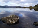
Loch Shin
Encyclopedia
Loch Shin is a loch
in the Scottish North West Highlands
. To the south is the small town of Lairg
. The loch is the largest in Sutherland
, runs from the north-west to the south-east and is 17 miles (27.2 kilometre) long.
In the 1950s, the level of the loch was raised by over 30 feet (10 metres) by the construction of Lairg Dam by Wimpey Construction
as part of a hydro-electric
scheme.
Around the loch are some mountain ranges; the 3,273 foot (998 m) Ben More Assynt
in the west and Ben Klibreck
(3,154 feet/962 metre) to the east. The loch drains to the North Sea
by way of the short River Shin
that feeds into the Dornoch Firth
.
Three miles to the north of Lairg is a monument to remember an early attempt to tame the Highlands
. During the 1870s, the Duke of Sutherland
ploughed up about 2,000 acres (8 km²), but the industry never rewarded that. Today the area around the loch is one of the major farming centres for sheep in Scotland
.
Loch
Loch is the Irish and Scottish Gaelic word for a lake or a sea inlet. It has been anglicised as lough, although this is pronounced the same way as loch. Some lochs could also be called a firth, fjord, estuary, strait or bay...
in the Scottish North West Highlands
Scottish Highlands
The Highlands is an historic region of Scotland. The area is sometimes referred to as the "Scottish Highlands". It was culturally distinguishable from the Lowlands from the later Middle Ages into the modern period, when Lowland Scots replaced Scottish Gaelic throughout most of the Lowlands...
. To the south is the small town of Lairg
Lairg
Lairg is a village in Sutherland, Highland, Scotland. It has a population of about 700and is situated at the south-eastern end of Lairg is a village in [[Sutherland]], [[Highland |Highland]], [[Scotland]]...
. The loch is the largest in Sutherland
Sutherland
Sutherland is a registration county, lieutenancy area and historic administrative county of Scotland. It is now within the Highland local government area. In Gaelic the area is referred to according to its traditional areas: Dùthaich 'IcAoidh , Asainte , and Cataibh...
, runs from the north-west to the south-east and is 17 miles (27.2 kilometre) long.
In the 1950s, the level of the loch was raised by over 30 feet (10 metres) by the construction of Lairg Dam by Wimpey Construction
George Wimpey
George Wimpey was formed in 1880 and, based in Hammersmith, operated largely as a road surfacing contractor. The business was acquired by Godfrey Mitchell in 1919 and he developed it into the UK’s pre-eminent construction and housebuilding firm. In 2007, Wimpey merged with Taylor Woodrow to create...
as part of a hydro-electric
Hydroelectricity
Hydroelectricity is the term referring to electricity generated by hydropower; the production of electrical power through the use of the gravitational force of falling or flowing water. It is the most widely used form of renewable energy...
scheme.
Around the loch are some mountain ranges; the 3,273 foot (998 m) Ben More Assynt
Ben More Assynt
Ben More Assynt is a mountain in Assynt in the far north-west of Scotland, north-north-east of the town of Ullapool...
in the west and Ben Klibreck
Ben Klibreck
Ben Klibreck is a Scottish mountain located in central Sutherland. It is an isolated hill, rising above a large area of moorland. The highest point, Meall nan Con, rises to 962 m and is therefore the second most northerly Munro after Ben Hope...
(3,154 feet/962 metre) to the east. The loch drains to the North Sea
North Sea
In the southwest, beyond the Straits of Dover, the North Sea becomes the English Channel connecting to the Atlantic Ocean. In the east, it connects to the Baltic Sea via the Skagerrak and Kattegat, narrow straits that separate Denmark from Norway and Sweden respectively...
by way of the short River Shin
River Shin
The River Shin is a river in the Scottish North West Highlands.The river flows from Loch Shin into the Dornoch Firth and then into the North Sea. The river is just long....
that feeds into the Dornoch Firth
Dornoch Firth
The Dornoch Firth is a firth on the east coast of Highland, in northern Scotland. It forms part of the boundary between Ross and Cromarty, to the south, and Sutherland, to the north....
.
Three miles to the north of Lairg is a monument to remember an early attempt to tame the Highlands
Scottish Highlands
The Highlands is an historic region of Scotland. The area is sometimes referred to as the "Scottish Highlands". It was culturally distinguishable from the Lowlands from the later Middle Ages into the modern period, when Lowland Scots replaced Scottish Gaelic throughout most of the Lowlands...
. During the 1870s, the Duke of Sutherland
George Sutherland-Leveson-Gower, 3rd Duke of Sutherland
George Granville William Sutherland Leveson-Gower, 3rd Duke of Sutherland , styled Viscount Trentham until 1833, Earl Gower in 1833 and Marquess of Stafford between 1833 and 1861, was a British politician.-Background:Sutherland was the son of George Sutherland-Leveson-Gower, 2nd Duke of Sutherland...
ploughed up about 2,000 acres (8 km²), but the industry never rewarded that. Today the area around the loch is one of the major farming centres for sheep in Scotland
Scotland
Scotland is a country that is part of the United Kingdom. Occupying the northern third of the island of Great Britain, it shares a border with England to the south and is bounded by the North Sea to the east, the Atlantic Ocean to the north and west, and the North Channel and Irish Sea to the...
.

