

List of numbered roads in York Region
Encyclopedia
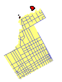


York Region
Regional Municipality of York, Ontario
The Regional Municipality of York, also called York Region, is a regional municipality in Southern Ontario, Canada, between Lake Simcoe and Toronto. It replaced the former York County in 1971, and is part of the Greater Toronto Area and the inner ring of the Golden Horseshoe...
, located in southwestern Ontario
Ontario
Ontario is a province of Canada, located in east-central Canada. It is Canada's most populous province and second largest in total area. It is home to the nation's most populous city, Toronto, and the nation's capital, Ottawa....
, assigned approximately 50 regional road
Regional road
A regional road in Ireland is a class of road not forming a major route , but nevertheless forming a link in the national route network. There are over 11,600 kilometres of regional roads. Regional roads are numbered with three digit route numbers, prefixed by "R" A regional road in Ireland is a...
s, each with a number ranging from 1 to 99. All expenses of York Regional Roads (for example, snow shoveling, road repairs, traffic lights) are funded by the York Region government.
Boundaries of York Region
- Steeles AvenueSteeles AvenueSteeles Avenue is an east-west street that forms the northern city limit of Toronto and the southern limit of York Region, Ontario, Canada. It stretches across the western Greater Toronto Area from Milborough Townline in Halton Region east to the Scarborough-Pickering limit. It runs for within...
marks the York Region / City of Toronto Boundary - York-Durham Regional Road 30 (York-Durham Line) and York Regional Road 32 (Ravenshoe Road) mark the York Region / Durham RegionRegional Municipality of Durham, OntarioThe Regional Municipality of Durham, informally referred to as Durham Region, is a regional municipality located in Southern Ontario east of Toronto, Ontario. It has an area of approximately 2,500 square kilometres. Durham Region is considered part of the Greater Toronto Area, with the communities...
boundary - York Regional Road 24 (or Peel Regional Road 50) marks the York Region / Peel RegionRegional Municipality of Peel, OntarioThe Regional Municipality of Peel is a regional municipality in Southern Ontario, Canada. It consists of three municipalities to the west and northwest of Toronto: the cities of Brampton and Mississauga, and the town of Caledon. The entire region is part of the Greater Toronto Area and the inner...
boundary - Highway 9Highway 9 (Ontario)King's Highway 9, also known as Highway 9, is a provincially maintained highway in the Canadian province of Ontario. Often cited as an example of poor planning, Highway 9 has been divided into two segments since January 1, 1998, when the segment between Harriston and Orangeville was downloaded to...
and Holland RiverHolland RiverThe Holland River is a river in Ontario, Canada that drains the Holland River watershed into Cook's Bay, the southern extremity of Lake Simcoe. It is named after Captain Samuel Holland, , Dutch born first Surveyor General of British North America. The river flows generally north, and its...
form the York Region / Simcoe CountySimcoe County, OntarioSimcoe County is located in central portion of Southern Ontario. The County is situated just north of the Greater Toronto Area stretching from the shores of Lake Simcoe in the east to Georgian Bay in the west...
boundary
Regional Roads
| Regional road # | Local Name | Western/Northern terminus | Eastern/Southern terminus | Municipality(ies) within York Region | Additional notes/Traffic |
|---|---|---|---|---|---|
 |
Yonge Street | York Region / Simcoe County boundary | Steeles Avenue Steeles Avenue Steeles Avenue is an east-west street that forms the northern city limit of Toronto and the southern limit of York Region, Ontario, Canada. It stretches across the western Greater Toronto Area from Milborough Townline in Halton Region east to the Scarborough-Pickering limit. It runs for within... |
Markham Markham, Ontario Markham is a town in the Regional Municipality of York, located within the Greater Toronto Area of Southern Ontario, Canada. The population was 261,573 at the 2006 Canadian census... , Vaughan Vaughan, Ontario Vaughan is a city in York Region north of Toronto, Ontario, Canada. Vaughan is the fastest growing municipality in Canada achieving a population growth rate of 80.2% between 1996–2006, according to Statistics Canada having nearly doubled in population since 1991. Vaughan is located in Southern... , Richmond Hill Richmond Hill, Ontario Richmond Hill is a town located in Southern Ontario, Canada in the central portion of York Region, Ontario. It is part of the Greater Toronto Area, being located about halfway between Toronto and Lake Simcoe... , Aurora Aurora, Ontario Aurora is an affluent town in York Region, approximately 20 km north of Toronto. It is partially situated on the Oak Ridges Moraine, and is a part of the Greater Toronto Area and Golden Horseshoe of Southern Ontario.Many Aurora residents commute to Toronto and surrounding communities.In the... , Newmarket Newmarket, Ontario Newmarket is a town in Southern Ontario located approximately 50 km north of downtown Toronto, Ontario, Canada. It is part of the Greater Toronto Area and is connected to Toronto by freeway, and is served by three interchanges along Highway 404. It is also connected to Highway 400 via Highway 9... , East Gwillimbury |
Very busy road with a lot of traffic (especially in Richmond Hill, Thornhill, and Toronto Toronto Toronto is the provincial capital of Ontario and the largest city in Canada. It is located in Southern Ontario on the northwestern shore of Lake Ontario. A relatively modern city, Toronto's history dates back to the late-18th century, when its land was first purchased by the British monarchy from... ). Viva Blue Viva Blue Viva Blue, or the Finch/Richmond Hill/Newmarket line, is a line on the Viva bus rapid transit system in York Region, north of Toronto, Canada... runs on Yonge Street. |
 |
Kennedy Road | Lake Drive East in Georgina Georgina, Ontario Georgina is a town in south-central Ontario, and the northernmost municipality in the Regional Municipality of York. It forms part of the northern boundary of the Greater Toronto Area and is situated on the southern shores of Lake Simcoe... |
Steeles Avenue Steeles Avenue Steeles Avenue is an east-west street that forms the northern city limit of Toronto and the southern limit of York Region, Ontario, Canada. It stretches across the western Greater Toronto Area from Milborough Townline in Halton Region east to the Scarborough-Pickering limit. It runs for within... |
Markham Markham, Ontario Markham is a town in the Regional Municipality of York, located within the Greater Toronto Area of Southern Ontario, Canada. The population was 261,573 at the 2006 Canadian census... , Stouffville Whitchurch-Stouffville, Ontario Whitchurch–Stouffville is a municipality in the Greater Toronto Area of Ontario, Canada, approximately 14 kilometres north of the City of Toronto. It is 206.74 square kilometers in size, and located in the mid-eastern area of the Regional Municipality of York on the ecologically sensitive Oak... , East Gwillimbury, Georgina Georgina, Ontario Georgina is a town in south-central Ontario, and the northernmost municipality in the Regional Municipality of York. It forms part of the northern boundary of the Greater Toronto Area and is situated on the southern shores of Lake Simcoe... |
Former sections of Kennedy before the present alignment include Old Kennedy Road, Fresno Circuit, and Main Street Unionville Main Street Unionville Main Street Unionville is a collector route that runs through the historical suburban community of Unionville, Ontario. Like most other Main Streets, the street serves as an important road for local tourism development. All along the road, the street has structures that are virtually unchanged from... . |
| Eagle Street Water Street Gorham Street |
Yonge Street | Leslie Street | Newmarket Newmarket, Ontario Newmarket is a town in Southern Ontario located approximately 50 km north of downtown Toronto, Ontario, Canada. It is part of the Greater Toronto Area and is connected to Toronto by freeway, and is served by three interchanges along Highway 404. It is also connected to Highway 400 via Highway 9... |
One of Newmarket's busiest residential roads. Crosses the north end of Fairy Lake in Newmarket. Transferred to Newmarket. | |
 |
Keele Street | King Road | Steeles Avenue Steeles Avenue Steeles Avenue is an east-west street that forms the northern city limit of Toronto and the southern limit of York Region, Ontario, Canada. It stretches across the western Greater Toronto Area from Milborough Townline in Halton Region east to the Scarborough-Pickering limit. It runs for within... |
Vaughan Vaughan, Ontario Vaughan is a city in York Region north of Toronto, Ontario, Canada. Vaughan is the fastest growing municipality in Canada achieving a population growth rate of 80.2% between 1996–2006, according to Statistics Canada having nearly doubled in population since 1991. Vaughan is located in Southern... , King King, Ontario King is a township in York Region north of Toronto, within the Greater Toronto Area in Ontario, Canada.The rolling hills of the Oak Ridges Moraine are the most prominent visible geographical feature of King. The Holland Marsh, considered to be Ontario's "vegetable basket", straddles King Township... |
Sometimes referred to as 4th Concession Road |
 |
Highway 7 | York Region / Peel Region Boundary | Main Street Markham | Vaughan Vaughan, Ontario Vaughan is a city in York Region north of Toronto, Ontario, Canada. Vaughan is the fastest growing municipality in Canada achieving a population growth rate of 80.2% between 1996–2006, according to Statistics Canada having nearly doubled in population since 1991. Vaughan is located in Southern... , Richmond Hill Richmond Hill, Ontario Richmond Hill is a town located in Southern Ontario, Canada in the central portion of York Region, Ontario. It is part of the Greater Toronto Area, being located about halfway between Toronto and Lake Simcoe... , Markham Markham, Ontario Markham is a town in the Regional Municipality of York, located within the Greater Toronto Area of Southern Ontario, Canada. The population was 261,573 at the 2006 Canadian census... |
This route is a very heavily travelled route, especially between Highway 400 and McCowan Road in Vaughan, Richmond Hill, and Markham. Most of Viva Purple Viva Purple Viva Purple, or the York University/Richmond Hill/Cornell line, is a line on the Viva bus rapid transit system in York Region, north of Toronto, Canada... and Viva Pink Viva Pink Viva Pink, or the Finch-Richmond Hill-Unionville line, is a bus rapid transit line in York Region, north of Toronto, Canada.There are eighteen stations on the Viva Pink line, plus one proposed :... run on Highway 7. This route was part of Ontario Highway 7 before the 1997 downloadings. |
 |
Woodbine Avenue | Lake Drive North in Georgina Georgina, Ontario Georgina is a town in south-central Ontario, and the northernmost municipality in the Regional Municipality of York. It forms part of the northern boundary of the Greater Toronto Area and is situated on the southern shores of Lake Simcoe... |
Steeles Avenue Steeles Avenue Steeles Avenue is an east-west street that forms the northern city limit of Toronto and the southern limit of York Region, Ontario, Canada. It stretches across the western Greater Toronto Area from Milborough Townline in Halton Region east to the Scarborough-Pickering limit. It runs for within... |
Markham Markham, Ontario Markham is a town in the Regional Municipality of York, located within the Greater Toronto Area of Southern Ontario, Canada. The population was 261,573 at the 2006 Canadian census... , Stouffville Whitchurch-Stouffville, Ontario Whitchurch–Stouffville is a municipality in the Greater Toronto Area of Ontario, Canada, approximately 14 kilometres north of the City of Toronto. It is 206.74 square kilometers in size, and located in the mid-eastern area of the Regional Municipality of York on the ecologically sensitive Oak... , Georgina Georgina, Ontario Georgina is a town in south-central Ontario, and the northernmost municipality in the Regional Municipality of York. It forms part of the northern boundary of the Greater Toronto Area and is situated on the southern shores of Lake Simcoe... |
Intersection of Woodbine Avenue and Elgin Mills Road was realigned. The Woodbine By-Pass opened on November 15, 2010. |
| Baseline Road | Woodbine Avenue | Dalton Road | Georgina Georgina, Ontario Georgina is a town in south-central Ontario, and the northernmost municipality in the Regional Municipality of York. It forms part of the northern boundary of the Greater Toronto Area and is situated on the southern shores of Lake Simcoe... |
The road as an undersigned York Regional Road number #88, which makes it the second highest numbered York Regional Road. | |
| Dalton Road | Lake Drive North | Baseline Road | Georgina Georgina, Ontario Georgina is a town in south-central Ontario, and the northernmost municipality in the Regional Municipality of York. It forms part of the northern boundary of the Greater Toronto Area and is situated on the southern shores of Lake Simcoe... (Sutton Sutton, Ontario Sutton is a suburban community located nearly 2 km south of Lake Simcoe in Ontario, Canada. The community was formerly a village but is now part of the Town of Georgina after amalgamation with it and North Gwillimbury in 1971.-Geography and information:... ) |
It passes through the heart of Sutton | |
 |
King Road | York Region / Peel Region Boundary | Yonge Street | Richmond Hill Richmond Hill, Ontario Richmond Hill is a town located in Southern Ontario, Canada in the central portion of York Region, Ontario. It is part of the Greater Toronto Area, being located about halfway between Toronto and Lake Simcoe... , King King, Ontario King is a township in York Region north of Toronto, within the Greater Toronto Area in Ontario, Canada.The rolling hills of the Oak Ridges Moraine are the most prominent visible geographical feature of King. The Holland Marsh, considered to be Ontario's "vegetable basket", straddles King Township... |
It passes through King City King City, Ontario King City is an affluent, unincorporated village in King Township, Ontario, Canada, located just north of Toronto. It is the largest community in King Township, with 1,629 dwellings and a population of 4,902.-History:... , Nobleton Nobleton, Ontario Nobleton is an unincorporated village in southwestern King, Ontario, Canada. It is the third-largest community in the township, after King City and Schomberg. Located south of the Oak Ridges Moraine, Nobleton is surrounded by hills and forests... and Oak Ridges Oak Ridges, Ontario Oak Ridges is an unincorporated community in Ontario, Canada, and has been part of Richmond Hill's administrative area since its annexation in 1971. Although physically separate and distinct from Richmond Hill, it forms the northern portion of the municipality's boundary. Located about 16.5 km... |
 |
Don Mills Road Leslie Street The Queensway South |
Metro Road South / Morton Avenue | Steeles Avenue Steeles Avenue Steeles Avenue is an east-west street that forms the northern city limit of Toronto and the southern limit of York Region, Ontario, Canada. It stretches across the western Greater Toronto Area from Milborough Townline in Halton Region east to the Scarborough-Pickering limit. It runs for within... |
Markham Markham, Ontario Markham is a town in the Regional Municipality of York, located within the Greater Toronto Area of Southern Ontario, Canada. The population was 261,573 at the 2006 Canadian census... , Richmond Hill Richmond Hill, Ontario Richmond Hill is a town located in Southern Ontario, Canada in the central portion of York Region, Ontario. It is part of the Greater Toronto Area, being located about halfway between Toronto and Lake Simcoe... , Aurora Aurora, Ontario Aurora is an affluent town in York Region, approximately 20 km north of Toronto. It is partially situated on the Oak Ridges Moraine, and is a part of the Greater Toronto Area and Golden Horseshoe of Southern Ontario.Many Aurora residents commute to Toronto and surrounding communities.In the... , Newmarket Newmarket, Ontario Newmarket is a town in Southern Ontario located approximately 50 km north of downtown Toronto, Ontario, Canada. It is part of the Greater Toronto Area and is connected to Toronto by freeway, and is served by three interchanges along Highway 404. It is also connected to Highway 400 via Highway 9... , East Gwillimbury, Georgina Georgina, Ontario Georgina is a town in south-central Ontario, and the northernmost municipality in the Regional Municipality of York. It forms part of the northern boundary of the Greater Toronto Area and is situated on the southern shores of Lake Simcoe... |
Famous for its recent blooming of commercial and industrial areas in Richmond Hill |
| Mount Albert Road Bradford Street Yonge Street Yonge Street Yonge Street is a major arterial route connecting the shores of Lake Ontario in Toronto to Lake Simcoe, a gateway to the Upper Great Lakes. It was formerly listed in the Guinness Book of Records as the longest street in the world at , and the construction of Yonge Street is designated an "Event of... |
Holland Landing Road | York-Durham Line | East Gwillimbury | Connects Holland Landing, Sharon Sharon, Ontario Sharon is a former village which has been incorporated into the municipality of the Town of East Gwillimbury, Ontario, Canada, formerly the Township of East Gwillimbury... and Mount Albert Mount Albert, Ontario Mount Albert is an exurban community located within the Town of East Gwillimbury and is part of northern York Region. It is located about 65 km N of Toronto, about 15 km NE of Newmarket, about 15 km S of Sutton, W SW of Beaverton and N of Markham... |
|
 |
Stouffville Road Main Street Stouffville |
Yonge Street | York-Durham Line | Richmond Hill Richmond Hill, Ontario Richmond Hill is a town located in Southern Ontario, Canada in the central portion of York Region, Ontario. It is part of the Greater Toronto Area, being located about halfway between Toronto and Lake Simcoe... , Stouffville Whitchurch-Stouffville, Ontario Whitchurch–Stouffville is a municipality in the Greater Toronto Area of Ontario, Canada, approximately 14 kilometres north of the City of Toronto. It is 206.74 square kilometers in size, and located in the mid-eastern area of the Regional Municipality of York on the ecologically sensitive Oak... |
It passes through the heart of Gormley Gormley - People :* Antony Gormley , British-born German-Irish sculptor* Beatrice Gormley, American children's writer* Bob Gormley , former U.S... and Stouffville. It is one of the busiest rural roads in York Region. |
 |
Wellington Street Aurora Road |
Dufferin Street | York-Durham Line | King King, Ontario King is a township in York Region north of Toronto, within the Greater Toronto Area in Ontario, Canada.The rolling hills of the Oak Ridges Moraine are the most prominent visible geographical feature of King. The Holland Marsh, considered to be Ontario's "vegetable basket", straddles King Township... Aurora Aurora, Ontario Aurora is an affluent town in York Region, approximately 20 km north of Toronto. It is partially situated on the Oak Ridges Moraine, and is a part of the Greater Toronto Area and Golden Horseshoe of Southern Ontario.Many Aurora residents commute to Toronto and surrounding communities.In the... , Whitchurch-Stouffville Whitchurch-Stouffville, Ontario Whitchurch–Stouffville is a municipality in the Greater Toronto Area of Ontario, Canada, approximately 14 kilometres north of the City of Toronto. It is 206.74 square kilometers in size, and located in the mid-eastern area of the Regional Municipality of York on the ecologically sensitive Oak... |
Pass through the centre of Aurora. The Aurora GO train station can also be found on this road. |
 |
Lloydtown-Aurora Road Jane Street 18th Sideroad |
Highway 27 | Bathurst Street | King King, Ontario King is a township in York Region north of Toronto, within the Greater Toronto Area in Ontario, Canada.The rolling hills of the Oak Ridges Moraine are the most prominent visible geographical feature of King. The Holland Marsh, considered to be Ontario's "vegetable basket", straddles King Township... (Community of Lloydtown) |
Accessible to Highway 400, links Aurora Aurora, Ontario Aurora is an affluent town in York Region, approximately 20 km north of Toronto. It is partially situated on the Oak Ridges Moraine, and is a part of the Greater Toronto Area and Golden Horseshoe of Southern Ontario.Many Aurora residents commute to Toronto and surrounding communities.In the... and Lloydtown |
| Islington Avenue | Major MacKenzie Drive | Steeles Avenue Steeles Avenue Steeles Avenue is an east-west street that forms the northern city limit of Toronto and the southern limit of York Region, Ontario, Canada. It stretches across the western Greater Toronto Area from Milborough Townline in Halton Region east to the Scarborough-Pickering limit. It runs for within... |
Vaughan Vaughan, Ontario Vaughan is a city in York Region north of Toronto, Ontario, Canada. Vaughan is the fastest growing municipality in Canada achieving a population growth rate of 80.2% between 1996–2006, according to Statistics Canada having nearly doubled in population since 1991. Vaughan is located in Southern... |
Because this road is along the Humber River Humber River (Ontario) The Humber River is one of two major rivers on either side of Toronto, Ontario, Canada, the other being the Don River to the east. It was designated a Canadian Heritage River on September 24, 1999.... , this road is very steep at times and contains a lot of curves |
|
| Park Road | Hedge Road in Georgina Georgina, Ontario Georgina is a town in south-central Ontario, and the northernmost municipality in the Regional Municipality of York. It forms part of the northern boundary of the Greater Toronto Area and is situated on the southern shores of Lake Simcoe... |
Ravenshoe Road | Georgina Georgina, Ontario Georgina is a town in south-central Ontario, and the northernmost municipality in the Regional Municipality of York. It forms part of the northern boundary of the Greater Toronto Area and is situated on the southern shores of Lake Simcoe... |
The road passes through Sibbald Point Provincial Park Sibbald Point Provincial Park Sibbald Point Provincial Park is a provincial park located in Sutton West, Ontario, Canada on the southern shores of Lake Simcoe, 70 km north of Toronto... , and accessible to Highway 48 Highway 48 (Ontario) King's Highway 48, also known as Highway 48, is a provincially-maintained highway in southern Ontario that extends from Major Mackenzie Drive in Markham, through Whitchurch-Stouffville, to Highway 12 south-east of Beaverton, Ontario. Prior to 1998, Highway 48 extended from Highway 401 in Toronto to... |
|
 |
Green Lane | Bathurst Street | Woodbine Avenue | East Gwillimbury | Highway 404's terminus is at Green Lane (until its future extension is complete), and because of that, traffic is very busy between Yonge Street Yonge Street Yonge Street is a major arterial route connecting the shores of Lake Ontario in Toronto to Lake Simcoe, a gateway to the Upper Great Lakes. It was formerly listed in the Guinness Book of Records as the longest street in the world at , and the construction of Yonge Street is designated an "Event of... and Highway 404 |
| Pefferlaw Road | Highway 48 Highway 48 (Ontario) King's Highway 48, also known as Highway 48, is a provincially-maintained highway in southern Ontario that extends from Major Mackenzie Drive in Markham, through Whitchurch-Stouffville, to Highway 12 south-east of Beaverton, Ontario. Prior to 1998, Highway 48 extended from Highway 401 in Toronto to... |
Lake Ridge Road (York Region / Durham Region Boundary) | Georgina Georgina, Ontario Georgina is a town in south-central Ontario, and the northernmost municipality in the Regional Municipality of York. It forms part of the northern boundary of the Greater Toronto Area and is situated on the southern shores of Lake Simcoe... |
Passes through the heart of Pefferlaw | |
 |
Highway 50 | Peel Regional Road 14 (Mayfield Road) | Steeles Avenue Steeles Avenue Steeles Avenue is an east-west street that forms the northern city limit of Toronto and the southern limit of York Region, Ontario, Canada. It stretches across the western Greater Toronto Area from Milborough Townline in Halton Region east to the Scarborough-Pickering limit. It runs for within... |
Vaughan Vaughan, Ontario Vaughan is a city in York Region north of Toronto, Ontario, Canada. Vaughan is the fastest growing municipality in Canada achieving a population growth rate of 80.2% between 1996–2006, according to Statistics Canada having nearly doubled in population since 1991. Vaughan is located in Southern... |
Forms the boundary between York Region and Peel Region. Most often referred to as Peel Regional Road 50 Peel Regional Road 50 King's Highway 50, commonly referred to as Highway 50, was a provincially maintained highway in the Canadian province of Ontario. The highway was decommissioned in 1998, though locals still frequently refer to it as Highway 50... , although the road lies in York Region geographically until Peel Regional Road 14. |
 |
Major MacKenzie Drive | York Region/Peel Region boundary | York-Durham Line | Vaughan Vaughan, Ontario Vaughan is a city in York Region north of Toronto, Ontario, Canada. Vaughan is the fastest growing municipality in Canada achieving a population growth rate of 80.2% between 1996–2006, according to Statistics Canada having nearly doubled in population since 1991. Vaughan is located in Southern... , Richmond Hill Richmond Hill, Ontario Richmond Hill is a town located in Southern Ontario, Canada in the central portion of York Region, Ontario. It is part of the Greater Toronto Area, being located about halfway between Toronto and Lake Simcoe... , Markham Markham, Ontario Markham is a town in the Regional Municipality of York, located within the Greater Toronto Area of Southern Ontario, Canada. The population was 261,573 at the 2006 Canadian census... |
Formerly a rural road, but urban sprawl in Markham and Vaughan has turned this road into somewhat of an urban thoroughfare. Named after Major Addison Alexander Mackenzie Addison Alexander Mackenzie Dr. Addison Alexander Mackenzie MC , was a Canadian soldier and doctor from Richmond Hill, Ontario.He originally pursued a military career, joining the Governor-General's Body Guard in 1912... , a former provincial politician and World War I veteran. |
| St. John's Sideroad | Bathurst Street | Woodbine Avenue | Aurora Aurora, Ontario Aurora is an affluent town in York Region, approximately 20 km north of Toronto. It is partially situated on the Oak Ridges Moraine, and is a part of the Greater Toronto Area and Golden Horseshoe of Southern Ontario.Many Aurora residents commute to Toronto and surrounding communities.In the... , Stouffville Whitchurch-Stouffville, Ontario Whitchurch–Stouffville is a municipality in the Greater Toronto Area of Ontario, Canada, approximately 14 kilometres north of the City of Toronto. It is 206.74 square kilometers in size, and located in the mid-eastern area of the Regional Municipality of York on the ecologically sensitive Oak... |
No access to Highway 404 | |
 |
Highway 27 | Highway 9 Highway 9 (Ontario) King's Highway 9, also known as Highway 9, is a provincially maintained highway in the Canadian province of Ontario. Often cited as an example of poor planning, Highway 9 has been divided into two segments since January 1, 1998, when the segment between Harriston and Orangeville was downloaded to... or York Region / Simcoe County boundary |
Steeles Avenue Steeles Avenue Steeles Avenue is an east-west street that forms the northern city limit of Toronto and the southern limit of York Region, Ontario, Canada. It stretches across the western Greater Toronto Area from Milborough Townline in Halton Region east to the Scarborough-Pickering limit. It runs for within... |
Vaughan Vaughan, Ontario Vaughan is a city in York Region north of Toronto, Ontario, Canada. Vaughan is the fastest growing municipality in Canada achieving a population growth rate of 80.2% between 1996–2006, according to Statistics Canada having nearly doubled in population since 1991. Vaughan is located in Southern... , King King, Ontario King is a township in York Region north of Toronto, within the Greater Toronto Area in Ontario, Canada.The rolling hills of the Oak Ridges Moraine are the most prominent visible geographical feature of King. The Holland Marsh, considered to be Ontario's "vegetable basket", straddles King Township... |
Formerly Highway 27 (referred to as Highway 27 in Toronto, and Simcoe County Road 27 in Simcoe County) |
| Gamble Road 19th Avenue |
Bathurst Street | Leslie Street | Richmond Hill Richmond Hill, Ontario Richmond Hill is a town located in Southern Ontario, Canada in the central portion of York Region, Ontario. It is part of the Greater Toronto Area, being located about halfway between Toronto and Lake Simcoe... , Markham Markham, Ontario Markham is a town in the Regional Municipality of York, located within the Greater Toronto Area of Southern Ontario, Canada. The population was 261,573 at the 2006 Canadian census... |
||
 |
York-Durham Line (Also Durham Regional Road 30) | Queensville Sideroad in East Gwillimbury East Gwillimbury, Ontario East Gwillimbury is a town on the East Holland River in the Regional Municipality of York. It is part of the Greater Toronto Area of south-central Ontario, in Canada. It was formed by the amalgamation of the Township of East Gwillimbury with all the previously incorporated villages and hamlets... |
Steeles Avenue Steeles Avenue Steeles Avenue is an east-west street that forms the northern city limit of Toronto and the southern limit of York Region, Ontario, Canada. It stretches across the western Greater Toronto Area from Milborough Townline in Halton Region east to the Scarborough-Pickering limit. It runs for within... |
Markham Markham, Ontario Markham is a town in the Regional Municipality of York, located within the Greater Toronto Area of Southern Ontario, Canada. The population was 261,573 at the 2006 Canadian census... , Stouffville Whitchurch-Stouffville, Ontario Whitchurch–Stouffville is a municipality in the Greater Toronto Area of Ontario, Canada, approximately 14 kilometres north of the City of Toronto. It is 206.74 square kilometers in size, and located in the mid-eastern area of the Regional Municipality of York on the ecologically sensitive Oak... , East Gwillimbury |
Separates Durham Region and York Region |
 |
Davis Drive (Formerly Provincial Highway 9) | Jane Street | York-Durham Region boundary | Newmarket Newmarket, Ontario Newmarket is a town in Southern Ontario located approximately 50 km north of downtown Toronto, Ontario, Canada. It is part of the Greater Toronto Area and is connected to Toronto by freeway, and is served by three interchanges along Highway 404. It is also connected to Highway 400 via Highway 9... , East Gwillimbury, Stouffville Whitchurch-Stouffville, Ontario Whitchurch–Stouffville is a municipality in the Greater Toronto Area of Ontario, Canada, approximately 14 kilometres north of the City of Toronto. It is 206.74 square kilometers in size, and located in the mid-eastern area of the Regional Municipality of York on the ecologically sensitive Oak... |
One of the busiest rural roads in York Region, separates East Gwillimbury and Whitchurch-Stouffville. Road is still referred to as Davis Drive east into Durham Region |
| Ravenshoe Road | Holland River Holland River The Holland River is a river in Ontario, Canada that drains the Holland River watershed into Cook's Bay, the southern extremity of Lake Simcoe. It is named after Captain Samuel Holland, , Dutch born first Surveyor General of British North America. The river flows generally north, and its... at a dead end |
Lakeridge Road (Durham Regional Road 23) | Georgina Georgina, Ontario Georgina is a town in south-central Ontario, and the northernmost municipality in the Regional Municipality of York. It forms part of the northern boundary of the Greater Toronto Area and is situated on the southern shores of Lake Simcoe... |
Runs from southeast of Keswick Keswick, Ontario Keswick is a community in the south central portion of the Canadian province of Ontario. Located north of Toronto on Cook's Bay , Keswick is part of the Town of Georgina... to Udora. |
|
 |
Glenwoods Avenue | The Queensway South | Woodbine Avenue | Georgina Georgina, Ontario Georgina is a town in south-central Ontario, and the northernmost municipality in the Regional Municipality of York. It forms part of the northern boundary of the Greater Toronto Area and is situated on the southern shores of Lake Simcoe... |
|
 |
Bayview Avenue Prospect Street |
Davis Drive | Steeles Avenue Steeles Avenue Steeles Avenue is an east-west street that forms the northern city limit of Toronto and the southern limit of York Region, Ontario, Canada. It stretches across the western Greater Toronto Area from Milborough Townline in Halton Region east to the Scarborough-Pickering limit. It runs for within... |
Markham Markham, Ontario Markham is a town in the Regional Municipality of York, located within the Greater Toronto Area of Southern Ontario, Canada. The population was 261,573 at the 2006 Canadian census... , Richmond Hill Richmond Hill, Ontario Richmond Hill is a town located in Southern Ontario, Canada in the central portion of York Region, Ontario. It is part of the Greater Toronto Area, being located about halfway between Toronto and Lake Simcoe... , Aurora Aurora, Ontario Aurora is an affluent town in York Region, approximately 20 km north of Toronto. It is partially situated on the Oak Ridges Moraine, and is a part of the Greater Toronto Area and Golden Horseshoe of Southern Ontario.Many Aurora residents commute to Toronto and surrounding communities.In the... , Newmarket Newmarket, Ontario Newmarket is a town in Southern Ontario located approximately 50 km north of downtown Toronto, Ontario, Canada. It is part of the Greater Toronto Area and is connected to Toronto by freeway, and is served by three interchanges along Highway 404. It is also connected to Highway 400 via Highway 9... |
Very busy with a lot of traffic especially in Markham and Richmond Hill. In Newmarket, a handful of York Region's government buildings can be found. |
 |
Bathurst Street | Holland Marsh Holland Marsh The Holland Marsh is a wetland and agricultural area north of Toronto, Ontario. It lies entirely within the valley of the Holland River, stretching from the northern edge of the Oak Ridges Moraine near Schomberg to the river mouth at Cook's Bay, Lake Simcoe. In its entirety it comprises about or... at a dead end |
Steeles Avenue Steeles Avenue Steeles Avenue is an east-west street that forms the northern city limit of Toronto and the southern limit of York Region, Ontario, Canada. It stretches across the western Greater Toronto Area from Milborough Townline in Halton Region east to the Scarborough-Pickering limit. It runs for within... |
Vaughan Vaughan, Ontario Vaughan is a city in York Region north of Toronto, Ontario, Canada. Vaughan is the fastest growing municipality in Canada achieving a population growth rate of 80.2% between 1996–2006, according to Statistics Canada having nearly doubled in population since 1991. Vaughan is located in Southern... , King King, Ontario King is a township in York Region north of Toronto, within the Greater Toronto Area in Ontario, Canada.The rolling hills of the Oak Ridges Moraine are the most prominent visible geographical feature of King. The Holland Marsh, considered to be Ontario's "vegetable basket", straddles King Township... , Newmarket Newmarket, Ontario Newmarket is a town in Southern Ontario located approximately 50 km north of downtown Toronto, Ontario, Canada. It is part of the Greater Toronto Area and is connected to Toronto by freeway, and is served by three interchanges along Highway 404. It is also connected to Highway 400 via Highway 9... |
The road was interrupted by the natural landscape in King |
 |
Bloomington Road | Bathurst Street | York-Durham Line | Richmond Hill Richmond Hill, Ontario Richmond Hill is a town located in Southern Ontario, Canada in the central portion of York Region, Ontario. It is part of the Greater Toronto Area, being located about halfway between Toronto and Lake Simcoe... , Stouffville Whitchurch-Stouffville, Ontario Whitchurch–Stouffville is a municipality in the Greater Toronto Area of Ontario, Canada, approximately 14 kilometres north of the City of Toronto. It is 206.74 square kilometers in size, and located in the mid-eastern area of the Regional Municipality of York on the ecologically sensitive Oak... |
Formerly Highway 47, one of the busiest rural roads in York Region |
 |
Doane Road | Yonge Street | Woodbine Avenue | East Gwillimbury | Runs from Holland Landing to south of Queensville. |
 |
Donald Cousens Parkway York Regional Road 48 Donald Cousens Parkway, regionally designated as York Regional Road 48 and historically known as the Markham Bypass or Markham Bypass Extension, is a regionally maintained arterial bypass of Markham in the Canadian province of Ontario... |
Major MacKenzie Drive | Highway 407 | Markham Markham, Ontario Markham is a town in the Regional Municipality of York, located within the Greater Toronto Area of Southern Ontario, Canada. The population was 261,573 at the 2006 Canadian census... |
The road is newly constructed, and therefore the terminus could change in a year-to-year basis. Furthermore, the road is for trucks that have now been banned from Main Street Markham. Formerly called Markham Bypass, the road is now named after the former mayor of Markham, Donald Cousens. |
| |
Elgin Mills Road Teston Road Nashville Road |
York Region / Peel Region Boundary | Woodbine Avenue | Vaughan Vaughan, Ontario Vaughan is a city in York Region north of Toronto, Ontario, Canada. Vaughan is the fastest growing municipality in Canada achieving a population growth rate of 80.2% between 1996–2006, according to Statistics Canada having nearly doubled in population since 1991. Vaughan is located in Southern... , Richmond Hill Richmond Hill, Ontario Richmond Hill is a town located in Southern Ontario, Canada in the central portion of York Region, Ontario. It is part of the Greater Toronto Area, being located about halfway between Toronto and Lake Simcoe... , Markham Markham, Ontario Markham is a town in the Regional Municipality of York, located within the Greater Toronto Area of Southern Ontario, Canada. The population was 261,573 at the 2006 Canadian census... |
York Regional Road status was interrupted between Highway 27 and Pine Valley Drive, and also between Keele Street and Dufferin Street. |
| Yonge Street | Queensville Sideroad | Yonge Street | East Gwillimbury | The road passes through the heart of Holland Landing and serves as an extension of Yonge Street | |
 |
Dufferin Street | Lloydtown-Aurora Road / 18th Sideroad | Steeles Avenue Steeles Avenue Steeles Avenue is an east-west street that forms the northern city limit of Toronto and the southern limit of York Region, Ontario, Canada. It stretches across the western Greater Toronto Area from Milborough Townline in Halton Region east to the Scarborough-Pickering limit. It runs for within... |
King King, Ontario King is a township in York Region north of Toronto, within the Greater Toronto Area in Ontario, Canada.The rolling hills of the Oak Ridges Moraine are the most prominent visible geographical feature of King. The Holland Marsh, considered to be Ontario's "vegetable basket", straddles King Township... , Vaughan Vaughan, Ontario Vaughan is a city in York Region north of Toronto, Ontario, Canada. Vaughan is the fastest growing municipality in Canada achieving a population growth rate of 80.2% between 1996–2006, according to Statistics Canada having nearly doubled in population since 1991. Vaughan is located in Southern... |
Sometimes referred to as 3rd Concession Road |
 |
Jane Street | Highway 9 Highway 9 (Ontario) King's Highway 9, also known as Highway 9, is a provincially maintained highway in the Canadian province of Ontario. Often cited as an example of poor planning, Highway 9 has been divided into two segments since January 1, 1998, when the segment between Harriston and Orangeville was downloaded to... |
Steeles Avenue Steeles Avenue Steeles Avenue is an east-west street that forms the northern city limit of Toronto and the southern limit of York Region, Ontario, Canada. It stretches across the western Greater Toronto Area from Milborough Townline in Halton Region east to the Scarborough-Pickering limit. It runs for within... |
King King, Ontario King is a township in York Region north of Toronto, within the Greater Toronto Area in Ontario, Canada.The rolling hills of the Oak Ridges Moraine are the most prominent visible geographical feature of King. The Holland Marsh, considered to be Ontario's "vegetable basket", straddles King Township... , Vaughan Vaughan, Ontario Vaughan is a city in York Region north of Toronto, Ontario, Canada. Vaughan is the fastest growing municipality in Canada achieving a population growth rate of 80.2% between 1996–2006, according to Statistics Canada having nearly doubled in population since 1991. Vaughan is located in Southern... |
Sometimes referred to as 5th Concession Road |
 |
Weston Road | Highway 9 Highway 9 (Ontario) King's Highway 9, also known as Highway 9, is a provincially maintained highway in the Canadian province of Ontario. Often cited as an example of poor planning, Highway 9 has been divided into two segments since January 1, 1998, when the segment between Harriston and Orangeville was downloaded to... |
Steeles Avenue Steeles Avenue Steeles Avenue is an east-west street that forms the northern city limit of Toronto and the southern limit of York Region, Ontario, Canada. It stretches across the western Greater Toronto Area from Milborough Townline in Halton Region east to the Scarborough-Pickering limit. It runs for within... |
King King, Ontario King is a township in York Region north of Toronto, within the Greater Toronto Area in Ontario, Canada.The rolling hills of the Oak Ridges Moraine are the most prominent visible geographical feature of King. The Holland Marsh, considered to be Ontario's "vegetable basket", straddles King Township... , Vaughan Vaughan, Ontario Vaughan is a city in York Region north of Toronto, Ontario, Canada. Vaughan is the fastest growing municipality in Canada achieving a population growth rate of 80.2% between 1996–2006, according to Statistics Canada having nearly doubled in population since 1991. Vaughan is located in Southern... |
Sometimes referred to as 6th Concession Road |
 |
Pine Valley Drive | Teston Road | Steeles Avenue Steeles Avenue Steeles Avenue is an east-west street that forms the northern city limit of Toronto and the southern limit of York Region, Ontario, Canada. It stretches across the western Greater Toronto Area from Milborough Townline in Halton Region east to the Scarborough-Pickering limit. It runs for within... |
Vaughan Vaughan, Ontario Vaughan is a city in York Region north of Toronto, Ontario, Canada. Vaughan is the fastest growing municipality in Canada achieving a population growth rate of 80.2% between 1996–2006, according to Statistics Canada having nearly doubled in population since 1991. Vaughan is located in Southern... |
Pine Valley Drive's York Regional Road status was interrupted between Langstaff Road and Rutherford Road |
 |
Warden Avenue | Ravenshoe Road | Steeles Avenue Steeles Avenue Steeles Avenue is an east-west street that forms the northern city limit of Toronto and the southern limit of York Region, Ontario, Canada. It stretches across the western Greater Toronto Area from Milborough Townline in Halton Region east to the Scarborough-Pickering limit. It runs for within... |
Markham Markham, Ontario Markham is a town in the Regional Municipality of York, located within the Greater Toronto Area of Southern Ontario, Canada. The population was 261,573 at the 2006 Canadian census... , Stouffville Whitchurch-Stouffville, Ontario Whitchurch–Stouffville is a municipality in the Greater Toronto Area of Ontario, Canada, approximately 14 kilometres north of the City of Toronto. It is 206.74 square kilometers in size, and located in the mid-eastern area of the Regional Municipality of York on the ecologically sensitive Oak... , East Gwillimbury |
Passes through the heart of the developing Downtown Markham and is being widened to 6 lanes from Steeles to Apple Creek Drive to accommodate the anticipated traffic it will bring. Traffic frequently jams up between Apple Creek and Highway 7 due to the amount of traffic lights on that stretch. |
 |
McCowan Road | Bloomington Road | Steeles Avenue Steeles Avenue Steeles Avenue is an east-west street that forms the northern city limit of Toronto and the southern limit of York Region, Ontario, Canada. It stretches across the western Greater Toronto Area from Milborough Townline in Halton Region east to the Scarborough-Pickering limit. It runs for within... |
Markham Markham, Ontario Markham is a town in the Regional Municipality of York, located within the Greater Toronto Area of Southern Ontario, Canada. The population was 261,573 at the 2006 Canadian census... , Stouffville Whitchurch-Stouffville, Ontario Whitchurch–Stouffville is a municipality in the Greater Toronto Area of Ontario, Canada, approximately 14 kilometres north of the City of Toronto. It is 206.74 square kilometers in size, and located in the mid-eastern area of the Regional Municipality of York on the ecologically sensitive Oak... |
Passes through Markville Mall in Markham and is the temporary eastern terminus for Viva Purple Viva Purple Viva Purple, or the York University/Richmond Hill/Cornell line, is a line on the Viva bus rapid transit system in York Region, north of Toronto, Canada... . This road also jams up frequently between Highway 407 and Bullock Drive, due to Markville Mall and the amount of traffic lights in the area. |
 |
Markham Road Main Street Markham |
Highway 407 | Steeles Avenue Steeles Avenue Steeles Avenue is an east-west street that forms the northern city limit of Toronto and the southern limit of York Region, Ontario, Canada. It stretches across the western Greater Toronto Area from Milborough Townline in Halton Region east to the Scarborough-Pickering limit. It runs for within... |
Markham Markham, Ontario Markham is a town in the Regional Municipality of York, located within the Greater Toronto Area of Southern Ontario, Canada. The population was 261,573 at the 2006 Canadian census... |
Formerly Highway 48 Highway 48 (Ontario) King's Highway 48, also known as Highway 48, is a provincially-maintained highway in southern Ontario that extends from Major Mackenzie Drive in Markham, through Whitchurch-Stouffville, to Highway 12 south-east of Beaverton, Ontario. Prior to 1998, Highway 48 extended from Highway 401 in Toronto to... , the road becomes Highway 48 after 16th Avenue |
 |
Ninth Line | Aurora Road | Steeles Avenue Steeles Avenue Steeles Avenue is an east-west street that forms the northern city limit of Toronto and the southern limit of York Region, Ontario, Canada. It stretches across the western Greater Toronto Area from Milborough Townline in Halton Region east to the Scarborough-Pickering limit. It runs for within... |
Markham Markham, Ontario Markham is a town in the Regional Municipality of York, located within the Greater Toronto Area of Southern Ontario, Canada. The population was 261,573 at the 2006 Canadian census... , Stouffville Whitchurch-Stouffville, Ontario Whitchurch–Stouffville is a municipality in the Greater Toronto Area of Ontario, Canada, approximately 14 kilometres north of the City of Toronto. It is 206.74 square kilometers in size, and located in the mid-eastern area of the Regional Municipality of York on the ecologically sensitive Oak... |
Was at once considered for an expressway. 9th Line borders Cornell and is now changing from a rural road to somewhat of an urban thoroughfare due to urban sprawl, especially in Cornell Cornell, Ontario Cornell is a new community being developed in northeast Markham, Ontario and bounded by Highway 407, 16th Avenue, Ninth Line, and the Don Cousens Parkway.-History:... |
| 14th Avenue Centre Street |
Highway 7 | York-Durham Line | Markham Markham, Ontario Markham is a town in the Regional Municipality of York, located within the Greater Toronto Area of Southern Ontario, Canada. The population was 261,573 at the 2006 Canadian census... , Vaughan Vaughan, Ontario Vaughan is a city in York Region north of Toronto, Ontario, Canada. Vaughan is the fastest growing municipality in Canada achieving a population growth rate of 80.2% between 1996–2006, according to Statistics Canada having nearly doubled in population since 1991. Vaughan is located in Southern... |
York Regional Road status interrupted between Warden Avenue and Bathurst Street. The original road, however, is linked by Alden Road, John Street John Street (Markham) John Street is an east-west arterial road in the Town of Markham, Ontario. It is one of the oldest roads in the Township of Markham and forms the backbone of the 200 year old community of Thornhill.... and Esna Park Drive, but they are not recognized officially as York Regional Road 71. |
|
 |
Langstaff Road | York Region / Peel Region boundary | Highway 7 | Vaughan Vaughan, Ontario Vaughan is a city in York Region north of Toronto, Ontario, Canada. Vaughan is the fastest growing municipality in Canada achieving a population growth rate of 80.2% between 1996–2006, according to Statistics Canada having nearly doubled in population since 1991. Vaughan is located in Southern... |
The road is interrupted twice. The first time is between Keele Street and Jane Street because of the CN Canadian National Railway The Canadian National Railway Company is a Canadian Class I railway headquartered in Montreal, Quebec. CN's slogan is "North America's Railroad".... rail yard. The second time is between Islington Avenue and Highwya 27 because of the Humber River Humber River (Ontario) The Humber River is one of two major rivers on either side of Toronto, Ontario, Canada, the other being the Don River to the east. It was designated a Canadian Heritage River on September 24, 1999.... . |
 |
16th Avenue Carrville Road Rutherford Road |
York Region/Peel Region boundary | York-Durham Line | Vaughan Vaughan, Ontario Vaughan is a city in York Region north of Toronto, Ontario, Canada. Vaughan is the fastest growing municipality in Canada achieving a population growth rate of 80.2% between 1996–2006, according to Statistics Canada having nearly doubled in population since 1991. Vaughan is located in Southern... , Richmond Hill Richmond Hill, Ontario Richmond Hill is a town located in Southern Ontario, Canada in the central portion of York Region, Ontario. It is part of the Greater Toronto Area, being located about halfway between Toronto and Lake Simcoe... , Markham Markham, Ontario Markham is a town in the Regional Municipality of York, located within the Greater Toronto Area of Southern Ontario, Canada. The population was 261,573 at the 2006 Canadian census... |
One of the busiest roads in York Region. It is often packed during the rush hour periods between Kennedy Road and Warden Avenue in Markham. |
 |
Mulock Drive Vivian Drive |
Bathurst Street | York-Durham Line | Newmarket Newmarket, Ontario Newmarket is a town in Southern Ontario located approximately 50 km north of downtown Toronto, Ontario, Canada. It is part of the Greater Toronto Area and is connected to Toronto by freeway, and is served by three interchanges along Highway 404. It is also connected to Highway 400 via Highway 9... , Stouffville Whitchurch-Stouffville, Ontario Whitchurch–Stouffville is a municipality in the Greater Toronto Area of Ontario, Canada, approximately 14 kilometres north of the City of Toronto. It is 206.74 square kilometers in size, and located in the mid-eastern area of the Regional Municipality of York on the ecologically sensitive Oak... |
|
| Main Street (Schomberg) | Highway 9 Highway 9 (Ontario) King's Highway 9, also known as Highway 9, is a provincially maintained highway in the Canadian province of Ontario. Often cited as an example of poor planning, Highway 9 has been divided into two segments since January 1, 1998, when the segment between Harriston and Orangeville was downloaded to... |
Highway 27 | King King, Ontario King is a township in York Region north of Toronto, within the Greater Toronto Area in Ontario, Canada.The rolling hills of the Oak Ridges Moraine are the most prominent visible geographical feature of King. The Holland Marsh, considered to be Ontario's "vegetable basket", straddles King Township... |
||
| Queensville Sideroad | Bathurst Street | Woodbine Avenue | East Gwillimbury | Connects River Drive Park, Holland Landing and Queensville. | |
| Metro Road Morton Avenue |
Woodbine Avenue | Dalton Road | Georgina Georgina, Ontario Georgina is a town in south-central Ontario, and the northernmost municipality in the Regional Municipality of York. It forms part of the northern boundary of the Greater Toronto Area and is situated on the southern shores of Lake Simcoe... |
Built on the former railway of the Toronto and York Radial Railway Toronto and York Radial Railway The Toronto and York Radial Railway operated radial transit services outside of Toronto. Service began in 1904 with the merger of several operators:* Metropolitan Street Railway... , it passes through the heart of the community of Keswick Keswick, Ontario Keswick is a community in the south central portion of the Canadian province of Ontario. Located north of Toronto on Cook's Bay , Keswick is part of the Town of Georgina... |
|
| Old Homestead Road Station Road |
Metro Road North | Pufferlaw Road | Georgina Georgina, Ontario Georgina is a town in south-central Ontario, and the northernmost municipality in the Regional Municipality of York. It forms part of the northern boundary of the Greater Toronto Area and is situated on the southern shores of Lake Simcoe... |
||
| Black River Road | Dalton Road | Park Road | Georgina Georgina, Ontario Georgina is a town in south-central Ontario, and the northernmost municipality in the Regional Municipality of York. It forms part of the northern boundary of the Greater Toronto Area and is situated on the southern shores of Lake Simcoe... |
Named after Black River Black River (Ontario) Black River may refer to several rivers by that name in the province of Ontario, Canada.*The Black River in Hastings County, Ontario joins the Moira River near Tweed, Ontario.... in Jackson's Point, Ontario |
|
| Weir's Sideroad | Old Homestead Road | Ravenshoe Road | Georgina Georgina, Ontario Georgina is a town in south-central Ontario, and the northernmost municipality in the Regional Municipality of York. It forms part of the northern boundary of the Greater Toronto Area and is situated on the southern shores of Lake Simcoe... |
||
| Victoria Road | Ravenshoe Road | Lake Ridge Road (York Region / Durham Region Boundary) | Georgina Georgina, Ontario Georgina is a town in south-central Ontario, and the northernmost municipality in the Regional Municipality of York. It forms part of the northern boundary of the Greater Toronto Area and is situated on the southern shores of Lake Simcoe... |
||
| Holland Landing Road | Yonge Street | Toll Road | East Gwillimbury | ||
| 99 | Highway 427 | Zenway Boulevard | Highway 7 | Vaughan Vaughan, Ontario Vaughan is a city in York Region north of Toronto, Ontario, Canada. Vaughan is the fastest growing municipality in Canada achieving a population growth rate of 80.2% between 1996–2006, according to Statistics Canada having nearly doubled in population since 1991. Vaughan is located in Southern... |
York Region built "extension" of Highway 427. Regional Road 99 will be bypassed and subsequently removed with the pending northerly extension of Highway 427. |