
Main Street Unionville
Encyclopedia

Unionville, Ontario
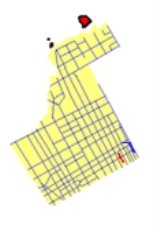
Unionville is a suburban village in Markham, Ontario, Canada. It is located 33 km northeast of downtown Toronto and 4 km east of southern Richmond Hill. Unionville is located between Woodbine Avenue as the western limit, alongside the Rouge River leading to McCowan Road as the eastern...
. Like most other Main Street
Main Street
Main Street is the metonym for a generic street name of the primary retail street of a village, town, or small city in many parts of the world...
s, the street serves as an important road for local tourism development. All along the road, the street has structures that are virtually unchanged from its founding in 1794. Renowned for its pubs, parks, restaurants, and its historical European view, the road also hosts the annual Unionville Festival, which draws several thousand visitors to the town.
Road Information
- Local name: Main Street
- Attractions: Unionville Fairways Golf Course, Historical Village of UnionvilleUnionville, OntarioUnionville is a suburban village in Markham, Ontario, Canada. It is located 33 km northeast of downtown Toronto and 4 km east of southern Richmond Hill. Unionville is located between Woodbine Avenue as the western limit, alongside the Rouge River leading to McCowan Road as the eastern...
, Varley Gallery - Road Status: From Unionville Gate to Carlton Road, the road is a paved 4-lane avenue, with a speed limit of 40 km/h. However, the right lane is often blocked due to parked vehicles left by tourists. North of Carlton Road, the road is a paved, two-laned street.
- Zonings: Mainly commercial and parklands, with residential zonings from 1794.
Entertainment Trivia
Main Street Unionville hosts annual jazz and Celtic festivals, as well as live music in the new bandstand in the summer. The street was also used as a stand-in for fictional Connecticut town Stars Hollow during the first season of The WB's Gilmore GirlsGilmore Girls
Gilmore Girls is an American family comedy-drama series created by Amy Sherman-Palladino, starring Lauren Graham and Alexis Bledel. On October 5, 2000, the series debuted on The WB and was cancelled in its seventh season, ending on May 15, 2007 on The CW...
television show.
Also, the movie The Scream Team
The Scream Team
The Scream Team is a Disney Channel Original Movie. The movie was aired October 23 , 2004 in the U.S.- Plot :Two children move into a town where their grandfather has just died. They later discover that a society of ghosts are searching for their grandfather's lost soul. The children decide to find...
, was shot on this street.
Road History
Main Street Unionville was the original 6th line of Markham Township. This road was undeveloped until about 1840 when the mill was developed at what is now Carlton Road. The mill needed the water from the pond to the north-west but the swamp to its immediate south made travel virtually impossible. The common road developed along the ridge to the south and this became the main passage way. About this time the area on the north-west corner of the road and 15th Avenue (now York Regional Road 7) was subdivided but undeveloped until the coming of the railway in 1872. UnionvilleUnionville
-Canada:*Unionville, Ontario**Unionville GO Station, a station in the GO Transit network located in the community-United States:*Unionville, Connecticut*Unionville, Georgia*Unionville, Illinois, the former name of Streator, Illinois*Unionville, Indiana...
, as the center of the township, had until the 1970s held the town offices. The development of the subdivision immediately to the west of the small town in the late 1960s, brought attention to the run down nature of the buildings in the business area. The provincial government, with support of the regional and township governments were prepared to widen the road, which would have meant the demolition of the buildings. A great furor arose, culminating the Unionville Annual Festival, whose original purpose was to bring attention to the situation and to raise funds to fight the widening. Quickly, local politicians came on board and the road widening was stopped. In the early 1980s, the bypass was built around Main Street Unionville to relieve the heavy traffic. The bypass became what is now Kennedy Road and the original line was renamed as Main Street Unionville. With the coming of change the buildings were revived and a unique Victorian Village atmosphere came into being.
Landmarks
- Unionville Fairways Golf Course
- Historical Village of UnionvilleUnionville, OntarioUnionville is a suburban village in Markham, Ontario, Canada. It is located 33 km northeast of downtown Toronto and 4 km east of southern Richmond Hill. Unionville is located between Woodbine Avenue as the western limit, alongside the Rouge River leading to McCowan Road as the eastern...
- Varley Art Gallery
- Unionville Library