
List of crossings of the Rivière des Mille Îles
Encyclopedia
This is a list of bridge
s and other crossings from Laval
to the north shore
of the Rivière des Mille Îles
from where it joins the Rivière des Prairies
upstream to the Ottawa River
(Lac des Deux Montagnes
).
Bridge
A bridge is a structure built to span physical obstacles such as a body of water, valley, or road, for the purpose of providing passage over the obstacle...
s and other crossings from Laval
Laval, Quebec
Laval is a Canadian city and a region in southwestern Quebec. It is the largest suburb of Montreal, the third largest municipality in the province of Quebec, and the 14th largest city in Canada with a population of 368,709 in 2006...
to the north shore
North Shore (Laval)
The North Shore is the general term for the northern suburbs of Montreal. The North Shore is located in southwestern Quebec on the northern shores of the Rivière des Prairies and the Rivière des Mille Îles, opposite the Island of Montreal and the Island of Laval. It consists of twenty...
of the Rivière des Mille Îles
Rivière des Mille Îles
The Rivière des Mille Îles is a channel of the Ottawa River in southwestern Quebec, Canada and runs into the Rivière des Prairies....
from where it joins the Rivière des Prairies
Rivière des Prairies
The Rivière des Prairies is a delta channel of the Ottawa River in southwestern Quebec, Canada....
upstream to the Ottawa River
Ottawa River
The Ottawa River is a river in the Canadian provinces of Ontario and Quebec. For most of its length, it now defines the border between these two provinces.-Geography:...
(Lac des Deux Montagnes
Lac des Deux Montagnes
Lake of Two Mountains is part of the river delta widening of the Ottawa River in Quebec, Canada, where it feeds into the St. Lawrence River....
).
| Crossing | Year | Carries | Location | Coordinates Geographic coordinate system A geographic coordinate system is a coordinate system that enables every location on the Earth to be specified by a set of numbers. The coordinates are often chosen such that one of the numbers represent vertical position, and two or three of the numbers represent horizontal position... and comments |
|---|---|---|---|---|
| Railway Bridge, R des M-Î/QGR1 | Quebec Gatineau Railway Chemins de Fer Québec-Gatineau Les Chemins de fer Québec-Gatineau , in English the Quebec Gatineau Railway is a shortline railway operating the long ex-Canadian Pacific Railway line between Quebec City, Trois-Rivières, Laval, Lachute and Gatineau, formerly Hull... |
Laval Laval, Quebec Laval is a Canadian city and a region in southwestern Quebec. It is the largest suburb of Montreal, the third largest municipality in the province of Quebec, and the 14th largest city in Canada with a population of 368,709 in 2006... (Saint-François Saint-François, Quebec Saint-François is the second largest neighbourhood of Laval, Quebec, Canada, after Duvernay. It was a separate city until the municipal mergers on August 6, 1965.Agriculture occupies most of the land area.... ) - Terrebonne Terrebonne, Quebec Terrebonne is an off-island suburb of Montreal, in western Quebec, Canada. It is located on the north shores of the Rivière des Mille-Îles and of the Rivière des Prairies, North of Montreal and Laval.... |
45°41′34"N 73°37′17"W | |
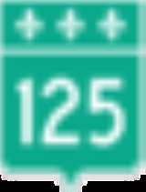
| Pont Sophie-Masson | 2006/ 2008 |
Route 125 Quebec route 125 Route 125 is a Quebec highway running from Montreal to Saint-Donat, Quebec in the Laurentians. The southern section of Route 125 runs parallel to Autoroute 25 in Laval, Mascouche, and Terrebonne... |
Laval (Saint-François) - Terrebonne | 45°41′22"N 73°37′47"W * Replaces Vieux Pont de Terrebonne which has been sold as scrap Scrap Scrap is a term used to describe recyclable and other materials left over from every manner of product consumption, such as parts of vehicles, building supplies, and surplus materials. Unlike waste, scrap has significant monetary value... . |
| Pont Préfontaine-Prévost, a.k.a Vieux Pont de Terrebonne | Abandoned | Laval (Saint-François) - Terrebonne | 45°41′22"N 73°37′47"W * Replaced by Pont Sophie-Masson and sold as scrap. |
|
| Île des Moulins dam | Île des Moulins dam | Within Terrebonne, from Île Saint-Jean to Île des Moulins, and from Île des Moulins to the mainland. | Pedestrians and bicycles only. Partial crossing |
|
| Pont Matthieu |  Autoroute 25 Autoroute 25Quebec Autoroute 25 Autoroute 25 is an Autoroute in the Lanaudière region of Quebec. It is currently long.... |
Laval (Saint-François) - Terrebonne (Île Sain-Jean) | 45°41′18"N 73°39′1"W | |
| Pont Lepage | Terrebonne (Île Sain-Jean) - Terrebonne (Rive Nord North Shore (Laval) The North Shore is the general term for the northern suburbs of Montreal. The North Shore is located in southwestern Quebec on the northern shores of the Rivière des Prairies and the Rivière des Mille Îles, opposite the Island of Montreal and the Island of Laval. It consists of twenty... ) |
45°41′46"N 73°39′4"W | ||
| Plage des Îles | Plage des Îles | Within Laval, connects Laval (Saint-François) with Île Saint-Joseph (Saint-François) only | 45°40′50"N 73°42′3"W Partial crossing |
|
| Pont Anathase-David | Route 335 Quebec route 335 Route 335 is a north-south route from Montreal north into the Lanaudière region of Quebec.South of The Metropolitan 335 runs on Rue Saint-Denis to its southern terminus. Northwards until the Rivière des Prairies, 335 runs on Rue Berri south and Rue Lajeunesse north, then it runs over the Pont Viau... |
Laval (Auteuil Auteuil, Quebec Auteuil is a neighbourhood in Laval, Quebec. It was a separate city until the municipal mergers on August 6, 1965.- Geography :Auteuil is delimited north-west by the Rivière des Mille-Îles, north-east by Saint-François, south-east by Duvernay, south by Vimont and south-west by Sainte-Rose... ) - Bois-des-Filion Bois-des-Filion, Quebec Bois-des-Filion is an off-island suburb of Montreal, located in Quebec, Canada, to the north of Montreal.Historically, hundreds of families annually traveled to this region seasonally to experience the magnificent maple forests; however the tourist industry is currently a minor source of income for... |
45°39′40"N 73°45′13"W | |
| Railway Bridge, R des M-Î/QGR2 | Quebec Gatineau Railway Chemins de Fer Québec-Gatineau Les Chemins de fer Québec-Gatineau , in English the Quebec Gatineau Railway is a shortline railway operating the long ex-Canadian Pacific Railway line between Quebec City, Trois-Rivières, Laval, Lachute and Gatineau, formerly Hull... AMT Agence métropolitaine de transport The Agence métropolitaine de transport is the umbrella organization that plans, integrates, and coordinates public transportation services across Canada's Greater Montreal Region, including the Island of Montreal, Laval , and communities along both the North Shore of the Rivière des Mille-Îles... Blainville-Saint-Jerome |
Laval (Sainte-Rose Sainte-Rose, Quebec Sainte-Rose is a neighbourhood in Laval, Quebec. It was incorporated as a village in 1850, and was a separate town until the municipal mergers on August 6, 1965 which amalgamated all the municipalities on Île Jésus into a single City of Laval.... ) - Rosemère Rosemère, Quebec Rosemère is an off-island suburb of Montreal, in southwestern Quebec, Canada on the north shore of the Rivière des Mille-Îles in the Regional County Municipality of Thérèse-de-Blainville. The town is noted for its green look, due to the high density of trees. Some wooded areas in the town have... |
45°37′50"N 73°47′15"W | |
| Pont Marius-Dufresne | Route 117 Quebec route 117 Route 117 is a provincial highway within the Canadian province of Quebec, running between Montreal and the Quebec/Ontario border where it continues as Highway 66 east of Kearns, Ontario... |
Laval (Sainte-Rose Sainte-Rose, Quebec Sainte-Rose is a neighbourhood in Laval, Quebec. It was incorporated as a village in 1850, and was a separate town until the municipal mergers on August 6, 1965 which amalgamated all the municipalities on Île Jésus into a single City of Laval.... ) - Rosemère Rosemère, Quebec Rosemère is an off-island suburb of Montreal, in southwestern Quebec, Canada on the north shore of the Rivière des Mille-Îles in the Regional County Municipality of Thérèse-de-Blainville. The town is noted for its green look, due to the high density of trees. Some wooded areas in the town have... via Île Bélair |
45°36′55"N 73°47′39"W | |
| Île Ducharme | Chemin de l'Île-Ducharme | Within Boisbriand, connects Île Ducharme to the mainland | 45°37′8"N 73°48′25"W Partial crossing |
|
| Île Gagnon | Rue Île-Gagnon | Within Laval, connects Île Gagnon to Laval (Sainte-Rose) | 45°36′31"N 73°47′52"W Partial crossing, private |
|
| Pont Gédéon-Ouimet |  Autoroute 15 Autoroute 15Quebec Autoroute 15 Autoroute 15 is a highway in western Quebec, Canada... |
Laval (Fabreville Fabreville, Quebec Fabreville is a neighbourhood in Laval, Quebec. It was a separate city until the municipal mergers on August 6, 1965.- Geography :Fabreville is delimited north-west by the Rivière des Mille-Îles, north-east by Sainte-Rose, south-east by Chomedey, south by Sainte-Dorothée and west by Laval-Ouest.The... /Sainte-Rose Sainte-Rose, Quebec Sainte-Rose is a neighbourhood in Laval, Quebec. It was incorporated as a village in 1850, and was a separate town until the municipal mergers on August 6, 1965 which amalgamated all the municipalities on Île Jésus into a single City of Laval.... ) - Boisbriand Boisbriand, Quebec Boisbriand is an off-island suburb of Montreal, in southwestern Quebec, Canada on the north shore of the Rivière des Mille-Îles in the Regional County Municipality of Thérèse-de-Blainville.The Hasidic community of Kiryas Tosh is located within the city limits... via Île Locas (no exit) |
45°36′33"N 73°48′41"W | |
| Île Locas | Bd de Lisbonne | Within Laval, connects Île Locas to Laval (Fabreville) | 45°36′21"N 73°48′40"W Partial crossing |
|
| Île Morris | Chemin de l'Île Morris | Within Boisbriand, connects Île Morris to the mainland. | 45°36′47"N 73°49′14"W Partial crossing |
|
| Île de Mai | Chemin de l'Île de Mai | Within Boisbriand, connects Île de Mai to the mainland. | 45°36′34"N 73°49′42"W Partial crossing |
|
| Pont Vachon |  Autoroute 13 Autoroute 13Quebec Autoroute 13 Autoroute 13 , is a freeway in the urban region of Montreal, Quebec, Canada. Its southern end is at the junction of A-20 on the Island of Montreal near Pierre Elliott Trudeau International Airport. Its northern terminus is at the junction of A-640 near Boisbriand... |
Laval (Fabreville) - Boisbriand/Saint-Eustache | 45°34′50"N 73°50′15"W | |
| Îles Corbeil | Chemin des Îles Corbeil | Within Saint-Eustache, connects Îles Corbeil to the mainland. | 45°34′50"N 73°50′15"W Partial crossing |
|
| Private bridge | Chemin des Îles Yale | Within Saint-Eustache, connects Îles Yale to the mainland. | 45°34′42"N 73°51′10"W Partial crossing, private |
|
| Pont Arthur-Sauvé | Route 148 Quebec route 148 Route 148 is a major east-west highway in Quebec, Canada. It runs from Autoroute 25 in Laval in the Montreal region to the Ontario-Quebec border in L'Isle-aux-Allumettes in western Quebec. For most of its length, Route 148 follows the north shore of the Ottawa River where it acts as the principal... |
Laval (Laval-Ouest Laval-Ouest, Quebec Laval-Ouest is a neighbourhood in Laval, Quebec. It was a separate city until the municipal mergers on August 6, 1965.- Geography :Laval-Ouest is delimited north and north-west by the Rivière des Mille-Îles, south-west by Laval-sur-le-Lac, east by Fabreville and south by Sainte-Dorothée.-External... ) - Saint-Eustache Saint-Eustache, Quebec Saint-Eustache is an off-island suburb of Montreal, in western Quebec, Canada, west of Montreal on the north shore of the Rivière des Mille-Îles.... |
45°33′30"N 73°53′22"W | |
| Barrage du Grand-Moulin(aka Le Barrage des Grands Moulins or Barrage Grand-Moulin), Flood control gate Flood control In communications, flood control is a feature of many communication protocols designed to prevent overwhelming of a destination receiver. Such controls can be implemented either in software or in hardware, and will often request that the message be resent after the receiver has finished... |
Top deck carries pedestrian Pedestrian A pedestrian is a person traveling on foot, whether walking or running. In some communities, those traveling using roller skates or skateboards are also considered to be pedestrians. In modern times, the term mostly refers to someone walking on a road or footpath, but this was not the case... s and bicycle Bicycle A bicycle, also known as a bike, pushbike or cycle, is a human-powered, pedal-driven, single-track vehicle, having two wheels attached to a frame, one behind the other. A person who rides a bicycle is called a cyclist, or bicyclist.... s |
Laval (Laval-sur-le-Lac Laval-sur-le-Lac Laval-sur-le-Lac is a small neighbourhood on the western-end part of Laval and was a separate city until the municipal mergers on August 6, 1965.- Geography :... ) - Deux-Montagnes Deux-Montagnes, Quebec Deux-Montagnes is a municipality in southwestern Quebec, Canada on the north shore of the Rivière des Mille Îles where it flows out of Lake of Two Mountains... , via Île Boisée which is in Laval-Ouest |
45°32′1"N 73°52′58"W | |
| Railway Bridge, R des M-Î/CN | Canadian National Railway Canadian National Railway The Canadian National Railway Company is a Canadian Class I railway headquartered in Montreal, Quebec. CN's slogan is "North America's Railroad".... AMT Agence métropolitaine de transport The Agence métropolitaine de transport is the umbrella organization that plans, integrates, and coordinates public transportation services across Canada's Greater Montreal Region, including the Island of Montreal, Laval , and communities along both the North Shore of the Rivière des Mille-Îles... Deux-Montagnes |
45°32′1"N 73°52′58"W Immediately upstream from the barrage |
See also
- List of crossings of the Rivière des Prairies
- List of crossings of the Saint Lawrence River
- List of bridges in Montreal
- List of crossings of the Ottawa River
External links
- Interactive map of Laval from the official website Shows both the borders and names of the 14 former municipalities (purple) and the borders only of the current 6 sectors (maroon), tick off both boxes beside "Limite administrative".