

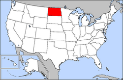
List of cities in North Dakota
Encyclopedia
This is a list of places incorporated
in the North Dakota as a city
, regardless of size; there are no towns, villages, or hamlets in the state.
 Population data based on 2010 Census.
Municipal corporation
A municipal corporation is the legal term for a local governing body, including cities, counties, towns, townships, charter townships, villages, and boroughs. Municipal incorporation occurs when such municipalities become self-governing entities under the laws of the state or province in which...
in the North Dakota as a city
City
A city is a relatively large and permanent settlement. Although there is no agreement on how a city is distinguished from a town within general English language meanings, many cities have a particular administrative, legal, or historical status based on local law.For example, in the U.S...
, regardless of size; there are no towns, villages, or hamlets in the state.
Largest cities
| Rank | City/Town | Population | County |
|---|---|---|---|
| 1 | Fargo † Fargo, North Dakota Fargo is the largest city in the U.S. state of North Dakota and the county seat of Cass County. In 2010, its population was 105,549, and it had an estimated metropolitan population of 208,777... |
105,549 | Cass Cass County, North Dakota -Demographics:As of the census of 2000, there were 123,138 people, 51,315 households, and 29,814 families residing in the county. The population density was 70 people per square mile . There were 53,790 housing units at an average density of 30 per square mile... |
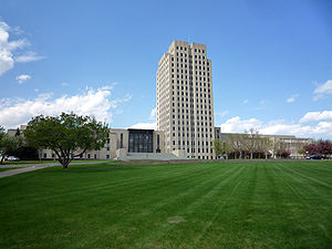
| 2 | Bismarck †† Bismarck, North Dakota Bismarck is the capital of the U.S. state of North Dakota and the county seat of Burleigh County. It is the second most populous city in North Dakota after Fargo. The city's population was 61,272 at the 2010 census, while its metropolitan population was 108,779... |
61,272 | Burleigh Burleigh County, North Dakota -National protected areas:*Canfield Lake National Wildlife Refuge*Florence Lake National Wildlife Refuge*Long Lake National Wildlife Refuge -Demographics:... |
| 3 | Grand Forks † Grand Forks, North Dakota Grand Forks is the third-largest city in the U.S. state of North Dakota and the county seat of Grand Forks County. According to the 2010 census, the city's population was 52,838, while that of the city and surrounding metropolitan area was 98,461... |
52,838 | Grand Forks Grand Forks County, North Dakota -National protected areas:*Kellys Slough National Wildlife Refuge*Little Goose National Wildlife Refuge-Demographics:As of the census of 2000, there were 66,109 people, 25,435 households, and 15,617 families residing in the county. The population density was 46 people per square mile . There were... |
| 4 | Minot † Minot, North Dakota Minot is a city located in north central North Dakota in the United States. It is most widely known for the Air Force base located approximately 15 miles north of the city. With a population of 40,888 at the 2010 census, Minot is the fourth largest city in the state... |
40,888 | Ward Ward County, North Dakota -National protected areas:*Des Lacs National Wildlife Refuge *Hiddenwood National Wildlife Refuge *Upper Souris National Wildlife Refuge -Demographics:... |
| 5 | West Fargo West Fargo, North Dakota As of the census of 2000, there were 14,940 people, 5,771 households, and 4,091 families residing in the city, however the current population of West Fargo is estimated at over 26,000 residents. The population density was 2,049.2 per square mile . There were 5,968 housing units at an average... |
25,830 | Cass Cass County, North Dakota -Demographics:As of the census of 2000, there were 123,138 people, 51,315 households, and 29,814 families residing in the county. The population density was 70 people per square mile . There were 53,790 housing units at an average density of 30 per square mile... |
| 6 | Mandan † Mandan, North Dakota As of the census of 2000, there were 16,718 people, 6,647 households, and 4,553 families residing in the city. The population density was 1,642.8 per square mile . There were 6,958 housing units at an average density of 683.7 per square mile... |
18,331 | Morton Morton County, North Dakota -Demographics:As of the census of 2000, there were 25,303 people, 9,889 households, and 6,932 families residing in the county. The population density was 13 people per square mile . There were 10,587 housing units at an average density of 6 per square mile... |
| 7 | Dickinson † Dickinson, North Dakota As of the census of 2000, there were 16,010 people, 6,517 households, and 4,020 families residing in the city. The population density was 1,690.7 inhabitants per square mile . There were 7,033 housing units at an average density of 742.7 per square mile... |
17,787 | Stark Stark County, North Dakota -Demographics:As of the census of 2000, there were 22,636 people, 8,932 households, and 5,877 families residing in the county. The population density was 17 people per square mile . There were 9,722 housing units at an average density of 7 per square mile... |
| 8 | Jamestown † Jamestown, North Dakota As of the census of 2000, there were 15,527 people, 6,505 households, and 3,798 families residing in the city. The population density was 1,246.7 per square mile . There were 6,970 housing units at an average density of 559.6 per square mile... |
15,427 | Stutsman Stutsman County, North Dakota -National protected areas:*Arrowwood National Wildlife Refuge *Chase Lake National Wildlife Refuge*Halfway Lake National Wildlife Refuge-Demographics:... |
| 9 | Williston † Williston, North Dakota -Demographics:Preliminary data from a 2010 housing study indicates that population has grown by nearly 22 percent over the past decade; the actual increase might be much higher. Williston is in western North Dakota's booming oil patch, and adequate, affordable housing has become a concern. The... |
14,716 | Williams Williams County, North Dakota -Major highways:* U.S. Highway 2* U.S. Highway 85* North Dakota Highway 40* North Dakota Highway 50* North Dakota Highway 1804-National protected areas:* Fort Union Trading Post National Historic Site * Lake Zahl National Wildlife Refuge... |
| 10 | Wahpeton † Wahpeton, North Dakota The first European explorer in the area was Jonathan Carver in 1767. He explored and mapped the Northwest at the request of Major Robert Rogers, commander of Fort Michilimackinac, the British fort at Mackinaw City, Michigan, which protected the passage between Lake Michigan and Lake Huron... |
7,766 | Richland Richland County, North Dakota -History:Richland County wa formed in 1873. It was named for Morgan T. Rich, an early settler in the area.-Demographics:As of the census of 2000, there were 17,998 people, 6,885 households, and 4,427 families residing in the county. The population density was 12 people per square mile . There... |
| 11 | Devils Lake † Devils Lake, North Dakota As of the 2000 Census, there were 7,222 people, 3,127 households, and 1,773 families residing in the city. The population density was . There were 3,508 housing units at an average density of . The racial makeup of the city was 89.23% White, 0.22% African American, 7.84% Native American, 0.28%... |
7,141 | Ramsey Ramsey County, North Dakota -National protected area:*Lake Alice National Wildlife Refuge *Silver Lake National Wildlife Refuge -Demographics:As of the census of 2000, there were 12,066 people, 4,957 households, and 3,187 families residing in the county. The population density was 10 people per square mile . There were... |
| 12 | Valley City † Valley City, North Dakota As of the census of 2000, there were 6,826 people, 2,996 households, and 1,668 families residing in the city. The population density was 2,062.5 per square mile . There were 3,250 housing units at an average density of 982.0 per square mile... |
6,585 | Barnes Barnes County, North Dakota -National protected areas:*Hobart Lake National Wildlife Refuge*Stoney Slough National Wildlife Refuge*Tomahawk National Wildlife Refuge-Demographics:... |
| 13 | Grafton † Grafton, North Dakota -Education:The city of Grafton is served by the Grafton Public Schools system. The system includes Century Elementary School , Central Middle School , and Grafton High School .-Library:... |
4,284 | Walsh Walsh County, North Dakota -Demographics:As of the census of 2000, there were 12,389 people, 5,029 households, and 3,319 families residing in the county. The population density was 10 people per square mile . There were 5,757 housing units at an average density of 4 per square mile... |
| 14 | Beulah Beulah, North Dakota At the 2000 census, there were 3,152 people, 1,213 households, and 851 families residing in the city. The population density was 1,307.8 inhabitants per square mile . There were 1,475 housing units at an average density of 612.0 per square mile... |
3,121 | Mercer Mercer County, North Dakota -Major highways:* North Dakota Highway 31* North Dakota Highway 48* North Dakota Highway 49* North Dakota Highway 200* North Dakota Highway 1806-Demographics:... |
| 15 | Rugby † Rugby, North Dakota Rugby is a city in Pierce County, North Dakota in the United States. It is the county seat of Pierce County. The population was 2,876 at the 2010 census. Rugby was founded in 1886.Rugby is often billed as being the geographic center of North America.... |
2,876 | Pierce Pierce County, North Dakota -National protected area:*Buffalo Lake National Wildlife Refuge-Demographics:As of the census of 2000, there were 4,675 people, 1,964 households, and 1,276 families residing in the county. The population density was 5 people per square mile . There were 2,269 housing units at an average density... |
| 16 | Horace Horace, North Dakota As of the census of 2000, there were 915 people, 300 households, and 248 families residing in the city. The population density was 408.7 people per square mile . There were 311 housing units at an average density of 138.9 per square mile... |
2,430 | Cass Cass County, North Dakota -Demographics:As of the census of 2000, there were 123,138 people, 51,315 households, and 29,814 families residing in the county. The population density was 70 people per square mile . There were 53,790 housing units at an average density of 30 per square mile... |
| 17 | Hazen Hazen, North Dakota As of the census of 2000, there were 2,457 people, 937 households, and 684 families residing in the city. The population density was 1,981.6 inhabitants per square mile . There were 1,131 housing units at an average density of 912.2 per square mile... |
2,411 | Mercer Mercer County, North Dakota -Major highways:* North Dakota Highway 31* North Dakota Highway 48* North Dakota Highway 49* North Dakota Highway 200* North Dakota Highway 1806-Demographics:... |
| 18 | Lincoln Lincoln, North Dakota As of the census of 2000, there were 1,730 people, 527 households, and 452 families residing in the city. The population density was 1,700.3 people per square mile . There were 541 housing units at an average density of 531.7 per square mile... |
2,406 | Burleigh Burleigh County, North Dakota -National protected areas:*Canfield Lake National Wildlife Refuge*Florence Lake National Wildlife Refuge*Long Lake National Wildlife Refuge -Demographics:... |
| 19 | Casselton Casselton, North Dakota As of the census of 2000, there were 1,855 people, 702 households, and 509 families residing in the city. The population density was 1,315.5 people per square mile . There were 738 housing units at an average density of 523.4 per square mile... |
2,329 | Cass Cass County, North Dakota -Demographics:As of the census of 2000, there were 123,138 people, 51,315 households, and 29,814 families residing in the county. The population density was 70 people per square mile . There were 53,790 housing units at an average density of 30 per square mile... |
| 20 | Bottineau † Bottineau, North Dakota As of the census of 2000, there were 2,336 people, 979 households, and 550 families residing in the city. The population density was 2,230.0 people per square mile . There were 1,114 housing units at an average density of 1,063.4 per square mile... |
2,211 | Bottineau Bottineau County, North Dakota -Major highways:* U.S. Highway 83* North Dakota Highway 5* North Dakota Highway 14* North Dakota Highway 43* North Dakota Highway 60* North Dakota Highway 256-National protected areas:*J... |
| 21 | Lisbon † Lisbon, North Dakota As of the census of 2000, there were 2,292 people, 948 households, and 571 families residing in the city. The population density was 1,019.7 people per square mile . There were 1,017 housing units at an average density of 452.4 per square mile... |
2,154 | Ransom Ransom County, North Dakota -Demographics:As of the census of 2000, there were 5,890 people, 2,350 households, and 1,560 families residing in the county. The population density was 7 people per square mile . There were 2,604 housing units at an average density of 3 per square mile... |
| 22 | Carrington † Carrington, North Dakota As of the census of 2000, there were 2,268 people, 961 households, and 594 families residing in the city. The population density was 1,531.9 people per square mile . There were 1,057 housing units at an average density of 713.9 per square mile... |
2,065 | Foster Foster County, North Dakota -Demographics:As of the census of 2000, there were 3,759 people, 1,540 households, and 1,031 families residing in the county. The population density was 2/km² . There were 1,793 housing units at an average density of 1/km²... |
| 23 | New Town New Town, North Dakota As of the census of 2000, there were 1,367 people, 488 households, and 318 families residing in the city. The population density was 2,031.6 people per square mile . There were 512 housing units at an average density of 760.9 per square mile... |
1,925 | Mountrail Mountrail County, North Dakota -Major highways:* U.S. Highway 2* North Dakota Highway 8* North Dakota Highway 23* North Dakota Highway 31* North Dakota Highway 1804-National protected areas:*Lostwood National Wildlife Refuge *Shell Lake National Wildlife Refuge-Demographics:... |
| 24 | Langdon † Langdon, North Dakota As of the census of 2000, there were 2,101 people, 917 households, and 565 families residing in the city. The population density was 1,233.1 people per square mile . There were 1,178 housing units at an average density of 691.4 per square mile... |
1,878 | Cavalier Cavalier County, North Dakota -Major highways:* North Dakota Highway 1* North Dakota Highway 5* North Dakota Highway 20* North Dakota Highway 66-Demographics:As of the census of 2000, there were 4,831 people, 2,017 households, and 1,361 families residing in the county. The population density was 3 people per square mile... |
| 25 | Mayville Mayville, North Dakota Mayville is a city in Traill County, North Dakota in the United States. The population was 1,858 at the 2010 census, which makes Mayville the largest community in Traill County. Mayville was founded in 1881.... |
1,858 | Traill Traill County, North Dakota Traill County is a county located in the U.S. state of North Dakota. The 2010 census listed the population at 8,121. Its county seat is Hillsboro, and its largest city is Mayville.-History:... |
| 26 | Oakes Oakes, North Dakota As of the census of 2000, there were 1,979 people, 828 households, and 495 families residing in the city. The population density was 1,203.0 people per square mile . There were 908 housing units at an average density of 552.0 per square mile... |
1,856 | Dickey Dickey County, North Dakota -Major highways:* U.S. Highway 281* North Dakota Highway 1* North Dakota Highway 11* North Dakota Highway 56-National protected areas:*Dakota Lake National Wildlife Refuge*Maple River National Wildlife Refuge-Demographics:... |
| 27 | Harvey Harvey, North Dakota As of the census of 2000, there were 1,989 people, 926 households, and 529 families residing in the city. The population density was 1,031.8 people per square mile . There were 1,056 housing units at an average density of 547.8 per square mile... |
1,783 | Wells Wells County, North Dakota -Demographics:As of the census of 2000, there were 5,102 people, 2,215 households, and 1,453 families residing in the county. The population density was 4 people per square mile . There were 2,643 housing units at an average density of 2 per square mile... |
| 28 | Watford City † Watford City, North Dakota As of the census of 2000, there were 1,435 people, 619 households, and 378 families residing in the city. The population density was 964.8 people per square mile . There were 790 housing units at an average density of 531.2 per square mile... |
1,744 | McKenzie McKenzie County, North Dakota -Major highways:* U.S. Highway 85* North Dakota Highway 22* North Dakota Highway 23* North Dakota Highway 58* North Dakota Highway 68* North Dakota Highway 73* North Dakota Highway 200* North Dakota Highway 1806-National protected areas:... |
| 29 | Bowman † Bowman, North Dakota As of the census of 2000, there were 1,600 people, 702 households, and 419 families residing in the city. The population density was 1,227.8 people per square mile . There were 799 housing units at an average density of 613.2 per square mile . The racial makeup of the city was 99.12% White, 0.12%... |
1,650 | Bowman Bowman County, North Dakota -Major highways:* U.S. Highway 12* U.S. Highway 85* North Dakota Highway 67-Demographics:As of the census of 2000, there were 3,242 people, 1,358 households, and 890 families residing in the county. The population density was 3 people per square mile . There were 1,596 housing units at an average... |
| 30 | Hillsboro Hillsboro, North Dakota As of the census of 2010, there were 1,603 people, 679 households, and 414 families residing in the city. The population density was 1,460.6 people per square mile . There were 727 housing units at an average density of 679.4 per square mile... |
1,603 | Traill Traill County, North Dakota Traill County is a county located in the U.S. state of North Dakota. The 2010 census listed the population at 8,121. Its county seat is Hillsboro, and its largest city is Mayville.-History:... |
| 31 | Stanley † Stanley, North Dakota As of the census of 2000, there were 1,279 people, 576 households, and 332 families residing in the city. The population density was 740.3 people per square mile . There were 664 housing units at an average density of 384.3 per square mile... |
1,458 | Mountrail Mountrail County, North Dakota -Major highways:* U.S. Highway 2* North Dakota Highway 8* North Dakota Highway 23* North Dakota Highway 31* North Dakota Highway 1804-National protected areas:*Lostwood National Wildlife Refuge *Shell Lake National Wildlife Refuge-Demographics:... |
| 32 | Garrison Garrison, North Dakota As of the census of 2010, there were 1,453 people, 590 households, and 362 families residing in the city. The population density was 941.5 people per square mile . There were 655 housing units at an average density of 467.9 per square mile... |
1,453 | McLean McLean County, North Dakota -Major highways:* U.S. Highway 83* North Dakota Highway 28* North Dakota Highway 37* North Dakota Highway 53* North Dakota Highway 41* North Dakota Highway 200* North Dakota Highway 1804-National protected areas:*Audubon National Wildlife Refuge... |
| 33 | Park River Park River, North Dakota As of the census of 2000, there were 1,535 people, 660 households, and 390 families residing in the city. The population density was 772.6 people per square mile . There were 760 housing units at an average density of 382.5 per square mile... |
1,403 | Walsh Walsh County, North Dakota -Demographics:As of the census of 2000, there were 12,389 people, 5,029 households, and 3,319 families residing in the county. The population density was 10 people per square mile . There were 5,757 housing units at an average density of 4 per square mile... |
| 34 | Ellendale † Ellendale, North Dakota As of the census of 2000, there were 1,559 people, 603 households, and 355 families residing in the city. The population density was 1,083.6 people per square mile . There were 750 housing units at an average density of 521.3 per square mile... |
1,394 | Dickey Dickey County, North Dakota -Major highways:* U.S. Highway 281* North Dakota Highway 1* North Dakota Highway 11* North Dakota Highway 56-National protected areas:*Dakota Lake National Wildlife Refuge*Maple River National Wildlife Refuge-Demographics:... |
| 35 | New Rockford † New Rockford, North Dakota As of the census of 2000, there were 1,463 people, 651 households, and 378 families residing in the city. The population density was 970.7 people per square mile . There were 778 housing units at an average density of 516.2 per square mile... |
1,391 | Eddy Eddy County, North Dakota -Major highways:* U.S. Highway 281*North Dakota Highway 15*North Dakota Highway 20-Eddy County Road 14:Eddy County Road 14 is a north-south County Road in North Dakota... |
| 36 | Larimore Larimore, North Dakota -Today:Unlike many of small towns in North Dakota, Larimore has maintained a relatively stable population for the last forty years. Its close proximity to employment opportunities in Grand Forks and at the Grand Forks Air Force Base have led the town to become an attractive choice for commuters... |
1,346 | Grand Forks Grand Forks County, North Dakota -National protected areas:*Kellys Slough National Wildlife Refuge*Little Goose National Wildlife Refuge-Demographics:As of the census of 2000, there were 66,109 people, 25,435 households, and 15,617 families residing in the county. The population density was 46 people per square mile . There were... |
| 37 | Cavalier † Cavalier, North Dakota Cavalier is a city in Pembina County, North Dakota in the United States. It is the county seat of Pembina County. The population was 1,302 at the 2010 census. Cavalier was founded in 1877 and became the county seat in 1911.... |
1,302 | Pembina Pembina County, North Dakota Pembina County is a county located in the U.S. state of North Dakota. At the time of the 2010 Census its population was 7,413. The county seat is Cavalier.... |
| 38 | Rolla † Rolla, North Dakota As of the census of 2000, there were 1,417 people, 599 households, and 357 families residing in the city. The population density was 1,141.2 people per square mile . There were 656 housing units at an average density of 528.3 per square mile... |
1,280 | Rolette Rolette County, North Dakota -National protected areas:*Lords Lake National Wildlife Refuge *Rabb Lake National Wildlife Refuge*School Section Lake National Wildlife Refuge*Willow Lake National Wildlife Refuge-Demographics:... |
| 39 | Washburn † Washburn, North Dakota Washburn is a city in McLean County, North Dakota in the United States. It is the county seat of McLean County. The population was 1,246 at the 2010 census... |
1,246 | McLean McLean County, North Dakota -Major highways:* U.S. Highway 83* North Dakota Highway 28* North Dakota Highway 37* North Dakota Highway 53* North Dakota Highway 41* North Dakota Highway 200* North Dakota Highway 1804-National protected areas:*Audubon National Wildlife Refuge... |
| 40 | Tioga Tioga, North Dakota As of the census of 2000, there were 1,125 people, 490 households, and 311 families residing in the city. The population density was 856.1 people per square mile . There were 569 housing units at an average density of 433.0 per square mile... |
1,230 | Williams Williams County, North Dakota -Major highways:* U.S. Highway 2* U.S. Highway 85* North Dakota Highway 40* North Dakota Highway 50* North Dakota Highway 1804-National protected areas:* Fort Union Trading Post National Historic Site * Lake Zahl National Wildlife Refuge... |
| 41 | Hettinger † Hettinger, North Dakota As of the census of 2000, there were 1,307 people, 584 households, and 345 families residing in the city. The population density was 1,556.6 people per square mile . There were 720 housing units at an average density of 857.5 per square mile... |
1,226 | Adams Adams County, North Dakota As of the census of 2000, there were 2,593 people, 1,121 households, and 725 families residing in the county. The population density was 2.6 people per square mile . There were 1,416 housing units at an average density of 1.4 per square mile... |
| 42 | Cando † Cando, North Dakota As of the census of 2000, there were 1,342 people, 595 households, and 345 families residing in the city. The population density was 2,178.3 people per square mile . There were 707 housing units at an average density of 1,147.6 per square mile... |
1,115 | Towner Towner County, North Dakota -National protected areas:*Brumba National Wildlife Refuge*Lake Alice National Wildlife Refuge *Rock Lake National Wildlife Refuge*Snyder Lake National Wildlife Refuge-Demographics:... |
| 43 | Linton † Linton, North Dakota As of the census of 2000, there were 1,321 people, 613 households, and 386 families residing in the city. The population density was 1,791.4 people per square mile . There were 701 housing units at an average density of 950.6 per square mile . The racial makeup of the city was 99.17% White, 0.23%... |
1,097 | Emmons Emmons County, North Dakota -Major highways:* U.S. Highway 83*North Dakota Highway 11*North Dakota Highway 13*North Dakota Highway 34*North Dakota Highway 1804-National protected areas:*Appert Lake National Wildlife Refuge*Springwater National Wildlife Refuge... |
| 44 | Kenmare Kenmare, North Dakota As of the census of 2000, there were 1,081 people, 468 households, and 278 families residing in the city. The population density was 872.8 people per square mile . There were 553 housing units at an average density of 446.5 per square mile... |
1,096 | Ward Ward County, North Dakota -National protected areas:*Des Lacs National Wildlife Refuge *Hiddenwood National Wildlife Refuge *Upper Souris National Wildlife Refuge -Demographics:... |
| 45 | Velva Velva, North Dakota As of the census of 2000, there were 1,049 people, 436 households, and 275 families residing in the city. The population density was 1,359.7 people per square mile . There were 483 housing units at an average density of 626.1 per square mile . The racial makeup of the city was 99.33% White, 0.10%... |
1,084 | McHenry McHenry County, North Dakota -National protected areas:*Cottonwood Lake National Wildlife Refuge*J. Clark Salyer National Wildlife Refuge *Wintering River National Wildlife Refuge-Demographics:... |
| 46 | Crosby † Crosby, North Dakota As of the census of 2000, there were 1,089 people, 489 households, and 290 families residing in the city. The population density was 807.6 people per square mile . There were 637 housing units at an average density of 472.4 per square mile... |
1,070 | Divide Divide County, North Dakota -Major highways:* U.S. Highway 85* North Dakota Highway 5* North Dakota Highway 40* North Dakota Highway 42- Places of interest :Two petroglyphs are displayed at Writing Rock State Historical Site in Writing Rock Township.-Demographics:... |
| 47 | Burlington Burlington, North Dakota Burlington is a city in Ward County, North Dakota in the United States. Burlington was founded in 1883, having been third in a series that included two earlier settlements. Despite this, Burlington is still the oldest city in Ward County, as well as north-western and north central North Dakota... |
1,060 | Ward Ward County, North Dakota -National protected areas:*Des Lacs National Wildlife Refuge *Hiddenwood National Wildlife Refuge *Upper Souris National Wildlife Refuge -Demographics:... |
| 48 | Beach † Beach, North Dakota As of the 2000 Census, there were 1,116 people, 470 households, and 292 families residing in the city. The population density was . There were 570 housing units at an average density of . The racial makeup of the city was 98.66% White, 0.18% Native American, 0.18% Asian, 0.54% from other races, and... |
1,019 | Golden Valley Golden Valley County, North Dakota -Demographics:As of the census of 2000, there were 1,924 people, 761 households, and 506 families residing in the county. The population density was 1.92 people per square mile . There were 973 housing units at an average density of 0.97 per square mile... |
| 49 | Wishek Wishek, North Dakota As of the census of 2000, there were 1,122 people, 466 households, and 290 families residing in the city. The population density was 772.1 people per square mile . There were 532 housing units at an average density of 366.1 per square mile... |
1,002 | McIntosh McIntosh County, North Dakota -Major highways:* North Dakota Highway 3* North Dakota Highway 11* North Dakota Highway 13-Demographics:As of the census of 2000, there were 3,390 people, 1,467 households, and 975 families residing in the county. The population density was 4 people per square mile . There were 1,853 housing... |
| 50 | Walhalla Walhalla, North Dakota As of the census of 2000, there were 1,057 people, 452 households, and 271 families residing in the city. The population density was 1,004.4 people per square mile . There were 556 housing units at an average density of 528.3 per square mile . The racial makeup of the city was 89.78% White, 5.96%... |
996 | Pembina Pembina County, North Dakota Pembina County is a county located in the U.S. state of North Dakota. At the time of the 2010 Census its population was 7,413. The county seat is Cavalier.... |
| 51 | Thompson Thompson, North Dakota -Education:The city is served by . The school offers grades K-12.-High school championships:* State Class 'B' volleyball: 1997, 1998, 2004, 2005* State Class 'B' baseball: 1983, 1985, 1999, 2005* State Class 'B' jazz: 2010... |
986 | Grand Forks Grand Forks County, North Dakota -National protected areas:*Kellys Slough National Wildlife Refuge*Little Goose National Wildlife Refuge-Demographics:As of the census of 2000, there were 66,109 people, 25,435 households, and 15,617 families residing in the county. The population density was 46 people per square mile . There were... |
| 52 | Cooperstown † Cooperstown, North Dakota As of the census of 2000, there were 1,053 people, 489 households, and 270 families residing in the city. The population density was 1,128.2 people per square mile . There were 563 housing units at an average density of 603.2 per square mile... |
984 | Griggs Griggs County, North Dakota -Major highways:* North Dakota Highway 1* North Dakota Highway 45* North Dakota Highway 65* North Dakota Highway 200-Demographics:As of the census of 2000, there were 2,754 people, 1,178 households, and 781 families residing in the county. The population density was 4 people per square mile... |
| 53 | New Salem New Salem, North Dakota As of the census of 2000, there were 938 people, 411 households, and 246 families residing in the city. The population density was 649.0 people per square mile . There were 448 housing units at an average density of 310.0 per square mile... |
946 | Morton Morton County, North Dakota -Demographics:As of the census of 2000, there were 25,303 people, 9,889 households, and 6,932 families residing in the county. The population density was 13 people per square mile . There were 10,587 housing units at an average density of 6 per square mile... |
| 54 | Northwood Northwood, North Dakota -External links:*... |
945 | Grand Forks Grand Forks County, North Dakota -National protected areas:*Kellys Slough National Wildlife Refuge*Little Goose National Wildlife Refuge-Demographics:As of the census of 2000, there were 66,109 people, 25,435 households, and 15,617 families residing in the county. The population density was 46 people per square mile . There were... |
| 55 | Surrey Surrey, North Dakota As of the census of 2000, there were 917 people, 307 households, and 260 families residing in the city. The population density was 943.1 people per square mile . There were 313 housing units at an average density of 321.9 per square mile . The racial makeup of the city was 97.27% White, 1.85%... |
934 | Ward Ward County, North Dakota -National protected areas:*Des Lacs National Wildlife Refuge *Hiddenwood National Wildlife Refuge *Upper Souris National Wildlife Refuge -Demographics:... |
| 56 | Hankinson Hankinson, North Dakota As of the census of 2000, there were 1,058 people, 454 households, and 261 families residing in the city. The population density was 756.5 people per square mile . There were 524 housing units at an average density of 374.7 per square mile... |
919 | Richland Richland County, North Dakota -History:Richland County wa formed in 1873. It was named for Morgan T. Rich, an early settler in the area.-Demographics:As of the census of 2000, there were 17,998 people, 6,885 households, and 4,427 families residing in the county. The population density was 12 people per square mile . There... |
| 57 | Parshall Parshall, North Dakota Parshall is a city lying within the jurisdictional boundaries of the Mandan, Hidatsa, and Arikara Nation. It is located on the Fort Berthold Indian Reservation in Mountrail County, North Dakota, in the United States. Its population was 903 at the 2010 census... |
903 | Mountrail Mountrail County, North Dakota -Major highways:* U.S. Highway 2* North Dakota Highway 8* North Dakota Highway 23* North Dakota Highway 31* North Dakota Highway 1804-National protected areas:*Lostwood National Wildlife Refuge *Shell Lake National Wildlife Refuge-Demographics:... |
| 58 | LaMoure † LaMoure, North Dakota As of the census of 2000, there were 944 people, 386 households, and 238 families residing in the city. The population density was 736.2 people per square mile . There were 433 housing units at an average density of 337.7 per square mile . The racial makeup of the city was 99.15% White, 0.42%... |
889 | LaMoure LaMoure County, North Dakota LaMoure County is a county located in the U.S. state of North Dakota. As of 2010, the population was 4,139. Its county seat is LaMoure.-Geography:According to the U.S... |
| 59 | Enderlin Enderlin, North Dakota Enderlin is a city in Cass and Ransom counties in the U.S. state of North Dakota. The population was 886 at the 2010 census. Enderlin was founded in 1891.... |
886 | Ransom Ransom County, North Dakota -Demographics:As of the census of 2000, there were 5,890 people, 2,350 households, and 1,560 families residing in the county. The population density was 7 people per square mile . There were 2,604 housing units at an average density of 3 per square mile... |
| 60 | Drayton Drayton, North Dakota As of the census of 2000, there were 913 people, 401 households, and 249 families residing in the city. The population density was 1,548.9 people per square mile . There were 440 housing units at an average density of 746.5 per square mile . The racial makeup of the city was 97.81% White, 0.22%... |
824 | Pembina Pembina County, North Dakota Pembina County is a county located in the U.S. state of North Dakota. At the time of the 2010 Census its population was 7,413. The county seat is Cavalier.... |
| 61 | Glen Ullin Glen Ullin, North Dakota As of the census of 2000, there were 865 people, 369 households, and 221 families residing in the city. The population density was 831.2 people per square mile . There were 405 housing units at an average density of 389.2 per square mile... |
807 | Morton Morton County, North Dakota -Demographics:As of the census of 2000, there were 25,303 people, 9,889 households, and 6,932 families residing in the county. The population density was 13 people per square mile . There were 10,587 housing units at an average density of 6 per square mile... |
| 62 | Belfield Belfield, North Dakota As of the 2000 Census, there were 866 people, 355 households, and 235 families residing in the city. The population density was 799.8 people per square mile . There were 439 housing units at an average density of 405.4 per square mile... |
800 | Stark Stark County, North Dakota -Demographics:As of the census of 2000, there were 22,636 people, 8,932 households, and 5,877 families residing in the county. The population density was 17 people per square mile . There were 9,722 housing units at an average density of 7 per square mile... |
| 63 | Napoleon † Napoleon, North Dakota The median household income was $28,167, and the median family income was $36,042. Males had a median income of $28,036 versus $20,000 for females. The per capita income for the city was $16,208. About 5.9% of families and 8.8% of the population were below the poverty line, including 5.4% of those... |
792 | Logan |
| 64 | Mohall † Mohall, North Dakota At the 2000 census, there were 812 people, 340 households and 214 families residing in the city. The population density was 747.9 per square mile . There were 397 housing units at an average density of 365.6 per square mile . The racial makeup of the city was 98.40% White, 0.74% Native American,... |
783 | Renville Renville County, North Dakota -Demographics:As of the census of 2000, there were 2,610 people, 1,085 households, and 748 families residing in the county. The population density was 3 people per square mile . There were 1,413 housing units at an average density of 2 per square mile... |
| 65 | Underwood Underwood, North Dakota As of the census of 2000, there were 812 people, 323 households, and 229 families residing in the city. The population density was 910.8 people per square mile . There were 381 housing units at an average density of 427.3 per square mile . The racial makeup of the city was 96.80% White, 1.11%... |
778 | McLean McLean County, North Dakota -Major highways:* U.S. Highway 83* North Dakota Highway 28* North Dakota Highway 37* North Dakota Highway 53* North Dakota Highway 41* North Dakota Highway 200* North Dakota Highway 1804-National protected areas:*Audubon National Wildlife Refuge... |
| 66 | Hatton Hatton, North Dakota As of the census of 2000, there were 407 people, 289 households, and 186 families residing in the city. The population density was 1,184.2 people per square mile . There were 331 housing units at an average density of 554.4 per square mile... |
777 | Traill Traill County, North Dakota Traill County is a county located in the U.S. state of North Dakota. The 2010 census listed the population at 8,121. Its county seat is Hillsboro, and its largest city is Mayville.-History:... |
| 67 | Dunseith Dunseith, North Dakota As of the census of 2000, there were 739 people, 253 households, and 178 families residing in the city. The population density was 729.2 people per square mile . There were 282 housing units at an average density of 278.2 per square mile... |
773 | Rolette Rolette County, North Dakota -National protected areas:*Lords Lake National Wildlife Refuge *Rabb Lake National Wildlife Refuge*School Section Lake National Wildlife Refuge*Willow Lake National Wildlife Refuge-Demographics:... |
| 68 | Mapleton Mapleton, North Dakota As of the census of 2000, there were 606 people, 191 households, and 160 families residing in the city. The population density was 151.4 people per square mile . There were 193 housing units at an average density of 48.2 per square mile . The racial makeup of the city was 98.18% White, 0.17%... |
762 | Cass Cass County, North Dakota -Demographics:As of the census of 2000, there were 123,138 people, 51,315 households, and 29,814 families residing in the county. The population density was 70 people per square mile . There were 53,790 housing units at an average density of 30 per square mile... |
| 69 | Gwinner Gwinner, North Dakota As of the census of 2000, there were 717 people, 298 households, and 202 families residing in the city. The population density was 560.2 people per square mile . There were 329 housing units at an average density of 257.0 per square mile . The racial makeup of the city was 98.33% White, 0.42%... |
753 | Sargent Sargent County, North Dakota -National protected areas:*Storm Lake National Wildlife Refuge*Tewaukon National Wildlife Refuge*Wild Rice Lake National Wildlife Refuge-Demographics:... |
| 70 | Killdeer Killdeer, North Dakota As of the census of 2000, there were 713 people, 297 households, and 182 families residing in the city. The population density was 752.7 people per square mile . There were 351 housing units at an average density of 370.6 per square mile . The racial makeup of the city was 93.97% White, 4.91%... |
751 | Dunn Dunn County, North Dakota -Major highways:*North Dakota Highway 8*North Dakota Highway 22*North Dakota Highway 200-Demographics:As of the census of 2000, there were 3,600 people, 1,378 households, and 986 families residing in the county. The population density was 2 people per square mile . There were 1,965 housing units... |
| 71 | Ashley † Ashley, North Dakota As of the census of 2000, there were 882 people, 436 households, and 258 families residing in the city. The population density was 1,404.9 people per square mile . There were 528 housing units at an average density of 841.0 per square mile . The racial makeup of the city was 98.41% White, 0.34%... |
749 | McIntosh McIntosh County, North Dakota -Major highways:* North Dakota Highway 3* North Dakota Highway 11* North Dakota Highway 13-Demographics:As of the census of 2000, there were 3,390 people, 1,467 households, and 975 families residing in the county. The population density was 4 people per square mile . There were 1,853 housing... |
| 72 | Hebron Hebron, North Dakota As of the census of 2000, there were 803 people, 357 households, and 228 families residing in the city. The population density was 539.2 people per square mile . There were 434 housing units at an average density of 291.4 per square mile... |
747 | Morton Morton County, North Dakota -Demographics:As of the census of 2000, there were 25,303 people, 9,889 households, and 6,932 families residing in the county. The population density was 13 people per square mile . There were 10,587 housing units at an average density of 6 per square mile... |
| 73 | Mott † Mott, North Dakota As of the census of 2000, there were 808 people, 362 households, and 205 families residing in the city. The population density was 894.4 people per square mile . There were 441 housing units at an average density of 488.1 per square mile... |
721 | Hettinger Hettinger County, North Dakota -Major highways:* North Dakota Highway 8* North Dakota Highway 21* North Dakota Highway 22-Demographics:As of the 2000 Census, there were 2,715 people, 1,152 households, and 778 families residing in the county. The population density was 2.4 people per square mile . There were 1,419 housing units... |
| 74 | Harwood Harwood, North Dakota As of the census of 2000, there were 607 people, 192 households, and 174 families residing in the city. The population density was 517.9 people per square mile . There were 201 housing units at an average density of 171.5 per square mile . The racial makeup of the city was 99.01% White, 0.33% from... |
718 | Cass Cass County, North Dakota -Demographics:As of the census of 2000, there were 123,138 people, 51,315 households, and 29,814 families residing in the county. The population density was 70 people per square mile . There were 53,790 housing units at an average density of 30 per square mile... |
| 75 | Steele † Steele, North Dakota As of the census of 2000, there were 761 people, 336 households, and 191 families residing in the city. The population density was 1,338.5 people per square mile . There were 367 housing units at an average density of 645.5 per square mile... |
715 | Kidder Kidder County, North Dakota -National protected areas:*Hutchinson Lake National Wildlife Refuge*Lake George National Wildlife Refuge*Long Lake National Wildlife Refuge *Slade National Wildlife Refuge-Demographics:... |
| 76 | Wilton Wilton, North Dakota As of the census of 2000, there were 807 people, 309 households, and 219 families residing in the city. The population density was 1,395.3 people per square mile . There were 347 housing units at an average density of 599.9 per square mile . The racial makeup of the city was 98.27% White, 0.12%... |
711 | McLean McLean County, North Dakota -Major highways:* U.S. Highway 83* North Dakota Highway 28* North Dakota Highway 37* North Dakota Highway 53* North Dakota Highway 41* North Dakota Highway 200* North Dakota Highway 1804-National protected areas:*Audubon National Wildlife Refuge... |
| 77 | Kindred Kindred, North Dakota As of the census of 2000, there were 614 people, 248 households, and 167 families residing in the city. The population density was 615.3 people per square mile . There were 267 housing units at an average density of 267.6 per square mile... |
692 | Cass Cass County, North Dakota -Demographics:As of the census of 2000, there were 123,138 people, 51,315 households, and 29,814 families residing in the county. The population density was 70 people per square mile . There were 53,790 housing units at an average density of 30 per square mile... |
| 78 | Lakota † Lakota, North Dakota Lakota is a city in, and the county seat of, Nelson County, North Dakota in the United States. The population was 672 at the 2010 census. Lakota was founded in 1883.-Geography:... |
672 | Nelson Nelson County, North Dakota -National protected areas:*Johnson Lake National Wildlife Refuge *Lambs Lake National Wildlife Refuge*Rose Lake National Wildlife Refuge*Stump Lake National Wildlife Refuge-Demographics:... |
| 79 | Milnor Milnor, North Dakota As of the census of 2000, there were 711 people, 301 households, and 195 families residing in the city. The population density was 761.5 people per square mile . There were 338 housing units at an average density of 362.0 per square mile . The racial makeup of the city was 97.61% White, 1.41%... |
653 | Sargent Sargent County, North Dakota -National protected areas:*Storm Lake National Wildlife Refuge*Tewaukon National Wildlife Refuge*Wild Rice Lake National Wildlife Refuge-Demographics:... |
| 80 | Lidgerwood Lidgerwood, North Dakota As of the census of 2000, there were 738 people, 345 households, and 207 families residing in the city. The population density was 1,122.4 people per square mile . There were 404 housing units at an average density of 614.4 per square mile . The racial makeup of the city was 97.29% White, 1.76%... |
652 | Richland Richland County, North Dakota -History:Richland County wa formed in 1873. It was named for Morgan T. Rich, an early settler in the area.-Demographics:As of the census of 2000, there were 17,998 people, 6,885 households, and 4,427 families residing in the county. The population density was 12 people per square mile . There... |
| 81 | Elgin Elgin, North Dakota As of the census of 2000, there were 659 people, 316 households, and 170 families residing in the city. The population density was 814.5 people per square mile . There were 379 housing units at an average density of 468.5 per square mile... |
642 | Grant Grant County, North Dakota -Major highways:* North Dakota Highway 21* North Dakota Highway 31* North Dakota Highway 49-National protected areas:*Cedar River National Grassland *Pretty Rock National Wildlife Refuge-Demographics:... |
| 82 | Portland Portland, North Dakota As of the census of 2000, there were 604 people, 269 households, and 161 families residing in the city. The population density was 702.0 people per square mile . There were 286 housing units at an average density of 332.4 per square mile . The racial makeup of the city was 99.50% White, 0.17%... |
606 | Traill Traill County, North Dakota Traill County is a county located in the U.S. state of North Dakota. The 2010 census listed the population at 8,121. Its county seat is Hillsboro, and its largest city is Mayville.-History:... |
| 83 | Minto Minto, North Dakota As of the census of 2000, there were 657 people, 269 households, and 185 families residing in the city. The population density was 458.9 people per square mile . There were 298 housing units at an average density of 208.2 per square mile . The racial makeup of the city was 96.35% White, 0.76%... |
604 | Walsh Walsh County, North Dakota -Demographics:As of the census of 2000, there were 12,389 people, 5,029 households, and 3,319 families residing in the county. The population density was 10 people per square mile . There were 5,757 housing units at an average density of 4 per square mile... |
| 84 | New England New England, North Dakota As of the census of 2000, there were 555 people, 266 households, and 155 families residing in the city. The population density was 1,106.1 people per square mile . There were 320 housing units at an average density of 637.8 per square mile . The racial makeup of the city was 98.20% White, 0.54%... |
600 | Hettinger Hettinger County, North Dakota -Major highways:* North Dakota Highway 8* North Dakota Highway 21* North Dakota Highway 22-Demographics:As of the 2000 Census, there were 2,715 people, 1,152 households, and 778 families residing in the county. The population density was 2.4 people per square mile . There were 1,419 housing units... |
| 85 | Rolette Rolette, North Dakota As of the census of 2000, there were 538 people, 243 households, and 140 families residing in the city. The population density was 535.4 people per square mile . There were 286 housing units at an average density of 284.6 per square mile... |
594 | Rolette Rolette County, North Dakota -National protected areas:*Lords Lake National Wildlife Refuge *Rabb Lake National Wildlife Refuge*School Section Lake National Wildlife Refuge*Willow Lake National Wildlife Refuge-Demographics:... |
| 86 | Pembina Pembina, North Dakota Pembina is a city in Pembina County, North Dakota in the United States. The population was 592 at the 2010 census.The area of Pembina was long inhabited by various indigenous peoples... |
592 | Pembina Pembina County, North Dakota Pembina County is a county located in the U.S. state of North Dakota. At the time of the 2010 Census its population was 7,413. The county seat is Cavalier.... |
| 87 | Ray Ray, North Dakota As of the census of 2000, there were 534 people, 232 households, and 154 families residing in the city. The population density was 531.5 people per square mile . There were 296 housing units at an average density of 294.6 per square mile . The racial makeup of the city was 99.06% White, 0.56%... |
592 | Williams Williams County, North Dakota -Major highways:* U.S. Highway 2* U.S. Highway 85* North Dakota Highway 40* North Dakota Highway 50* North Dakota Highway 1804-National protected areas:* Fort Union Trading Post National Historic Site * Lake Zahl National Wildlife Refuge... |
| 88 | Turtle Lake Turtle Lake, North Dakota As of the census of 2000, there were 580 people, 290 households, and 171 families residing in the city. The population density was 1,154.2 people per square mile . There were 329 housing units at an average density of 654.7 per square mile... |
581 | McLean McLean County, North Dakota -Major highways:* U.S. Highway 83* North Dakota Highway 28* North Dakota Highway 37* North Dakota Highway 53* North Dakota Highway 41* North Dakota Highway 200* North Dakota Highway 1804-National protected areas:*Audubon National Wildlife Refuge... |
| 89 | Center † Center, North Dakota As of the census of 2000, there were 678 people, 279 households, and 196 families residing in the city. The population density was 1,743.8 people per square mile . There were 310 housing units at an average density of 797.3 per square mile . The racial makeup of the city was 93.81% White, 0.44%... |
571 | Oliver Oliver County, North Dakota -Demographics:As of the census of 2000, there were 2,065 people, 791 households, and 604 families residing in the county. The population density was 1/km² . There were 903 housing units at an average density of 0/km²... |
| 90 | Edgeley Edgeley, North Dakota As of the census of 2000, there were 637 people, 293 households, and 162 families residing in the city. The population density was 870.1 people per square mile . There were 336 housing units at an average density of 458.9 per square mile . The racial makeup of the city was 99.37% White, and 0.63%... |
563 | LaMoure LaMoure County, North Dakota LaMoure County is a county located in the U.S. state of North Dakota. As of 2010, the population was 4,139. Its county seat is LaMoure.-Geography:According to the U.S... |
| 91 | Towner † Towner, North Dakota As of the census of 2000, there were 574 people, 295 households, and 158 families residing in the city. The population density was 694.0 people per square mile . There were 335 housing units at an average density of 405.0 per square mile . The racial makeup of the city was 97.91% White, 0.35%... |
533 | McHenry McHenry County, North Dakota -National protected areas:*Cottonwood Lake National Wildlife Refuge*J. Clark Salyer National Wildlife Refuge *Wintering River National Wildlife Refuge-Demographics:... |
| 92 | Richardton Richardton, North Dakota As of the census of 2000, there were 619 people, 251 households, and 168 families residing in the city. The population density was 1,686.7 people per square mile . There were 285 housing units at an average density of 776.6 per square mile... |
529 | Stark Stark County, North Dakota -Demographics:As of the census of 2000, there were 22,636 people, 8,932 households, and 5,877 families residing in the county. The population density was 17 people per square mile . There were 9,722 housing units at an average density of 7 per square mile... |
| 93 | Reile's Acres Reile's Acres, North Dakota As of the census of 2000, there were 254 people, 72 households, and 68 families residing in the city. The population density was 528.6 people per square mile . There were 72 housing units at an average density of 149.8 per square mile... |
513 | Cass Cass County, North Dakota -Demographics:As of the census of 2000, there were 123,138 people, 51,315 households, and 29,814 families residing in the county. The population density was 70 people per square mile . There were 53,790 housing units at an average density of 30 per square mile... |
| 94 | Forman † Forman, North Dakota As of the census of 2000, there were 506 people, 221 households, and 129 families residing in the city. The population density was 719.2 people per square mile . There were 256 housing units at an average density of 363.8 per square mile . The racial makeup of the city was 97.63% White, 0.20%... |
504 | Sargent Sargent County, North Dakota -National protected areas:*Storm Lake National Wildlife Refuge*Tewaukon National Wildlife Refuge*Wild Rice Lake National Wildlife Refuge-Demographics:... |
| 95 | Fessenden † Fessenden, North Dakota As of the census of 2000, there were 625 people, 279 households, and 171 families residing in the city. The population density was 1,378.4 people per square mile . There were 306 housing units at an average density of 674.9 per square mile . The racial makeup of the city was 99.20% White, 0.32%... |
479 | Wells Wells County, North Dakota -Demographics:As of the census of 2000, there were 5,102 people, 2,215 households, and 1,453 families residing in the county. The population density was 4 people per square mile . There were 2,643 housing units at an average density of 2 per square mile... |
| 96 | Argusville Argusville, North Dakota As of the census of 2000, there were 147 people, 62 households, and 45 families residing in the city, though the town had a housing boom from 2004 to 2009. The population density was 36.8 people per square mile . There were 65 housing units at an average density of 16.3 per square mile . The racial... |
475 | Cass Cass County, North Dakota -Demographics:As of the census of 2000, there were 123,138 people, 51,315 households, and 29,814 families residing in the county. The population density was 70 people per square mile . There were 53,790 housing units at an average density of 30 per square mile... |
| 97 | Berthold Berthold, North Dakota As of the census of 2000, there were 466 people, 170 households, and 131 families residing in the city. The population density was 1,214.7 people per square mile . There were 181 housing units at an average density of 471.8 per square mile... |
454 | Ward Ward County, North Dakota -National protected areas:*Des Lacs National Wildlife Refuge *Hiddenwood National Wildlife Refuge *Upper Souris National Wildlife Refuge -Demographics:... |
| 98 | Finley † Finley, North Dakota As of the census of 2000, there were 515 people, 224 households, and 144 families residing in the city. The population density was 147.4 people per square mile . There were 256 housing units at an average density of 73.3 per square mile . The racial makeup of the city was 97.28% White, 1.75% Native... |
445 | Steele Steele County, North Dakota -Demographics:As of the census of 2000, there were 2,258 people, 923 households, and 635 families residing in the county. The population density was 3 people per square mile . There were 1,231 housing units at an average density of 2 per square mile... |
| 99 | Wyndmere Wyndmere, North Dakota As of the census of 2000, there were 533 people, 214 households, and 144 families residing in the city. The population density was 608.7 people per square mile . There were 247 housing units at an average density of 282.1 per square mile... |
429 | Richland Richland County, North Dakota -History:Richland County wa formed in 1873. It was named for Morgan T. Rich, an early settler in the area.-Demographics:As of the census of 2000, there were 17,998 people, 6,885 households, and 4,427 families residing in the county. The population density was 12 people per square mile . There... |
| 100 | Westhope Westhope, North Dakota As of the census of 2000, there were 533 people, 228 households, and 134 families residing in the city. The population density was 1,663.5 people per square mile . There were 268 housing units at an average density of 836.5 per square mile... |
429 | Bottineau Bottineau County, North Dakota -Major highways:* U.S. Highway 83* North Dakota Highway 5* North Dakota Highway 14* North Dakota Highway 43* North Dakota Highway 60* North Dakota Highway 256-National protected areas:*J... |
| 101 | Leeds Leeds, North Dakota As of the census of 2000, there were 464 people, 212 households, and 129 families residing in the city. The population density was 1,018.8 people per square mile . There were 282 housing units at an average density of 619.2 per square mile... |
427 | Benson Benson County, North Dakota -Major highways:* U.S. Highway 2* U.S. Highway 281* North Dakota Highway 19* North Dakota Highway 20* North Dakota Highway 57-National protected areas:*Pleasant Lake National Wildlife Refuge*Silver Lake National Wildlife Refuge... |
| 102 | Emerado | 414 | Grand Forks Grand Forks County, North Dakota -National protected areas:*Kellys Slough National Wildlife Refuge*Little Goose National Wildlife Refuge-Demographics:As of the census of 2000, there were 66,109 people, 25,435 households, and 15,617 families residing in the county. The population density was 46 people per square mile . There were... |
| 103 | Strasburg Strasburg, North Dakota As of the census of 2000, there were 549 people, 216 households, and 136 families residing in Strasburg. The population density was 1,823.0 people per square mile . There were 245 housing units at an average density of 813.5 per square mile . The racial makeup of the town was 96.72% White, 0.18%... |
409 | Emmons Emmons County, North Dakota -Major highways:* U.S. Highway 83*North Dakota Highway 11*North Dakota Highway 13*North Dakota Highway 34*North Dakota Highway 1804-National protected areas:*Appert Lake National Wildlife Refuge*Springwater National Wildlife Refuge... |
| 104 | Maddock Maddock, North Dakota As of the census of 2000, there were 498 people, 238 households, and 127 families residing in the city. The population density was 564.7 people per square mile . There were 276 housing units at an average density of 313.0 per square mile . The racial makeup of the city was 99.60% White, 0.20%... |
382 | Benson Benson County, North Dakota -Major highways:* U.S. Highway 2* U.S. Highway 281* North Dakota Highway 19* North Dakota Highway 20* North Dakota Highway 57-National protected areas:*Pleasant Lake National Wildlife Refuge*Silver Lake National Wildlife Refuge... |
| 105 | Glenburn Glenburn, North Dakota As of the census of 2000, there were 374 people, 150 households, and 102 families residing in the city. The population density was 1,440.2 people per square mile . There were 181 housing units at an average density of 697.0 per square mile... |
380 | Renville Renville County, North Dakota -Demographics:As of the census of 2000, there were 2,610 people, 1,085 households, and 748 families residing in the county. The population density was 3 people per square mile . There were 1,413 housing units at an average density of 2 per square mile... |
| 106 | McClusky † McClusky, North Dakota As of the census of 2000, there were 415 people, 205 households, and 110 families residing in the city. The population density was 1,072.9 people per square mile . There were 247 housing units at an average density of 638.6 per square mile . The racial makeup of the city was 99.28% White and 0.72%... |
380 | Sheridan Sheridan County, North Dakota -Demographics:As of the census of 2000, there were 1,710 people, 731 households, and 515 families residing in the county. The population density was 2 people per square mile . There were 924 housing units at an average density of 1 per square mile... |
| 107 | Neche Neche, North Dakota As of the census of 2000, there were 437 people, 169 households, and 114 families residing in the city. The population density was 1,248.0 people per square mile . There were 188 housing units at an average density of 536.9 per square mile... |
371 | Pembina Pembina County, North Dakota Pembina County is a county located in the U.S. state of North Dakota. At the time of the 2010 Census its population was 7,413. The county seat is Cavalier.... |
| 108 | Fairmount Fairmount, North Dakota As of the census of 2000, there were 406 people, 174 households, and 104 families residing in the city. The population density was 1,234.2 people per square mile . There were 202 housing units at an average density of 614.0 per square mile . The racial makeup of the city was 95.07% White, 2.46%... |
367 | Richland Richland County, North Dakota -History:Richland County wa formed in 1873. It was named for Morgan T. Rich, an early settler in the area.-Demographics:As of the census of 2000, there were 17,998 people, 6,885 households, and 4,427 families residing in the county. The population density was 12 people per square mile . There... |
| 109 | Stanton † Stanton, North Dakota Stanton is a city in Mercer County, North Dakota in the United States. It is the county seat of Mercer County. The population was 366 at the 2010 census. Stanton was founded in 1883 and became the county seat when Mercer County organized in 1884.... |
366 | Mercer Mercer County, North Dakota -Major highways:* North Dakota Highway 31* North Dakota Highway 48* North Dakota Highway 49* North Dakota Highway 200* North Dakota Highway 1806-Demographics:... |
| 110 | Manvel | 360 | Grand Forks Grand Forks County, North Dakota -National protected areas:*Kellys Slough National Wildlife Refuge*Little Goose National Wildlife Refuge-Demographics:As of the census of 2000, there were 66,109 people, 25,435 households, and 15,617 families residing in the county. The population density was 46 people per square mile . There were... |
| 111 | Sawyer Sawyer, North Dakota As of the census of 2000, there were 377 people, 150 households, and 108 families residing in the city. The population density was 782.4 people per square mile . There were 162 housing units at an average density of 336.2 per square mile . The racial makeup of the city was 98.14% White, 0.53%... |
357 | Ward Ward County, North Dakota -National protected areas:*Des Lacs National Wildlife Refuge *Hiddenwood National Wildlife Refuge *Upper Souris National Wildlife Refuge -Demographics:... |
| 112 | Kulm Kulm, North Dakota Kulm is a city in LaMoure County, North Dakota in the United States. The population was 354 at the 2010 census. Kulm was founded in 1892.-Geography:Kulm is located at .... |
354 | LaMoure LaMoure County, North Dakota LaMoure County is a county located in the U.S. state of North Dakota. As of 2010, the population was 4,139. Its county seat is LaMoure.-Geography:According to the U.S... |
| 113 | McVille McVille, North Dakota McVille is a city in Nelson County, North Dakota in the United States. The population was 349 at the 2010 census. McVille was founded in 1906.-History:McVille was founded in 1906 after the railroad was established as a continuation from Aneta, North Dakota... |
349 | Nelson Nelson County, North Dakota -National protected areas:*Johnson Lake National Wildlife Refuge *Lambs Lake National Wildlife Refuge*Rose Lake National Wildlife Refuge*Stump Lake National Wildlife Refuge-Demographics:... |
| 114 | St. John St. John, North Dakota As of the census of 2000, there were 358 people, 142 households, and 91 families residing in the city. The population density was 1,217.1 people per square mile . There were 154 housing units at an average density of 523.6 per square mile . The racial makeup of the city was 37.99% White, 55.59%... |
341 | Rolette Rolette County, North Dakota -National protected areas:*Lords Lake National Wildlife Refuge *Rabb Lake National Wildlife Refuge*School Section Lake National Wildlife Refuge*Willow Lake National Wildlife Refuge-Demographics:... |
| 115 | Arthur Arthur, North Dakota As of the census of 2000, there were 402 people, 129 households, and 82 families residing in the city. The population density was 265.2 people per square mile . There were 140 housing units at an average density of 92.4 per square mile... |
337 | Cass Cass County, North Dakota -Demographics:As of the census of 2000, there were 123,138 people, 51,315 households, and 29,814 families residing in the county. The population density was 70 people per square mile . There were 53,790 housing units at an average density of 30 per square mile... |
| 116 | Bowbells † Bowbells, North Dakota As of the census of 2000, there were 406 people, 174 households, and 116 families residing in the town. The population density was 511.2 people per square mile . There were 214 housing units at an average density of 269.5 per square mile . The racial makeup of the town was 98.77% White, 0.74%... |
336 | Burke Burke County, North Dakota -National protected areas:*Des Lacs National Wildlife Refuge *Lostwood National Wildlife Refuge -Demographics:As of the 2000 United States Census, there were 2,242 people, 1,013 households, and 680 families residing in the county. The population density was 2.0 people per square mile... |
| 117 | Max Max, North Dakota As of the census of 2000, there were 278 people, 129 households, and 74 families residing in the city. The population density was 362.3 people per square mile . There were 150 housing units at an average density of 195.5 per square mile... |
334 | McLean McLean County, North Dakota -Major highways:* U.S. Highway 83* North Dakota Highway 28* North Dakota Highway 37* North Dakota Highway 53* North Dakota Highway 41* North Dakota Highway 200* North Dakota Highway 1804-National protected areas:*Audubon National Wildlife Refuge... |
| 118 | St. Thomas St. Thomas, North Dakota As of the census of 2000, there were 447 people, 174 households, and 123 families residing in the city. The population density was 421.7 people per square mile . There were 201 housing units at an average density of 189.6 per square mile . The racial makeup of the city was 94.18% White, 4.25% from... |
331 | Pembina Pembina County, North Dakota Pembina County is a county located in the U.S. state of North Dakota. At the time of the 2010 Census its population was 7,413. The county seat is Cavalier.... |
| 119 | Buxton Buxton, North Dakota As of the 2000 Census, there were 350 people, 133 households, and 96 families residing in the city. The population density was 1,735.1 people per square mile . There were 141 housing units at an average density of 699.0 per square mile . The racial makeup of the city was 98.00% White, 0.29% Asian,... |
323 | Traill Traill County, North Dakota Traill County is a county located in the U.S. state of North Dakota. The 2010 census listed the population at 8,121. Its county seat is Hillsboro, and its largest city is Mayville.-History:... |
| 120 | Gackle Gackle, North Dakota As of the census of 2000, there were 335 people, 163 households, and 93 families residing in the city. The population density was 617.3 people per square mile . There were 212 housing units at an average density of 390.6 per square mile . The racial makeup of the city was 99.40% White, and 0.60%... |
310 | Logan Logan County, North Dakota -Major highways:* North Dakota Highway 3* North Dakota Highway 13* North Dakota Highway 30* North Dakota Highway 34* North Dakota Highway 56-Demographics:... |
| 121 | Medina Medina, North Dakota As of the census of 2000, there were 335 people, 165 households, and 99 families residing in the city. The population density was 331.3 people per square mile . There were 209 housing units at an average density of 206.7 per square mile . The racial makeup of the city was 99.40% White, and 0.60%... |
308 | Stutsman Stutsman County, North Dakota -National protected areas:*Arrowwood National Wildlife Refuge *Chase Lake National Wildlife Refuge*Halfway Lake National Wildlife Refuge-Demographics:... |
| 122 | Oxbow Oxbow, North Dakota As of the census of 2000, there were 248 people, 83 households, and 76 families residing in the city. The population density was 609.5 people per square mile . There were 84 housing units at an average density of 206.5 per square mile... |
305 | Cass Cass County, North Dakota -Demographics:As of the census of 2000, there were 123,138 people, 51,315 households, and 29,814 families residing in the county. The population density was 70 people per square mile . There were 53,790 housing units at an average density of 30 per square mile... |
| 123 | South Heart South Heart, North Dakota As of the census of 2000, there were 307 people, 108 households, and 81 families residing in the city. The population density was 327.7 people per square mile . There were 119 housing units at an average density of 127.0 per square mile... |
301 | Stark Stark County, North Dakota -Demographics:As of the census of 2000, there were 22,636 people, 8,932 households, and 5,877 families residing in the county. The population density was 17 people per square mile . There were 9,722 housing units at an average density of 7 per square mile... |
| 124 | Reynolds Reynolds, North Dakota As of the census of 2000, there were 350 people, 130 households, and 95 families residing in the city. The population density was 525.2 people per square mile . There were 135 housing units at an average density of 202.6 per square mile... |
301 | Traill Traill County, North Dakota Traill County is a county located in the U.S. state of North Dakota. The 2010 census listed the population at 8,121. Its county seat is Hillsboro, and its largest city is Mayville.-History:... |
| 125 | Michigan City Michigan City, North Dakota As of the census of 2000, there were 345 people, 159 households, and 94 families residing in the city. The population density was 645.7 people per square mile . There were 176 housing units at an average density of 329.4 per square mile... |
294 | Nelson Nelson County, North Dakota -National protected areas:*Johnson Lake National Wildlife Refuge *Lambs Lake National Wildlife Refuge*Rose Lake National Wildlife Refuge*Stump Lake National Wildlife Refuge-Demographics:... |
| 126 | Carson † Carson, North Dakota As of the census of 2000, there were 319 people, 154 households, and 83 families residing in the city. The population density was 79.4 people per square mile . There were 201 housing units at an average density of 50.1 per square mile . The racial makeup of the city was 96.87% White, 1.25% from... |
293 | Grant Grant County, North Dakota -Major highways:* North Dakota Highway 21* North Dakota Highway 31* North Dakota Highway 49-National protected areas:*Cedar River National Grassland *Pretty Rock National Wildlife Refuge-Demographics:... |
| 127 | Scranton Scranton, North Dakota As of the census of 2000, there were 304 people, 125 households, and 86 families residing in the city. The population density was 343.6 people per square mile . There were 139 housing units at an average density of 157.1 per square mile . The racial makeup of the city was 99.01% White, 0.33% Native... |
281 | Bowman Bowman County, North Dakota -Major highways:* U.S. Highway 12* U.S. Highway 85* North Dakota Highway 67-Demographics:As of the census of 2000, there were 3,242 people, 1,358 households, and 890 families residing in the county. The population density was 3 people per square mile . There were 1,596 housing units at an average... |
| 128 | Powers Lake Powers Lake, North Dakota As of the census of 2000, there were 309 people, 148 households, and 84 families residing in the city. The population density was 312.1 people per square mile . There were 183 housing units at an average density of 184.8 per square mile... |
280 | Burke Burke County, North Dakota -National protected areas:*Des Lacs National Wildlife Refuge *Lostwood National Wildlife Refuge -Demographics:As of the 2000 United States Census, there were 2,242 people, 1,013 households, and 680 families residing in the county. The population density was 2.0 people per square mile... |
| 129 | Drake Drake, North Dakota As of the census of 2000, there were 322 people, 164 households, and 94 families residing in the city. The population density was 163.1 people per square mile . There were 201 housing units at an average density of 101.8 per square mile . The racial makeup of the city was 100.00% White... |
275 | McHenry McHenry County, North Dakota -National protected areas:*Cottonwood Lake National Wildlife Refuge*J. Clark Salyer National Wildlife Refuge *Wintering River National Wildlife Refuge-Demographics:... |
| 130 | Abercrombie Abercrombie, North Dakota As of the census of 2000, there were 296 people, 118 households, and 73 families residing in the city. The population density was 482.6 people per square mile . There were 138 housing units at an average density of 225.0 per square mile... |
263 | Richland Richland County, North Dakota -History:Richland County wa formed in 1873. It was named for Morgan T. Rich, an early settler in the area.-Demographics:As of the census of 2000, there were 17,998 people, 6,885 households, and 4,427 families residing in the county. The population density was 12 people per square mile . There... |
| 131 | Hunter Hunter, North Dakota As of the census of 2000, there were 326 people, 141 households, and 84 families residing in the city. The population density was 212.4 people per square mile . There were 160 housing units at an average density of 104.2 per square mile . The racial makeup of the city was 98.47%... |
261 | Cass Cass County, North Dakota -Demographics:As of the census of 2000, there were 123,138 people, 51,315 households, and 29,814 families residing in the county. The population density was 70 people per square mile . There were 53,790 housing units at an average density of 30 per square mile... |
| 132 | Hope Hope, North Dakota As of the census of 2000, there were 303 people, 131 households, and 75 families residing in the city. The population density was 491.0 people per square mile . There were 155 housing units at an average density of 251.1 per square mile . The racial makeup of the city was 98.68% White, 0.33%... |
258 | Steele Steele County, North Dakota -Demographics:As of the census of 2000, there were 2,258 people, 923 households, and 635 families residing in the county. The population density was 3 people per square mile . There were 1,231 housing units at an average density of 2 per square mile... |
| 133 | Tower City Tower City, North Dakota As of the census of 2000, there were 252 people, 107 households, and 75 families residing in the city. The population density was 121.2 people per square mile . There were 113 housing units at an average density of 54.3 per square mile... |
253 | Cass Cass County, North Dakota -Demographics:As of the census of 2000, there were 123,138 people, 51,315 households, and 29,814 families residing in the county. The population density was 70 people per square mile . There were 53,790 housing units at an average density of 30 per square mile... |
| 134 | Davenport Davenport, North Dakota As of the census of 2000, there were 261 people, 91 households, and 77 families residing in the city. The population density was 2,091.2 people per square mile . There were 92 housing units at an average density of 737.1 per square mile . The racial makeup of the city was 98.47% White and 1.53% Asian... |
252 | Cass Cass County, North Dakota -Demographics:As of the census of 2000, there were 123,138 people, 51,315 households, and 29,814 families residing in the county. The population density was 70 people per square mile . There were 53,790 housing units at an average density of 30 per square mile... |
| 135 | Lansford Lansford, North Dakota As of the census of 2000, there were 253 people, 106 households, and 73 families residing in the city. The population density was 726.3 people per square mile . There were 131 housing units at an average density of 376.1 per square mile . The racial makeup of the city was 98.81% White, 0.79%... |
245 | Bottineau Bottineau County, North Dakota -Major highways:* U.S. Highway 83* North Dakota Highway 5* North Dakota Highway 14* North Dakota Highway 43* North Dakota Highway 60* North Dakota Highway 256-National protected areas:*J... |
| 136 | Grenora Grenora, North Dakota As of the census of 2000, there were 202 people, 98 households, and 58 families residing in the city. The population density was 342.7 people per square mile . There were 139 housing units at an average density of 235.8 per square mile... |
244 | Williams Williams County, North Dakota -Major highways:* U.S. Highway 2* U.S. Highway 85* North Dakota Highway 40* North Dakota Highway 50* North Dakota Highway 1804-National protected areas:* Fort Union Trading Post National Historic Site * Lake Zahl National Wildlife Refuge... |
| 137 | Hoople Hoople, North Dakota As of the census of 2000, there were 292 people, 133 households, and 79 families residing in the city. The population density was 817.0 people per square mile . There were 148 housing units at an average density of 414.1 per square mile . The racial makeup of the city was 97.60% White, 0.68% Native... |
242 | Walsh Walsh County, North Dakota -Demographics:As of the census of 2000, there were 12,389 people, 5,029 households, and 3,319 families residing in the county. The population density was 10 people per square mile . There were 5,757 housing units at an average density of 4 per square mile... |
| 138 | Sherwood Sherwood, North Dakota As of the census of 2000, there were 255 people, 117 households, and 65 families residing in the city. The population density was 802.2 people per square mile . There were 138 housing units at an average density of 434.1 per square mile... |
242 | Renville Renville County, North Dakota -Demographics:As of the census of 2000, there were 2,610 people, 1,085 households, and 748 families residing in the county. The population density was 3 people per square mile . There were 1,413 housing units at an average density of 2 per square mile... |
| 139 | Granville Granville, North Dakota As of the census of 2000, there were 286 people, 120 households, and 77 families residing in the city. The population density was 1,042.5 people per square mile . There were 141 housing units at an average density of 514.0 per square mile... |
241 | McHenry McHenry County, North Dakota -National protected areas:*Cottonwood Lake National Wildlife Refuge*J. Clark Salyer National Wildlife Refuge *Wintering River National Wildlife Refuge-Demographics:... |
| 140 | Gladstone Gladstone, North Dakota As of the census of 2000, there were 248 people, 95 households, and 64 families residing in the city. The population density was 695.8 people per square mile . There were 106 housing units at an average density of 297.4 per square mile . The racial makeup of the city was 95.56% White, 1.21% Native... |
239 | Stark Stark County, North Dakota -Demographics:As of the census of 2000, there were 22,636 people, 8,932 households, and 5,877 families residing in the county. The population density was 17 people per square mile . There were 9,722 housing units at an average density of 7 per square mile... |
| 141 | Gilby | 237 | Grand Forks Grand Forks County, North Dakota -National protected areas:*Kellys Slough National Wildlife Refuge*Little Goose National Wildlife Refuge-Demographics:As of the census of 2000, there were 66,109 people, 25,435 households, and 15,617 families residing in the county. The population density was 46 people per square mile . There were... |
| 142 | Zap Zap, North Dakota As of the census of 2000, there were 231 people, 101 households, and 68 families residing in the city. The population density was 221.8 people per square mile . There were 129 housing units at an average density of 123.8 per square mile... |
237 | Mercer Mercer County, North Dakota -Major highways:* North Dakota Highway 31* North Dakota Highway 48* North Dakota Highway 49* North Dakota Highway 200* North Dakota Highway 1806-Demographics:... |
| 143 | Walcott Walcott, North Dakota As of the census of 2000, there were 189 people, 78 households, and 49 families residing in the city. The population density was 184.7 people per square mile . There were 89 housing units at an average density of 87.0 per square mile . The racial makeup of the city was 99.47% White, and 0.53% from... |
235 | Richland Richland County, North Dakota -History:Richland County wa formed in 1873. It was named for Morgan T. Rich, an early settler in the area.-Demographics:As of the census of 2000, there were 17,998 people, 6,885 households, and 4,427 families residing in the county. The population density was 12 people per square mile . There... |
| 144 | Hazelton Hazelton, North Dakota As of the census of 2000, there were 237 people, 117 households, and 62 families residing in the city. The population density was 988.5 people per square mile . There were 129 housing units at an average density of 538.0 per square mile . The racial makeup of the city was 100.00% White... |
235 | Emmons Emmons County, North Dakota -Major highways:* U.S. Highway 83*North Dakota Highway 11*North Dakota Highway 13*North Dakota Highway 34*North Dakota Highway 1804-National protected areas:*Appert Lake National Wildlife Refuge*Springwater National Wildlife Refuge... |
| 145 | Page Page, North Dakota As of the census of 2000, there were 225 people, 101 households, and 61 families residing in the city. The population density was 1,259.1 people per square mile . There were 125 housing units at an average density of 699.5 per square mile . The racial makeup of the city was 99.11% White, 0.44%... |
232 | Cass Cass County, North Dakota -Demographics:As of the census of 2000, there were 123,138 people, 51,315 households, and 29,814 families residing in the county. The population density was 70 people per square mile . There were 53,790 housing units at an average density of 30 per square mile... |
| 146 | Flasher Flasher, North Dakota As of the census of 2000, there were 285 people, 130 households, and 72 families residing in the city. The population density was 408.0 people per square mile . There were 155 housing units at an average density of 221.9 per square mile . The racial makeup of the city was 97.89% White, 0.35% Native... |
232 | Morton Morton County, North Dakota -Demographics:As of the census of 2000, there were 25,303 people, 9,889 households, and 6,932 families residing in the county. The population density was 13 people per square mile . There were 10,587 housing units at an average density of 6 per square mile... |
| 147 | Anamoose Anamoose, North Dakota As of the census of 2000, there were 282 people, 130 households, and 86 families residing in the city. The population density was 455.2 people per square mile . There were 149 housing units at an average density of 240.5 per square mile . The racial makeup of the city was 99.65% White, and 0.35%... |
227 | McHenry McHenry County, North Dakota -National protected areas:*Cottonwood Lake National Wildlife Refuge*J. Clark Salyer National Wildlife Refuge *Wintering River National Wildlife Refuge-Demographics:... |
| 148 | Minnewaukan † Minnewaukan, North Dakota As of the census of 2000, there were 318 people, 148 households, and 87 families residing in the city. The population density was 1,157.0 people per square mile . There were 199 housing units at an average density of 724.1 per square mile . The racial makeup of the city was 86.16% White, 9.75%... |
224 | Benson Benson County, North Dakota -Major highways:* U.S. Highway 2* U.S. Highway 281* North Dakota Highway 19* North Dakota Highway 20* North Dakota Highway 57-National protected areas:*Pleasant Lake National Wildlife Refuge*Silver Lake National Wildlife Refuge... |
| 149 | Leonard Leonard, North Dakota As of the census of 2000, there were 255 people, 116 households, and 74 families residing in the city. The population density was 514.9 people per square mile . There were 124 housing units at an average density of 250.4 per square mile . The racial makeup of the city was 98.04% White, 1.18% Native... |
223 | Cass Cass County, North Dakota -Demographics:As of the census of 2000, there were 123,138 people, 51,315 households, and 29,814 families residing in the county. The population density was 70 people per square mile . There were 53,790 housing units at an average density of 30 per square mile... |
| 150 | Alexander Alexander, North Dakota As of the census of 2000, there were 217 people, 87 households, and 60 families residing in the city. The population density was 150.6 people per square mile . There were 106 housing units at an average density of 73.6 per square mile . The racial makeup of the city was 93.55% White, 5.99% Native... |
223 | McKenzie McKenzie County, North Dakota -Major highways:* U.S. Highway 85* North Dakota Highway 22* North Dakota Highway 23* North Dakota Highway 58* North Dakota Highway 68* North Dakota Highway 73* North Dakota Highway 200* North Dakota Highway 1806-National protected areas:... |
| 151 | Aneta Aneta, North Dakota As of the census of 2000, there were 284 people, 124 households, and 62 families residing in the city. The population density was 288.8 people per square mile . There were 155 housing units at an average density of 157.6 per square mile... |
222 | Nelson Nelson County, North Dakota -National protected areas:*Johnson Lake National Wildlife Refuge *Lambs Lake National Wildlife Refuge*Rose Lake National Wildlife Refuge*Stump Lake National Wildlife Refuge-Demographics:... |
| 152 | New Leipzig New Leipzig, North Dakota As of the census of 2000, there were 274 people, 131 households, and 78 families residing in the city. The population density was 306.4 people per square mile . There were 164 housing units at an average density of 183.4 per square mile . The racial makeup of the city was 99.27% White and 0.73%... |
221 | Grant Grant County, North Dakota -Major highways:* North Dakota Highway 21* North Dakota Highway 31* North Dakota Highway 49-National protected areas:*Cedar River National Grassland *Pretty Rock National Wildlife Refuge-Demographics:... |
| 153 | Wimbledon Wimbledon, North Dakota As of the census of 2000, there were 237 people, 111 households, and 68 families residing in the city. The population density was 512.3 people per square mile . There were 126 housing units at an average density of 272.4 per square mile . The racial makeup of the city was 97.89% White, 0.42%... |
216 | Barnes Barnes County, North Dakota -National protected areas:*Hobart Lake National Wildlife Refuge*Stoney Slough National Wildlife Refuge*Tomahawk National Wildlife Refuge-Demographics:... |
| 154 | Frontier Frontier, North Dakota As of the census of 2000, there were 273 people, 78 households, and 73 families residing in the city. The population density was 1,522.5 people per square mile . There were 78 housing units at an average density of 435.0 per square mile . The racial makeup of the city was 99.27% White and 0.73%... |
214 | Cass Cass County, North Dakota -Demographics:As of the census of 2000, there were 123,138 people, 51,315 households, and 29,814 families residing in the county. The population density was 70 people per square mile . There were 53,790 housing units at an average density of 30 per square mile... |
| 155 | Fordville Fordville, North Dakota As of the census of 2000, there were 266 people, 115 households, and 73 families residing in the city. The population density was 265.2 people per square mile . There were 131 housing units at an average density of 130.6 per square mile... |
212 | Walsh Walsh County, North Dakota -Demographics:As of the census of 2000, there were 12,389 people, 5,029 households, and 3,319 families residing in the county. The population density was 10 people per square mile . There were 5,757 housing units at an average density of 4 per square mile... |
| 156 | Munich Munich, North Dakota As of the census of 2000, there were 268 people, 112 households, and 73 families residing in the city. The population density was 436.3 people per square mile . There were 124 housing units at an average density of 201.9 per square mile . The racial makeup of the city was 97.76% White, 0.37% from... |
210 | Cavalier Cavalier County, North Dakota -Major highways:* North Dakota Highway 1* North Dakota Highway 5* North Dakota Highway 20* North Dakota Highway 66-Demographics:As of the census of 2000, there were 4,831 people, 2,017 households, and 1,361 families residing in the county. The population density was 3 people per square mile... |
| 157 | Riverdale Riverdale, North Dakota Riverdale is a town in McLean County, North Dakota in the United States. The population was 205 at the 2010 census.Riverdale was the largest of the construction camps that sprang up in 1946 to house workers building the Garrison Dam just to the west... |
205 | McLean McLean County, North Dakota -Major highways:* U.S. Highway 83* North Dakota Highway 28* North Dakota Highway 37* North Dakota Highway 53* North Dakota Highway 41* North Dakota Highway 200* North Dakota Highway 1804-National protected areas:*Audubon National Wildlife Refuge... |
| 158 | Des Lacs Des Lacs, North Dakota As of the census of 2000, there were 209 people, 75 households, and 63 families residing in the city. The population density was 390.1 people per square mile . There were 76 housing units at an average density of 141.9 per square mile . The racial makeup of the city was 99.04% White, 0.48% Native... |
204 | Ward Ward County, North Dakota -National protected areas:*Des Lacs National Wildlife Refuge *Hiddenwood National Wildlife Refuge *Upper Souris National Wildlife Refuge -Demographics:... |
| 159 | Sheyenne Sheyenne, North Dakota Sheyenne is a city in Eddy County, North Dakota in the United States. The population was 204 at the 2010 census. Sheyenne was founded in 1883. Located in the city is a U.S. post office, a senior citizen's center, and a fire department. A community center and the Log Cabin Museum are located on Main... |
204 | Eddy Eddy County, North Dakota -Major highways:* U.S. Highway 281*North Dakota Highway 15*North Dakota Highway 20-Eddy County Road 14:Eddy County Road 14 is a north-south County Road in North Dakota... |
A
- AbercrombieAbercrombie, North DakotaAs of the census of 2000, there were 296 people, 118 households, and 73 families residing in the city. The population density was 482.6 people per square mile . There were 138 housing units at an average density of 225.0 per square mile...
- AdamsAdams, North DakotaAs of the census of 2000, there were 203 people, 87 households, and 60 families residing in the city. The population density was 205.3 people per square mile . There were 118 housing units at an average density of 119.3 per square mile . The racial makeup of the city was 94.58% White, 1.97% from...
- AlamoAlamo, North DakotaAs of the census of 2000, there were 51 people, 25 households, and 18 families residing in the city. The population density was 94.0 people per square mile . There were 43 housing units at an average density of 79.3 per square mile...
- AlexanderAlexander, North DakotaAs of the census of 2000, there were 217 people, 87 households, and 60 families residing in the city. The population density was 150.6 people per square mile . There were 106 housing units at an average density of 73.6 per square mile . The racial makeup of the city was 93.55% White, 5.99% Native...
- AliceAlice, North DakotaAs of the census of 2000, there were 56 people, 23 households, and 18 families residing in the city. The population density was 57.9 people per square mile . There were 25 housing units at an average density of 25.8 per square mile...
- AlmontAlmont, North DakotaAs of the census of 2000, there were 89 people, 43 households, and 22 families residing in the city. The population density was 33.8 people per square mile . There were 63 housing units at an average density of 23.9 per square mile...
- AlsenAlsen, North DakotaAs of the census of 2000, there were 68 people, 25 households, and 19 families residing in the city. The population density was 2.3 people per square mile . There were 45 housing units at an average density of 1.5 per square mile . The racial makeup of the city was 97.06% White, and 2.94% from two...
- AmbroseAmbrose, North DakotaAs of the census of 2000, there were 23 people, 13 households, and 5 families residing in the city. The population density was 21.6 people per square mile . There were 41 housing units at an average density of 38.5 per square mile...
- AmeniaAmenia, North DakotaAs of the census of 2000, there were 89 people, 35 households, and 26 families residing in the city. The population density was 62.7 people per square mile . There were 35 housing units at an average density of 24.7 per square mile...
- AmidonAmidon, North DakotaAs of the census of 2000, there were 26 people, 14 households, and 9 families residing in the city. The population density was 41.2 people per square mile . There were 17 housing units at an average density of 26.9 per square mile...
- AnamooseAnamoose, North DakotaAs of the census of 2000, there were 282 people, 130 households, and 86 families residing in the city. The population density was 455.2 people per square mile . There were 149 housing units at an average density of 240.5 per square mile . The racial makeup of the city was 99.65% White, and 0.35%...
- AnetaAneta, North DakotaAs of the census of 2000, there were 284 people, 124 households, and 62 families residing in the city. The population density was 288.8 people per square mile . There were 155 housing units at an average density of 157.6 per square mile...
- AntlerAntler, North DakotaAs of the 2000 Census, there were 47 people, 24 households, and 13 families residing in the city. The population density was 264.5 people per square mile . There were 44 housing units at an average density of 247.6 per square mile . The racial makeup of the city was 100.00% white...
- ArdochArdoch, North DakotaAs of the census of 2000, there were 61 people, 18 households, and 12 families residing in the city. The population density was 235.0 people per square mile . There were 41 housing units at an average density of 157.9 per square mile . The racial makeup of the city was 60.66% White, 24.59% from...
- ArgusvilleArgusville, North DakotaAs of the census of 2000, there were 147 people, 62 households, and 45 families residing in the city, though the town had a housing boom from 2004 to 2009. The population density was 36.8 people per square mile . There were 65 housing units at an average density of 16.3 per square mile . The racial...
- ArnegardArnegard, North DakotaAs of the census of 2000, there were 105 people, 44 households, and 23 families residing in the city. The population density was 415.5 people per square mile . There were 60 housing units at an average density of 237.4 per square mile...
- ArthurArthur, North DakotaAs of the census of 2000, there were 402 people, 129 households, and 82 families residing in the city. The population density was 265.2 people per square mile . There were 140 housing units at an average density of 92.4 per square mile...
- AshleyAshley, North DakotaAs of the census of 2000, there were 882 people, 436 households, and 258 families residing in the city. The population density was 1,404.9 people per square mile . There were 528 housing units at an average density of 841.0 per square mile . The racial makeup of the city was 98.41% White, 0.34%...
- AyrAyr, North DakotaAs of the census of 2000, there were 23 people, 11 households, and 7 families residing in the city. The population density was 279.5 people per square mile . There were 13 housing units at an average density of 158.0 per square mile...
B
- BalfourBalfour, North DakotaAs of the census of 2000, there were 20 people, 14 households, and 6 families residing in the city. The population density was 41.2 people per square mile . There were 21 housing units at an average density of 43.2 per square mile . The racial makeup of the city was 100.00% White...
- BantryBantry, North DakotaAs of the census of 2000, there were 19 people, 11 households, and 4 families residing in the city. The population density was 115.6 people per square mile . There were 11 housing units at an average density of 66.9 per square mile...
- BarneyBarney, North DakotaAs of the census of 2000, there were 69 people, 25 households, and 17 families residing in the city. The population density was 432.5 people per square mile . There were 28 housing units at an average density of 175.5 per square mile...
- BathgateBathgate, North DakotaAs of the census of 2000, there were 66 people, 25 households, and 18 families residing in the city. The population density was 206.2 people per square mile . There were 28 housing units at an average density of 87.5 per square mile...
- BeachBeach, North DakotaAs of the 2000 Census, there were 1,116 people, 470 households, and 292 families residing in the city. The population density was . There were 570 housing units at an average density of . The racial makeup of the city was 98.66% White, 0.18% Native American, 0.18% Asian, 0.54% from other races, and...
- BeldenBelden, North DakotaBelden is a ghost town located in Sikes Township in Mountrail County, North Dakota. It is located along North Dakota Highway 8 between Stanley and the former town of Van Hook. The village was founded in 1904, and was reportedly named for W. L...
- BelfieldBelfield, North DakotaAs of the 2000 Census, there were 866 people, 355 households, and 235 families residing in the city. The population density was 799.8 people per square mile . There were 439 housing units at an average density of 405.4 per square mile...
- BenedictBenedict, North DakotaAs of the census of 2000, there were 53 people, 22 households, and 13 families residing in the city. The population density was 210.7 people per square mile . There were 27 housing units at an average density of 107.4 per square mile...
- BergenBergen, North DakotaAs of the census of 2000, there were 11 people, 4 households, and 3 families residing in the city. The population density was 15.4 people per square mile . There were 11 housing units at an average density of 15.4 per square mile...
- BerlinBerlin, North DakotaAs of the census of 2000, there were 35 people, 15 households, and 10 families residing in the city. The population density was 340.9 people per square mile . There were 20 housing units at an average density of 194.8 per square mile...
- BertholdBerthold, North DakotaAs of the census of 2000, there were 466 people, 170 households, and 131 families residing in the city. The population density was 1,214.7 people per square mile . There were 181 housing units at an average density of 471.8 per square mile...
- BeulahBeulah, North DakotaAt the 2000 census, there were 3,152 people, 1,213 households, and 851 families residing in the city. The population density was 1,307.8 inhabitants per square mile . There were 1,475 housing units at an average density of 612.0 per square mile...
- BinfordBinford, North DakotaAs of the census[1] of 2000, there were 201 people, 94 households, and 57 families residing in the city. The population density was 573.4 people per square mile . There were 120 housing units at an average density of 342.3/sq mi...
- BisbeeBisbee, North DakotaAs of the census of 2000, there were 167 people, 82 households, and 39 families residing in the city. The population density was 624.2 people per square mile . There were 102 housing units at an average density of 381.3 per square mile...
- BismarckBismarck, North DakotaBismarck is the capital of the U.S. state of North Dakota and the county seat of Burleigh County. It is the second most populous city in North Dakota after Fargo. The city's population was 61,272 at the 2010 census, while its metropolitan population was 108,779...
- BottineauBottineau, North DakotaAs of the census of 2000, there were 2,336 people, 979 households, and 550 families residing in the city. The population density was 2,230.0 people per square mile . There were 1,114 housing units at an average density of 1,063.4 per square mile...
- BowbellsBowbells, North DakotaAs of the census of 2000, there were 406 people, 174 households, and 116 families residing in the town. The population density was 511.2 people per square mile . There were 214 housing units at an average density of 269.5 per square mile . The racial makeup of the town was 98.77% White, 0.74%...
- BowdonBowdon, North DakotaAs of the census of 2000, there were 139 people, 83 households, and 43 families residing in the city. The population density was 544.4 people per square mile . There were 104 housing units at an average density of 407.3 per square mile...
- BowmanBowman, North DakotaAs of the census of 2000, there were 1,600 people, 702 households, and 419 families residing in the city. The population density was 1,227.8 people per square mile . There were 799 housing units at an average density of 613.2 per square mile . The racial makeup of the city was 99.12% White, 0.12%...
- BraddockBraddock, North DakotaAs of the census of 2000, there were 43 people, 20 households, and 16 families residing in the city. The population density was 173.6 people per square mile . There were 27 housing units at an average density of 109.0 per square mile . The racial makeup of the city was 100.00% White...
- BriarwoodBriarwood, North DakotaAs of the census of 2000, there were 78 people, 25 households, and 21 families residing in the city. The population density was 353.8 people per square mile . There were 26 housing units at an average density of 117.9 per square mile . The racial makeup of the city was 98.72% White, and 1.28% from...
- BrinsmadeBrinsmade, North DakotaAs of the census of 2000, there were 29 people, 14 households, and 9 families residing in the city. The population density was 129.4 people per square mile . There were 24 housing units at an average density of 107.1 per square mile...
- BrocketBrocket, North DakotaAs of the census of 2000, there were 65 people, 26 households, and 15 families residing in the city. The population density was 65 people per square mile . There were 35 housing units at an average density of 44.6 per square mile...
- BuchananBuchanan, North DakotaAs of the census of 2000, there were 77 people, 27 households, and 19 families residing in the city. The population density was 980.9 people per square mile . There were 29 housing units at an average density of 369.4 per square mile...
- BucyrusBucyrus, North DakotaAs of the census of 2000, there were 26 people, 14 households, and 7 families residing in the city. The population density was 75.6 people per square mile . There were 16 housing units at an average density of 46.5 per square mile...
- BuffaloBuffalo, North DakotaAs of the census of 2000, there were 209 people, 96 households, and 57 families residing in the city. The population density was 846.1 people per square mile . There were 105 housing units at an average density of 425.1 per square mile...
- BurlingtonBurlington, North DakotaBurlington is a city in Ward County, North Dakota in the United States. Burlington was founded in 1883, having been third in a series that included two earlier settlements. Despite this, Burlington is still the oldest city in Ward County, as well as north-western and north central North Dakota...
- ButteButte, North DakotaAs of the census of 2000, there were 92 people, 50 households, and 25 families residing in the city. The population density was 366.7 people per square mile . There were 82 housing units at an average density of 326.8 per square mile...
- BuxtonBuxton, North DakotaAs of the 2000 Census, there were 350 people, 133 households, and 96 families residing in the city. The population density was 1,735.1 people per square mile . There were 141 housing units at an average density of 699.0 per square mile . The racial makeup of the city was 98.00% White, 0.29% Asian,...
C
- CalioCalio, North DakotaAs of the census of 2000, there were 24 people, 9 households, and 6 families residing in the city. The population density was 2.9 people per square mile . There were 17 housing units at an average density of 2.1 per square mile...
- CalvinCalvin, North DakotaAs of the census of 2000, there were 26 people, 11 households, and 6 families residing in the city. The population density was 119.3 people per square mile . There were 19 housing units at an average density of 87.2 per square mile...
- CandoCando, North DakotaAs of the census of 2000, there were 1,342 people, 595 households, and 345 families residing in the city. The population density was 2,178.3 people per square mile . There were 707 housing units at an average density of 1,147.6 per square mile...
- Canton CityCanton City, North DakotaAs of the census of 2000, there were 42 people, 22 households, and 13 families residing in the city. The population density was 288.1 people per square mile . There were 29 housing units at an average density of 198.9 per square mile...
- CarpioCarpio, North DakotaAs of the census of 2000, there were 148 people, 67 households, and 39 families residing in the city. The population density was 251.3 people per square mile . There were 90 housing units at an average density of 152.8 per square mile . The racial makeup of the city was 100.00% White...
- CarringtonCarrington, North DakotaAs of the census of 2000, there were 2,268 people, 961 households, and 594 families residing in the city. The population density was 1,531.9 people per square mile . There were 1,057 housing units at an average density of 713.9 per square mile...
- CarsonCarson, North DakotaAs of the census of 2000, there were 319 people, 154 households, and 83 families residing in the city. The population density was 79.4 people per square mile . There were 201 housing units at an average density of 50.1 per square mile . The racial makeup of the city was 96.87% White, 1.25% from...
- CasseltonCasselton, North DakotaAs of the census of 2000, there were 1,855 people, 702 households, and 509 families residing in the city. The population density was 1,315.5 people per square mile . There were 738 housing units at an average density of 523.4 per square mile...
- CathayCathay, North DakotaAs of the census of 2000, there were 56 people, 21 households, and 14 families residing in the city. The population density was 305.9 people per square mile . There were 37 housing units at an average density of 202.1 per square mile . The racial makeup of the city was 98.21% White, and 1.79% from...
- CavalierCavalier, North DakotaCavalier is a city in Pembina County, North Dakota in the United States. It is the county seat of Pembina County. The population was 1,302 at the 2010 census. Cavalier was founded in 1877 and became the county seat in 1911....
- CayugaCayuga, North DakotaAs of the census of 2000, there were 61 people, 26 households, and 13 families residing in the city. The population density was 61.8 people per square mile . There were 32 housing units at an average density of 32.4 per square mile...
- CenterCenter, North DakotaAs of the census of 2000, there were 678 people, 279 households, and 196 families residing in the city. The population density was 1,743.8 people per square mile . There were 310 housing units at an average density of 797.3 per square mile . The racial makeup of the city was 93.81% White, 0.44%...
- ChaffeeChaffee, North Dakota-History:The post office of Chaffee, was established on April 21 in 1894. The site was renamed to honor Eben Chaffee, who had promoted the site. In 1966, the post office was closed....
- ChristineChristine, North DakotaAs of the census of 2000, there were 153 people, 60 households, and 43 families residing in the city. The population density was 846.1 people per square mile . There were 61 housing units at an average density of 337.4 per square mile...
- Churchs FerryChurchs Ferry, North Dakota-History:The waters level in Devils Lake began rising in the early 1990s, and more than 400 homes around the lake have been relocated or destroyed. This includes the city of Churchs Ferry, one of two municipalities that have been bought out by government agencies...
- ClevelandCleveland, North DakotaAs of the census of 2000, there were 112 people, 52 households, and 34 families residing in the city. The population density was 617.5 people per square mile . There were 59 housing units at an average density of 325.3 per square mile...
- CliffordClifford, North DakotaAt the 2000 census, there were 51 people, 21 households and 12 families residing in the city. The population density was 366.9 per square mile . There were 26 housing units at an average density of 187.1 per square mile...
- CogswellCogswell, North DakotaAs of the census of 2000, there were 165 people, 68 households, and 49 families residing in the city. The population density was 493.4 people per square mile . There were 81 housing units at an average density of 242.2 per square mile . The racial makeup of the city was 99.39% White, and 0.61% from...
- ColeharborColeharbor, North DakotaAs of the census of 2000, there were 106 people, 42 households, and 30 families residing in the city. The population density was 581.2 people per square mile . There were 56 housing units at an average density of 307.0 per square mile...
- ColfaxColfax, North DakotaAs of the census of 2000, there were 91 people, 40 households, and 28 families residing in the city. The population density was 102.5 people per square mile . There were 44 housing units at an average density of 49.6 per square mile . The racial makeup of the city was 100.00% White...
- ColumbusColumbus, North DakotaAs of the census of 2000, there were 151 people, 83 households, and 44 families residing in the city. The population density was 548.5 people per square mile . There were 142 housing units at an average density of 515.8 per square mile...
- ConwayConway, North DakotaAs of the census of 2000, there were 23 people, 9 households, and 7 families residing in the city. The population density was 105.2 people per square mile . There were 11 housing units at an average density of 50.3 per square mile...
- CooperstownCooperstown, North DakotaAs of the census of 2000, there were 1,053 people, 489 households, and 270 families residing in the city. The population density was 1,128.2 people per square mile . There were 563 housing units at an average density of 603.2 per square mile...
- CourtenayCourtenay, North DakotaAs of the census of 2000, there were 53 people, 24 households, and 15 families residing in the city. The population density was 120.4 people per square mile . There were 30 housing units at an average density of 68.2 per square mile...
- CraryCrary, North DakotaAs of the census of 2000, there were 149 people, 47 households, and 42 families residing in the city. The population density was 169.6 people per square mile . There were 54 housing units at an average density of 61.5 per square mile...
- CrosbyCrosby, North DakotaAs of the census of 2000, there were 1,089 people, 489 households, and 290 families residing in the city. The population density was 807.6 people per square mile . There were 637 housing units at an average density of 472.4 per square mile...
- CrystalCrystal, North DakotaAs of the census of 2000, there were 167 people, 76 households, and 45 families residing in the city. The population density was 256.0 people per square mile . There were 92 housing units at an average density of 141.0 per square mile . The racial makeup of the city was 93.41% White, 6.59% from...
D
- DavenportDavenport, North DakotaAs of the census of 2000, there were 261 people, 91 households, and 77 families residing in the city. The population density was 2,091.2 people per square mile . There were 92 housing units at an average density of 737.1 per square mile . The racial makeup of the city was 98.47% White and 1.53% Asian...
- DawsonDawson, North DakotaAs of the census of 2000, there were 75 people, 38 households, and 16 families residing in the city. The population density was 186.9 people per square mile . There were 52 housing units at an average density of 129.6 per square mile...
- DazeyDazey, North DakotaDazey is a city in Barnes County, North Dakota in the United States. The population was 104 at the 2010 census. Dazey was founded in 1883 after a local farmer, Charles Dazey, donated land to start a townsite.-Geography:...
- DeeringDeering, North DakotaAs of the census of 2000, there were 118 people, 42 households, and 33 families residing in the city. The population density was 1,655.6 people per square mile . There were 50 housing units at an average density of 701.5 per square mile . The racial makeup of the city was 94.07% White, 4.24% Native...
- Des LacsDes Lacs, North DakotaAs of the census of 2000, there were 209 people, 75 households, and 63 families residing in the city. The population density was 390.1 people per square mile . There were 76 housing units at an average density of 141.9 per square mile . The racial makeup of the city was 99.04% White, 0.48% Native...
- Devils LakeDevils Lake, North DakotaAs of the 2000 Census, there were 7,222 people, 3,127 households, and 1,773 families residing in the city. The population density was . There were 3,508 housing units at an average density of . The racial makeup of the city was 89.23% White, 0.22% African American, 7.84% Native American, 0.28%...
- DickeyDickey, North DakotaAs of the census of 2000, there were 57 people, 26 households, and 12 families residing in the city. The population density was 260.8 people per square mile . There were 31 housing units at an average density of 141.8 per square mile...
- DickinsonDickinson, North DakotaAs of the census of 2000, there were 16,010 people, 6,517 households, and 4,020 families residing in the city. The population density was 1,690.7 inhabitants per square mile . There were 7,033 housing units at an average density of 742.7 per square mile...
- DodgeDodge, North DakotaAs of the census of 2000, there were 125 people, 50 households, and 31 families residing in the city. The population density was 267.3 people per square mile . There were 73 housing units at an average density of 156.1 per square mile . The racial makeup of the city was 97.60% White and 2.40%...
- DonnybrookDonnybrook, North DakotaAs of the census of 2000, there were 90 people, 36 households, and 28 families residing in the city. The population density was 128.5 people per square mile . There were 46 housing units at an average density of 65.7 per square mile . The racial makeup of the city was 95.56% White, 4.44% from other...
- DouglasDouglas, North DakotaAs of the census of 2000, there were 64 people, 30 households, and 17 families residing in the city. The population density was 223.1 people per square mile . There were 44 housing units at an average density of 153.4 per square mile . The racial makeup of the city was 93.75% White and 6.25% Native...
- DrakeDrake, North DakotaAs of the census of 2000, there were 322 people, 164 households, and 94 families residing in the city. The population density was 163.1 people per square mile . There were 201 housing units at an average density of 101.8 per square mile . The racial makeup of the city was 100.00% White...
- DraytonDrayton, North DakotaAs of the census of 2000, there were 913 people, 401 households, and 249 families residing in the city. The population density was 1,548.9 people per square mile . There were 440 housing units at an average density of 746.5 per square mile . The racial makeup of the city was 97.81% White, 0.22%...
- Dunn CenterDunn Center, North DakotaAs of the census of 2000, there were 122 people, 58 households, and 33 families residing in the city. The population density was 304.5 people per square mile . There were 81 housing units at an average density of 202.2 per square mile...
- DunseithDunseith, North DakotaAs of the census of 2000, there were 739 people, 253 households, and 178 families residing in the city. The population density was 729.2 people per square mile . There were 282 housing units at an average density of 278.2 per square mile...
- DwightDwight, North DakotaAs of the census of 2000, there were 75 people, 33 households, and 17 families residing in the city. The population density was 377.7 people per square mile . There were 36 housing units at an average density of 181.3 per square mile...
E
- EdgeleyEdgeley, North DakotaAs of the census of 2000, there were 637 people, 293 households, and 162 families residing in the city. The population density was 870.1 people per square mile . There were 336 housing units at an average density of 458.9 per square mile . The racial makeup of the city was 99.37% White, and 0.63%...
- EdinburgEdinburg, North DakotaAs of the census of 2000, there were 252 people, 118 households, and 73 families residing in the city. The population density was 831.5 people per square mile . There were 132 housing units at an average density of 435.6 per square mile . The racial makeup of the city was 97.22% White, 0.40% Asian,...
- EdmoreEdmore, North DakotaAs of the census of 2000, there were 256 people, 112 households, and 64 families residing in the city. The population density was 931.4 people per square mile . There were 143 housing units at an average density of 520.3 per square mile . The racial makeup of the city was 98.05% White, 0.78% Native...
- EgelandEgeland, North DakotaAs of the census of 2000, there were 49 people, 21 households, and 14 families residing in the city. The population density was 125.7 people per square mile . There were 48 housing units at an average density of 123.1 per square mile...
- ElginElgin, North DakotaAs of the census of 2000, there were 659 people, 316 households, and 170 families residing in the city. The population density was 814.5 people per square mile . There were 379 housing units at an average density of 468.5 per square mile...
- EllendaleEllendale, North DakotaAs of the census of 2000, there were 1,559 people, 603 households, and 355 families residing in the city. The population density was 1,083.6 people per square mile . There were 750 housing units at an average density of 521.3 per square mile...
- ElliottElliott, North DakotaAs of the census of 2000, there were 44 people, 17 households, and 10 families residing in the city. The population density was 295.6 people per square mile . There were 18 housing units at an average density of 120.9 per square mile...
- Emerado
- EnderlinEnderlin, North DakotaEnderlin is a city in Cass and Ransom counties in the U.S. state of North Dakota. The population was 886 at the 2010 census. Enderlin was founded in 1891....
- EppingEpping, North DakotaAs of the census of 2000, there were 79 people, 33 households, and 23 families residing in the city. The population density was 207.7 people per square mile . There were 41 housing units at an average density of 107.8 per square mile...
- EsmondEsmond, North DakotaAs of the census of 2000, there were 159 people, 78 households, and 42 families residing in the city. The population density was 352.8 people per square mile . There were 114 housing units at an average density of 253.0 per square mile . The racial makeup of the city was 94.97% White, 3.14% Native...
F
- FairdaleFairdale, North DakotaAs of the census of 2000, there were 51 people, 26 households, and 15 families residing in the city. The population density was 164.0 people per square mile . There were 38 housing units at an average density of 122.2 per square mile...
- FairmountFairmount, North DakotaAs of the census of 2000, there were 406 people, 174 households, and 104 families residing in the city. The population density was 1,234.2 people per square mile . There were 202 housing units at an average density of 614.0 per square mile . The racial makeup of the city was 95.07% White, 2.46%...
- FargoFargo, North DakotaFargo is the largest city in the U.S. state of North Dakota and the county seat of Cass County. In 2010, its population was 105,549, and it had an estimated metropolitan population of 208,777...
- FessendenFessenden, North DakotaAs of the census of 2000, there were 625 people, 279 households, and 171 families residing in the city. The population density was 1,378.4 people per square mile . There were 306 housing units at an average density of 674.9 per square mile . The racial makeup of the city was 99.20% White, 0.32%...
- FingalFingal, North DakotaAs of the census of 2000, there were 133 people, 51 households, and 36 families residing in the city. The population density was 330.5 people per square mile . There were 62 housing units at an average density of 154.1 per square mile...
- FinleyFinley, North DakotaAs of the census of 2000, there were 515 people, 224 households, and 144 families residing in the city. The population density was 147.4 people per square mile . There were 256 housing units at an average density of 73.3 per square mile . The racial makeup of the city was 97.28% White, 1.75% Native...
- FlasherFlasher, North DakotaAs of the census of 2000, there were 285 people, 130 households, and 72 families residing in the city. The population density was 408.0 people per square mile . There were 155 housing units at an average density of 221.9 per square mile . The racial makeup of the city was 97.89% White, 0.35% Native...
- FlaxtonFlaxton, North DakotaAs of the census of 2000, there were 73 people, 40 households, and 19 families residing in the city. The population density was 258.8 people per square mile . There were 77 housing units at an average density of 273.0 per square mile...
- ForbesForbes, North DakotaForbes is a city in Dickey County, North Dakota in the United States. The population was 53 at the 2010 census. Forbes was founded in 1905.-Geography:Forbes is located at ....
- FordvilleFordville, North DakotaAs of the census of 2000, there were 266 people, 115 households, and 73 families residing in the city. The population density was 265.2 people per square mile . There were 131 housing units at an average density of 130.6 per square mile...
- Forest RiverForest River, North DakotaAs of the census of 2000, there were 154 people, 59 households, and 42 families residing in the city. The population density was 305.9 people per square mile . There were 68 housing units at an average density of 135.1 per square mile . The racial makeup of the city was 99.35% White, and 0.65% from...
- FormanForman, North DakotaAs of the census of 2000, there were 506 people, 221 households, and 129 families residing in the city. The population density was 719.2 people per square mile . There were 256 housing units at an average density of 363.8 per square mile . The racial makeup of the city was 97.63% White, 0.20%...
- Fort RansomFort Ransom, North DakotaAs of the census of 2000, there were 70 people, 37 households, and 19 families residing in the city. The population density was 233.1 people per square mile . There were 44 housing units at an average density of 146.5 per square mile...
- FortunaFortuna, North DakotaAs of the census of 2000, there were 31 people, 17 households, and 8 families residing in the city. The population density was 31.0 people per square mile . There were 39 housing units at an average density of 39.0 per square mile . The racial makeup of the city was 100.00% White...
- Fort YatesFort Yates, North DakotaFort Yates is a city in Sioux County, North Dakota in the United States. It is the tribal headquarters of the Standing Rock Sioux Tribe and county seat of Sioux County...
- FredoniaFredonia, North DakotaAs of the census of 2000, there were 51 people, 22 households, and 13 families residing in the city. The population density was 212.9 people per square mile . There were 30 housing units at an average density of 125.2 per square mile . The racial makeup of the city was 100.00% White...
- FrontierFrontier, North DakotaAs of the census of 2000, there were 273 people, 78 households, and 73 families residing in the city. The population density was 1,522.5 people per square mile . There were 78 housing units at an average density of 435.0 per square mile . The racial makeup of the city was 99.27% White and 0.73%...
- FullertonFullerton, North DakotaFullerton is a city in Dickey County, North Dakota in the United States. The population was 54 at the 2010 census. Fullerton was founded in 1888.-Geography:Fullerton is located at ....
G
- GackleGackle, North DakotaAs of the census of 2000, there were 335 people, 163 households, and 93 families residing in the city. The population density was 617.3 people per square mile . There were 212 housing units at an average density of 390.6 per square mile . The racial makeup of the city was 99.40% White, and 0.60%...
- GalesburgGalesburg, North DakotaAs of the census of 2000, there were 157 people, 66 households, and 44 families residing in the city. The population density was 937.8 people per square mile . There were 76 housing units at an average density of 454.0 per square mile...
- GardenaGardena, North DakotaAs of the census of 2000, there were 38 people, 13 households, and 7 families residing in the city. The population density was 115.6 people per square mile . There were 21 housing units at an average density of 63.9 per square mile . The racial makeup of the city was 97.37% White, 2.63% from other...
- GardnerGardner, North DakotaAs of the census of 2000, there were 80 people, 35 households, and 19 families residing in the city. The population density was 173.3 people per square mile . There were 39 housing units at an average density of 84.5 per square mile . The racial makeup of the city was 100.00% White...
- GarrisonGarrison, North DakotaAs of the census of 2010, there were 1,453 people, 590 households, and 362 families residing in the city. The population density was 941.5 people per square mile . There were 655 housing units at an average density of 467.9 per square mile...
- GascoyneGascoyne, North DakotaAs of the census of 2000, there were 23 people, 9 households, and 8 families residing in the city. The population density was 23.3 people per square mile . There were 15 housing units at an average density of 15.2 per square mile...
- Gilby
- GladstoneGladstone, North DakotaAs of the census of 2000, there were 248 people, 95 households, and 64 families residing in the city. The population density was 695.8 people per square mile . There were 106 housing units at an average density of 297.4 per square mile . The racial makeup of the city was 95.56% White, 1.21% Native...
- GlenburnGlenburn, North DakotaAs of the census of 2000, there were 374 people, 150 households, and 102 families residing in the city. The population density was 1,440.2 people per square mile . There were 181 housing units at an average density of 697.0 per square mile...
- GlenfieldGlenfield, North DakotaAs of the census of 2000, there were 134 people, 57 households, and 38 families residing in the city. The population density was 1,043.3 people per square mile . There were 59 housing units at an average density of 459.4 per square mile...
- Glen UllinGlen Ullin, North DakotaAs of the census of 2000, there were 865 people, 369 households, and 221 families residing in the city. The population density was 831.2 people per square mile . There were 405 housing units at an average density of 389.2 per square mile...
- Golden ValleyGolden Valley, North DakotaAs of the census of 2000, there were 183 people, 91 households, and 51 families residing in the city. The population density was 253.2 people per square mile . There were 124 housing units at an average density of 171.6 per square mile...
- GolvaGolva, North DakotaAs of the census of 2000, there were 106 people, 46 households, and 28 families residing in the city. The population density was 314.8 people per square mile . There were 71 housing units at an average density of 210.9 per square mile...
- GoodrichGoodrich, North DakotaAs of the census of 2000, there were 163 people, 81 households, and 45 families residing in the city. The population density was 582.8 people per square mile . There were 113 housing units at an average density of 404.1 per square mile...
- Grace CityGrace City, North DakotaAs of the census of 2000, there were 71 people, 30 households, and 17 families residing in the city. The population density was 176.4 people per square mile . There were 39 housing units at an average density of 96.9 per square mile . The racial makeup of the city was 100.00% White...
- GraftonGrafton, North Dakota-Education:The city of Grafton is served by the Grafton Public Schools system. The system includes Century Elementary School , Central Middle School , and Grafton High School .-Library:...
- Grand ForksGrand Forks, North DakotaGrand Forks is the third-largest city in the U.S. state of North Dakota and the county seat of Grand Forks County. According to the 2010 census, the city's population was 52,838, while that of the city and surrounding metropolitan area was 98,461...
- GrandinGrandin, North DakotaAs of the census of 2000, there were 181 people, 72 households, and 56 families residing in the city. The population density was 1,086.2 people per square mile . There were 80 housing units at an average density of 480.1 per square mile . The racial makeup of the city was 98.90% White, 0.55% Native...
- GranoGrano, North DakotaAs of the census of 2000, there were 9 people, 5 households, and 3 families residing in the city. The population density was 30.2 people per square mile . There were 5 housing units at an average density of 16.8 per square mile...
- GranvilleGranville, North DakotaAs of the census of 2000, there were 286 people, 120 households, and 77 families residing in the city. The population density was 1,042.5 people per square mile . There were 141 housing units at an average density of 514.0 per square mile...
- Great BendGreat Bend, North DakotaAs of the 2000 Census, there were 118 people, 40 households, and 33 families residing in the city. The population density was 207.6 people per square mile . There were 42 housing units at an average density of 73.9 per square mile...
- GrenoraGrenora, North DakotaAs of the census of 2000, there were 202 people, 98 households, and 58 families residing in the city. The population density was 342.7 people per square mile . There were 139 housing units at an average density of 235.8 per square mile...
- GwinnerGwinner, North DakotaAs of the census of 2000, there were 717 people, 298 households, and 202 families residing in the city. The population density was 560.2 people per square mile . There were 329 housing units at an average density of 257.0 per square mile . The racial makeup of the city was 98.33% White, 0.42%...
H
- HagueHague, North DakotaAs of the census of 2000, there were 91 people, 43 households, and 28 families residing in the city. The population density was 330.4 people per square mile . There were 53 housing units at an average density of 192.4 per square mile . The racial makeup of the city was 96.70% White, 1.10% African...
- HallidayHalliday, North DakotaAs of the census of 2000, there were 227 people, 117 households, and 62 families residing in the city. The population density was 489.6 people per square mile . There were 155 housing units at an average density of 334.3 per square mile . The racial makeup of the city was 92.51% White, 6.17% Native...
- HambergHamberg, North DakotaAs of the census of 2000, there were 28 people, 13 households, and 6 families residing in the city. The population density was 72.3 people per square mile . There were 15 housing units at an average density of 38.7 per square mile...
- HamiltonHamilton, North DakotaAs of the census of 2000, there were 73 people, 34 households, and 21 families residing in the city. The population density was 224.4 people per square mile . There were 40 housing units at an average density of 122.9 per square mile...
- HampdenHampden, North DakotaAs of the census of 2000, there were 60 people, 34 households, and 14 families residing in the city. The population density was 348.9 people per square mile . There were 53 housing units at an average density of 308.2 per square mile . The racial makeup of the city was 100.00% White. Mayor Capt...
- HankinsonHankinson, North DakotaAs of the census of 2000, there were 1,058 people, 454 households, and 261 families residing in the city. The population density was 756.5 people per square mile . There were 524 housing units at an average density of 374.7 per square mile...
- HannafordHannaford, North DakotaAs of the census of 2000, there were 181 people, 79 households, and 51 families residing in the city. The population density was 842.8 people per square mile . There were 85 housing units at an average density of 395.8 per square mile...
- HannahHannah, North DakotaAs of the census of 2000, there were 20 people, 13 households, and 5 families residing in the city. The population density was 103.5 people per square mile . There were 24 housing units at an average density of 124.2 per square mile...
- HansboroHansboro, North DakotaAs of the census of 2000, there were 8 people, 5 households, and 1 family residing in the city. The population density was 43.0 people per square mile . There were 13 housing units at an average density of 69.9 per square mile...
- HarveyHarvey, North DakotaAs of the census of 2000, there were 1,989 people, 926 households, and 529 families residing in the city. The population density was 1,031.8 people per square mile . There were 1,056 housing units at an average density of 547.8 per square mile...
- HarwoodHarwood, North DakotaAs of the census of 2000, there were 607 people, 192 households, and 174 families residing in the city. The population density was 517.9 people per square mile . There were 201 housing units at an average density of 171.5 per square mile . The racial makeup of the city was 99.01% White, 0.33% from...
- HattonHatton, North DakotaAs of the census of 2000, there were 407 people, 289 households, and 186 families residing in the city. The population density was 1,184.2 people per square mile . There were 331 housing units at an average density of 554.4 per square mile...
- HavanaHavana, North DakotaAs of the census of 2000, there were 94 people, 43 households, and 31 families residing in the city. The population density was 252.0 people per square mile . There were 51 housing units at an average density of 136.7 per square mile...
- HaynesHaynes, North DakotaAs of the census of 2000, there were 19 people, 10 households, and 5 families residing in the city. The population density was 143.4 people per square mile . There were 15 housing units at an average density of 113.2 per square mile...
- HazeltonHazelton, North DakotaAs of the census of 2000, there were 237 people, 117 households, and 62 families residing in the city. The population density was 988.5 people per square mile . There were 129 housing units at an average density of 538.0 per square mile . The racial makeup of the city was 100.00% White...
- HazenHazen, North DakotaAs of the census of 2000, there were 2,457 people, 937 households, and 684 families residing in the city. The population density was 1,981.6 inhabitants per square mile . There were 1,131 housing units at an average density of 912.2 per square mile...
- HebronHebron, North DakotaAs of the census of 2000, there were 803 people, 357 households, and 228 families residing in the city. The population density was 539.2 people per square mile . There were 434 housing units at an average density of 291.4 per square mile...
- HettingerHettinger, North DakotaAs of the census of 2000, there were 1,307 people, 584 households, and 345 families residing in the city. The population density was 1,556.6 people per square mile . There were 720 housing units at an average density of 857.5 per square mile...
- HillsboroHillsboro, North DakotaAs of the census of 2010, there were 1,603 people, 679 households, and 414 families residing in the city. The population density was 1,460.6 people per square mile . There were 727 housing units at an average density of 679.4 per square mile...
- HirschvilleHirschville, North DakotaHirschville is an unincorporated community in Dunn County, North Dakota, United States.On December 12, 1910, Casper and Marianna Hirsch donated of land for a country church – St. Philip's Catholic Church – to hold services for German speaking immigrants. Shortly after the church was completed,...
- HoopleHoople, North DakotaAs of the census of 2000, there were 292 people, 133 households, and 79 families residing in the city. The population density was 817.0 people per square mile . There were 148 housing units at an average density of 414.1 per square mile . The racial makeup of the city was 97.60% White, 0.68% Native...
- HopeHope, North DakotaAs of the census of 2000, there were 303 people, 131 households, and 75 families residing in the city. The population density was 491.0 people per square mile . There were 155 housing units at an average density of 251.1 per square mile . The racial makeup of the city was 98.68% White, 0.33%...
- HoraceHorace, North DakotaAs of the census of 2000, there were 915 people, 300 households, and 248 families residing in the city. The population density was 408.7 people per square mile . There were 311 housing units at an average density of 138.9 per square mile...
- HunterHunter, North DakotaAs of the census of 2000, there were 326 people, 141 households, and 84 families residing in the city. The population density was 212.4 people per square mile . There were 160 housing units at an average density of 104.2 per square mile . The racial makeup of the city was 98.47%...
- HurdsfieldHurdsfield, North DakotaAs of the census of 2000, there were 91 people, 43 households, and 27 families residing in the city. The population density was 318.5 people per square mile . There were 65 housing units at an average density of 227.5 per square mile...
K
- KarlsruheKarlsruhe, North Dakota-External links:*...
- KathrynKathryn, North DakotaAs of the census of 2000, there were 63 people, 29 households, and 18 families residing in the city. The population density was 106.1 people per square mile . There were 43 housing units at an average density of 72.4 per square mile...
- KenmareKenmare, North DakotaAs of the census of 2000, there were 1,081 people, 468 households, and 278 families residing in the city. The population density was 872.8 people per square mile . There were 553 housing units at an average density of 446.5 per square mile...
- KensalKensal, North DakotaAs of the census of 2000, there were 161 people, 68 households, and 49 families residing in the city. The population density was 267.4 people per square mile . There were 86 housing units at an average density of 142.8 per square mile...
- KiefKief, North DakotaAs of the 2000 Census, there were 13 people, 8 households, and 3 families residing in the city. The population density was 10.7 people per square mile . There were 18 housing units at an average density of 14.8 per square mile...
- KilldeerKilldeer, North DakotaAs of the census of 2000, there were 713 people, 297 households, and 182 families residing in the city. The population density was 752.7 people per square mile . There were 351 housing units at an average density of 370.6 per square mile . The racial makeup of the city was 93.97% White, 4.91%...
- KindredKindred, North DakotaAs of the census of 2000, there were 614 people, 248 households, and 167 families residing in the city. The population density was 615.3 people per square mile . There were 267 housing units at an average density of 267.6 per square mile...
- Klosten
- KnoxKnox, North DakotaAs of the census of 2000, there were 59 people, 22 households, and 13 families residing in the city. The population density was 118.6 people per square mile . There were 28 housing units at an average density of 56.3 per square mile . The racial makeup of the city was 96.61% White, 1.69% African...
- KramerKramer, North DakotaAs of the census of 2000, there were 44 people, 23 households, and 12 families residing in the city. The population density was 277.8 people per square mile . There were 43 housing units at an average density of 271.5 per square mile...
- KulmKulm, North DakotaKulm is a city in LaMoure County, North Dakota in the United States. The population was 354 at the 2010 census. Kulm was founded in 1892.-Geography:Kulm is located at ....
L
- LakotaLakota, North DakotaLakota is a city in, and the county seat of, Nelson County, North Dakota in the United States. The population was 672 at the 2010 census. Lakota was founded in 1883.-Geography:...
- LaMoureLaMoure, North DakotaAs of the census of 2000, there were 944 people, 386 households, and 238 families residing in the city. The population density was 736.2 people per square mile . There were 433 housing units at an average density of 337.7 per square mile . The racial makeup of the city was 99.15% White, 0.42%...
- LandaLanda, North DakotaAs of the census of 2000, there were 28 people, 15 households, and 7 families residing in the city. The population density was 386.1 people per square mile . There were 28 housing units at an average density of 386.1 per square mile...
- LangdonLangdon, North DakotaAs of the census of 2000, there were 2,101 people, 917 households, and 565 families residing in the city. The population density was 1,233.1 people per square mile . There were 1,178 housing units at an average density of 691.4 per square mile...
- LankinLankin, North DakotaAs of the census of 2000, there were 131 people, 64 households, and 38 families residing in the city. The population density was 375.5 people per square mile . There were 83 housing units at an average density of 237.9 per square mile...
- LansfordLansford, North DakotaAs of the census of 2000, there were 253 people, 106 households, and 73 families residing in the city. The population density was 726.3 people per square mile . There were 131 housing units at an average density of 376.1 per square mile . The racial makeup of the city was 98.81% White, 0.79%...
- LarimoreLarimore, North Dakota-Today:Unlike many of small towns in North Dakota, Larimore has maintained a relatively stable population for the last forty years. Its close proximity to employment opportunities in Grand Forks and at the Grand Forks Air Force Base have led the town to become an attractive choice for commuters...
- LawtonLawton, North DakotaAs of the census of 2000, there were 42 people, 24 households, and 10 families residing in the city. The population density was 45.3 people per square mile . There were 38 housing units at an average density of 41.0 per square mile...
- LealLeal, North DakotaAs of the 2000 census, there were 36 people, 12 households, and 11 families residing in the city. The population density was . There were 12 housing units at an average density of . The racial makeup of the city was 100.00% White. The top 4 ancestry groups in the city are Norwegian , German ,...
- LeedsLeeds, North DakotaAs of the census of 2000, there were 464 people, 212 households, and 129 families residing in the city. The population density was 1,018.8 people per square mile . There were 282 housing units at an average density of 619.2 per square mile...
- LehrLehr, North DakotaAs of the census of 2000, there were 114 people, 65 households, and 36 families residing in the city. The population density was 638.8 people per square mile . There were 98 housing units at an average density of 549.1 per square mile...
- LeithLeith, North DakotaAs of the census of 2000, there were 28 people, 14 households, and 7 families residing in the city. The population density was 22.7 people per square mile . There were 21 housing units at an average density of 17.0 per square mile...
- LeonardLeonard, North DakotaAs of the census of 2000, there were 255 people, 116 households, and 74 families residing in the city. The population density was 514.9 people per square mile . There were 124 housing units at an average density of 250.4 per square mile . The racial makeup of the city was 98.04% White, 1.18% Native...
- LidgerwoodLidgerwood, North DakotaAs of the census of 2000, there were 738 people, 345 households, and 207 families residing in the city. The population density was 1,122.4 people per square mile . There were 404 housing units at an average density of 614.4 per square mile . The racial makeup of the city was 97.29% White, 1.76%...
- LigniteLignite, North DakotaAs of the census of 2000, there were 174 people, 85 households, and 57 families residing in the city. The population density was 1,244.4 people per square mile . There were 111 housing units at an average density of 793.8 per square mile...
- LincolnLincoln, North DakotaAs of the census of 2000, there were 1,730 people, 527 households, and 452 families residing in the city. The population density was 1,700.3 people per square mile . There were 541 housing units at an average density of 531.7 per square mile...
- LintonLinton, North DakotaAs of the census of 2000, there were 1,321 people, 613 households, and 386 families residing in the city. The population density was 1,791.4 people per square mile . There were 701 housing units at an average density of 950.6 per square mile . The racial makeup of the city was 99.17% White, 0.23%...
- LisbonLisbon, North DakotaAs of the census of 2000, there were 2,292 people, 948 households, and 571 families residing in the city. The population density was 1,019.7 people per square mile . There were 1,017 housing units at an average density of 452.4 per square mile...
- LitchvilleLitchville, North DakotaAs of the census of 2000, there were 191 people, 88 households, and 55 families residing in the city. The population density was 129.2 people per square mile . There were 110 housing units at an average density of 74.4 per square mile...
- LomaLoma, North DakotaAs of the census of 2000, there were 21 people, 9 households, and 7 families residing in the city. The population density was 0.8 people per square mile . There were 10 housing units at an average density of 0.4 per square mile...
- LoraineLoraine, North DakotaAs of the census of 2000, there were 19 people, 8 households, and 5 families residing in the city. The population density was 78.7 people per square mile . There were 8 housing units at an average density of 33.1 per square mile...
- LuddenLudden, North DakotaLudden is a city in Dickey County, North Dakota in the United States. The population was 23 at the 2010 census. Ludden was founded in 1886.-Geography:Ludden is located at ....
- LuverneLuverne, North DakotaAs of the census of 2000, there were 44 people, 16 households, and 12 families residing in the city. The population density was 170.6 people per square mile . There were 23 housing units at an average density of 89.2 per square mile...
M
- McCluskyMcClusky, North DakotaAs of the census of 2000, there were 415 people, 205 households, and 110 families residing in the city. The population density was 1,072.9 people per square mile . There were 247 housing units at an average density of 638.6 per square mile . The racial makeup of the city was 99.28% White and 0.72%...
- McHenryMcHenry, North DakotaAs of the census of 2000, there were 71 people, 36 households, and 27 families residing in the city. The population density was 276.0 people per square mile . There were 45 housing units at an average density of 174.9 per square mile . The racial makeup of the city was 98.59% White, and 1.41% from...
- McVilleMcVille, North DakotaMcVille is a city in Nelson County, North Dakota in the United States. The population was 349 at the 2010 census. McVille was founded in 1906.-History:McVille was founded in 1906 after the railroad was established as a continuation from Aneta, North Dakota...
- MaddockMaddock, North DakotaAs of the census of 2000, there were 498 people, 238 households, and 127 families residing in the city. The population density was 564.7 people per square mile . There were 276 housing units at an average density of 313.0 per square mile . The racial makeup of the city was 99.60% White, 0.20%...
- MakotiMakoti, North DakotaAs of the census of 2000, there were 145 people, 74 households, and 35 families residing in the city. The population density was 733.3 people per square mile . There were 89 housing units at an average density of 450.1 per square mile...
- MandanMandan, North DakotaAs of the census of 2000, there were 16,718 people, 6,647 households, and 4,553 families residing in the city. The population density was 1,642.8 per square mile . There were 6,958 housing units at an average density of 683.7 per square mile...
- MantadorMantador, North DakotaAs of the census of 2000, there were 71 people, 31 households, and 15 families residing in the city. The population density was 501.5 people per square mile . There were 37 housing units at an average density of 261.4 per square mile...
- Manvel
- MapletonMapleton, North DakotaAs of the census of 2000, there were 606 people, 191 households, and 160 families residing in the city. The population density was 151.4 people per square mile . There were 193 housing units at an average density of 48.2 per square mile . The racial makeup of the city was 98.18% White, 0.17%...
- MarionMarion, North DakotaAs of the census of 2000, there were 146 people, 71 households, and 40 families residing in the city. The population density was 174.4 people per square mile . There were 86 housing units at an average density of 102.8 per square mile...
- MarmarthMarmarth, North DakotaAs of the census of 2000, there were 140 people, 66 households, and 35 families residing in the city. The population density was 55.2 people per square mile . There were 101 housing units at an average density of 39.8 per square mile . The racial makeup of the city was 99.29% White, and 0.71% from...
- MartinMartin, North DakotaAs of the census of 2000, there were 96 people, 44 households, and 26 families residing in the city. The population density was 1,094.7 people per square mile . There were 48 housing units at an average density of 547.4 per square mile . The racial makeup of the city was 100.00% White...
- MaxMax, North DakotaAs of the census of 2000, there were 278 people, 129 households, and 74 families residing in the city. The population density was 362.3 people per square mile . There were 150 housing units at an average density of 195.5 per square mile...
- MaxbassMaxbass, North DakotaAs of the census of 2000, there were 91 people, 45 households, and 25 families residing in the city. The population density was 554.2 people per square mile . There were 70 housing units at an average density of 426.3 per square mile...
- MayvilleMayville, North DakotaMayville is a city in Traill County, North Dakota in the United States. The population was 1,858 at the 2010 census, which makes Mayville the largest community in Traill County. Mayville was founded in 1881....
- MazaMaza, North DakotaAs of the census of 2000, there were 5 people, 3 households, and 2 families residing in the city. The population density was 0.6 people per square mile . There were 5 housing units at an average density of 0.6/sq mi...
- MedinaMedina, North DakotaAs of the census of 2000, there were 335 people, 165 households, and 99 families residing in the city. The population density was 331.3 people per square mile . There were 209 housing units at an average density of 206.7 per square mile . The racial makeup of the city was 99.40% White, and 0.60%...
- MedoraMedora, North DakotaIn the city the population was spread out with 26.0% under the age of 18, 4.0% from 18 to 24, 29.0% from 25 to 44, 26.0% from 45 to 64, and 15.0% who were 65 years of age or older. The median age was 41 years. For every 100 females there were 96.1 males...
- MercerMercer, North DakotaAs of the census of 2000, there were 86 people, 49 households, and 22 families residing in the city. The population density was 398.2 people per square mile . There were 56 housing units at an average density of 259.3 per square mile...
- Michigan CityMichigan City, North DakotaAs of the census of 2000, there were 345 people, 159 households, and 94 families residing in the city. The population density was 645.7 people per square mile . There were 176 housing units at an average density of 329.4 per square mile...
- MilnorMilnor, North DakotaAs of the census of 2000, there were 711 people, 301 households, and 195 families residing in the city. The population density was 761.5 people per square mile . There were 338 housing units at an average density of 362.0 per square mile . The racial makeup of the city was 97.61% White, 1.41%...
- MiltonMilton, North DakotaAs of the census of 2000, there were 85 people, 40 households, and 22 families residing in the city. The population density was 214.8 people per square mile . There were 60 housing units at an average density of 151.7 per square mile . The racial makeup of the city was 90.59% White, 2.35% Native...
- MinnewaukanMinnewaukan, North DakotaAs of the census of 2000, there were 318 people, 148 households, and 87 families residing in the city. The population density was 1,157.0 people per square mile . There were 199 housing units at an average density of 724.1 per square mile . The racial makeup of the city was 86.16% White, 9.75%...
- MinotMinot, North DakotaMinot is a city located in north central North Dakota in the United States. It is most widely known for the Air Force base located approximately 15 miles north of the city. With a population of 40,888 at the 2010 census, Minot is the fourth largest city in the state...
- MintoMinto, North DakotaAs of the census of 2000, there were 657 people, 269 households, and 185 families residing in the city. The population density was 458.9 people per square mile . There were 298 housing units at an average density of 208.2 per square mile . The racial makeup of the city was 96.35% White, 0.76%...
- MohallMohall, North DakotaAt the 2000 census, there were 812 people, 340 households and 214 families residing in the city. The population density was 747.9 per square mile . There were 397 housing units at an average density of 365.6 per square mile . The racial makeup of the city was 98.40% White, 0.74% Native American,...
- MonangoMonango, North DakotaMonango is a city in Dickey County, North Dakota in the United States. The population was 36 at the 2010 census. Monango was founded in 1886.-Geography:Monango is located at ....
- MontpelierMontpelier, North DakotaAs of the census of 2000, there were 103 people, 44 households, and 31 families residing in the town. The population density was 385.9 people per square mile . There were 45 housing units at an average density of 168.6 per square mile...
- MooretonMooreton, North DakotaAs of the census of 2000, there were 204 people, 92 households, and 49 families residing in the city. The population density was 769.7 people per square mile . There were 95 housing units at an average density of 358.5 per square mile . The racial makeup of the city was 98.04% White and 1.96%...
- MottMott, North DakotaAs of the census of 2000, there were 808 people, 362 households, and 205 families residing in the city. The population density was 894.4 people per square mile . There were 441 housing units at an average density of 488.1 per square mile...
- MountainMountain, North DakotaAs of the census of 2000, there were 133 people, 43 households, and 26 families residing in the city. The population density was 978.4 people per square mile . There were 55 housing units at an average density of 404.6 per square mile...
- MunichMunich, North DakotaAs of the census of 2000, there were 268 people, 112 households, and 73 families residing in the city. The population density was 436.3 people per square mile . There were 124 housing units at an average density of 201.9 per square mile . The racial makeup of the city was 97.76% White, 0.37% from...
- MyloMylo, North DakotaAs of the census of 2000, there were 19 people, 10 households, and 7 families residing in the city. The population density was 21.0 people per square mile . There were 14 housing units at an average density of 15.5 per square mile...
N
- NapoleonNapoleon, North DakotaThe median household income was $28,167, and the median family income was $36,042. Males had a median income of $28,036 versus $20,000 for females. The per capita income for the city was $16,208. About 5.9% of families and 8.8% of the population were below the poverty line, including 5.4% of those...
- NecheNeche, North DakotaAs of the census of 2000, there were 437 people, 169 households, and 114 families residing in the city. The population density was 1,248.0 people per square mile . There were 188 housing units at an average density of 536.9 per square mile...
- NekomaNekoma, North DakotaAs of the census of 2000, there were 51 people, 21 households, and 12 families residing in the city. The population density was 136.7 people per square mile . There were 41 housing units at an average density of 109.9 per square mile...
- NewburgNewburg, North DakotaAs of the census of 2000, there were 88 people, 47 households, and 25 families residing in the city. The population density was 676.9 people per square mile . There were 64 housing units at an average density of 492.3 per square mile...
- New EnglandNew England, North DakotaAs of the census of 2000, there were 555 people, 266 households, and 155 families residing in the city. The population density was 1,106.1 people per square mile . There were 320 housing units at an average density of 637.8 per square mile . The racial makeup of the city was 98.20% White, 0.54%...
- New LeipzigNew Leipzig, North DakotaAs of the census of 2000, there were 274 people, 131 households, and 78 families residing in the city. The population density was 306.4 people per square mile . There were 164 housing units at an average density of 183.4 per square mile . The racial makeup of the city was 99.27% White and 0.73%...
- New RockfordNew Rockford, North DakotaAs of the census of 2000, there were 1,463 people, 651 households, and 378 families residing in the city. The population density was 970.7 people per square mile . There were 778 housing units at an average density of 516.2 per square mile...
- New SalemNew Salem, North DakotaAs of the census of 2000, there were 938 people, 411 households, and 246 families residing in the city. The population density was 649.0 people per square mile . There were 448 housing units at an average density of 310.0 per square mile...
- New TownNew Town, North DakotaAs of the census of 2000, there were 1,367 people, 488 households, and 318 families residing in the city. The population density was 2,031.6 people per square mile . There were 512 housing units at an average density of 760.9 per square mile...
- Niagara
- NomeNome, North DakotaAs of the census of 2000, there were 70 people, 31 households, and 20 families residing in the city. The population density was 168.8 people per square mile . There were 38 housing units at an average density of 91.6 per square mile...
- NoonanNoonan, North DakotaAs of the census of 2000, there were 154 people, 76 households, and 30 families residing in the city. The population density was 563.6 people per square mile . There were 116 housing units at an average density of 424.6 per square mile...
- North RiverNorth River, North DakotaAs of the census of 2000, there were 65 people, 19 households, and 19 families residing in the city. The population density was 1,017.5 people per square mile . There were 19 housing units at an average density of 297.4 per square mile...
- NorthwoodNorthwood, North Dakota-External links:*...
O
- OakesOakes, North DakotaAs of the census of 2000, there were 1,979 people, 828 households, and 495 families residing in the city. The population density was 1,203.0 people per square mile . There were 908 housing units at an average density of 552.0 per square mile...
- OberonOberon, North DakotaAs of the census of 2000, there were 81 people, 38 households, and 21 families residing in the city. The population density was 240.9 people per square mile . There were 46 housing units at an average density of 136.8 per square mile...
- OriskaOriska, North DakotaAs of the census of 2000, there were 128 people, 47 households, and 31 families residing in the city. The population density was 463.4 people per square mile . There were 57 housing units at an average density of 206.3 per square mile . The racial makeup of the city was 98.44% White, and 1.56% from...
- OsnabrockOsnabrock, North DakotaAs of the census of 2000, there were 174 people, 64 households, and 40 families residing in the city. The population density was 592.2 people per square mile . There were 85 housing units at an average density of 289.3 per square mile . The racial makeup of the city was 95.98% White, 2.30% Native...
- OverlyOverly, North DakotaAs of the 2000 census, there were 19 people, 9 households, and 5 families residing in the city. The population density was 53.1 people per square mile . There were 10 housing units at an average density of 28.0 per square mile...
- OxbowOxbow, North DakotaAs of the census of 2000, there were 248 people, 83 households, and 76 families residing in the city. The population density was 609.5 people per square mile . There were 84 housing units at an average density of 206.5 per square mile...
P
- PagePage, North DakotaAs of the census of 2000, there were 225 people, 101 households, and 61 families residing in the city. The population density was 1,259.1 people per square mile . There were 125 housing units at an average density of 699.5 per square mile . The racial makeup of the city was 99.11% White, 0.44%...
- PalermoPalermo, North DakotaAs of the census of 2000, there were 77 people, 38 households, and 22 families residing in the city. The population density was 35.2 people per square mile . There were 53 housing units at an average density of 24.2 per square mile...
- Park RiverPark River, North DakotaAs of the census of 2000, there were 1,535 people, 660 households, and 390 families residing in the city. The population density was 772.6 people per square mile . There were 760 housing units at an average density of 382.5 per square mile...
- ParshallParshall, North DakotaParshall is a city lying within the jurisdictional boundaries of the Mandan, Hidatsa, and Arikara Nation. It is located on the Fort Berthold Indian Reservation in Mountrail County, North Dakota, in the United States. Its population was 903 at the 2010 census...
- PekinPekin, North DakotaAs of the census of 2000, there were 80 people, 41 households, and 20 families residing in the city. The population density was 310.2 people per square mile . There were 63 housing units at an average density of 244.3 per square mile...
- PembinaPembina, North DakotaPembina is a city in Pembina County, North Dakota in the United States. The population was 592 at the 2010 census.The area of Pembina was long inhabited by various indigenous peoples...
- PerthPerth, North DakotaAs of the census of 2000, there were 13 people, 4 households, and 2 families residing in the city. The population density was 98.6 people per square mile . There were 6 housing units at an average density of 45.5 per square mile...
- PetersburgPetersburg, North DakotaAs of the census of 2000, there were 195 people, 82 households, and 51 families residing in the city. The population density was 189.0 people per square mile . There were 106 housing units at an average density of 102.7 per square mile...
- PettibonePettibone, North DakotaAs of the census of 2000, there were 88 people, 42 households, and 24 families residing in the city. The population density was 501.8 people per square mile . There were 60 housing units at an average density of 342.2 per square mile...
- Pick CityPick City, North DakotaAs of the census of 2000, there were 166 people, 72 households, and 51 families residing in the city. The population density was 951.5 people per square mile . There were 117 housing units at an average density of 670.6 per square mile...
- PillsburyPillsbury, North DakotaAs of the census of 2000, there were 24 people, 11 households, and six families residing in the city. The population density was 96.1 people per square mile . There were 11 housing units at an average density of 44.0 per square mile...
- PingreePingree, North DakotaAs of the census of 2000, there were 66 people, 26 households, and 21 families residing in the city. The population density was 367.9 people per square mile . There were 32 housing units at an average density of 178.4 per square mile...
- PisekPisek, North DakotaAs of the census of 2000, there were 96 people, 48 households, and 27 families residing in the city. The population density was 825.6 people per square mile . There were 60 housing units at an average density of 516.0 per square mile . The racial makeup of the city was 96.88% White, 1.04% Native...
- PlazaPlaza, North DakotaAs of the census of 2000, there were 167 people, 80 households, and 47 families residing in the city. The population density was 148.7 people per square mile . There were 115 housing units at an average density of 102.4 per square mile...
- PortalPortal, North DakotaAs of the census of 2000, there were 131 people, 63 households, and 43 families residing in the city. The population density was 232.8 people per square mile . There were 98 housing units at an average density of 174.1 per square mile...
- PortlandPortland, North DakotaAs of the census of 2000, there were 604 people, 269 households, and 161 families residing in the city. The population density was 702.0 people per square mile . There were 286 housing units at an average density of 332.4 per square mile . The racial makeup of the city was 99.50% White, 0.17%...
- Powers LakePowers Lake, North DakotaAs of the census of 2000, there were 309 people, 148 households, and 84 families residing in the city. The population density was 312.1 people per square mile . There were 183 housing units at an average density of 184.8 per square mile...
- Prairie RosePrairie Rose, North DakotaAt the 2000 census, there were 68 people, 20 households and 19 families residing in the city. The population density was 1,253.2 per square mile . There were 20 housing units at an average density of 368.6 per square mile...
R
- RawsonRawson, North DakotaAs of the census of 2000, there were 6 people, 2 households, and 2 families residing in the city. The population density was 24.5 people per square mile . There were 7 housing units at an average density of 28.5 per square mile...
- RayRay, North DakotaAs of the census of 2000, there were 534 people, 232 households, and 154 families residing in the city. The population density was 531.5 people per square mile . There were 296 housing units at an average density of 294.6 per square mile . The racial makeup of the city was 99.06% White, 0.56%...
- ReederReeder, North DakotaAs of the 2000 Census, there were 181 people, 100 households, and 53 families residing in the city. The population density was 294.4 people per square mile . There were 130 housing units at an average density of 211.5 per square mile...
- ReganRegan, North DakotaAs of the census of 2000, there were 43 people, 23 households, and 12 families residing in the city. The population density was 42.6 people per square mile . There were 32 housing units at an average density of 31.7 per square mile...
- RegentRegent, North DakotaAs of the census of 2000, there were 211 people, 99 households, and 62 families residing in the city. The population density was 385.8 people per square mile . There were 126 housing units at an average density of 230.4 per square mile . The racial makeup of the city was 98.58% White and 1.42%...
- Reile's AcresReile's Acres, North DakotaAs of the census of 2000, there were 254 people, 72 households, and 68 families residing in the city. The population density was 528.6 people per square mile . There were 72 housing units at an average density of 149.8 per square mile...
- ReynoldsReynolds, North DakotaAs of the census of 2000, there were 350 people, 130 households, and 95 families residing in the city. The population density was 525.2 people per square mile . There were 135 housing units at an average density of 202.6 per square mile...
- RhameRhame, North DakotaRhame is a city in Bowman County, North Dakota in the United States. The population was 169 at the 2010 census. Rhame was founded in 1908.-History:...
- RichardtonRichardton, North DakotaAs of the census of 2000, there were 619 people, 251 households, and 168 families residing in the city. The population density was 1,686.7 people per square mile . There were 285 housing units at an average density of 776.6 per square mile...
- RiverdaleRiverdale, North DakotaRiverdale is a town in McLean County, North Dakota in the United States. The population was 205 at the 2010 census.Riverdale was the largest of the construction camps that sprang up in 1946 to house workers building the Garrison Dam just to the west...
- RobinsonRobinson, North DakotaAs of the census of 2000, there were 71 people, 40 households, and 21 families residing in the city. The population density was 432.2 people per square mile . There were 56 housing units at an average density of 340.9 per square mile...
- RocklakeRocklake, North DakotaAs of the census of 2000, there were 194 people, 89 households, and 54 families residing in the city. The population density was 897.4 people per square mile . There were 116 housing units at an average density of 536.6 per square mile . The racial makeup of the city was 95.88% White, 3.61% Native...
- RogersRogers, North DakotaAs of the census of 2000, there were 61 people, 26 households, and 15 families residing in the city. The population density was 62.1 people per square mile . There were 29 housing units at an average density of 29.5 per square mile...
- RoletteRolette, North DakotaAs of the census of 2000, there were 538 people, 243 households, and 140 families residing in the city. The population density was 535.4 people per square mile . There were 286 housing units at an average density of 284.6 per square mile...
- RollaRolla, North DakotaAs of the census of 2000, there were 1,417 people, 599 households, and 357 families residing in the city. The population density was 1,141.2 people per square mile . There were 656 housing units at an average density of 528.3 per square mile...
- RossRoss, North DakotaAs of the census of 2000, there were 48 people, 24 households, and 13 families residing in the city. The population density was 169.6 people per square mile . There were 29 housing units at an average density of 102.5 per square mile...
- RugbyRugby, North DakotaRugby is a city in Pierce County, North Dakota in the United States. It is the county seat of Pierce County. The population was 2,876 at the 2010 census. Rugby was founded in 1886.Rugby is often billed as being the geographic center of North America....
- RusoRuso, North DakotaAs of the census of 2000, there were six people, three households, and three families residing in the city. The population density was 23.9 people per square mile . There were three housing units at an average density of 11.9 per square mile...
- RutlandRutland, North DakotaAs of the census of 2000, there were 220 people, 91 households, and 53 families residing in the city. The population density was 581.3 people per square mile . There were 102 housing units at an average density of 269.5 per square mile...
- RyderRyder, North DakotaAs of the census of 2000, there were 92 people, 44 households, and 23 families residing in the city. The population density was 282.9 people per square mile . There were 67 housing units at an average density of 206.1 per square mile...
S
- St. JohnSt. John, North DakotaAs of the census of 2000, there were 358 people, 142 households, and 91 families residing in the city. The population density was 1,217.1 people per square mile . There were 154 housing units at an average density of 523.6 per square mile . The racial makeup of the city was 37.99% White, 55.59%...
- St. MichaelSt. Michael, North DakotaSaint Michael is an unincorporated community in southeastern Benson County, North Dakota, United States, on the Spirit Lake Indian Reservation. It lies along North Dakota Highway 57 in Mission Township, southeast of the city of Minnewaukan, the county seat...
- St. ThomasSt. Thomas, North DakotaAs of the census of 2000, there were 447 people, 174 households, and 123 families residing in the city. The population density was 421.7 people per square mile . There were 201 housing units at an average density of 189.6 per square mile . The racial makeup of the city was 94.18% White, 4.25% from...
- SanbornSanborn, North DakotaAs of the census of 2000, there were 194 people, 74 households, and 54 families residing in the city. The population density was 357.0 people per square mile . There were 80 housing units at an average density of 147.2 per square mile...
- SarlesSarles, North DakotaAs of the census of 2000, there were 25 people, 16 households, and 5 families residing in the city. The population density was 97.5 people per square mile . There were 44 housing units at an average density of 171.5 per square mile...
- SawyerSawyer, North DakotaAs of the census of 2000, there were 377 people, 150 households, and 108 families residing in the city. The population density was 782.4 people per square mile . There were 162 housing units at an average density of 336.2 per square mile . The racial makeup of the city was 98.14% White, 0.53%...
- ScrantonScranton, North DakotaAs of the census of 2000, there were 304 people, 125 households, and 86 families residing in the city. The population density was 343.6 people per square mile . There were 139 housing units at an average density of 157.1 per square mile . The racial makeup of the city was 99.01% White, 0.33% Native...
- SelfridgeSelfridge, North DakotaSelfridge is a city in Sioux County, North Dakota in the United States and on the Standing Rock Indian Reservation. Selfridge was founded in 1911. The population was 160 at the 2010 census...
- Sentinel ButteSentinel Butte, North DakotaAs of the census of 2000, there were 62 people, 30 households, and 18 families residing in the city. The population density was 55.3 people per square mile . There were 44 housing units at an average density of 39.2 per square mile...
- SharonSharon, North DakotaAs of the census of 2000, there were 109 people, 57 households, and 29 families residing in the city. The population density was 70.6 people per square mile . There were 76 housing units at an average density of 49.3 per square mile...
- SheldonSheldon, North DakotaAs of the census of 2000, there were 135 people, 62 households, and 30 families residing in the city. The population density was 680.8 people per square mile . There were 71 housing units at an average density of 358.0 per square mile...
- SherwoodSherwood, North DakotaAs of the census of 2000, there were 255 people, 117 households, and 65 families residing in the city. The population density was 802.2 people per square mile . There were 138 housing units at an average density of 434.1 per square mile...
- SheyenneSheyenne, North DakotaSheyenne is a city in Eddy County, North Dakota in the United States. The population was 204 at the 2010 census. Sheyenne was founded in 1883. Located in the city is a U.S. post office, a senior citizen's center, and a fire department. A community center and the Log Cabin Museum are located on Main...
- SibleySibley, North DakotaAs of the census of 2000, there were 46 people, 23 households, and 14 families residing in the city. The population density was 1,053.4 people per square mile . There were 59 housing units at an average density of 1,351.1 per square mile...
- SolenSolen, North DakotaAs of the census of 2000, there were 86 people, 36 households, and 23 families residing in the city. The population density was 287.0 people per square mile . There were 43 housing units at an average density of 143.5 per square mile . The racial makeup of the city was 34.88% White and 65.12%...
- SourisSouris, North DakotaSouris is a city in Bottineau County, North Dakota in the United States. The population was 58 at the 2010 census. Souris was founded in 1901.-Geography:Souris is located at in the central part of the county...
- South HeartSouth Heart, North DakotaAs of the census of 2000, there were 307 people, 108 households, and 81 families residing in the city. The population density was 327.7 people per square mile . There were 119 housing units at an average density of 127.0 per square mile...
- Spiritwood LakeSpiritwood Lake, North DakotaAs of the census of 2000, there were 72 people, 31 households, and 23 families residing in the city. The population density was 66.5 people per square mile . There were 63 housing units at an average density of 58.2 per square mile...
- SpringbrookSpringbrook, North DakotaAs of the census of 2000, there were 26 people, 14 households, and 7 families residing in the city. The population density was 70.4 people per square mile . There were 20 housing units at an average density of 54.2 per square mile . The racial makeup of the city was 100.00% White...
- StanleyStanley, North DakotaAs of the census of 2000, there were 1,279 people, 576 households, and 332 families residing in the city. The population density was 740.3 people per square mile . There were 664 housing units at an average density of 384.3 per square mile...
- StantonStanton, North DakotaStanton is a city in Mercer County, North Dakota in the United States. It is the county seat of Mercer County. The population was 366 at the 2010 census. Stanton was founded in 1883 and became the county seat when Mercer County organized in 1884....
- StarkweatherStarkweather, North DakotaAs of the census of 2000, there were 157 people, 60 households, and 46 families residing in the city. The population density was 1,120.1 people per square mile . There were 89 housing units at an average density of 634.9 per square mile . The racial makeup of the city was 98.73% White, 0.64% Native...
- SteeleSteele, North DakotaAs of the census of 2000, there were 761 people, 336 households, and 191 families residing in the city. The population density was 1,338.5 people per square mile . There were 367 housing units at an average density of 645.5 per square mile...
- StrasburgStrasburg, North DakotaAs of the census of 2000, there were 549 people, 216 households, and 136 families residing in Strasburg. The population density was 1,823.0 people per square mile . There were 245 housing units at an average density of 813.5 per square mile . The racial makeup of the town was 96.72% White, 0.18%...
- StreeterStreeter, North DakotaAs of the census of 2000, there were 172 people, 86 households, and 46 families residing in the city. The population density was 508.2 people per square mile . There were 125 housing units at an average density of 369.3 per square mile...
- SurreySurrey, North DakotaAs of the census of 2000, there were 917 people, 307 households, and 260 families residing in the city. The population density was 943.1 people per square mile . There were 313 housing units at an average density of 321.9 per square mile . The racial makeup of the city was 97.27% White, 1.85%...
- SykestonSykeston, North DakotaAs of the census of 2000, there were 153 people, 74 households, and 40 families residing in the city. The population density was 407.8 people per square mile . There were 95 housing units at an average density of 253.2 per square mile...
T
- TappenTappen, North DakotaAs of the census of 2000, there were 210 people, 88 households, and 54 families residing in the city. The population density was 167.7 people per square mile . There were 100 housing units at an average density of 79.9 per square mile . The racial makeup of the city was 99.52% White and 0.48%...
- TaylorTaylor, North DakotaAs of the census of 2000, there were 150 people, 65 households, and 44 families residing in the city. The population density was 301.5 people per square mile . There were 83 housing units at an average density of 166.8 per square mile...
- ThompsonThompson, North Dakota-Education:The city is served by . The school offers grades K-12.-High school championships:* State Class 'B' volleyball: 1997, 1998, 2004, 2005* State Class 'B' baseball: 1983, 1985, 1999, 2005* State Class 'B' jazz: 2010...
- TiogaTioga, North DakotaAs of the census of 2000, there were 1,125 people, 490 households, and 311 families residing in the city. The population density was 856.1 people per square mile . There were 569 housing units at an average density of 433.0 per square mile...
- TolleyTolley, North DakotaAs of the census of 2000, there were 63 people, 32 households, and 15 families residing in the city. The population density was 490.9 people per square mile . There were 39 housing units at an average density of 303.9 per square mile...
- TolnaTolna, North DakotaAs of the census of 2000, there were 202 people, 104 households, and 50 families residing in the city. The population density was 260.8 people per square mile . There were 118 housing units at an average density of 152.3 per square mile...
- Tower CityTower City, North DakotaAs of the census of 2000, there were 252 people, 107 households, and 75 families residing in the city. The population density was 121.2 people per square mile . There were 113 housing units at an average density of 54.3 per square mile...
- TownerTowner, North DakotaAs of the census of 2000, there were 574 people, 295 households, and 158 families residing in the city. The population density was 694.0 people per square mile . There were 335 housing units at an average density of 405.0 per square mile . The racial makeup of the city was 97.91% White, 0.35%...
- Turtle LakeTurtle Lake, North DakotaAs of the census of 2000, there were 580 people, 290 households, and 171 families residing in the city. The population density was 1,154.2 people per square mile . There were 329 housing units at an average density of 654.7 per square mile...
- TuttleTuttle, North DakotaAs of the census of 2000, there were 106 people, 56 households, and 28 families residing in the city. The population density was 429.1 people per square mile . There were 79 housing units at an average density of 319.8 per square mile...
V
- Valley CityValley City, North DakotaAs of the census of 2000, there were 6,826 people, 2,996 households, and 1,668 families residing in the city. The population density was 2,062.5 per square mile . There were 3,250 housing units at an average density of 982.0 per square mile...
- VelvaVelva, North DakotaAs of the census of 2000, there were 1,049 people, 436 households, and 275 families residing in the city. The population density was 1,359.7 people per square mile . There were 483 housing units at an average density of 626.1 per square mile . The racial makeup of the city was 99.33% White, 0.10%...
- VenturiaVenturia, North DakotaAs of the census of 2000, there were 23 people, 10 households, and 8 families residing in the city. The population density was 343.0 people per square mile . There were 14 housing units at an average density of 208.8 per square mile...
- VeronaVerona, North DakotaAs of the census of 2000, there were 108 people, 44 households, and 30 families residing in the city. The population density was 417.6 people per square mile . There were 53 housing units at an average density of 205.0 per square mile...
- VoltaireVoltaire, North DakotaAs of the census of 2000, there were 51 people, 20 households, 45 Dogs, 3 horses, and 14 families residing in the city. The population density was 125.1 people per square mile . There were 21 housing units at an average density of 51.5 per square mile...
W
- WahpetonWahpeton, North DakotaThe first European explorer in the area was Jonathan Carver in 1767. He explored and mapped the Northwest at the request of Major Robert Rogers, commander of Fort Michilimackinac, the British fort at Mackinaw City, Michigan, which protected the passage between Lake Michigan and Lake Huron...
- WalcottWalcott, North DakotaAs of the census of 2000, there were 189 people, 78 households, and 49 families residing in the city. The population density was 184.7 people per square mile . There were 89 housing units at an average density of 87.0 per square mile . The racial makeup of the city was 99.47% White, and 0.53% from...
- WalesWales, North DakotaAs of the census of 2000, there were 30 people, 18 households, and 7 families residing in the city. The population density was 127.3 people per square mile . There were 31 housing units at an average density of 131.5 per square mile...
- WalhallaWalhalla, North DakotaAs of the census of 2000, there were 1,057 people, 452 households, and 271 families residing in the city. The population density was 1,004.4 people per square mile . There were 556 housing units at an average density of 528.3 per square mile . The racial makeup of the city was 89.78% White, 5.96%...
- WarwickWarwick, North DakotaAs of the census of 2000, there were 75 people, 34 households, and 21 families residing in the city. The population density was 113.2 people per square mile . There were 47 housing units at an average density of 71.0 per square mile...
- WashburnWashburn, North DakotaWashburn is a city in McLean County, North Dakota in the United States. It is the county seat of McLean County. The population was 1,246 at the 2010 census...
- Watford CityWatford City, North DakotaAs of the census of 2000, there were 1,435 people, 619 households, and 378 families residing in the city. The population density was 964.8 people per square mile . There were 790 housing units at an average density of 531.2 per square mile...
- West FargoWest Fargo, North DakotaAs of the census of 2000, there were 14,940 people, 5,771 households, and 4,091 families residing in the city, however the current population of West Fargo is estimated at over 26,000 residents. The population density was 2,049.2 per square mile . There were 5,968 housing units at an average...
- WesthopeWesthope, North DakotaAs of the census of 2000, there were 533 people, 228 households, and 134 families residing in the city. The population density was 1,663.5 people per square mile . There were 268 housing units at an average density of 836.5 per square mile...
- White EarthWhite Earth, North DakotaAs of the census of 2000, there were 63 people, 24 households, and 16 families residing in the city. The population density was 42.1 people per square mile . There were 27 housing units at an average density of 18.0 per square mile...
- WildroseWildrose, North DakotaAs of the census of 2000, there were 129 people, 63 households, and 36 families residing in the city. The population density was 464.4 people per square mile . There were 102 housing units at an average density of 367.2 per square mile...
- WillistonWilliston, North Dakota-Demographics:Preliminary data from a 2010 housing study indicates that population has grown by nearly 22 percent over the past decade; the actual increase might be much higher. Williston is in western North Dakota's booming oil patch, and adequate, affordable housing has become a concern. The...
- Willow CityWillow City, North DakotaAs of the census of 2000, there were 221 people, 100 households, and 62 families residing in the city. The population density was 486.8 people per square mile . There were 143 housing units at an average density of 315.0 per square mile...
- WiltonWilton, North DakotaAs of the census of 2000, there were 807 people, 309 households, and 219 families residing in the city. The population density was 1,395.3 people per square mile . There were 347 housing units at an average density of 599.9 per square mile . The racial makeup of the city was 98.27% White, 0.12%...
- WimbledonWimbledon, North DakotaAs of the census of 2000, there were 237 people, 111 households, and 68 families residing in the city. The population density was 512.3 people per square mile . There were 126 housing units at an average density of 272.4 per square mile . The racial makeup of the city was 97.89% White, 0.42%...
- WingWing, North DakotaAs of the census of 2000, there were 124 people, 68 households, and 32 families residing in the city. The population density was 210.3 people per square mile . There were 89 housing units at an average density of 150.9 per square mile . The racial makeup of the city was 99.19% White, and 0.81% from...
- WishekWishek, North DakotaAs of the census of 2000, there were 1,122 people, 466 households, and 290 families residing in the city. The population density was 772.1 people per square mile . There were 532 housing units at an average density of 366.1 per square mile...
- WolfordWolford, North DakotaAs of the census of 2000, there were 50 people, 21 households, and 14 families residing in the city. The population density was 312.8 people per square mile . There were 30 housing units at an average density of 187.7 per square mile...
- WoodworthWoodworth, North DakotaAs of the census of 2000, there were 80 people, 37 households, and 24 families residing in the city. The population density was 368.4 people per square mile . There were 56 housing units at an average density of 257.9 per square mile...
- WyndmereWyndmere, North DakotaAs of the census of 2000, there were 533 people, 214 households, and 144 families residing in the city. The population density was 608.7 people per square mile . There were 247 housing units at an average density of 282.1 per square mile...