

List of Pennsylvania state historical markers in Cumberland County
Encyclopedia
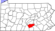
This is intended to be a complete list of the official state historical markers placed in Cumberland County, Pennsylvania
Cumberland County, Pennsylvania
Cumberland County is a county located in the U.S. state of Pennsylvania and is one of three counties comprising the Harrisburg–Carlisle Metropolitan Statistical Area. As of 2010, the population was 235,406.-History:...
by the Pennsylvania Historical and Museum Commission
Pennsylvania Historical and Museum Commission
The Pennsylvania Historical and Museum Commission is the governmental agency of the Commonwealth of Pennsylvania responsible for the collection, conservation and interpretation of Pennsylvania's historic heritage...
(PHMC). The locations of the historical markers, as well as the latitude and longitude coordinates as provided by the PHMC's database, are included below when available. There are 71 historical markers located in Cumberland County.
Historical markers
| Marker title | Image | Date dedicated | Location | Marker type | Topics |
|---|---|---|---|---|---|
| Bethel A.M.E. Church | 131 E Pomfret St., Carlisle °N °W |
City | African American, Religion, Underground Railroad | ||
| Big Spring Presbyterian Church | S. Corporation St. at church, Newville 40.17272°N 77.39736°W |
Roadside | Religion | ||
| Blaine House | S. Hanover St. between Pomfret & High Sts., Carlisle 40.20075°N 77.18907°W |
City | American Revolution, George Washington, Military, Whiskey Rebellion | ||
| Braddock Expedition Braddock expedition The Braddock expedition, also called Braddock's campaign or, more commonly, Braddock's Defeat, was a failed British military expedition which attempted to capture the French Fort Duquesne in the summer of 1755 during the French and Indian War. It was defeated at the Battle of the Monongahela on... |
US 11 (W. King St.), Shippensburg 40.04797°N 77.52655°W |
Roadside | French & Indian War, Military | ||
| Carlisle Carlisle, Pennsylvania Carlisle is a borough in and the county seat of Cumberland County, Pennsylvania, United States. The name is traditionally pronounced with emphasis on the second syllable. Carlisle is located within the Cumberland Valley, a highly productive agricultural region. As of the 2010 census, the borough... |
Near Walnut Bottom Rd. & Washington St. intersection, at Thornwall Park entrance, Carlisle 40.19357°N 77.19817°W |
Roadside | Cities & Towns, Early Settlement, Military, Whiskey Rebellion | ||
| Carlisle | US 11N, east of Carlisle 40.21144°N 77.18074°W |
Roadside | American Revolution, Cities & Towns, Early Settlement, Government & Politics, Whiskey Rebellion | ||
| Carlisle | U.S. 11 W of Carlisle 40.20167°N 77.21158°W |
Roadside | American Revolution, Cities & Towns, Government & Politics, Whiskey Rebellion | ||
| Carlisle | PA 34 S of Carlisle, between Noble Blvd. & W Ridge St. 40.19227°N 77.19037°W |
Roadside | American Revolution, Cities & Towns, Government & Politics, Whiskey Rebellion | ||
| Carlisle | PA 34 N of Carlisle, at PA Turnpike overpass 40.22017°N 77.18666°W |
Roadside | Cities & Towns | ||
| Carlisle Barracks Carlisle Barracks Carlisle Barracks is a United States Army facility located in Carlisle, Pennsylvania. It is part of the United States Army Training and Doctrine Command and is the site of the U.S. Army War College... |
n/a | U.S. 11 opposite War College, NE end Carlisle 40.21258°N 77.17875°W |
Roadside | American Revolution, Military, Native American | |
| Carlisle Fort | W. High St. between Pitt & Hanover Sts., Carlisle 40.20156°N 77.19075°W |
City | American Revolution, Military | ||
| Carlisle Indian Industrial School Carlisle Indian Industrial School Carlisle Indian Industrial School was an Indian boarding school in Carlisle, Pennsylvania. Founded in 1879 at Carlisle, Pennsylvania by Captain Richard Henry Pratt, the school was the first off-reservation boarding school, and it became a model for Indian boarding schools in other locations... |
North side of Claremont Road, 50 feet East of the Carlisle Barracks entrance 40.20754°N 77.17075°W |
Roadside | Education, Native American | ||
| Carlisle Iron Works | PA 174 just E of Boiling Springs 40.15061°N 77.12449°W |
Roadside | Business & Industry, Coal, Furnaces, Iron | ||
| Charles Albert "Chief" Bender | Indian Field, Carlisle Barracks, off U.S. 11, Carlisle 40.20907°N 77.17532°W |
Roadside | Baseball, Education, Native American, Sports | ||
| Cumberland County Cumberland County, Pennsylvania Cumberland County is a county located in the U.S. state of Pennsylvania and is one of three counties comprising the Harrisburg–Carlisle Metropolitan Statistical Area. As of 2010, the population was 235,406.-History:... |
Old Courthouse, High & Hanover Sts., Carlisle 40.20129°N 77.1894°W |
City | Government & Politics, Government & Politics 18th Century, Roads, Transportation | ||
| Cumberland Riflemen | At park, Market St. between 24th & 25th Sts., Camp Hill 40.24099°N 76.9254°W |
Roadside | American Revolution, Military | ||
| Cumberland Valley Railroad Cumberland Valley Railroad The Cumberland Valley Railroad was an early railroad in Pennsylvania, USA, originally chartered in 1831 to connect with Pennsylvania’s Main Line of Public Works... |
4 Strawberry Alley, Mechanicsburg 40.21377°N 77.00872°W |
Roadside | Railroads, Transportation | ||
| Daniel Drawbaugh Daniel Drawbaugh Daniel Drawbaugh was a purported inventor of the telephone for which he sought a patent in 1880. His claims were contested by the Bell Telephone Company, which won a court decision in 1888.... |
155 Lake Rd. (SR 2033) at Eberly's Mill, 1 mile W of New Cumberland 40.22423°N 76.90683°W |
Roadside | Business & Industry, Invention, Professions & Vocations | ||
| Daniel Kaufman | 301 Front Street, Boiling Springs 40.1384°N 77.12717°W |
Roadside | African American, Early Settlement, Underground Railroad | ||
| Dickinson College Dickinson College Dickinson College is a private, residential liberal arts college in Carlisle, Pennsylvania. Originally established as a Grammar School in 1773, Dickinson was chartered September 9, 1783, five days after the signing of the Treaty of Paris, making it the first college to be founded in the newly... |
W High St., near 74N intersection at campus, Carlisle 40.20223°N 77.19549°W |
Roadside | Education | ||
| Dickinson School of Law Dickinson School of Law Penn State University Dickinson School of Law is the law school of The Pennsylvania State University... |
S. College St. near South St. at Law School, Carlisle 40.19933°N 77.19696°W |
City | Education | ||
| Episcopal Square | NE corner, High & Hanover Sts., Carlisle 40.20161°N 77.18888°W |
City | Government & Politics 18th Century, Religion | ||
| Farthest North of Confederates - PLAQUE | PA 34 (E side), .7 mile N of Carlisle Springs °N °W |
Plaque | Civil War, Military | ||
| First Presbyterian Church First Presbyterian Church First Presbyterian Church may refer to:-Alabama:... |
NW corner, High & Hanover Sts., Carlisle 40.20172°N 77.18926°W |
City | Buildings, George Washington, Religion | ||
| Forbes Road (Raystown Path) | US 11 just W of Carlisle 40.20144°N 77.21228°W |
Roadside | French & Indian War, Military, Roads, Transportation | ||
| Forbes Road (Raystown Path) | US 11, 1 mile NE of Shippensburg 40.07105°N 77.49013°W |
Roadside | French & Indian War, Military, Roads, Transportation | ||
| Fort Couch | 8th & Ohio Sts., Lemoyne 40.24607°N 76.90425°W |
Roadside | Civil War, Forts, Military | ||
| Fort Couch | Indiana Ave., betw. 8th St. & West Park, Lemoyne 40.24669°N 76.90478°W |
City | Civil War, Forts, Military | ||
| Fort Franklin | n/a | U.S. 11 in Shippensburg (MISSING) °N °W |
Roadside | Early Settlement, Forts, French & Indian War, Military, Native American | |
| Fort Morris | King (US 11) & Queen Sts., Shippensburg 40.0545°N 77.51511°W |
Roadside | Forts, French & Indian War, Military | ||
| Fort Morris - PLAQUE | N side of W King St. (US 11), betw. Spring & Morris, Shippensburg 40.0545°N 77.51511°W |
Plaque | Forts, French & Indian War, Military, Native American | ||
| Frederick Watts Frederick Watts Frederick Watts , is called the “Father of Penn State University” and was a prominent agricultural reformer, lawyer and businessman who headed the U.S. Department of Agriculture as Commissioner of Agriculture from 1871-1877 under President Ulysses S... |
Ritner Hwy. (US 11) & Shearer Dr. at entrance to Watts Bus. Park, W of Carlisle 40.19287°N 77.23634°W |
Roadside | Agriculture, Education, Environment, Government & Politics, Professions & Vocations | ||
| Gen. John Armstrong | NE corner, High & Bedford Sts., Carlisle 40.20111°N 77.18647°W |
City | American Revolution, Government & Politics, Military | ||
| Gen. William Irvine | SE corner, High & Bedford Sts., Carlisle 40.201123°N 77.18657°W |
City | American Revolution, Government & Politics 18th Century, Medicine & Science, Military, Professions & Vocations | ||
| George Washington George Washington George Washington was the dominant military and political leader of the new United States of America from 1775 to 1799. He led the American victory over Great Britain in the American Revolutionary War as commander-in-chief of the Continental Army from 1775 to 1783, and presided over the writing of... |
W High & West Sts., Carlisle 40.20186°N 77.19345°W |
City | American Revolution, George Washington, Military, Whiskey Rebellion | ||
| Gettysburg Campaign Gettysburg Campaign The Gettysburg Campaign was a series of battles fought in June and July 1863, during the American Civil War. After his victory in the Battle of Chancellorsville, Confederate General Robert E. Lee's Army of Northern Virginia moved north for offensive operations in Maryland and Pennsylvania. The... |
5115 East Trindle Road, Mechanicsburg 40.22389°N 76.97544°W |
Roadside | Civil War, Military | ||
| Gettysburg Campaign Gettysburg Campaign The Gettysburg Campaign was a series of battles fought in June and July 1863, during the American Civil War. After his victory in the Battle of Chancellorsville, Confederate General Robert E. Lee's Army of Northern Virginia moved north for offensive operations in Maryland and Pennsylvania. The... |
5002 Carlisle Pike, Hampden Township(@ Ye Olde Ale House) 40.23997°N 76.93239°W |
Roadside | Civil War, Military | ||
| Gettysburg Campaign Gettysburg Campaign The Gettysburg Campaign was a series of battles fought in June and July 1863, during the American Civil War. After his victory in the Battle of Chancellorsville, Confederate General Robert E. Lee's Army of Northern Virginia moved north for offensive operations in Maryland and Pennsylvania. The... |
PA 74 just E of Carlisle near I-81 40.19517°N 77.1679°W |
Roadside | Civil War, Military | ||
| Gettysburg Campaign Gettysburg Campaign The Gettysburg Campaign was a series of battles fought in June and July 1863, during the American Civil War. After his victory in the Battle of Chancellorsville, Confederate General Robert E. Lee's Army of Northern Virginia moved north for offensive operations in Maryland and Pennsylvania. The... |
PA 34, .3 mile S of Carlisle near I-81 40.17874°N 77.19034°W |
Roadside | Civil War, Military | ||
| Gettysburg Campaign Gettysburg Campaign The Gettysburg Campaign was a series of battles fought in June and July 1863, during the American Civil War. After his victory in the Battle of Chancellorsville, Confederate General Robert E. Lee's Army of Northern Virginia moved north for offensive operations in Maryland and Pennsylvania. The... |
Walnut Bottom Rd. (SR 3023), .5 mile SW of Carlisle near I-81 40.18822°N 77.20499°W |
Roadside | Civil War, Military | ||
| Gettysburg Campaign Gettysburg Campaign The Gettysburg Campaign was a series of battles fought in June and July 1863, during the American Civil War. After his victory in the Battle of Chancellorsville, Confederate General Robert E. Lee's Army of Northern Virginia moved north for offensive operations in Maryland and Pennsylvania. The... |
3025 Market St., Camp Hill 40.23997°N 76.93239°W |
Roadside | Civil War, Military | ||
| Green Tree Inn Green Tree Inn GreenTree Inns Hotel Management Group Inc. is an American-funded budget hotel chain based in China. The company was founded in 2004 by Alex Xu. There are currently over 400 GreenTree locations across China. The plans are to expand to 1000 locations by the end of 2012... |
S. Hanover St. between Pomfret & High Sts., Carlisle 40.20086°N 77.18943°W |
City | Business & Industry, George Washington, Native American, Inns & Taverns | ||
| Harrisburg | Front St., at Market St., Wormleysburg 40.253067°N 76.89576°W |
Roadside | Cities & Towns, Early Settlement, Government & Politics | ||
| Henszey's Wrought Iron Arch Bridge | Valley Road on edge of campus of Central Pennsylania College, Enola 40.30543°N 76.9334°W |
Roadside | Bridges, Business & Industry, Iron, Transportation | ||
| Irving Female College | E. Main St. (Pa. 641) near Filbert St., Mechanicsburg 40.21547°N 76.99963°W |
City | Education, Women | ||
| James Wilson James Wilson James Wilson was one of the Founding Fathers of the United States and a signer of the United States Declaration of Independence. Wilson was elected twice to the Continental Congress, and was a major force in drafting the United States Constitution... |
SW corner, High & Pitt Sts., Carlisle 40.20141°N 77.19194°W |
City | Government & Politics, Government & Politics 18th Century, Professions & Vocations | ||
| John Bannister Gibson John Bannister Gibson John Bannister Gibson was a Pennsylvania attorney and judge.-Early life:Born in Perry County, Pennsylvania, Gibson was named for John Banister, a Virginia hero of the American Revolution. Gibson's father, George Gibson, also fought in the war and remained in service after its end... |
E. High St. between Hanover & Bedford Sts., Carlisle 40.20141°N 77.18794°W |
City | Government & Politics, Government & Politics 19th Century, Professions & Vocations, Writers | ||
| John W. Geary (1819-1873) | 3rd & Bridge Sts., New Cumberland 40.22568°N 76.86383°W |
City | Civil War, Government & Politics, Government & Politics 19th Century, Governors, Military | ||
| Joseph Ritner Joseph Ritner Joseph Ritner was the eighth Governor of the commonwealth of Pennsylvania, elected as a member of the Anti-Masonic Party. He was elected Governor of Pennsylvania in the Pennsylvania Gubernatorial election, 1835, and served from 1835 to 1839. Controversy surrounding his 1838 electoral defeat led... |
US 11, 6 miles SW of Carlisle 40.16003°N 77.31985°W |
Roadside | Education, Government & Politics, Government & Politics 19th Century, Governors | ||
| Laughlin Mill | PA 641 at E end of Newville 40.17476°N 77.39155°W |
Roadside | Buildings, Business & Industry, Mills | ||
| Locust Grove Cemetery | 100 block of N Queen St., Shippensburg °N °W |
Roadside | African American, Civil War, Military | ||
| Major Andre | S. Hanover St. between South & Pomfret Sts., Carlisle 40.19918°N 77.1894°W |
City | American Revolution, Military | ||
| Marcus A. Reno | 3rd & Reno Sts., New Cumberland 40.22526°N 76.86534°W |
City | Civil War, Military | ||
| Marianne Moore (1887-1972) | 343 N Hanover Street, Carlisle 40.20614°N 77.18754°W |
City | Education, Women, Writers | ||
| Middle Spring Church | SR 4001 (old PA 696), 2.6 miles N of Shippensburg 40.08162°N 77.54112°W |
Roadside | Buildings, Ethnic & Immigration, Religion | ||
| Molly Pitcher Molly Pitcher Molly Pitcher was a nickname given to a woman said to have fought in the American Revolutionary War, who is generally believed to have been Mary Ludwig Hays... |
S. Hanover St. between Walnut & South Sts., Carlisle 40.19762°N 77.18935°W |
City | American Revolution, Military, Women | ||
| Old Court House | E King St. (US 11) & Queen St., Shippensburg 40.08456°N 77.51296°W |
Roadside | Buildings, Government & Politics, Government & Politics 18th Century, Inns & Taverns | ||
| One-Room Schoolhouse | N Earl St./Newburg Rd. (PA 696) at the University, Shippensburg 40.05594°N 77.52427°W |
Roadside | Buildings, Education | ||
| Peace Church | Pa. 641 (Trindle Rd.) at St. John's Rd. W of Camp Hill 40.23169°N 76.95499°W |
Roadside | Buildings, Religion | ||
| Peace Church | Carlisle Pike (SR 1010) at St. John's Rd., 1.2 miles W. of Camp Hill 40.23757°N 76.96156°W |
Roadside | Buildings, Religion | ||
| Robert Whitehill (1735-1813) | 1903 Market St., Camp Hill 40.23988°N 76.9163°W |
Roadside | Government & Politics, Government & Politics 18th Century, Mansions & Manors, William Penn | ||
| Shippensburg | E King St. (US 11) near Walnut Bottom Rd. (Rt. 174), E end of Shippensburg 40.05935°N 77.50686°W |
Roadside | Cities & Towns | ||
| Shippensburg - PLAQUE | King St. (US 11) & Prince St., on Vigilant Hose Co. #1 bldg., Shippensburg 40.05935°N 77.50686°W |
Plaque | Cities & Towns, Early Settlement | ||
| Silver Spring Presbyterian Church | n/a | 444 Silver Spring Rd., at church, S of Carlisle Pk. (US 11), Mechanicsburg 40.23893°N 77.00765°W |
Roadside | Early Settlement, Ethnic & Immigration, Religion | |
| Simpson Ferry Road | Simpson St. near Walnut St., Mechanicsburg 40.21296°N 77.00122°W |
City | Early Settlement, Roads, Transportation | ||
| St. Patrick's Church | 140 E. Pomfret St. at church, Carlisle 40.19952°N 77.18578°W |
City | Buildings, Native American, Religion | ||
| State Police School | Walnut St. near Big Spring Ave., Newville 40.16993°N 77.40149°W |
Roadside | Education, Police and Safety | ||
| Thomas Butler Thomas Butler -Nobility and politics:*Thomas Butler , congressman from Louisiana*Thomas B. Butler , U.S. congressman from Connecticut... |
W. High St. between Pitt & West Sts., Carlisle 40.20253°N 77.19253°W |
City | American Revolution, Military, Professions & Vocations | ||
| Thompson's Rifle Battalion | E. South St. at Old Graveyard, Carlisle (MISSING) °N °W |
City | American Revolution, Military | ||
| Union Church | 39 E. Main St. (Pa. 641) at church, Mechanicsburg 40.21372°N 77.00688°W |
City | Buildings, Religion | ||
| Williams Grove Williams Grove Williams Grove is a historic home located at Berlin, Worcester County, Maryland, United States. It is a two-story, three-part house built in three principal stages. The construction sequence began about 1810 with a two-story, two-bay frame house with a single-story wing, that forms the center of... |
Williams Grove Rd. (SR 2011), .5 mile S of Wms. Grove Park °N °W |
Roadside | Agriculture, Railroads, Transportation |
See also
- List of Pennsylvania state historical markers
- National Register of Historic Places listings in Cumberland County, PennsylvaniaNational Register of Historic Places listings in Cumberland County, PennsylvaniaThis is a list of the National Register of Historic Places listings in Cumberland County, Pennsylvania.This is intended to be a complete list of the properties and districts on National Register of Historic Places in the Cumberland County, Pennsylvania...