
List of Missouri highways
Encyclopedia
State highways in Missouri were first designated in 1922 and Missouri's
system was used (along with Wisconsin's
) as a plan for the entire U.S. Highway system which was created in 1926. In Missouri, odd-numbered highways run north-south and even-numbered highways run east-west (with a few exceptions, such as Route 112). Missouri also maintains a secondary set of roads, supplemental routes, which are lettered rather than numbered.
 Missouri has also changed highway designations with a US route or an interstate
with the same number is designated through the state (MO-40 was redesignated Route 14 to avoid duplicating numbers with US-40 which also passes through the state).
In some states (such as Arkansas
), highways are allowed to be discontinuous. Missouri overlaps
highways in order to maintain continuity.
The Missouri Department of Transportation
routinely uses the term "Route" in reference to the names of the roads. However, Missouri statutes define them as "State Highways". Missourians may use the terms "Route" and "Highway" interchangeably when referring to a state road.
s in Missouri
are the responsibility of the Missouri Department of Transportation
.
Missouri Routes 1-199
* See also Route 64A and Route 64B
Missouri Routes 200-999
 This is a list of former highways as assigned in 1922. All numbers from Route 1 to Route 72 were issued. From Route 72 to Route 98, only even numbers were issued.
In 1926, the U.S. Highway system was created and many of the highways listed below became part of a new U.S. Highway; in some cases, a highway's number was changed so as not to conflict with a U.S. Highway number (or, later, an Interstate Highway number) which came through Missouri.
East-West Highways
North-South Highways
The following two interstates have been proposed in Missouri. Locations and mileage are approximate and are based on the most probable route of the interstates in Missouri.
In addition, the following has been proposed with an extension further into Missouri.
Missouri
Missouri is a US state located in the Midwestern United States, bordered by Iowa, Illinois, Kentucky, Tennessee, Arkansas, Oklahoma, Kansas and Nebraska. With a 2010 population of 5,988,927, Missouri is the 18th most populous state in the nation and the fifth most populous in the Midwest. It...
system was used (along with Wisconsin's
Wisconsin
Wisconsin is a U.S. state located in the north-central United States and is part of the Midwest. It is bordered by Minnesota to the west, Iowa to the southwest, Illinois to the south, Lake Michigan to the east, Michigan to the northeast, and Lake Superior to the north. Wisconsin's capital is...
) as a plan for the entire U.S. Highway system which was created in 1926. In Missouri, odd-numbered highways run north-south and even-numbered highways run east-west (with a few exceptions, such as Route 112). Missouri also maintains a secondary set of roads, supplemental routes, which are lettered rather than numbered.
Interstate Highway System
The Dwight D. Eisenhower National System of Interstate and Defense Highways, , is a network of limited-access roads including freeways, highways, and expressways forming part of the National Highway System of the United States of America...
with the same number is designated through the state (MO-40 was redesignated Route 14 to avoid duplicating numbers with US-40 which also passes through the state).
In some states (such as Arkansas
Arkansas
Arkansas is a state located in the southern region of the United States. Its name is an Algonquian name of the Quapaw Indians. Arkansas shares borders with six states , and its eastern border is largely defined by the Mississippi River...
), highways are allowed to be discontinuous. Missouri overlaps
Concurrency (road)
A concurrency, overlap, or coincidence in a road network is an instance of one physical road bearing two or more different highway, motorway, or other route numbers...
highways in order to maintain continuity.
The Missouri Department of Transportation
Missouri Department of Transportation
The Missouri Department of Transportation is a state government organization in charge of maintaining public roadways of the U.S. state of Missouri.-External links:*...
routinely uses the term "Route" in reference to the names of the roads. However, Missouri statutes define them as "State Highways". Missourians may use the terms "Route" and "Highway" interchangeably when referring to a state road.
Missouri State Highways
The following is a list of state highways in Missouri. State highwayState highway
State highway, state road or state route can refer to one of three related concepts, two of them related to a state or provincial government in a country that is divided into states or provinces :#A...
s in Missouri
Missouri
Missouri is a US state located in the Midwestern United States, bordered by Iowa, Illinois, Kentucky, Tennessee, Arkansas, Oklahoma, Kansas and Nebraska. With a 2010 population of 5,988,927, Missouri is the 18th most populous state in the nation and the fifth most populous in the Midwest. It...
are the responsibility of the Missouri Department of Transportation
Missouri Department of Transportation
The Missouri Department of Transportation is a state government organization in charge of maintaining public roadways of the U.S. state of Missouri.-External links:*...
.
Missouri Routes 1-199
| 1 | 2 | 3 | 5 | 6 | 7 | 8 | 9 | 10 | 11 | 12 | 13 | 14 | 15 | 16 | 17 | 18 | 19 | ||
|---|---|---|---|---|---|---|---|---|---|---|---|---|---|---|---|---|---|---|---|
| 20 | 21 | 22 | 23 | 25 | 27 | 28 | 30 | 31 | 32 | 33 | 34 | 37 | 38 | 39 | |||||
| 41 | 42 | 43 | 45 | 46 | 47 | 48 | 49 | 51 | 52 | 53 | 58 | 59 | |||||||
| 64* | 66 | 68 | 72 | 73 | 74 | 75 | 76 | 77 | 78 | 79 | |||||||||
| 80 | 81 | 82 | 83 | 84 Missouri Route 84 Route 84 is a highway in the Missouri bootheel. It starts at the Arkansas state line west of Kennett and ends at Interstate 155/U.S. Route 412 south of Caruthersville.-Route description:... |
85 | 86 | 87 | 89 | 90 | 91 | 92 | 94 | 95 | 96 | 97 | 98 | 99 | ||
| 100 | 101 | 102 | 103 | 104 | 105 | 106 | 107 | 108 | 109 | 110 | 111 | 112 | 113 | 114 | 115 | 116 | 117 | 118 | 119 |
| 120 | 121 | 122 | 123 | 124 | 125 | 126 | 127 | 128 | 129 | 130 | 131 Missouri Route 131 Route 131 is a highway located in Lafayette and Johnson counties in western Missouri. Its northern terminus is at Route 224 in downtown Wellington and its southern terminus is on Route 2 south of Medford.... |
133 | 134 | 135 | 137 | 138 | 139 | ||
| 141 | 142 | 143 | 144 | 145 | 146 | 147 | 148 | 149 | 150 | 151 | 152 | 153 | 154 | 156 | 157 | 158 | |||
| 161 | 162 | 163 | 164 | 165 | 168 | 171 | 172 | 173 | 174 | 175 | 176 | 177 | 179 | ||||||
| 180 | 181 | 185 | 187 | 190 |
Missouri Routes 200-999
| 202 | 210, 213, 215 | 224 | 231 | 240, 245, 246, 248, 249 | 254 | 265, 266, 267, 269 | 273 | 283 | 291 |
|---|---|---|---|---|---|---|---|---|---|
| 340 | 350 | 360, 364, 366, 367 | 370, 371, 376 | ||||||
| 413 | 465 | ||||||||
| 571 | |||||||||
| 740, 744 | 752, 759 | 763, 765 | 799 |
Former state highways
In 1926, the U.S. Highway system was created and many of the highways listed below became part of a new U.S. Highway; in some cases, a highway's number was changed so as not to conflict with a U.S. Highway number (or, later, an Interstate Highway number) which came through Missouri.
- Route 1, Arkansas to Iowa via Kansas City: still exists near Kansas City
- Route 1A, Rock Port to Phelps City: became US 136
- Route 1B, branch to Craig: not built, since Route 1 (US 59) was routed through Craig
- Route 1C, Mound City to Bigelow: became Route 118
- Route 1D, Mound City to Skidmore: became Route 113
- Route 1E, branch to New Point: became Route 120
- Route 1F, Oregon to Forest City: became Route 111
- Route 1F, Joplin to Kansas: became US 66
- Route 2, Kansas City to St. Louis via Columbia: became US 40
- Route 3, Arkansas to Iowa via Springfield: became US 65
- Route 4, St. Joseph to Alexandria: became US 136
- Route 4A, Albany to Evona: became Route 85
- Route 5, Arkansas to Iowa via Boonville: still exists
- Route 5A, Wasola to Longrun: became Route 95
- Route 6, St. Joseph to Canton: still exists
- Route 7, Arkansas to Iowa via Jefferson City: became US 63
- Route 8, St. Joseph to Hannibal: became US 36
- Route 9, Arkansas to Iowa via St. Louis: became US 61
- Route 9A, Palmyra to Philadelphia: became Route 168
- Route 10, Kansas City to Monroe City: still exists west of Carrollton
- Route 11, Kansas City to Iowa: became US 69
- Route 12, Kansas City to St. Louis via Jefferson City: became US 50
- Route 12A, California to Jamestown: became Route 87
- Route 12B, Linn to Chamois: became Route 89
- Route 13, Buffalo to Gallatin: still exists
- Route 14, Carthage to St. Louis: became US 66
- Route 15, Buffalo to Iowa via Jefferson City: still exists north of Mexico
- Route 16, Oklahoma to Kentucky via Springfield: became US 60
- Route 17, Mountain View to Eugene: still exists
- Route 18, Tarkio to Stanberry: became US 136
- Route 19, Thayer to Cuba: still exists
- Route 20, Kansas City to Huntsville: still exists (realigned) west of Marshall
- Route 21, Arkansas to De Soto: still exists
- Route 22, Clark to Illinois: still exists west of Mexico
- Route 23, Arkansas to Fredericktown: became US 67
- Route 24, Kansas to Tuscumbia: became Route 52
- Route 25, Arkansas to Festus: still exists south of Jackson
- Route 26, Kansas to Osceola: became Route 82
- Route 27, Savannah to Iowa: became US 71 and Route 148
- Route 28, Waynesville to Rosebud: still exists
- Route 29, Stanberry to Iowa: became US 169
- Route 30, St. Clair to St. Louis: still exists
- Route 31, Clarksdale to King City: still exists
- Route 32, Licking to Flat River: still exists
- Route 33, Kansas City to Osborn: still exists
- Route 33A, Plattsburg to Lathrop: became Route 116
- Route 34, Garwood to Jackson: still exists
- Route 35, Harrisonville to Kansas City: swapped with US 71 and later became Route 291
- Route 36, Kansas to Springfield: became US 160
- Route 37, Arkansas to Monett: still exists
- Route 38, Carthage to Republic: became US 166
- Route 39, Pennsboro to Stockton: still exists
- Route 40, Billings to near West Plains: became Route 14
- Route 41, Lamine to De Witt: still exists
- Route 42, Alton to Poplar Bluff: became US 160
- Route 43, Arkansas to Marionville: became Route 13
- Route 44, Anderson to Spokane: became Route 76
- Route 45, Drake to Martinsburg: became Route 19
- Route 46, through Grant City: still exists
- Route 47, Villa Ridge to Troy: still exists
- Route 48, Rosendale to King City: still exists
- Route 49, Piedmont to Glover: still exists
- Route 50, St. Joseph to Grayson: became US 169
- Route 51, Advance to Illinois: still exists
- Route 51A, Dongola to Puxico: became Route 51
- Route 52, Kansas to St. Joseph: became US 59
- Route 52A, branch to Lewis and Clark Lake: became Route 45
- Route 53, Kennett to Poplar Bluff: still exists
- Route 54, Paris to New London: became Route 26; now Routes 154 and 19
- Route 54A, Perry to Hutchison: became Route 19
- Route 55, Wolf Island to Benton: became Route 77
- Route 55A, Charleston to East Prairie: became Route 105
- Route 56, Troy to O'Fallon: became Routes 47 and 79
- Route 57, Joplin to Kansas: became Route 171
- Route 58, Pleasant Hill to Warrensburg: still exists
- Route 59, Kansas City to Platte City: became Route 9
- Route 60, Leeton to Windsor: became Route 2
- Route 61, Tarkio to Iowa: became US 59
- Route 62, Steelville to Potosi: became Route 8
- Route 63, Harrisonville to Lees Summit: became Route 7
- Route 64, Collins to Preston: still exists east of Hermitage
- Route 64A, Wheatland to Quincy: became Route 83
- Route 65, St. James to Hawkins Store: became Route 68
- Route 66, El Dorado Springs to Fair Play: became US 54; now Route 32
- Route 67, Rocheport to Fayette: became Route 240
- Route 68, Farmington to Sainte Genevieve: became Route 32
- Route 69, Springfield to Bolivar: became Route 13
- Route 70, Ironton to Fredericktown: became Route 72
- Route 71, Springfield to Preston: absorbed by Route 3 (US 65) when its portion here was not built
- Route 72, Salem to Centerville: still exists
- Route 74, Dutchtown to Cape Girardeau: still exists
- Route 76, Spokane to Forsyth: still exists, though on a different alignment
- Route 78, Branson to Brownbranch: became Route 76
- Route 80, Gainesville to West Plains: became US 160
- Route 82, Malden to New Madrid: became US 62
- Route 84, Arkansas to Caruthersville: still exists
- Route 86, Blue Eye to Hollister: still exists
- Route 88, Lanagan to Arkansas: became US 71 when Route 59 was formed
- Route 90, Oklahoma to Noel: still exists
- Route 92, Kansas to Smithville: still exists
- Route 94, St. Charles to West Alton: still exists
- Route 96, Odessa to Marshall: not built, but now partly Route 20
- Route 98, Boonville to Overton: still exists
Later routes
The following routes were added after 1922, but no longer exist.- Route 3
- Route 4B
- Route 9
- Route 12
- Route 26 (1927)
- Route 26 (1950s)
- Route 38N
- Route 56
- Route 62
- Route 77
- Route 88
- Route 96
- Route 99
- Route 101
- Route 102
- Route 104
- Route 111
- Route 114
- Route 118
- Route 140
- Route 148
Proposed
Missouri highways proposed, but for some reason were never built. Route 221 is currently being studied.- Route 221
- Route 755
List of U.S. Highways in Missouri
Below are all US highways in Missouri with mileage in the state. The location of entrance (or terminus) in the state is also given along with where the highway leaves the state. Note: US 66 has been deleted and US 460 no longer enters the state.East-West Highways
| Number | East | West | Length in MO |
|---|---|---|---|
 US 24 US 24 |
Illinois Illinois Illinois is the fifth-most populous state of the United States of America, and is often noted for being a microcosm of the entire country. With Chicago in the northeast, small industrial cities and great agricultural productivity in central and northern Illinois, and natural resources like coal,... state line at West Quincy West Quincy, Missouri West Quincy is a small commercial area in northeastern Marion County, Missouri, United States, on U.S. Route 24. It has no permanent residents.-History:... |
Kansas Kansas Kansas is a US state located in the Midwestern United States. It is named after the Kansas River which flows through it, which in turn was named after the Kansa Native American tribe, which inhabited the area. The tribe's name is often said to mean "people of the wind" or "people of the south... state Line in Kansas City Kansas City, Missouri Kansas City, Missouri is the largest city in the U.S. state of Missouri and is the anchor city of the Kansas City Metropolitan Area, the second largest metropolitan area in Missouri. It encompasses in parts of Jackson, Clay, Cass, and Platte counties... |
214 mi (342 km) |
 US 36 US 36 |
Illinois state line at Hannibal Hannibal, Missouri Hannibal is a city in Marion and Ralls counties in the U.S. state of Missouri. Hannibal is located at the intersection of Interstate 72 and U.S. Routes 24, 36 and 61, approximately northwest of St. Louis. According to the 2010 U.S. Census the population was 17,606... |
Kansas state line at St. Joseph | 188 mi (301 km) |
 US 40 US 40 |
Illinois state line at St. Louis St. Louis, Missouri St. Louis is an independent city on the eastern border of Missouri, United States. With a population of 319,294, it was the 58th-largest U.S. city at the 2010 U.S. Census. The Greater St... |
Kansas state line at Kansas City | 238 mi (381 km) |
 US 50 US 50 |
Illinois state line south of St. Louis | Kansas state line at Kansas City | 251 mi (402 km) |
 US 54 US 54 |
Illinois state line at Louisiana Louisiana, Missouri Louisiana is a city in Pike County, Missouri, United States. The population was 3,863 at the 2000 census, making it the largest city in Pike Couunty. Louisiana is located in northeast Missouri, on the Mississippi River south of Hannibal.... |
Kansas state line west of Nevada Nevada, Missouri Nevada is a city in Vernon County, Missouri, United States. The population was 8,327 at the 2011 census. It is the county seat of Vernon County. Nevada is the home of Cottey College, a junior college for women operated by the P.E.O. Sisterhood.... |
267 mi (427 km) |
 US 56 US 56 |
Kansas City Kansas City, Missouri Kansas City, Missouri is the largest city in the U.S. state of Missouri and is the anchor city of the Kansas City Metropolitan Area, the second largest metropolitan area in Missouri. It encompasses in parts of Jackson, Clay, Cass, and Platte counties... |
Kansas state line at Kansas City | 3 mi (5 km) |
 US 60 US 60 |
Illinois state line east of Charleston Charleston, Missouri Charleston is a city in Mississippi County, Missouri, United States. The population was 4,732 at the 2000 census. It is the county seat of Mississippi County and it is a home to a local correctional facility.-History:... |
Oklahoma Oklahoma Oklahoma is a state located in the South Central region of the United States of America. With an estimated 3,751,351 residents as of the 2010 census and a land area of 68,667 square miles , Oklahoma is the 28th most populous and 20th-largest state... state line at Seneca Seneca, Missouri Seneca is a city in Newton County, Missouri, United States. The population was 2,336 at the 2010 census. It is part of the Joplin, Missouri Metropolitan Statistical Area.-2008 tornado:... |
349 mi (558 km) |
 US 62 US 62 |
Illinois state line east of Charleston | Arkansas Arkansas Arkansas is a state located in the southern region of the United States. Its name is an Algonquian name of the Quapaw Indians. Arkansas shares borders with six states , and its eastern border is largely defined by the Mississippi River... state line west of Campbell Campbell, Missouri Campbell is a city in Dunklin County, Missouri, United States. The population was 1,883 at the 2000 census.-Geography:Campbell is located at .According to the United States Census Bureau, the city has a total area of , all land.... |
86 mi (138 km) |
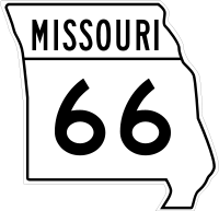
 US 66 US 66 |
Illinois state line at St. Louis | Kansas state line west of Joplin Joplin, Missouri Joplin is a city in southern Jasper County and northern Newton County in the southwestern corner of the US state of Missouri. Joplin is the largest city in Jasper County, though it is not the county seat. As of the 2010 census, the city population was 50,150... |
320 mi (512 km) |
 US 136 US 136 |
Iowa Iowa Iowa is a state located in the Midwestern United States, an area often referred to as the "American Heartland". It derives its name from the Ioway people, one of the many American Indian tribes that occupied the state at the time of European exploration. Iowa was a part of the French colony of New... state line west of Keokuk, Iowa Keokuk, Iowa Keokuk is a city in the southeastern part of the U.S. state of Iowa and one of the county seats of Lee County. The other county seat is Fort Madison. The population was 11,427 at the 2000 census. The city is named after the Sauk Chief Keokuk, who is thought to be buried in Rand Park... |
Nebraska Nebraska Nebraska is a state on the Great Plains of the Midwestern United States. The state's capital is Lincoln and its largest city is Omaha, on the Missouri River.... state line west of Rock Port Rock Port, Missouri Rock Port is a city in Clay Township, Atchison County, Missouri, United States and the county seat of Atchison County. The population was 1,318 at the 2010 census... |
244 mi (290 km) |
 US 160 US 160 |
Poplar Bluff Poplar Bluff, Missouri Poplar Bluff is a city in Butler County located in Southeast Missouri in the United States. It is the county seat of Butler County and is known as "The Gateway to the Ozarks" among other names. As of the 2000 U.S... |
Kansas state line west of Lamar Lamar, Missouri Lamar is a city in Barton County, Missouri, United States. The population was 4,474 at the 2011 census. It is the county seat of Barton County. Lamar is well known as the birthplace of President Harry S. Truman.-Geography:... |
334 mi (534 km) |
 US 166 US 166 |
West of Joplin Joplin, Missouri Joplin is a city in southern Jasper County and northern Newton County in the southwestern corner of the US state of Missouri. Joplin is the largest city in Jasper County, though it is not the county seat. As of the 2010 census, the city population was 50,150... |
Kansas state line west of Joplin | 0.4 mi (0.6 km) |
 US 400 US 400 |
West of Joplin | Kansas state line west of Joplin | 0.4 mi (0.6 km) |
 US 412 US 412 |
Tennessee Tennessee Tennessee is a U.S. state located in the Southeastern United States. It has a population of 6,346,105, making it the nation's 17th-largest state by population, and covers , making it the 36th-largest by total land area... state line east of Caruthersville Caruthersville, Missouri Caruthersville is the most populous city and county seat of Pemiscot County, located along the Mississippi River in the bootheel of southeastern Missouri in the United States. The population was 6,760 at the 2000 census.-History:... |
Arkansas state line south of Senath Senath, Missouri Senath is a city in Dunklin County, Missouri, United States. The population was 1,650 at the 2000 census.-Geography:Senath is located at .... |
51 mi (82 km) |
 US 460 US 460 |
Illinois state line at St. Louis | St. Louis St. Louis, Missouri St. Louis is an independent city on the eastern border of Missouri, United States. With a population of 319,294, it was the 58th-largest U.S. city at the 2010 U.S. Census. The Greater St... |
1 mi (2 km) |
North-South Highways
| Number | North | South | Length in MO |
|---|---|---|---|
 US 59 US 59 |
Iowa Iowa Iowa is a state located in the Midwestern United States, an area often referred to as the "American Heartland". It derives its name from the Ioway people, one of the many American Indian tribes that occupied the state at the time of European exploration. Iowa was a part of the French colony of New... state line north of Rock Port Rock Port, Missouri Rock Port is a city in Clay Township, Atchison County, Missouri, United States and the county seat of Atchison County. The population was 1,318 at the 2010 census... |
Kansas Kansas Kansas is a US state located in the Midwestern United States. It is named after the Kansas River which flows through it, which in turn was named after the Kansa Native American tribe, which inhabited the area. The tribe's name is often said to mean "people of the wind" or "people of the south... state line east of Atchison, Kansas Atchison, Kansas Atchison is a city situated along the Missouri River in the eastern part of Atchison County, located in northeast Kansas, in the Central United States. As of the 2010 census, the city population was 11,021. It is the county seat and most populous city of Atchison County... |
104 mi (166 km) |
 US 61 US 61 |
Iowa state line west of Keokuk, Iowa Keokuk, Iowa Keokuk is a city in the southeastern part of the U.S. state of Iowa and one of the county seats of Lee County. The other county seat is Fort Madison. The population was 11,427 at the 2000 census. The city is named after the Sauk Chief Keokuk, who is thought to be buried in Rand Park... |
Arkansas Arkansas Arkansas is a state located in the southern region of the United States. Its name is an Algonquian name of the Quapaw Indians. Arkansas shares borders with six states , and its eastern border is largely defined by the Mississippi River... state line south of Steele Steele, Missouri Steele is a city in Pemiscot County, Missouri, United States. The population was 2,263 at the 2000 census.-Geography:Steele is located at .According to the United States Census Bureau, the city has a total area of , all land.... |
398 mi (637 km) |
 US 63 US 63 |
Iowa state line north of Lancaster Lancaster, Missouri Lancaster is a city in Schuyler County, Missouri, in the United States. As of the 2010 census, the city population was 728. It is the county seat of Schuyler County.Lancaster is part of the Kirksville Micropolitan Statistical Area.-Geography:... |
Arkansas state line at Thayer Thayer, Missouri Thayer is a city in Oregon County, Missouri, United States. The population was 2,243 at the 2010 census. Its original name was Augusta.Thayer is considered a railroad town, as it was laid out in 1882 to be a division point. Currently, the Burlington Northern Santa Fe railroad travels through... |
326 mi (522 km) |
 US 65 US 65 |
Iowa state line north of Princeton Princeton, Missouri Princeton is a city in Mercer County, Missouri. The population was 1,166 at the 2010 census, an 11.4% increase in population from the 2000 census, which counted 1,047 people. It is the county seat of Mercer County.-Geography:... |
Arkansas state line south of Branson Branson, Missouri Branson is a city in Taney County in the U.S. state of Missouri. It was named after Reuben Branson, postmaster and operator of a general store in the area in the 1880s.... |
310 mi (496 km) |
 US 67 US 67 |
Illinois Illinois Illinois is the fifth-most populous state of the United States of America, and is often noted for being a microcosm of the entire country. With Chicago in the northeast, small industrial cities and great agricultural productivity in central and northern Illinois, and natural resources like coal,... state line east of West Alton West Alton, Missouri West Alton is a city in St. Charles County, Missouri, United States. The population was 573 at the 2000 census. It is located at the tip of the peninsula formed by the confluence of the Missouri and Mississippi Rivers.-Geography:... |
Arkansas state line south of Poplar Bluff Poplar Bluff, Missouri Poplar Bluff is a city in Butler County located in Southeast Missouri in the United States. It is the county seat of Butler County and is known as "The Gateway to the Ozarks" among other names. As of the 2000 U.S... |
196 mi (314 km) |
 US 69 US 69 |
Iowa state line north of Bethany Bethany, Missouri Bethany is a city in and the county seat of Harrison County, Missouri, United States. The population was 3,087 at the 2000 census.-Bethany Falls Limestone:... |
Kansas state line at Northmoor Northmoor, Missouri Northmoor is a city in Platte County, Missouri, United States. The population was 399 at the 2000 census.-Geography:Northmoor is located at .... |
122 mi (195 km) |
 US 71 US 71 |
Iowa state line north of Maryville Maryville, Missouri Maryville is a city in Nodaway County, Missouri, United States. The population was 10,581 at the 2000 census. The town, organized on February 14, 1845, was named for Mrs. Mary Graham, wife of Amos Graham, then the county clerk. Mary was the first Caucasian woman to have lived within the boundaries... |
Arkansas state line south of Pineville Pineville, Missouri Pineville is a city in and the county seat of McDonald County, Missouri, United States. The population was 916 at the 2009 census, at which time it was a town. It is part of the Fayetteville–Springdale–Rogers, AR-MO Metropolitan Statistical Area.... |
318 mi (509 km) |
 US 159 US 159 |
North of St. Joseph | Nebraska state line east of Rulo, Nebraska Rulo, Nebraska -History:The 'Leary' excavation is the main 'Oneota'- reference to the Missouri River. The Oneota were a 'Mississippi' equal culture that flourished from 1000 to 1650 AD. Oneota are the ancestors of Siouane-speaking tribes. The site is located near present Rulo. Around 1640, the area around the... |
16 mi (26 km) |
 US 169 US 169 |
Iowa state line north of Grant City Grant City, Missouri Grant City is a city in Worth County in the U.S. state of Missouri. The population was 926 at the 2000 census, at which time it was a town. It is the county seat of Worth County.-Geography:Grant City is located at... |
Kansas state line at Kansas City Kansas City, Missouri Kansas City, Missouri is the largest city in the U.S. state of Missouri and is the anchor city of the Kansas City Metropolitan Area, the second largest metropolitan area in Missouri. It encompasses in parts of Jackson, Clay, Cass, and Platte counties... |
120 mi (192 km) |
 US 275 US 275 |
Iowa state line south of Hamburg, Iowa Hamburg, Iowa Hamburg is a city in Fremont County, Iowa, United States, along the Nishnabotna River. The population was 1,240 at the 2000 census.-Geography:According to the United States Census Bureau, the city has a total area of , all of it land.-Demographics:... |
Rock Port Rock Port, Missouri Rock Port is a city in Clay Township, Atchison County, Missouri, United States and the county seat of Atchison County. The population was 1,318 at the 2010 census... |
16 mi (26 km) |
List of interstate freeways in Missouri
The following are all interstate freeways in Missouri. The entrance and exit point for each is also shown along with mileage in Missouri. Note:Interstate 244 has been deleted.| Number | North or East | South or West | Length in MO |
|---|---|---|---|
.svg.png) I-29 I-29 |
Iowa Iowa Iowa is a state located in the Midwestern United States, an area often referred to as the "American Heartland". It derives its name from the Ioway people, one of the many American Indian tribes that occupied the state at the time of European exploration. Iowa was a part of the French colony of New... state line south of Hamburg, Iowa Hamburg, Iowa Hamburg is a city in Fremont County, Iowa, United States, along the Nishnabotna River. The population was 1,240 at the 2000 census.-Geography:According to the United States Census Bureau, the city has a total area of , all of it land.-Demographics:... |
Kansas City, Missouri Kansas City, Missouri Kansas City, Missouri is the largest city in the U.S. state of Missouri and is the anchor city of the Kansas City Metropolitan Area, the second largest metropolitan area in Missouri. It encompasses in parts of Jackson, Clay, Cass, and Platte counties... |
123 mi (198 km) |
.svg.png) I-35 I-35 |
Iowa state line north of Eagleville Eagleville, Missouri Eagleville is a village in Harrison County, Missouri, United States. The population was 321 at the 2000 census, at which time it was a town.-Geography:Eagleville is located at .... |
Kansas Kansas Kansas is a US state located in the Midwestern United States. It is named after the Kansas River which flows through it, which in turn was named after the Kansa Native American tribe, which inhabited the area. The tribe's name is often said to mean "people of the wind" or "people of the south... state line at Kansas City |
114 mi (183 km) |
.svg.png) I-44 I-44 |
Illinois Illinois Illinois is the fifth-most populous state of the United States of America, and is often noted for being a microcosm of the entire country. With Chicago in the northeast, small industrial cities and great agricultural productivity in central and northern Illinois, and natural resources like coal,... state line at St. Louis St. Louis, Missouri St. Louis is an independent city on the eastern border of Missouri, United States. With a population of 319,294, it was the 58th-largest U.S. city at the 2010 U.S. Census. The Greater St... |
Oklahoma Oklahoma Oklahoma is a state located in the South Central region of the United States of America. With an estimated 3,751,351 residents as of the 2010 census and a land area of 68,667 square miles , Oklahoma is the 28th most populous and 20th-largest state... state line west of Joplin Joplin, Missouri Joplin is a city in southern Jasper County and northern Newton County in the southwestern corner of the US state of Missouri. Joplin is the largest city in Jasper County, though it is not the county seat. As of the 2010 census, the city population was 50,150... |
290 mi (467 km) |
.svg.png) I-55 I-55 |
Illinois state line at St. Louis | Arkansas Arkansas Arkansas is a state located in the southern region of the United States. Its name is an Algonquian name of the Quapaw Indians. Arkansas shares borders with six states , and its eastern border is largely defined by the Mississippi River... state line south of Steele Steele, Missouri Steele is a city in Pemiscot County, Missouri, United States. The population was 2,263 at the 2000 census.-Geography:Steele is located at .According to the United States Census Bureau, the city has a total area of , all land.... |
210 mi (340 km) |
.svg.png) I-57 I-57 |
Illinois state line north of Charleston Charleston, Missouri Charleston is a city in Mississippi County, Missouri, United States. The population was 4,732 at the 2000 census. It is the county seat of Mississippi County and it is a home to a local correctional facility.-History:... |
Sikeston Sikeston, Missouri Sikeston is a city located both in southern Scott County and northern New Madrid County, in the U.S. state of Missouri. It is geographically situated just north of the "Missouri Bootheel", although many locals consider Sikeston a part of it. By way of Interstate 55, Sikeston is close to the... |
23 mi (37 km) |
.svg.png) I-64 I-64 |
Illinois state line at St. Louis | Wentzville Wentzville, Missouri Wentzville is a city located in western St. Charles County, Missouri, United States. As of the 2010 census, the city had a total population of 29,070. The city's major employer is General Motors which has a full size van assembly plant located there. As the site of the county fairgrounds,... |
41 mi (66 km) |
.svg.png) I-70 I-70 |
Illinois state line at St. Louis | Kansas state line at Kansas City | 252 mi (408 km) |
.svg.png) I-72 I-72 |
Illinois state line at Hannibal Hannibal, Missouri Hannibal is a city in Marion and Ralls counties in the U.S. state of Missouri. Hannibal is located at the intersection of Interstate 72 and U.S. Routes 24, 36 and 61, approximately northwest of St. Louis. According to the 2010 U.S. Census the population was 17,606... |
Hannibal Hannibal, Missouri Hannibal is a city in Marion and Ralls counties in the U.S. state of Missouri. Hannibal is located at the intersection of Interstate 72 and U.S. Routes 24, 36 and 61, approximately northwest of St. Louis. According to the 2010 U.S. Census the population was 17,606... |
4 mi (6 km) |
.svg.png) I-155 I-155Interstate 155 (Missouri-Tennessee) Interstate 155 is an east–west spur beginning in far southeast Missouri. The western terminus is south of Hayti, Missouri at Interstate 55, exits 17A and exit 17B . The route proceeds east to the Tennessee border, where it crosses over the Mississippi River... |
Tennessee Tennessee Tennessee is a U.S. state located in the Southeastern United States. It has a population of 6,346,105, making it the nation's 17th-largest state by population, and covers , making it the 36th-largest by total land area... state line east of Caruthersville Caruthersville, Missouri Caruthersville is the most populous city and county seat of Pemiscot County, located along the Mississippi River in the bootheel of southeastern Missouri in the United States. The population was 6,760 at the 2000 census.-History:... |
East of Hayti Hayti, Missouri Hayti is a city in Pemiscot County, Missouri, United States. The population was 3,207 at the 2000 census.In 1955, a small earthquake broke windows in the village.- Geography :Hayti is located at .... |
12 mi (19 km) |
.svg.png) I-170 I-170 |
Berkeley Berkeley, Missouri Berkeley is an inner-ring suburb of St. Louis, located in St. Louis County, Missouri, United States. The population was 8,978 at the 2010 census. Portions of Lambert-St... |
Richmond Heights Richmond Heights, Missouri Richmond Heights, a city in St. Louis County, is an inner-ring suburb of St. Louis, Missouri. The population was 8,603 at the 2010 census. According to Robert L. Ramsay, the name was suggested by Robert E. Lee, who thought the topography of the area resembled Richmond, Virginia... |
11 mi (18 km) |
.svg.png) I-229 I-229Interstate 229 (Missouri) Interstate 229 in the state of Missouri, USA, is an approximately 14 mile Interstate Highway spur designed to speed traffic from Interstate 29 to downtown Saint Joseph.... |
North of St. Joseph | St. Joseph | 14 mi (23 km) |
.svg.png) I-255 I-255 |
Illinois state line south of St. Louis | South of Green Park Green Park, Missouri Green Park is a city in St. Louis County, Missouri, United States. The population was 2,622 at the 2010 census.-Geography:Green Park is located at .... |
4 mi (6 km) |
.svg.png) I-270 I-270Interstate 270 (Illinois-Missouri) Interstate 270 makes up a large portion of the outer belt freeway in the St. Louis, Missouri metropolitan area. The counterclockwise terminus of I-270 is at the junction with Interstate 55 in Mehlville, Missouri; the clockwise terminus of the freeway is at the junction with I-55 and I-70 north of... |
Illinois state line at St. Louis | South of Green Park | 34 mi (54 km) |
.svg.png) I-435 I-435 |
Kansas Kansas Kansas is a US state located in the Midwestern United States. It is named after the Kansas River which flows through it, which in turn was named after the Kansa Native American tribe, which inhabited the area. The tribe's name is often said to mean "people of the wind" or "people of the south... state line at Parkville Parkville, Missouri Parkville is a city in Platte County, Missouri, United States. The population was 4,059 at the 2000 census. Parkville is known for its antique shops, art galleries, and historic downtown. The city is home to Park University and English Landing Park.... |
Kansas state line at Kansas City | 53 mi (85 km) |
.svg.png) I-470 I-470Interstate 470 (Missouri) Interstate 470 is a loop of the Interstate Highway System that serves to link southeast Kansas City to Independence via Lee's Summit in Jackson County, Missouri. The western terminus of the freeway is at the Grandview Triangle interchange while the northern terminus is an cloverleaf interchange... |
Independence Independence, Missouri Independence is the fourth largest city in the U.S. state of Missouri, and is contained within the counties of Jackson and Clay. It is part of the Kansas City Metropolitan Area... |
Kansas City | 17 mi (27 km) |
.svg.png) I-635 I-635Interstate 635 (Kansas-Missouri) Interstate 635 is a connector highway between Interstate 35 in Overland Park, Kansas and Interstate 29 in Kansas City, Missouri, approximately 12 miles long. It is mostly in the U.S. state of Kansas, servicing the city of Kansas City, Kansas, but extends into Kansas City, Missouri as well... |
Kansas City Kansas City, Missouri Kansas City, Missouri is the largest city in the U.S. state of Missouri and is the anchor city of the Kansas City Metropolitan Area, the second largest metropolitan area in Missouri. It encompasses in parts of Jackson, Clay, Cass, and Platte counties... |
Kansas state line at Kansas City | 3 mi (5 km) |
.svg.png) I-670 I-670Interstate 670 (Kansas-Missouri) Interstate 670 is a 2.81 mile connector highway between I-70 in Kansas City, Kansas and I-70 in Kansas City, Missouri. The highway provides a more direct route through downtown Kansas City than the older mainline I-70, and avoids the sharp turn of the latter at the west end of the Intercity... |
Kansas City Kansas City, Missouri Kansas City, Missouri is the largest city in the U.S. state of Missouri and is the anchor city of the Kansas City Metropolitan Area, the second largest metropolitan area in Missouri. It encompasses in parts of Jackson, Clay, Cass, and Platte counties... |
Kansas state line at Kansas City | 2 mi (4 km) |
The following two interstates have been proposed in Missouri. Locations and mileage are approximate and are based on the most probable route of the interstates in Missouri.
| Number | North or East | South or West | Length in MO |
|---|---|---|---|
 I-49 I-49 |
Kansas City Kansas City, Missouri Kansas City, Missouri is the largest city in the U.S. state of Missouri and is the anchor city of the Kansas City Metropolitan Area, the second largest metropolitan area in Missouri. It encompasses in parts of Jackson, Clay, Cass, and Platte counties... |
Arkansas Arkansas Arkansas is a state located in the southern region of the United States. Its name is an Algonquian name of the Quapaw Indians. Arkansas shares borders with six states , and its eastern border is largely defined by the Mississippi River... state line south of Pineville Pineville, Missouri Pineville is a city in and the county seat of McDonald County, Missouri, United States. The population was 916 at the 2009 census, at which time it was a town. It is part of the Fayetteville–Springdale–Rogers, AR-MO Metropolitan Statistical Area.... |
197 mi (315 km) |
 I-66 I-66Interstate 66 (west) The U.S. Department of Transportation had plans to extend Interstate 66 westward across the country to California. However, Interstate 66 west of Wichita, Kansas, has been postponed, with the Nevada and California sections cancelled... |
Kentucky Kentucky The Commonwealth of Kentucky is a state located in the East Central United States of America. As classified by the United States Census Bureau, Kentucky is a Southern state, more specifically in the East South Central region. Kentucky is one of four U.S. states constituted as a commonwealth... state line south of Cairo, Illinois Cairo, Illinois Cairo is the southernmost city in the U.S. state of Illinois. It is the county seat of Alexander County. Cairo is located at the confluence of the Mississippi and Ohio rivers. The rivers converge at Fort Defiance State Park, an American Civil War fort that was commanded by General Ulysses S. Grant... |
Kansas Kansas Kansas is a US state located in the Midwestern United States. It is named after the Kansas River which flows through it, which in turn was named after the Kansa Native American tribe, which inhabited the area. The tribe's name is often said to mean "people of the wind" or "people of the south... state line west of Joplin Joplin, Missouri Joplin is a city in southern Jasper County and northern Newton County in the southwestern corner of the US state of Missouri. Joplin is the largest city in Jasper County, though it is not the county seat. As of the 2010 census, the city population was 50,150... |
340 mi (544 km) |
In addition, the following has been proposed with an extension further into Missouri.
| Number | East | West | Length in MO |
|---|---|---|---|
| I-72 |
Hannibal Hannibal, Missouri Hannibal is a city in Marion and Ralls counties in the U.S. state of Missouri. Hannibal is located at the intersection of Interstate 72 and U.S. Routes 24, 36 and 61, approximately northwest of St. Louis. According to the 2010 U.S. Census the population was 17,606... |
Cameron Cameron, Missouri Cameron is a city in Clinton and DeKalb Counties in the U.S. state of Missouri. The population was 8,312 at the 2000 census.The Clinton County portion of Cameron is part of the Kansas City, MO–KS Metropolitan Statistical Area, while the DeKalb County portion is part of the St... |
157 mi (253 km) |
See also
- Missouri Supplemental RouteMissouri Supplemental RouteA supplemental route is a state secondary road in the U.S. state of Missouri, designated with letters. Supplemental routes were various roads within the state which the Missouri Department of Transportation was given in 1952 to maintain in addition to the regular routes...
- U.S. Route 71 Alternate
- U.S. Route 71 Business in Joplin
- U.S. Route 66 in MissouriU.S. Route 66 in MissouriU.S. Route 66 in Missouri ran from downtown St. Louis at the Mississippi River to the Kansas state line west of Joplin. The highway was originally Route 14 from St. Louis to Joplin and Route 1F from Joplin to Kansas. It underwent two major realignments and several lesser realignments in the...
External links
- Missouri Department of Transportation website
- Official MoDOT Travel Information Map
- Official current and historical Missouri road maps (large PDF files)
- Kansas City Scout - KC area intelligent transportation system
- St. Louis Metro area intelligent transportation program website
- Road Signs of Missouri
- Missouri Highways (unofficial)