
Lincoln County, Idaho
Encyclopedia
Lincoln County is a county located in the U.S. state
of Idaho
. As of the 2000 census the county had a population of 4,044 (2008 estimate: 4,503) The county seat
and largest city is Shoshone
.
Lincoln County was created by the Idaho Legislature on March 18, 1895, by a partitioning of Blaine County
, which was created earlier that month by a merger of Alturas
and Logan
Counties. Lincoln County itself was partitioned on January 28, 1913, with a western portion becoming Gooding County
and an eastern portion becoming Minidoka County
. The county assumed its present borders on February 8, 1919 when a southern portion became Jerome County
.
Lincoln County is named after President
Abraham Lincoln
. The Idaho Territory
was created in 1863, during the Lincoln Administration of 1861–65.
The four highways converge in Shoshone, the southern terminus of SH-75.
of 2000, there were 4,044 people, 1,447 households, and 1,050 families residing in the county. The population density
was 3 people per square mile (1/km²). There were 1,651 housing units at an average density of 1 per square mile (1/km²). The racial makeup of the county was 86.47% White, 0.47% Black or African American, 1.21% Native American, 0.45% Asian, 0.05% Pacific Islander, 9.42% from other races, and 1.93% from two or more races. 13.40% of the population were Hispanic or Latino of any race. 16.8% were of English
, 12.4% American
, 11.5% German
and 8.3% Irish
ancestry according to Census 2000.
There were 1,447 households out of which 37.70% had children under the age of 18 living with them, 61.50% were married couples
living together, 5.50% had a female householder with no husband present, and 27.40% were non-families. 22.90% of all households were made up of individuals and 10.20% had someone living alone who was 65 years of age or older. The average household size was 2.77 and the average family size was 3.27.
In the county the population was spread out with 30.40% under the age of 18, 9.00% from 18 to 24, 25.50% from 25 to 44, 22.00% from 45 to 64, and 13.10% who were 65 years of age or older. The median age was 34 years. For every 100 females there were 106.50 males. For every 100 females age 18 and over, there were 105.80 males.
The median income for a household in the county was $32,484, and the median income for a family was $36,792. Males had a median income of $26,576 versus $20,032 for females. The per capita income
for the county was $14,257. 13.10% of the population and 10.80% of families were below the poverty line. Out of the total population, 18.30% of those under the age of 18 and 7.00% of those 65 and older were living below the poverty line.
U.S. state
A U.S. state is any one of the 50 federated states of the United States of America that share sovereignty with the federal government. Because of this shared sovereignty, an American is a citizen both of the federal entity and of his or her state of domicile. Four states use the official title of...
of Idaho
Idaho
Idaho is a state in the Rocky Mountain area of the United States. The state's largest city and capital is Boise. Residents are called "Idahoans". Idaho was admitted to the Union on July 3, 1890, as the 43rd state....
. As of the 2000 census the county had a population of 4,044 (2008 estimate: 4,503) The county seat
County seat
A county seat is an administrative center, or seat of government, for a county or civil parish. The term is primarily used in the United States....
and largest city is Shoshone
Shoshone, Idaho
Shoshone is the county seat and largest city of Lincoln County, Idaho, United States. The population was 1,398 at the 2000 census. In contrast to the Shoshone Native American tribe for which it is named, the city's name is correctly pronounced "Show-shown," with a silent 'e'.- History :Shoshone has...
.
Lincoln County was created by the Idaho Legislature on March 18, 1895, by a partitioning of Blaine County
Blaine County, Idaho
Blaine County is a county located in the U.S. state of Idaho. As of the 2010 Census the county had a population of 21,376. The county seat and largest city is Hailey. The county is home to the Sun Valley ski resort....
, which was created earlier that month by a merger of Alturas
Alturas County, Idaho
Alturas County was a county in Idaho Territory and later the state of Idaho from 1864 to 1895. It covered an area larger than the states of Maryland, New Jersey, and Delaware combined. Most present-day southern Idaho counties were created at least in part from the original Alturas County area...
and Logan
Logan County, Idaho
Logan County was a county in Idaho Territory and later the state of Idaho from 1889 to 1895.Logan County was created from parts of Alturas County by the Idaho Territorial Legislature in 1889 with Bellevue as its county seat. Six years later, the Idaho Legislature attempted to return Bellevue to...
Counties. Lincoln County itself was partitioned on January 28, 1913, with a western portion becoming Gooding County
Gooding County, Idaho
Gooding County is a county located in the U.S. state of Idaho. As of the 2000 Census the county had a population of 14,155...
and an eastern portion becoming Minidoka County
Minidoka County, Idaho
Minidoka County is a county located in the U.S. state of Idaho. The county seat and largest city is Rupert. As of the 2000 Census the county had a population of 20,174 ....
. The county assumed its present borders on February 8, 1919 when a southern portion became Jerome County
Jerome County, Idaho
Jerome County is a county in the U.S. state of Idaho. As of the 2000 Census the county had a population of 18,342 . The county seat and largest city is Jerome....
.
Lincoln County is named after President
President of the United States
The President of the United States of America is the head of state and head of government of the United States. The president leads the executive branch of the federal government and is the commander-in-chief of the United States Armed Forces....
Abraham Lincoln
Abraham Lincoln
Abraham Lincoln was the 16th President of the United States, serving from March 1861 until his assassination in April 1865. He successfully led his country through a great constitutional, military and moral crisis – the American Civil War – preserving the Union, while ending slavery, and...
. The Idaho Territory
Idaho Territory
The Territory of Idaho was an organized incorporated territory of the United States that existed from March 4, 1863, until July 3, 1890, when the final extent of the territory was admitted to the Union as the State of Idaho.-1860s:...
was created in 1863, during the Lincoln Administration of 1861–65.
Geography
According to the 2000 census, the county has a total area of 1205.86 square miles (3,123.2 km²), of which 1205.53 square miles (3,122.3 km²) (or 99.97%) is land and 0.33 square mile (0.8546960763 km²) (or 0.03%) is water.Adjacent counties
- Camas CountyCamas County, IdahoCamas County is a county in the southern portion of the U.S. state of Idaho. As of the 2000 Census, the rural county had a population of 991 . The county seat is Fairfield....
- northwest - Blaine CountyBlaine County, IdahoBlaine County is a county located in the U.S. state of Idaho. As of the 2010 Census the county had a population of 21,376. The county seat and largest city is Hailey. The county is home to the Sun Valley ski resort....
- north - Minidoka CountyMinidoka County, IdahoMinidoka County is a county located in the U.S. state of Idaho. The county seat and largest city is Rupert. As of the 2000 Census the county had a population of 20,174 ....
- east - Jerome CountyJerome County, IdahoJerome County is a county in the U.S. state of Idaho. As of the 2000 Census the county had a population of 18,342 . The county seat and largest city is Jerome....
- south - Gooding CountyGooding County, IdahoGooding County is a county located in the U.S. state of Idaho. As of the 2000 Census the county had a population of 14,155...
- west
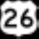
Highways
 - US 26
 - US 93U.S. Route 93 in IdahoU.S. Route 93 is a north–south U.S. Highway in the U.S. state of Idaho.-Route description:US 93 enters Idaho from a point immediately north of the border casino town of Jackpot, Nevada....
 - SH-24Idaho State Highway 24Idaho State Highway 24 is a long state highway in Idaho that runs east west from Shoshone, Idaho on the far west to Minidoka and Acequia on the far east. It passes Dietrich, Owinza, and Kimima and runs approximately north of Paul and Burley and 15 north of Rupert. U.S. Highway 93 borders the...
 - SH-75Idaho State Highway 75State Highway 75 is a two-lane highway that travels through the Sawtooth Range of central Idaho from Shoshone to Challis. The road is designated as one of Idaho's scenic byways and provides access to Sawtooth National Recreation Area...
- Sawtooth Scenic Byway
The four highways converge in Shoshone, the southern terminus of SH-75.
Demographics
As of the censusCensus
A census is the procedure of systematically acquiring and recording information about the members of a given population. It is a regularly occurring and official count of a particular population. The term is used mostly in connection with national population and housing censuses; other common...
of 2000, there were 4,044 people, 1,447 households, and 1,050 families residing in the county. The population density
Population density
Population density is a measurement of population per unit area or unit volume. It is frequently applied to living organisms, and particularly to humans...
was 3 people per square mile (1/km²). There were 1,651 housing units at an average density of 1 per square mile (1/km²). The racial makeup of the county was 86.47% White, 0.47% Black or African American, 1.21% Native American, 0.45% Asian, 0.05% Pacific Islander, 9.42% from other races, and 1.93% from two or more races. 13.40% of the population were Hispanic or Latino of any race. 16.8% were of English
English people
The English are a nation and ethnic group native to England, who speak English. The English identity is of early mediaeval origin, when they were known in Old English as the Anglecynn. England is now a country of the United Kingdom, and the majority of English people in England are British Citizens...
, 12.4% American
United States
The United States of America is a federal constitutional republic comprising fifty states and a federal district...
, 11.5% German
Germans
The Germans are a Germanic ethnic group native to Central Europe. The English term Germans has referred to the German-speaking population of the Holy Roman Empire since the Late Middle Ages....
and 8.3% Irish
Irish people
The Irish people are an ethnic group who originate in Ireland, an island in northwestern Europe. Ireland has been populated for around 9,000 years , with the Irish people's earliest ancestors recorded having legends of being descended from groups such as the Nemedians, Fomorians, Fir Bolg, Tuatha...
ancestry according to Census 2000.
There were 1,447 households out of which 37.70% had children under the age of 18 living with them, 61.50% were married couples
Marriage
Marriage is a social union or legal contract between people that creates kinship. It is an institution in which interpersonal relationships, usually intimate and sexual, are acknowledged in a variety of ways, depending on the culture or subculture in which it is found...
living together, 5.50% had a female householder with no husband present, and 27.40% were non-families. 22.90% of all households were made up of individuals and 10.20% had someone living alone who was 65 years of age or older. The average household size was 2.77 and the average family size was 3.27.
In the county the population was spread out with 30.40% under the age of 18, 9.00% from 18 to 24, 25.50% from 25 to 44, 22.00% from 45 to 64, and 13.10% who were 65 years of age or older. The median age was 34 years. For every 100 females there were 106.50 males. For every 100 females age 18 and over, there were 105.80 males.
The median income for a household in the county was $32,484, and the median income for a family was $36,792. Males had a median income of $26,576 versus $20,032 for females. The per capita income
Per capita income
Per capita income or income per person is a measure of mean income within an economic aggregate, such as a country or city. It is calculated by taking a measure of all sources of income in the aggregate and dividing it by the total population...
for the county was $14,257. 13.10% of the population and 10.80% of families were below the poverty line. Out of the total population, 18.30% of those under the age of 18 and 7.00% of those 65 and older were living below the poverty line.
Cities
- DietrichDietrich, IdahoDietrich is a city in Lincoln County, Idaho, United States. The population was 150 at the 2000 census.-Geography:Dietrich is located at .According to the United States Census Bureau, the city has a total area of , all of it land....
- RichfieldRichfield, IdahoRichfield is a city in Lincoln County, Idaho, in the United States. The population was 412 at the 2000 census.-Geography:Richfield is located at ....
- ShoshoneShoshone, IdahoShoshone is the county seat and largest city of Lincoln County, Idaho, United States. The population was 1,398 at the 2000 census. In contrast to the Shoshone Native American tribe for which it is named, the city's name is correctly pronounced "Show-shown," with a silent 'e'.- History :Shoshone has...