
Lecarrow
Encyclopedia
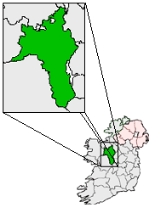
Lecarrow is a village in County Roscommon
, Ireland
. Situated 17 kilometers north-west of the town of Athlone on the N61
route between Athlone and Roscommon
town. A navigable canal connects it to Lough Ree
, the second-largest lake on the River Shannon
. Many of its residents commute to Athlone and Roscommon
. It is the closest population centre to the Geographical centre of Ireland
.
County Roscommon
County Roscommon is a county in Ireland. It is located in the West Region and is also part of the province of Connacht. It is named after the town of Roscommon. Roscommon County Council is the local authority for the county...
, Ireland
Republic of Ireland
Ireland , described as the Republic of Ireland , is a sovereign state in Europe occupying approximately five-sixths of the island of the same name. Its capital is Dublin. Ireland, which had a population of 4.58 million in 2011, is a constitutional republic governed as a parliamentary democracy,...
. Situated 17 kilometers north-west of the town of Athlone on the N61
N61 road (Ireland)
The N61 road is a national secondary road in County Roscommon, Ireland, linking the N4, N5 and N6 national primary roads.-Route:Starting at Athlone , the road goes Northwards to Knockcroghery, Roscommon, Tulsk , and ends just North of Boyle at the N4....
route between Athlone and Roscommon
Roscommon
Roscommon is the county town of County Roscommon in Ireland. Its population at the 2006 census stood at 5,017 . The town is located near the junctions of the N60, N61 and N63 roads.-History:...
town. A navigable canal connects it to Lough Ree
Lough Ree
Lough Ree is a lake in the midlands of Ireland, the second of the three major lakes on the River Shannon. Lough Ree is the second largest lake on the Shannon after Lough Derg. The other two major lakes are Lough Allen to the north, and Lough Derg to the south, there are also several minor lakes...
, the second-largest lake on the River Shannon
River Shannon
The River Shannon is the longest river in Ireland at . It divides the west of Ireland from the east and south . County Clare, being west of the Shannon but part of the province of Munster, is the major exception...
. Many of its residents commute to Athlone and Roscommon
Roscommon
Roscommon is the county town of County Roscommon in Ireland. Its population at the 2006 census stood at 5,017 . The town is located near the junctions of the N60, N61 and N63 roads.-History:...
. It is the closest population centre to the Geographical centre of Ireland
Geographical centre of Ireland
The geographical centre of Ireland is where the 8° Meridian West meets the 53°30' North Latitude in the townland of Carnagh East, County Roscommon on the western shore of Lough Ree, opposite the Cribby Islands and 8.85 kilometres NNW of Athlone Town....
.