Lake McKerrow
Encyclopedia

Maori language
Māori or te reo Māori , commonly te reo , is the language of the indigenous population of New Zealand, the Māori. It has the status of an official language in New Zealand...
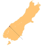
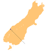
name of Whakatipu Waitai, lies at the northern end of Fiordland
Fiordland
Fiordland is a geographic region of New Zealand that is situated on the south-western corner of the South Island, comprising the western-most third of Southland. Most of Fiordland is dominated by the steep sides of the snow-capped Southern Alps, deep lakes and its ocean-flooded, steep western valleys...
, in the southwest of New Zealand
New Zealand
New Zealand is an island country in the south-western Pacific Ocean comprising two main landmasses and numerous smaller islands. The country is situated some east of Australia across the Tasman Sea, and roughly south of the Pacific island nations of New Caledonia, Fiji, and Tonga...
's South Island
South Island
The South Island is the larger of the two major islands of New Zealand, the other being the more populous North Island. It is bordered to the north by Cook Strait, to the west by the Tasman Sea, to the south and east by the Pacific Ocean...
. The lake runs from southeast to northwest, is 15 kilometres in length, and covers 28 km².
Lake McKerrow drains, and is drained by, the Hollyford River
Hollyford River
The Hollyford River is located in the southwest of the South Island of New Zealand. It runs for eighty miles in Fiordland, its source being ten kilometres to the north of the northern tip of Lake Te Anau and close to the Homer Tunnel....
. It is one of two lakes (along with Lake Alabaster
Lake Alabaster
Lake Alabaster, also known by the Maori name of Waiwahuika, lies at the northern end of Fiordland, in the southwest of New Zealand's South Island. The lake runs from northeast to southwest, is six kilometres in length, and covers 7 km²....
) found in the lower reaches of the Hollyford River system, and the Hollyford Track
Hollyford Track
The Hollyford Track is a tramping track in New Zealand. Located at the northern edge of Fiordland, in the southwestern South Island, it is unusual among Fiordland's major tracks in that it is largely flat and accessible year-round...
, one of New Zealand's most well-known and popular tramping tracks, follows its eastern shore for its full length.
The lake is technically a fiord which has been cut off from the Tasman Sea
Tasman Sea
The Tasman Sea is the large body of water between Australia and New Zealand, approximately across. It extends 2,800 km from north to south. It is a south-western segment of the South Pacific Ocean. The sea was named after the Dutch explorer Abel Janszoon Tasman, the first recorded European...
by sediment. The sea is now three kilometres from the lake's northern end.

