

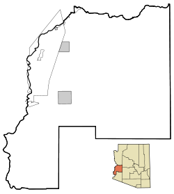
La Paz County, Arizona
Encyclopedia
La Paz County is a county
in the western part of the U.S. state
of Arizona
. As of the 2010 census its population was 20,489. The county seat
is Parker
. The name of the county is the Spanish
word for the peace, and is taken from the early settlement (now ghost town
) of La Paz
along the Colorado River.
La Paz County was established in 1983 after voters approved separating the northern portion of Yuma County
, making it the first and only county to be established after Arizona became a state in 1912. The county did not have a large enough tax base to begin supporting a separate county government immediately and had to rely on state money at first. As a result Arizona laws were changed to make splitting other existing counties much more difficult.
The Colorado River Indian Reservation
is located in the western portion of the county. Part of the reservation extends westward into San Bernardino
and Riverside
Counties in California
.
National protected area
is a public use airport
located one nautical mile (1.8 km) east of the central business district
of Parker
, a town in La Paz County. It is owned by the Colorado River Indian Tribes
.
of 2000, there were 19,715 people, 8,362 households, and 5,619 families residing in the county. The population density
was 4 people per square mile (2/km²). There were 15,133 housing units at an average density of 3 per square mile (1/km²). The racial makeup of the county was 74.15% White
, 0.79% Black
or African American
, 12.53% Native American
, 0.41% Asian
, 0.10% Pacific Islander
, 9.35% from other races
, and 2.68% from two or more races. 22.42% of the population were Hispanic
or Latino
of any race. 18.90% reported speaking Spanish
at home http://www.mla.org/map_data_results&state_id=4&county_id=12&mode=geographic&order=r.
There were 8,362 households out of which 21.20% had children under the age of 18 living with them, 54.20% were married couples
living together, 8.20% had a female householder with no husband present, and 32.80% were non-families. 26.60% of all households were made up of individuals and 12.90% had someone living alone who was 65 years of age or older. The average household size was 2.32 and the average family size was 2.79.
In the county the population was spread out with 21.10% under the age of 18, 6.10% from 18 to 24, 20.40% from 25 to 44, 26.60% from 45 to 64, and 25.80% who were 65 years of age or older. The median age was 47 years. For every 100 females there were 105.50 males. For every 100 females age 18 and over, there were 105.10 males.
The median income for a household in the county was $25,839, and the median income for a family was $29,141. Males had a median income of $26,642 versus $20,965 for females. The per capita income
for the county was $14,916. About 13.60% of families and 19.60% of the population were below the poverty line, including 28.50% of those under age 18 and 12.90% of those age 65 or over.
 There are a variety of flora and fauna associated with La Paz County. The endangered California Fan Palm, Washingtonia filifera
has a small number of grove occurrences within the county.
County (United States)
In the United States, a county is a geographic subdivision of a state , usually assigned some governmental authority. The term "county" is used in 48 of the 50 states; Louisiana is divided into parishes and Alaska into boroughs. Parishes and boroughs are called "county-equivalents" by the U.S...
in the western part of the U.S. state
U.S. state
A U.S. state is any one of the 50 federated states of the United States of America that share sovereignty with the federal government. Because of this shared sovereignty, an American is a citizen both of the federal entity and of his or her state of domicile. Four states use the official title of...
of Arizona
Arizona
Arizona ; is a state located in the southwestern region of the United States. It is also part of the western United States and the mountain west. The capital and largest city is Phoenix...
. As of the 2010 census its population was 20,489. The county seat
County seat
A county seat is an administrative center, or seat of government, for a county or civil parish. The term is primarily used in the United States....
is Parker
Parker, Arizona
Parker is a town in and the county seat of La Paz County, Arizona, United States, on the Colorado River in Parker Valley. The population was 3,140 at the 2000 census.-History:...
. The name of the county is the Spanish
Spanish language
Spanish , also known as Castilian , is a Romance language in the Ibero-Romance group that evolved from several languages and dialects in central-northern Iberia around the 9th century and gradually spread with the expansion of the Kingdom of Castile into central and southern Iberia during the...
word for the peace, and is taken from the early settlement (now ghost town
Ghost town
A ghost town is an abandoned town or city. A town often becomes a ghost town because the economic activity that supported it has failed, or due to natural or human-caused disasters such as floods, government actions, uncontrolled lawlessness, war, or nuclear disasters...
) of La Paz
La Paz, Arizona
La Paz was a short-lived, early gold mining town along the Colorado River in La Paz County on the western border of the U.S. state of Arizona. It was the location of the La Paz Incident in 1863, the westernmost confrontation of the American Civil War. The town was settled in 1862 in what was then...
along the Colorado River.
La Paz County was established in 1983 after voters approved separating the northern portion of Yuma County
Yuma County, Arizona
-2010:Whereas according to the 2010 U.S. Census Bureau:*70.4% White*2.0% Black*1.6% Native American*1.2% Asian*0.2% Native Hawaiian or Pacific Islander*3.8% Two or more races*20.8% Other races*59.7% Hispanic or Latino -2000:...
, making it the first and only county to be established after Arizona became a state in 1912. The county did not have a large enough tax base to begin supporting a separate county government immediately and had to rely on state money at first. As a result Arizona laws were changed to make splitting other existing counties much more difficult.
The Colorado River Indian Reservation
Colorado River Indian Reservation
The Colorado River Indian Reservation is 189 miles west of Phoenix, Arizona, on highway 95. It lies in western La Paz County, Arizona, southeastern San Bernardino County, California, and northeastern Riverside County, California. It has a total land area of 432.22 sq mi , and most of it lies...
is located in the western portion of the county. Part of the reservation extends westward into San Bernardino
San Bernardino County, California
San Bernardino County is a county in the U.S. state of California. As of the 2010 census, the population was 2,035,210, up from 1,709,434 as of the 2000 census...
and Riverside
Riverside County, California
Riverside County is a county in the U.S. state of California. One of 58 California counties, it covers in the southern part of the state, and stretches from Orange County to the Colorado River, which forms the state border with Arizona. The county derives its name from the city of Riverside,...
Counties in California
California
California is a state located on the West Coast of the United States. It is by far the most populous U.S. state, and the third-largest by land area...
.
Geography
According to the 2000 census, the county has a total area of 4513.36 square miles (11,689.5 km²), of which 4499.95 square miles (11,654.8 km²) (or 99.70%) is land and 13.4 square miles (34.7 km²) (or 0.30%) is water.Adjacent counties
- Mohave County, ArizonaMohave County, ArizonaMohave County is located in the northwestern corner of the U.S. state of Arizona. As of the 2010 census, its population was 200,186, an increase of 45,154 people since the 2000 census count of 155,032. The county seat is Kingman...
- north - Yavapai County, ArizonaYavapai County, Arizona-2010:Whereas according to the 2010 U.S. Census Bureau:*89.3% White*0.6% Black*1.7% Native American*0.8% Asian*0.1% Native Hawaiian or Pacific Islander*2.5% Two or more races*5.0% Other races*13.6% Hispanic or Latino -2000:...
- northeast - Maricopa County, ArizonaMaricopa County, Arizona-2010:Whereas according to the 2010 U.S. Census Bureau:*73.0% White*5.0% Black*2.1% Native American*3.5% Asian*0.2% Native Hawaiian or Pacific Islander*3.5% Two or more races*12.7% Other races*29.6% Hispanic or Latino -2000:...
- east - Yuma County, ArizonaYuma County, Arizona-2010:Whereas according to the 2010 U.S. Census Bureau:*70.4% White*2.0% Black*1.6% Native American*1.2% Asian*0.2% Native Hawaiian or Pacific Islander*3.8% Two or more races*20.8% Other races*59.7% Hispanic or Latino -2000:...
- south - Imperial County, CaliforniaImperial County, CaliforniaImperial County is a county located in the Imperial Valley, in the far southeast of the U.S. state of California, bordering both Arizona and Mexico. It is part of the El Centro Metropolitan Area, which encompasses all of Imperial County. The population as of 2000 was 142,361. The county seat is the...
- southwest - Riverside County, CaliforniaRiverside County, CaliforniaRiverside County is a county in the U.S. state of California. One of 58 California counties, it covers in the southern part of the state, and stretches from Orange County to the Colorado River, which forms the state border with Arizona. The county derives its name from the city of Riverside,...
- west - San Bernardino County, CaliforniaSan Bernardino County, CaliforniaSan Bernardino County is a county in the U.S. state of California. As of the 2010 census, the population was 2,035,210, up from 1,709,434 as of the 2000 census...
- northwest
National protected areaProtected areaProtected areas are locations which receive protection because of their recognised natural, ecological and/or cultural values. There are several kinds of protected areas, which vary by level of protection depending on the enabling laws of each country or the regulations of the international...
s
- Bill Williams River National Wildlife RefugeBill Williams River National Wildlife RefugeThe Bill Williams River National Wildlife Refuge holds one of the last stands of natural cottonwood-willow forests along the lower Colorado River, creating a unique ecosystem that provides good habitat for resident and migratory wildlife. There are few places where one can stand, look at a Saguaro...
(part) - Cibola National Wildlife RefugeCibola National Wildlife RefugeCibola National Wildlife Refuge is a U.S. National Wildlife Refuge in the floodplain of the lower Colorado River between Arizona and California and surrounded by a fringe of desert ridges and washes. The refuge encompasses both the historic Colorado River channel as well as a channelized portion...
(part) - Imperial National Wildlife RefugeImperial National Wildlife RefugeThe Imperial National Wildlife Refuge protects wildlife habitat along of the lower Colorado River in Arizona and California, including the last un-channeled section before the river enters Mexico...
(part) - Kofa National Wildlife RefugeKofa National Wildlife RefugeThe Kofa National Wildlife Refuge is located northeast of Yuma, Arizona, southeast of Quartzsite, Arizona, in the southwestern United States. The refuge, established in 1939 to protect Desert Bighorn Sheep, encompasses over of the Yuma Desert region of the Sonoran Desert...
(part)
Major highways
.svg.png) Interstate 10
Interstate 10 U.S. Route 95
 U.S. Route 60
 State Route 72
 State Route 95
Airports
Avi Suquilla AirportAvi Suquilla Airport
Avi Suquilla Airport is a public use airport located one nautical mile east of the central business district of Parker, a town in La Paz County, Arizona, United States. It is owned by the Colorado River Indian Tribes...
is a public use airport
Airport
An airport is a location where aircraft such as fixed-wing aircraft, helicopters, and blimps take off and land. Aircraft may be stored or maintained at an airport...
located one nautical mile (1.8 km) east of the central business district
Central business district
A central business district is the commercial and often geographic heart of a city. In North America this part of a city is commonly referred to as "downtown" or "city center"...
of Parker
Parker, Arizona
Parker is a town in and the county seat of La Paz County, Arizona, United States, on the Colorado River in Parker Valley. The population was 3,140 at the 2000 census.-History:...
, a town in La Paz County. It is owned by the Colorado River Indian Tribes
Colorado River Indian Tribes
The Colorado River Indian Tribes is a geo-political unit consisting of the four distinct tribes associated with the Colorado River Indian Reservation: the Mohave, Chemehuevi, Hopi and Navajo. The combined tribe is governed by a council of nine members and overseen by a tribal Chairman, Secretary...
.
Demographics
2010
Whereas according to the 2010 U.S. Census Bureau:- 69.8% WhiteWhite AmericanWhite Americans are people of the United States who are considered or consider themselves White. The United States Census Bureau defines White people as those "having origins in any of the original peoples of Europe, the Middle East, or North Africa...
- 0.6% BlackAfrican AmericanAfrican Americans are citizens or residents of the United States who have at least partial ancestry from any of the native populations of Sub-Saharan Africa and are the direct descendants of enslaved Africans within the boundaries of the present United States...
- 12.8% Native AmericanNative Americans in the United StatesNative Americans in the United States are the indigenous peoples in North America within the boundaries of the present-day continental United States, parts of Alaska, and the island state of Hawaii. They are composed of numerous, distinct tribes, states, and ethnic groups, many of which survive as...
- 0.5% AsianAsian AmericanAsian Americans are Americans of Asian descent. The U.S. Census Bureau definition of Asians as "Asian” refers to a person having origins in any of the original peoples of the Far East, Southeast Asia, or the Indian subcontinent, including, for example, Cambodia, China, India, Indonesia, Japan,...
- 0.0% Native Hawaiian or Pacific IslanderPacific Islander AmericanPacific Islander Americans, also known as Oceanian Americans, are residents of the United States with original ancestry from Oceania. They represent the smallest racial group counted in the United States census of 2000. They numbered 874,000 people or 0.3 percent of the United States population...
- 3.7% Two or more racesMultiracial AmericanMultiracial Americans, US residents who identify themselves as of "two or more races", were numbered at around 9 million, or 2.9% of the population, in the census of 2010. However there is considerable evidence that the real number is far higher. Prior to the mid-20th century many people hid their...
- 12.6% Other racesRace (United States Census)Race and ethnicity in the United States Census, as defined by the Federal Office of Management and Budget and the United States Census Bureau, are self-identification data items in which residents choose the race or races with which they most closely identify, and indicate whether or not they are...
- 23.5% Hispanic or LatinoHispanic and Latino AmericansHispanic or Latino Americans are Americans with origins in the Hispanic countries of Latin America or in Spain, and in general all persons in the United States who self-identify as Hispanic or Latino.1990 Census of Population and Housing: A self-designated classification for people whose origins...
(of any race)
2000
As of the censusCensus
A census is the procedure of systematically acquiring and recording information about the members of a given population. It is a regularly occurring and official count of a particular population. The term is used mostly in connection with national population and housing censuses; other common...
of 2000, there were 19,715 people, 8,362 households, and 5,619 families residing in the county. The population density
Population density
Population density is a measurement of population per unit area or unit volume. It is frequently applied to living organisms, and particularly to humans...
was 4 people per square mile (2/km²). There were 15,133 housing units at an average density of 3 per square mile (1/km²). The racial makeup of the county was 74.15% White
Race (United States Census)
Race and ethnicity in the United States Census, as defined by the Federal Office of Management and Budget and the United States Census Bureau, are self-identification data items in which residents choose the race or races with which they most closely identify, and indicate whether or not they are...
, 0.79% Black
Race (United States Census)
Race and ethnicity in the United States Census, as defined by the Federal Office of Management and Budget and the United States Census Bureau, are self-identification data items in which residents choose the race or races with which they most closely identify, and indicate whether or not they are...
or African American
Race (United States Census)
Race and ethnicity in the United States Census, as defined by the Federal Office of Management and Budget and the United States Census Bureau, are self-identification data items in which residents choose the race or races with which they most closely identify, and indicate whether or not they are...
, 12.53% Native American
Race (United States Census)
Race and ethnicity in the United States Census, as defined by the Federal Office of Management and Budget and the United States Census Bureau, are self-identification data items in which residents choose the race or races with which they most closely identify, and indicate whether or not they are...
, 0.41% Asian
Race (United States Census)
Race and ethnicity in the United States Census, as defined by the Federal Office of Management and Budget and the United States Census Bureau, are self-identification data items in which residents choose the race or races with which they most closely identify, and indicate whether or not they are...
, 0.10% Pacific Islander
Race (United States Census)
Race and ethnicity in the United States Census, as defined by the Federal Office of Management and Budget and the United States Census Bureau, are self-identification data items in which residents choose the race or races with which they most closely identify, and indicate whether or not they are...
, 9.35% from other races
Race (United States Census)
Race and ethnicity in the United States Census, as defined by the Federal Office of Management and Budget and the United States Census Bureau, are self-identification data items in which residents choose the race or races with which they most closely identify, and indicate whether or not they are...
, and 2.68% from two or more races. 22.42% of the population were Hispanic
Race (United States Census)
Race and ethnicity in the United States Census, as defined by the Federal Office of Management and Budget and the United States Census Bureau, are self-identification data items in which residents choose the race or races with which they most closely identify, and indicate whether or not they are...
or Latino
Race (United States Census)
Race and ethnicity in the United States Census, as defined by the Federal Office of Management and Budget and the United States Census Bureau, are self-identification data items in which residents choose the race or races with which they most closely identify, and indicate whether or not they are...
of any race. 18.90% reported speaking Spanish
Spanish language
Spanish , also known as Castilian , is a Romance language in the Ibero-Romance group that evolved from several languages and dialects in central-northern Iberia around the 9th century and gradually spread with the expansion of the Kingdom of Castile into central and southern Iberia during the...
at home http://www.mla.org/map_data_results&state_id=4&county_id=12&mode=geographic&order=r.
There were 8,362 households out of which 21.20% had children under the age of 18 living with them, 54.20% were married couples
Marriage
Marriage is a social union or legal contract between people that creates kinship. It is an institution in which interpersonal relationships, usually intimate and sexual, are acknowledged in a variety of ways, depending on the culture or subculture in which it is found...
living together, 8.20% had a female householder with no husband present, and 32.80% were non-families. 26.60% of all households were made up of individuals and 12.90% had someone living alone who was 65 years of age or older. The average household size was 2.32 and the average family size was 2.79.
In the county the population was spread out with 21.10% under the age of 18, 6.10% from 18 to 24, 20.40% from 25 to 44, 26.60% from 45 to 64, and 25.80% who were 65 years of age or older. The median age was 47 years. For every 100 females there were 105.50 males. For every 100 females age 18 and over, there were 105.10 males.
The median income for a household in the county was $25,839, and the median income for a family was $29,141. Males had a median income of $26,642 versus $20,965 for females. The per capita income
Per capita income
Per capita income or income per person is a measure of mean income within an economic aggregate, such as a country or city. It is calculated by taking a measure of all sources of income in the aggregate and dividing it by the total population...
for the county was $14,916. About 13.60% of families and 19.60% of the population were below the poverty line, including 28.50% of those under age 18 and 12.90% of those age 65 or over.
Communities
Cities and Towns (Population)
- QuartzsiteQuartzsite, ArizonaQuartzsite is a town in La Paz County, Arizona, United States. According to Census Bureau estimates, the population of the town was 3,397 in 2006.Interstate 10 runs directly through Quartzsite. It is at the intersection of U.S...
(3,354) - ParkerParker, ArizonaParker is a town in and the county seat of La Paz County, Arizona, United States, on the Colorado River in Parker Valley. The population was 3,140 at the 2000 census.-History:...
(3,140)
CDPS (Population)
- Parker StripParker Strip, ArizonaParker Strip is a census-designated place in La Paz County, Arizona, United States. The population was 3,302 at the 2000 census.-Geography:Parker Strip is located at ....
(3,302) - SalomeSalome, ArizonaSalome is a census-designated place in La Paz County, Arizona, United States. The population was 1,690 at the 2000 census.The usual local pronunciation of the town's name is .-Geography:Salome is located at ....
(1,690) - EhrenbergEhrenberg, ArizonaEhrenberg, also historically spelled "Ehrenburg" is a census-designated place in La Paz County, Arizona, United States. The population was 1,357 at the 2000 census. Ehrenberg is named for Herman Ehrenberg ....
(1,357) - BluewaterBluewater, ArizonaBluewater is a census-designated place in La Paz County, Arizona, United States. The population was 730 at the 2000 census.-Geography:Bluewater is located at ....
(730) - BouseBouse, ArizonaBouse is a census-designated place in La Paz County, Arizona, United States. Founded in 1908 as a mining camp, the economy of Bouse is now based on tourism, agriculture and retirees...
(615) - WendenWenden, ArizonaWenden is a census-designated place in La Paz County, Arizona, United States. The population was 556 at the 2000 census.-Geography:Wenden is located at ....
(556) - PostonPoston, ArizonaPoston is a census-designated place in La Paz County, Arizona, United States, in Parker Valley. The population was 389 at the 2000 census....
(389) - CibolaCibola, ArizonaCibola is a census-designated place in La Paz County, Arizona, United States. The population was 172 at the 2000 census. It is named for the famed city of gold of the same name.-Geography:Cibola is located at ....
(172)
Natural history
Washingtonia filifera
Washingtonia filifera , with the common names California Fan Palm , Desert Fan Palm, Cotton palm, and Arizona Fan Palm. It is a palm native to southwestern North America between an elevation range of , at seeps, desert bajadas, and springs where underground water is continuously available...
has a small number of grove occurrences within the county.
External links
- County website
- "Bills tackle county growth", Arizona Republic, Feb. 10, 2005
- "Arizona County Formation", Arizona Association of Counties