
L Taraval
Encyclopedia
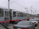
The L Taraval is a Muni Metro
line in San Francisco, California
, mainly serving the Parkside District
, an area which is immediately south of the Sunset District and which is regarded by some as the southern part of the Sunset District. It was one of San Francisco's streetcar lines in the early 20th century, and was converted to modern light rail
operation with the creation of the Muni Metro system in the late 1970s. While many streetcar lines were converted to buses after World War II
, the L Taraval remained a streetcar line due to its use of the Twin Peaks Tunnel
.
in the Financial District
to the 46th Avenue and Wawona Street, near the San Francisco Zoo
in the Sunset District. The downtown portion of the line runs in the Market Street Subway, which is shared with six other Muni Metro lines. It continues through the much older Twin Peaks Tunnel, shared by the K Ingleside
and M Ocean View lines, emerging at West Portal Station
. Once out of the tunnel, the L takes Ulloa Street to 15th Avenue and turns onto Taraval Street. It then follows Taraval to 46th Avenue, where it turns south towards the Zoo. The end of the line loops around Vicente, 47th Avenue and Wawona with the terminal stop on Wawona between 46th and 47th Avenues.
 Tracks on Taraval Street extend west from 46th Avenue to 48th Avenue/Great Highway
, but they are not used in revenue service. However, chartered streetcars and LRVs can operate there if requested.
The L Taraval line stops at large stations for the downtown section of the route and at smaller stops on the rest of the line. Most of the smaller stops are nothing more than a sign on the side of the street designating a stop and a few others are concrete islands in the middle of the street next to the tracks that provide access for wheelchair
s. Muni bus routes provide service to all stations and other systems with access to the stations are noted.
, it turns south on Market Street, which becomes Portola Drive. It follows Portola between the Diamond Heights
neighborhood and Twin Peaks
, turns onto Woodside and then Laguna Honda Boulevard, where it loops around at Forest Hill Station. It then backtracks on Laguna Honda Boulevard, Dewey, Claremont and Ulloa to West Portal Station, where it rejoins the daytime L line.
Muni Metro
Muni Metro is a light rail system serving San Francisco, California, operated by the San Francisco Municipal Railway , a division of the San Francisco Municipal Transportation Agency...
line in San Francisco, California
San Francisco, California
San Francisco , officially the City and County of San Francisco, is the financial, cultural, and transportation center of the San Francisco Bay Area, a region of 7.15 million people which includes San Jose and Oakland...
, mainly serving the Parkside District
Parkside, San Francisco, California
Parkside is a neighborhood in San Francisco. It originally began as a distinct district, but today it is generally considered to be the southern part of the Outer Sunset District.-Location:...
, an area which is immediately south of the Sunset District and which is regarded by some as the southern part of the Sunset District. It was one of San Francisco's streetcar lines in the early 20th century, and was converted to modern light rail
Light rail
Light rail or light rail transit is a form of urban rail public transportation that generally has a lower capacity and lower speed than heavy rail and metro systems, but higher capacity and higher speed than traditional street-running tram systems...
operation with the creation of the Muni Metro system in the late 1970s. While many streetcar lines were converted to buses after World War II
World War II
World War II, or the Second World War , was a global conflict lasting from 1939 to 1945, involving most of the world's nations—including all of the great powers—eventually forming two opposing military alliances: the Allies and the Axis...
, the L Taraval remained a streetcar line due to its use of the Twin Peaks Tunnel
Twin Peaks Tunnel
The Twin Peaks Tunnel is a long light rail transit/streetcar tunnel in San Francisco, California, United States, running under Twin Peaks. When it was opened on February 3, 1918, it was one of the longest railway tunnels in the world . It was the longest U.S...
.
Route description
The line runs from the Embarcadero StationEmbarcadero Station
Embarcadero is a BART and Muni Metro station in the Financial District of San Francisco. The easternmost stop on the Market Street Subway, Embarcadero acts as a major hub for passenger movement throughout the San Francisco Bay Area...
in the Financial District
Financial District, San Francisco, California
The Financial District is a neighborhood in San Francisco, California, that serves as its main central business district. The nickname "FiDi" is occasionally employed, analogous to nearby SoMa.-Location:...
to the 46th Avenue and Wawona Street, near the San Francisco Zoo
San Francisco Zoo
The San Francisco Zoo, housing more than 260 animal species, is a zoo located in the southwestern corner of San Francisco, California, between Lake Merced and the Pacific Ocean along the Great Highway...
in the Sunset District. The downtown portion of the line runs in the Market Street Subway, which is shared with six other Muni Metro lines. It continues through the much older Twin Peaks Tunnel, shared by the K Ingleside
K Ingleside
The K Ingleside is a Muni Metro line in San Francisco, California, mainly serving the West Portal and Ingleside neighborhoods. It was one of San Francisco's streetcar lines in the early 20th century, and was converted to modern light rail operation with the creation of the Muni Metro system in the...
and M Ocean View lines, emerging at West Portal Station
West Portal Station
West Portal Station is a Muni Metro station in the West Portal neighborhood in San Francisco, California. It is built around the entrance to the Twin Peaks Tunnel, which connects with the Market Street Subway and runs through the city to the Embarcadero...
. Once out of the tunnel, the L takes Ulloa Street to 15th Avenue and turns onto Taraval Street. It then follows Taraval to 46th Avenue, where it turns south towards the Zoo. The end of the line loops around Vicente, 47th Avenue and Wawona with the terminal stop on Wawona between 46th and 47th Avenues.
Great Highway
The Great Highway is a road in San Francisco that forms the city's western edge along the Pacific coast. It runs for approximately next to Ocean Beach...
, but they are not used in revenue service. However, chartered streetcars and LRVs can operate there if requested.
The L Taraval line stops at large stations for the downtown section of the route and at smaller stops on the rest of the line. Most of the smaller stops are nothing more than a sign on the side of the street designating a stop and a few others are concrete islands in the middle of the street next to the tracks that provide access for wheelchair
Wheelchair
A wheelchair is a chair with wheels, designed to be a replacement for walking. The device comes in variations where it is propelled by motors or by the seated occupant turning the rear wheels by hand. Often there are handles behind the seat for someone else to do the pushing...
s. Muni bus routes provide service to all stations and other systems with access to the stations are noted.
Operation
The L Taraval operates 24 hours a day, 7 days a week, primarily with train service beginning at 5 a.m. weekdays, 6 a.m. Saturdays and 8 a.m. Sundays and running until 12:30 a.m. Frequency headways range from 7 to 10 minutes during the day, and 15 to 20 during nighttime service. Late-night service is provided by the L Owl diesel bus line. This line is generally the same as the daytime L Taraval line, except it follows surface streets instead of going through the streetcar-only Market Street Subway and Twin Peaks Tunnel. The line begins at Steuart Street and Market Street, near Embarcadero Station, and follows Market past all of the Market Street Subway's seven underground stations served by the daytime L Taraval line. West of Castro StreetCastro Street
Castro Street may refer to:* Castro Street in The Castro, San Francisco, California* Castro Street , a 1966 short documentary film directed by Bruce Baillie* Castro Street Station, a Muni Metro underground station in San Francisco...
, it turns south on Market Street, which becomes Portola Drive. It follows Portola between the Diamond Heights
Diamond Heights, San Francisco, California
Diamond Heights is a neighborhood in the middle part of San Francisco, California, roughly bordered by Diamond Heights Boulevard and Noe Valley on the east side and Glen Canyon Park on the west side.-History:...
neighborhood and Twin Peaks
Twin Peaks, San Francisco, California
The Twin Peaks are two hills with an elevation of about near the geographic center of San Francisco, California. Except for Mount Davidson, they are the highest points in the city.-Location and climate:...
, turns onto Woodside and then Laguna Honda Boulevard, where it loops around at Forest Hill Station. It then backtracks on Laguna Honda Boulevard, Dewey, Claremont and Ulloa to West Portal Station, where it rejoins the daytime L line.