
Kurayoshi, Tottori
Encyclopedia
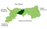
is a city
located in the central part of Tottori
, Japan
.
As of November 1, 2010, the city has an estimated population
of 50,360 and a density
of 185.05 persons per km², making it the third largest city in Tottori. The total area is 272.15 km².
The ancient provincial government of Hoki province
was located in this area, and in medieval times Uchikoshiyama (a hill) featured a castle. Today the remnants of the provincial government and two monasteries can still be seen in the city.
The city was officially founded on October 1, 1953 though historical Kurayoshi predates this foundation and the grid outline of the streets reflects a certain amount of Edo Period planning. Additionally there are many 'soil lacquered' warehouses (dozo, 土蔵) that survive, 'soil lacquering' being a traditional Japanese style of architecture.
Kurayoshi Park Square, a local development featuring museums, conference rooms, a music hall, restaurants, and park space, remains a popular meeting place. Nearby Utsubuki park is known throughout the prefecture as one of the best places to view cherry blossoms in spring. The park also features sports fields and a small animal zoo.
The San'in train line
operated by JR West
serves the city from Kurayoshi Station
and provides a connection to other major cities in Tottori, as well as cities in other regions like Kyoto
or Osaka
. There are also highway bus connections to Kobe
, Osaka
, Hiroshima
, Fukuoka
and Tokyo
. Tottori airport is the nearest airport.
On March 22, 2005 the town of Sekigane
, from Tōhaku District
, was merged into Kurayoshi.
Cities of Japan
||A is a local administrative unit in Japan. Cities are ranked on the same level as and , with the difference that they are not a component of...
located in the central part of Tottori
Tottori Prefecture
is a prefecture of Japan located in the Chūgoku region. The capital is the city of Tottori. It is the least populous prefecture in Japan.- History :Before the Meiji Restoration, Tottori encompassed the old provinces of Hōki and Inaba...
, Japan
Japan
Japan is an island nation in East Asia. Located in the Pacific Ocean, it lies to the east of the Sea of Japan, China, North Korea, South Korea and Russia, stretching from the Sea of Okhotsk in the north to the East China Sea and Taiwan in the south...
.
As of November 1, 2010, the city has an estimated population
Population
A population is all the organisms that both belong to the same group or species and live in the same geographical area. The area that is used to define a sexual population is such that inter-breeding is possible between any pair within the area and more probable than cross-breeding with individuals...
of 50,360 and a density
Population density
Population density is a measurement of population per unit area or unit volume. It is frequently applied to living organisms, and particularly to humans...
of 185.05 persons per km², making it the third largest city in Tottori. The total area is 272.15 km².
The ancient provincial government of Hoki province
Hoki Province
was an old province of Japan in the area that is today the western part of Tottori Prefecture. It was sometimes called . Hōki bordered on Inaba, Mimasaka, Bitchū, Bingo, and Izumo Provinces....
was located in this area, and in medieval times Uchikoshiyama (a hill) featured a castle. Today the remnants of the provincial government and two monasteries can still be seen in the city.
The city was officially founded on October 1, 1953 though historical Kurayoshi predates this foundation and the grid outline of the streets reflects a certain amount of Edo Period planning. Additionally there are many 'soil lacquered' warehouses (dozo, 土蔵) that survive, 'soil lacquering' being a traditional Japanese style of architecture.
Kurayoshi Park Square, a local development featuring museums, conference rooms, a music hall, restaurants, and park space, remains a popular meeting place. Nearby Utsubuki park is known throughout the prefecture as one of the best places to view cherry blossoms in spring. The park also features sports fields and a small animal zoo.
The San'in train line
San'in Main Line
The is a railway line in western Japan that runs from Kyoto to Shimonoseki, Yamaguchi Prefecture, operated by West Japan Railway Company . It is the major railway line of the San'in region, running along the Japan Sea, crossing Kyoto, Hyōgo, Tottori, Shimane and Yamaguchi prefectures...
operated by JR West
West Japan Railway Company
, also referred to as , is one of the Japan Railways Group companies and operates in western Honshū. It has its headquarters in Kita-ku, Osaka.-History:...
serves the city from Kurayoshi Station
Kurayoshi Station
is a railway station on the Sanin Main Line of West Japan Railway Company located in Kurayoshi, Tottori Prefecture, Japan. It serves the city of Kurayoshi.- External links :...
and provides a connection to other major cities in Tottori, as well as cities in other regions like Kyoto
Kyoto
is a city in the central part of the island of Honshū, Japan. It has a population close to 1.5 million. Formerly the imperial capital of Japan, it is now the capital of Kyoto Prefecture, as well as a major part of the Osaka-Kobe-Kyoto metropolitan area.-History:...
or Osaka
Osaka
is a city in the Kansai region of Japan's main island of Honshu, a designated city under the Local Autonomy Law, the capital city of Osaka Prefecture and also the biggest part of Keihanshin area, which is represented by three major cities of Japan, Kyoto, Osaka and Kobe...
. There are also highway bus connections to Kobe
Kobe
, pronounced , is the fifth-largest city in Japan and is the capital city of Hyōgo Prefecture on the southern side of the main island of Honshū, approximately west of Osaka...
, Osaka
Osaka
is a city in the Kansai region of Japan's main island of Honshu, a designated city under the Local Autonomy Law, the capital city of Osaka Prefecture and also the biggest part of Keihanshin area, which is represented by three major cities of Japan, Kyoto, Osaka and Kobe...
, Hiroshima
Hiroshima
is the capital of Hiroshima Prefecture, and the largest city in the Chūgoku region of western Honshu, the largest island of Japan. It became best known as the first city in history to be destroyed by a nuclear weapon when the United States Army Air Forces dropped an atomic bomb on it at 8:15 A.M...
, Fukuoka
Fukuoka, Fukuoka
is the capital city of Fukuoka Prefecture and is situated on the northern shore of the island of Kyushu in Japan.Voted number 14 in a 2010 poll of the World's Most Livable Cities, Fukuoka is praised for its green spaces in a metropolitan setting. It is the most populous city in Kyushu, followed by...
and Tokyo
Tokyo
, ; officially , is one of the 47 prefectures of Japan. Tokyo is the capital of Japan, the center of the Greater Tokyo Area, and the largest metropolitan area of Japan. It is the seat of the Japanese government and the Imperial Palace, and the home of the Japanese Imperial Family...
. Tottori airport is the nearest airport.
On March 22, 2005 the town of Sekigane
Sekigane, Tottori
was a town located in Tōhaku District, Tottori, Japan.On March 22, 2005 Sekigane was merged into the city of Kurayoshi.As of 2003, the town had an estimated population of 4,160 and a density of 42.60 persons per km². The total area was 97.65 km²....
, from Tōhaku District
Tohaku District, Tottori
is a district located in Tottori, Japan.As of 2003, the district has an estimated population of 65,944 and a density of 109.54 persons per km². The total area is 602.02 km².-Towns and villages:*Hokuei*Kotoura*Misasa*Yurihama-Mergers:...
, was merged into Kurayoshi.
Surrounding Municipalities
- Tottori PrefectureTottori Prefectureis a prefecture of Japan located in the Chūgoku region. The capital is the city of Tottori. It is the least populous prefecture in Japan.- History :Before the Meiji Restoration, Tottori encompassed the old provinces of Hōki and Inaba...
- HokueiHokuei, Tottoriis a town located in Tōhaku District, Tottori, Japan. Bordering it are Kotoura to the west, Kurayoshi to the south and Yurihama to the east.As of May 1, 2008, the town has an estimated population of 15,622 and a density of 273 persons per km²...
- YurihamaYurihama, Tottoriis a town located in Tōhaku District, Tottori, Japan.As of December 31, 2009, the town has an estimated population of 17,785 and a density of 228 persons per km²...
- MisasaMisasa, Tottoriis a town located in Tōhaku District, Tottori, Japan. It is also home to the official treasure of Sanbutsuji and the Okayama Hospital.The name "Misasa" originates from the belief that one who stays to enjoy three mornings in the town's famous hot springs will find all of his ailments cured.As of...
- KōfuKofu, Tottoriis a town located in Hino District, Tottori, Japan.As of 2003, the town has an estimated population of 3,758 and a density of 30.15 persons per km². The total area is 124.66 km².-External links:*...
- KotouraKotoura, Tottoriis a town located in Tōhaku District, Tottori, Japan. Bordering it are the towns of Daisen to the left, Kōfu to the south, Hokuei to the east, and the city of Kurayoshi to the southeast....
- Hokuei
- Okayama PrefectureOkayama Prefectureis a prefecture of Japan located in the Chūgoku region on Honshū island. The capital is the city of Okayama.- History :During the Meiji Restoration, the area of Okayama Prefecture was known as Bitchū Province, Bizen Province and Mimasaka Province.- Geography :...
- ManiwaManiwa, Okayamais a city in Okayama Prefecture, Japan.On 31 March 2005, the town of Hokubō ; the towns of Katsuyama, Ochiai, Yubara, and Kuse and the villages of Mikamo, Kawakami, Yatsuka, and Chūka merged to form the new city of Maniwa.On September 1, 2011, Maniwa had an area of 828.43 km², the largest area of...
- Maniwa
External links
- Official website in Japanese