

Kendleton, Texas
Encyclopedia
Kendleton is a city in western Fort Bend County
, Texas
within the Houston–Sugar Land–Baytown
metropolitan area. The population was 466 at the 2000 census. As of 2011 Darryl Humphrey is the mayor of the city.
and Victoria
, which passed through Kendleton. In 1884 a post office opened. In 1890 Kendleton had 25 inhabitants and a general store. In 1896 the community also had two additional general stores and two churches; one was Baptist and one was Methodist. In 1900 116 people lived in Kendleton. In 1933 Kendleton had 36 residents. By the late 1940s Kendleton had about 100 residents. In the 1960s and 1970s the population fluctuated between 150 and 200 people. In 1973 voters approved the incorporation of Kendleton as a city. After incorporation the population increased to over 600. In 1990 Kendleton had 496 residents. In 2000 Kendleton had 466 residents. According to the Handbook of Texas
, area residents estimated that about 2,200 people lived in Kendleton and surrounding areas.
 Kendleton is located at 29°26′52"N 95°59′59"W (29.447872, -95.999806).
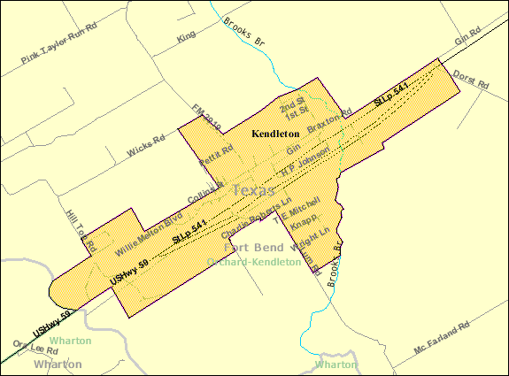
It is in western Fort Bend County, at the intersection of U.S. Route 59
and Farm to Market Road 2919. It is 19 miles (30.6 km) southwest of Rosenberg
.
According to the United States Census Bureau
, the city has a total area of 1.1 square miles (2.8 km²), all of it land.
, there were 466 people, 178 households and 116 families residing in the city. The population density
was 437.9 per square mile (169.7/km²). There were 209 housing units at an average density of 196.4/sq mi (76.1/km²). The racial makeup of the city was 12.45% White, 78.97% African American, 0.21% Pacific Islander, 5.15% from other races
, and 3.22% from two or more races. Hispanic or Latino of any race were 15.24% of the population.
There were 178 households of which 27.5% had children under the age of 18 living with them, 38.8% were married couples
living together, 21.9% had a female householder with no husband present, and 34.3% were non-families. 33.1% of all households were made up of individuals and 14.0% had someone living alone who was 65 years of age or older. The average household size was 2.62 and the average family size was 3.27.
Age distribution was 29.4% under the age of 18, 8.8% from 18 to 24, 26.0% from 25 to 44, 23.4% from 45 to 64, and 12.4% who were 65 years of age or older. The median age was 35 years. For every 100 females there were 77.9 males. For every 100 females age 18 and over, there were 72.3 males.
The median household income
was $21,563, and the median family income was $35,795. Males had a median income of $34,167 versus $21,964 for females. The per capita income
for the city was $12,196. About 14.6% of families and 19.5% of the population were below the poverty line, including 14.7% of those under age 18 and 28.6% of those age 65 or over.
Kendleton Post Office is located at 13635 Willie Melton Boulevard. Benjamin F. Williams was the first postmaster. A post office opened in Kendleton in 1884, shortly after Kendleton's founding. In July 2011 the USPS announced that the post office may close. The nearest available post office to Kendleton is over 10 miles (16.1 km) from the city. Darryl Humphrey, the mayor of Kendleton, criticized the proposed closing. Cindy Horswell and Megan Ryan of the Houston Chronicle
said that Humphrey "feels like his community will be erased from society if the post office is removed, too."
. Students are zoned to Beasley Elementary School in Beasley
, Wessendorff Middle School, Lamar Junior High School, and Lamar Consolidated High School
.
Historically the Kendleton area schools served Kendleton and surrounding communities. In 1903 the school system had 202 African-American students in three schools, and 12 White students in two schools.
Previously primary school students attended the Kendleton Independent School District
's Powell Point Elementary School, located Powell Point
, an unincorporated area north of Kendleton. On March 25, 2010, Texas Education Agency Commissioner Robert Scott announced that he was closing the Kendleton Independent School District. The closing is effective July 1, 2010. Kendleton ISD will be merged with Lamar Consolidated Independent School District. Commissioner Scott's statement was, “While it saddens me to close a school district, years of effort, including reconstituting its school, have failed to turn this district around. I believe students would be ill-served if Kendleton is allowed to continue to operate. The Texas Education Agency pledges to work with the citizens of Kendleton and Lamar Consolidated to make this transition as smooth as possible.” As a result of the closure, students at Powell Point were rezoned to Beasley and Wessendorf. LCISD, for a two year period, will operate its head start program at Powell Point. In July 2011 mayor Darryl Humphrey said that his community was still recovering from the closing of Pilot Point Elementary.
is located north of Kendleton in an unincorporated section of Fort Bend County.
Fort Bend County, Texas
Fort Bend County is a county located along the Gulf Coast region in the U.S. state of Texas within the Houston–Sugar Land–Baytown metropolitan area. In 2000 its population was 354,452, while the 2010 U.S...
, Texas
Texas
Texas is the second largest U.S. state by both area and population, and the largest state by area in the contiguous United States.The name, based on the Caddo word "Tejas" meaning "friends" or "allies", was applied by the Spanish to the Caddo themselves and to the region of their settlement in...
within the Houston–Sugar Land–Baytown
Greater Houston
Houston–Sugar Land–Baytown is a 10-county metropolitan area defined by the Office of Management and Budget. It is located along the Gulf Coast region in the U.S. state of Texas...
metropolitan area. The population was 466 at the 2000 census. As of 2011 Darryl Humphrey is the mayor of the city.
History
What is now Kendleton was a part of William E. Kendall's plantation. In the 1860s Kendall divided his property into various small farms and sold the plots to African-Americans who were former slaves. The community of the farms became known as Kendleton. In 1882 the New York, Texas and Mexican Railway Company established a railroad track between RosenbergRosenberg, Texas
Rosenberg is a city located in the U.S. state of Texas within Fort Bend County and is part of the Houston–Sugar Land–Baytown metropolitan area. The population was 31,676 at the 2010 census...
and Victoria
Victoria, Texas
Victoria is a city in and the seat of Victoria County, Texas, United States. The population was 60,603 at the 2000 census. The three counties of the Victoria Metropolitan Statistical Area had a population of 111,163 at the 2000 census,...
, which passed through Kendleton. In 1884 a post office opened. In 1890 Kendleton had 25 inhabitants and a general store. In 1896 the community also had two additional general stores and two churches; one was Baptist and one was Methodist. In 1900 116 people lived in Kendleton. In 1933 Kendleton had 36 residents. By the late 1940s Kendleton had about 100 residents. In the 1960s and 1970s the population fluctuated between 150 and 200 people. In 1973 voters approved the incorporation of Kendleton as a city. After incorporation the population increased to over 600. In 1990 Kendleton had 496 residents. In 2000 Kendleton had 466 residents. According to the Handbook of Texas
Handbook of Texas
The Handbook of Texas is a comprehensive encyclopedia of Texas geography, history, and historical persons published by the Texas State Historical Association .-History:...
, area residents estimated that about 2,200 people lived in Kendleton and surrounding areas.
Geography
It is in western Fort Bend County, at the intersection of U.S. Route 59
U.S. Route 59
U.S. Route 59 is a north–south United States highway . A latecomer to the U.S. numbered route system, U.S. 59 is now a border-to-border route, Part of NAFTA Corridor Highway System. It parallels U.S. Route 75 for nearly its entire route, never much more than away, until it veers southwest...
and Farm to Market Road 2919. It is 19 miles (30.6 km) southwest of Rosenberg
Rosenberg, Texas
Rosenberg is a city located in the U.S. state of Texas within Fort Bend County and is part of the Houston–Sugar Land–Baytown metropolitan area. The population was 31,676 at the 2010 census...
.
According to the United States Census Bureau
United States Census Bureau
The United States Census Bureau is the government agency that is responsible for the United States Census. It also gathers other national demographic and economic data...
, the city has a total area of 1.1 square miles (2.8 km²), all of it land.
Demographics
At the 2000 censusCensus
A census is the procedure of systematically acquiring and recording information about the members of a given population. It is a regularly occurring and official count of a particular population. The term is used mostly in connection with national population and housing censuses; other common...
, there were 466 people, 178 households and 116 families residing in the city. The population density
Population density
Population density is a measurement of population per unit area or unit volume. It is frequently applied to living organisms, and particularly to humans...
was 437.9 per square mile (169.7/km²). There were 209 housing units at an average density of 196.4/sq mi (76.1/km²). The racial makeup of the city was 12.45% White, 78.97% African American, 0.21% Pacific Islander, 5.15% from other races
Race (United States Census)
Race and ethnicity in the United States Census, as defined by the Federal Office of Management and Budget and the United States Census Bureau, are self-identification data items in which residents choose the race or races with which they most closely identify, and indicate whether or not they are...
, and 3.22% from two or more races. Hispanic or Latino of any race were 15.24% of the population.
There were 178 households of which 27.5% had children under the age of 18 living with them, 38.8% were married couples
Marriage
Marriage is a social union or legal contract between people that creates kinship. It is an institution in which interpersonal relationships, usually intimate and sexual, are acknowledged in a variety of ways, depending on the culture or subculture in which it is found...
living together, 21.9% had a female householder with no husband present, and 34.3% were non-families. 33.1% of all households were made up of individuals and 14.0% had someone living alone who was 65 years of age or older. The average household size was 2.62 and the average family size was 3.27.
Age distribution was 29.4% under the age of 18, 8.8% from 18 to 24, 26.0% from 25 to 44, 23.4% from 45 to 64, and 12.4% who were 65 years of age or older. The median age was 35 years. For every 100 females there were 77.9 males. For every 100 females age 18 and over, there were 72.3 males.
The median household income
Median household income
The median household income is commonly used to generate data about geographic areas and divides households into two equal segments with the first half of households earning less than the median household income and the other half earning more...
was $21,563, and the median family income was $35,795. Males had a median income of $34,167 versus $21,964 for females. The per capita income
Per capita income
Per capita income or income per person is a measure of mean income within an economic aggregate, such as a country or city. It is calculated by taking a measure of all sources of income in the aggregate and dividing it by the total population...
for the city was $12,196. About 14.6% of families and 19.5% of the population were below the poverty line, including 14.7% of those under age 18 and 28.6% of those age 65 or over.
Government and infrastructure
The United States Postal ServiceUnited States Postal Service
The United States Postal Service is an independent agency of the United States government responsible for providing postal service in the United States...
Kendleton Post Office is located at 13635 Willie Melton Boulevard. Benjamin F. Williams was the first postmaster. A post office opened in Kendleton in 1884, shortly after Kendleton's founding. In July 2011 the USPS announced that the post office may close. The nearest available post office to Kendleton is over 10 miles (16.1 km) from the city. Darryl Humphrey, the mayor of Kendleton, criticized the proposed closing. Cindy Horswell and Megan Ryan of the Houston Chronicle
Houston Chronicle
The Houston Chronicle is the largest daily newspaper in Texas, USA, headquartered in the Houston Chronicle Building in Downtown Houston. , it is the ninth-largest newspaper by circulation in the United States...
said that Humphrey "feels like his community will be erased from society if the post office is removed, too."
Public schools
Kendleton is served by the Lamar Consolidated Independent School DistrictLamar Consolidated Independent School District
Lamar Consolidated Independent School District, also Lamar Consolidated ISD, Lamar CISD or LCISD, is a public school district in the U.S...
. Students are zoned to Beasley Elementary School in Beasley
Beasley, Texas
Beasley is a city in Fort Bend County, Texas within the Houston–Sugar Land–Baytown metropolitan area. The city's population was 590 at the 2000 census.-Geography:Beasley is located at ....
, Wessendorff Middle School, Lamar Junior High School, and Lamar Consolidated High School
Lamar Consolidated High School
Lamar Consolidated High School is a grades 9–12 school located in Rosenberg, Texas, United States.The school, which serves serves the City of Richmond, parts of Rosenberg, the City of Kendleton, a minuscule part of Sugar Land, and unincorporated sections of Fort Bend County, is a part of the Lamar...
.
Historically the Kendleton area schools served Kendleton and surrounding communities. In 1903 the school system had 202 African-American students in three schools, and 12 White students in two schools.
Previously primary school students attended the Kendleton Independent School District
Kendleton Independent School District
Kendleton Independent School District was a public school district based in Powell Point. unincorporated Fort Bend County, Texas, United States, north of the city of Kendleton. The district served Kendleton and Powell Point....
's Powell Point Elementary School, located Powell Point
Powell Point, Texas
Powell Point is an unincorporated area in Fort Bend County, Texas, United States.The area is named after Elizabeth Powell, who received the original land grant there from the Mexican Government in 1831.-Education:...
, an unincorporated area north of Kendleton. On March 25, 2010, Texas Education Agency Commissioner Robert Scott announced that he was closing the Kendleton Independent School District. The closing is effective July 1, 2010. Kendleton ISD will be merged with Lamar Consolidated Independent School District. Commissioner Scott's statement was, “While it saddens me to close a school district, years of effort, including reconstituting its school, have failed to turn this district around. I believe students would be ill-served if Kendleton is allowed to continue to operate. The Texas Education Agency pledges to work with the citizens of Kendleton and Lamar Consolidated to make this transition as smooth as possible.” As a result of the closure, students at Powell Point were rezoned to Beasley and Wessendorf. LCISD, for a two year period, will operate its head start program at Powell Point. In July 2011 mayor Darryl Humphrey said that his community was still recovering from the closing of Pilot Point Elementary.
Colleges and universities
Bay Ridge Christian CollegeBay Ridge Christian College
-Intercollegiate athletics:Bay Ridge Christian College holds membership in the Association of Christian College Athletics , competing in men's basketball. The school's colors are Royal Blue, Gold, and White and the nickname is the Eagles.-Notable alumni:...
is located north of Kendleton in an unincorporated section of Fort Bend County.
Parks and recreation
Fort Bend County owns and operates the Bates M. Allen Park, located just outside the city limits of Kendleton. The 235 acre (0.9510121 km²) park includes a canoe ramp, a fishing pier, grills, a historical site, a lake, an observation deck, two pavilions, a play area, a sand volleyball court, tables, toilet facilities, walking trails and wetlands.External links
- Kendleton, Texas - Handbook of TexasHandbook of TexasThe Handbook of Texas is a comprehensive encyclopedia of Texas geography, history, and historical persons published by the Texas State Historical Association .-History:...