
Karikari Peninsula
Encyclopedia
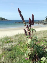
The Karikari Peninsula is a right-angled land mass of two relatively-distinct parts. The rocky northern part, which has an east-west orientation and is approximately 17km long, was originally an island.. It is connected to the rest of the Northland Region of New Zealand
by a low sandy strip approximately 11 km long, which has a north-south orientation. Rangaunu Harbour
is to the west and Doubtless Bay is to the southeast. The Moturoa Islands are to the north. . The spiritually-significant Puwheke sits high above the north-facing beaches.
The local iwi are Ngāti Kahu
. In Māori mythology
, the waka
Waipapa, captained by Kaiwhetu and Wairere, made its first landing
in New Zealand at Karikari.
Grapes are grown on the northern side of Karikari.
The two largest settlements are Whatuwhiwhi
, which is situated the south side of the north-eastern part of the peninsula and nearby Tokerau Beach, which lies at the northern end of the eastern side of the sandy strip. Matai Bay on the northeast coast and Rangiputa on the west coast are popular tourist destinations.
New Zealand
New Zealand is an island country in the south-western Pacific Ocean comprising two main landmasses and numerous smaller islands. The country is situated some east of Australia across the Tasman Sea, and roughly south of the Pacific island nations of New Caledonia, Fiji, and Tonga...
by a low sandy strip approximately 11 km long, which has a north-south orientation. Rangaunu Harbour
Rangaunu Harbour
Rangaunu Harbour is a shallow harbour in the far north of New Zealand. It is situated on the east coast at the base of the Aupouri Peninsula. The name in Māori means "To pull out a shoal of fish". With an area of it is the fifth-largest harbour in New Zealand....
is to the west and Doubtless Bay is to the southeast. The Moturoa Islands are to the north. . The spiritually-significant Puwheke sits high above the north-facing beaches.
The local iwi are Ngāti Kahu
Ngati Kahu
Ngāti Kahu is a Māori iwi of Northland, New Zealand. Ngāti Kahu take their name from their founding ancestress, Kahutianui, and link their ancestry back to the waka Māmaru...
. In Māori mythology
Maori mythology
Māori mythology and Māori traditions are the two major categories into which the legends of the Māori of New Zealand may usefully be divided...
, the waka
Waka (canoe)
Waka are Māori watercraft, usually canoes ranging in size from small, unornamented canoes used for fishing and river travel, to large decorated war canoes up to long...
Waipapa, captained by Kaiwhetu and Wairere, made its first landing
Maori migration canoes
Various Māori traditions recount how their ancestors set out from their homeland in great ocean-going canoes . Some of these traditions name a mythical homeland called Hawaiki....
in New Zealand at Karikari.
Grapes are grown on the northern side of Karikari.
The two largest settlements are Whatuwhiwhi
Whatuwhiwhi
Whatuwhiwhi is a settlement at the northern end of Tokerau Beach, on the Karikari Peninsula of Northland, New Zealand. To the south is Doubtless Bay. Kaitaia is about 39 km away.There are three shaded and sandy coves...
, which is situated the south side of the north-eastern part of the peninsula and nearby Tokerau Beach, which lies at the northern end of the eastern side of the sandy strip. Matai Bay on the northeast coast and Rangiputa on the west coast are popular tourist destinations.