
Julier Pass
Encyclopedia
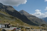
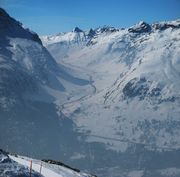
The Julier Pass (el. 2284 m) is a mountain pass
in Switzerland
, in the Albula Range
of the Alps
. It connects the Engadin
valley with the rest of Graubünden
. At its summit, the pass crosses the watershed / drainage divide between the basins
of the Rivers Rhine and Danube
.
Remains of a Roman temple and cart tracks were found to illustrate its importance in Roman times.
The road constructed in the 1820s to replace the old Septimer Pass
was well built and is still easily passable after moderate widening for normal cars and trucks. In some parts areas were rebuilt in 2009 to reduce the number of serpentine turns. Winter use requires winter tires, as well as snow chains in extremely poor weather.
Mountain pass
A mountain pass is a route through a mountain range or over a ridge. If following the lowest possible route, a pass is locally the highest point on that route...
in Switzerland
Switzerland
Switzerland name of one of the Swiss cantons. ; ; ; or ), in its full name the Swiss Confederation , is a federal republic consisting of 26 cantons, with Bern as the seat of the federal authorities. The country is situated in Western Europe,Or Central Europe depending on the definition....
, in the Albula Range
Albula Range
The Albula Alps is a mountain range in the Alps of eastern Switzerland. It is considered to be part of the Central Eastern Alps. It is named after the River Albula...
of the Alps
Alps
The Alps is one of the great mountain range systems of Europe, stretching from Austria and Slovenia in the east through Italy, Switzerland, Liechtenstein and Germany to France in the west....
. It connects the Engadin
Engadin
The Engadin or Engadine is a long valley in the Swiss Alps located in the canton of Graubünden in southeast Switzerland. It follows the route of the Inn River from its headwaters at Maloja Pass running northeast until the Inn flows into Austria one hundred kilometers downstream...
valley with the rest of Graubünden
Graubünden
Graubünden or Grisons is the largest and easternmost canton of Switzerland. The canton shares borders with the cantons of Ticino, Uri, Glarus and St. Gallen and international borders with Italy, Austria and Liechtenstein...
. At its summit, the pass crosses the watershed / drainage divide between the basins
Drainage basin
A drainage basin is an extent or an area of land where surface water from rain and melting snow or ice converges to a single point, usually the exit of the basin, where the waters join another waterbody, such as a river, lake, reservoir, estuary, wetland, sea, or ocean...
of the Rivers Rhine and Danube
Danube
The Danube is a river in the Central Europe and the Europe's second longest river after the Volga. It is classified as an international waterway....
.
Remains of a Roman temple and cart tracks were found to illustrate its importance in Roman times.
The road constructed in the 1820s to replace the old Septimer Pass
Septimer Pass
Septimer Pass is a high mountain pass in the canton of Graubünden in the Swiss Alps between the valleys of Bregaglia and Oberhalbstein ....
was well built and is still easily passable after moderate widening for normal cars and trucks. In some parts areas were rebuilt in 2009 to reduce the number of serpentine turns. Winter use requires winter tires, as well as snow chains in extremely poor weather.
Route
| Place | Elevation | Distance | Diff. elevation |
Total distance |
Total elevation diff. |
|---|---|---|---|---|---|
| Tiefencastel Tiefencastel Tiefencastel is a municipality in the district of Albula in the canton of Graubünden in Switzerland.-History:Tiefencastel is first mentioned in 831 as in Castello Impitinis. Starting around in the 14th Century it was known as Tüffenkasten.-Geography:Tiefencastel has an area, , of... |
851 m | - | - | - | - |
| Savognin Savognin Savognin is a municipality in the district of Albula in the canton of Graubünden in Switzerland.... |
1207 m | 9 km | 356 m | 9 km | 356 m |
| Rona Rona, Switzerland Rona is situated beside the Julier river , the village consists of three parts, the old lower village , the upper village and the new lower village .... |
1408 m | 5 km | 201 m | 14 km | 557 m |
| Mulegns Mulegns Mulegns is a municipality in the district of Albula in the canton of Graubünden in Switzerland.-History:Around 600-500 BC, a copper mine and smelter were built in the Val Faller near modern Mulegns. The village was founded by a Walser group during the 15th Century. It was first mentioned in... -Sur Sur Sur was a literary journal published in Buenos Aires. Its main backer was Victoria Ocampo, and it was supported intellectually by the Spanish philosopher José Ortega y Gasset. Many of the earliest editions of Sur carry the colophon of Ortega's Revista de Occidente... |
1538 m | 4.5 km | 130 m | 18.5 km | 687 m |
| Marmorera Marmorera Marmorera is a municipality in the district of Albula in the canton of Graubünden in Switzerland.Until the end of the 19th century, its population was almost exclusively Romansh-speaking... |
1680 m | 2.5 km | 142 m | 21 km | 829 m |
| Bivio Bivio Bivio is a municipality in the district of Albula of the Swiss canton of Graubünden.-History:Bivio is first mentioned about 840 as de stabulo Bivio. At one time it was known, in German, as Stallen and until 1895/1903 by its Italian name Stalla.-Geography:Bivio has an area, , of... |
1769 m | 5 km | 89 m | 27 km | 918 m |
| pass | 2284 m | 9 km | 515 m | 36 km | 1'433 m |
| Silvaplana Silvaplana Silvaplana is a municipality in the district of Maloja in the Swiss canton of Graubünden and the name of a lake in the municipality.-History:... |
1815 m | 7 km | 469 m | 43 km | - 469 m |
See also
- List of highest paved roads in Europe
- List of mountain passes
- List of the highest Swiss passes