

John Cary
Encyclopedia
England
England is a country that is part of the United Kingdom. It shares land borders with Scotland to the north and Wales to the west; the Irish Sea is to the north west, the Celtic Sea to the south west, with the North Sea to the east and the English Channel to the south separating it from continental...
cartographer.
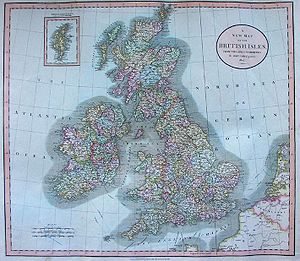
Cary served his apprenticeship as an engraver in London, before setting up his own business in the Strand in 1783. He soon gained a reputation for his maps and globes, his atlas, The New and Correct English Atlas published in 1787, becoming a standard reference work in England.
In 1794 Cary was commissioned by the Postmaster General
United Kingdom Postmaster General
The Postmaster General of the United Kingdom is a defunct Cabinet-level ministerial position in HM Government. Aside from maintaining the postal system, the Telegraph Act of 1868 established the Postmaster General's right to exclusively maintain electric telegraphs...
to survey England's roads. This resulted in Cary's New Itinerary (1798), a map of all the major roads in England and Wales
Wales
Wales is a country that is part of the United Kingdom and the island of Great Britain, bordered by England to its east and the Atlantic Ocean and Irish Sea to its west. It has a population of three million, and a total area of 20,779 km²...
. He also produced Ordnance Survey
Ordnance Survey
Ordnance Survey , an executive agency and non-ministerial government department of the Government of the United Kingdom, is the national mapping agency for Great Britain, producing maps of Great Britain , and one of the world's largest producers of maps.The name reflects its creation together with...
maps prior to 1805.
In his later life he collaborated on geological maps with the geologist William Smith
William Smith (geologist)
William 'Strata' Smith was an English geologist, credited with creating the first nationwide geological map. He is known as the "Father of English Geology" for collating the geological history of England and Wales into a single record, although recognition was very slow in coming...
. His business was eventually taken over by G. F. Cruchley (1822-1875).
Cary's major works include:
- Actual Survey of the country fifteen miles around London (1786)
- New and Correct English Atlas (1787)
- Camden's Britannia (1789) - maps for 1789 and 1806 editions
- Cary's Survey of the High Roads from London (1790)
- Cary's Traveller's Companion (1790)
- New Maps of England and Wales with part of Scotland (1794)
- Inland Navigation; or Select Plans of the Several Navigable Canals throughout Britain (1795)
- Cary's New Itinerary (1798)
- New British Atlas (1805) with John Stockdale
- Cary's New Universal Atlas (1808)
- Cary's English Atlas (1809)
- New Elementary Atlas (1813)
- Cary's New Itinerary (1817)