

Indiana State Road 62
Encyclopedia
State Road 62 in the U.S. State
of Indiana
is an east–west route that runs 228 miles (366.9 km) from the Illinois state line in the southwest corner of Indiana to the Louisville, Kentucky
area, then northeast toward the Cincinnati, Ohio
area.
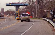
 State Road 62 begins at a toll bridge over the Wabash River
between New Haven, Illinois
and Posey County
. From the east side of Mount Vernon
through Evansville
, SR 62 is the Lloyd Expressway
, a divided expressway-grade highway until reaching U.S. 41 nearly halfway through the city. The expressway
is a mix of both stoplights and single-point exit ramps. Despite the construction delays and need for improvements, the $160 million east–west expressway allows drivers to travel from one end of the city to the other with much greater ease. Plans exist to add additional diamond interchanges as well as a cloverleaf interchange with US 41.
Then SR 62 concurs U.S. 41 with SR 66 to Morgan Avenue on which it leaves Evansville. East of Evansville, the four lane divided road continues to Chandler then becomes a two-lane road and for much of its trip through Spencer
, Perry
, Crawford
, Harrison
and western Floyd
counties, it is narrow, winding and hilly.
State Road 62 overlaps Interstate 64
, Interstate 265
and SR 265, bypassing the cities of New Albany
, Clarksville
and Jeffersonville
. The highway then turns to the northeast, serving the cities of Charlestown
, Hanover
and Madison
before ending at State Road 262 just south of U.S. Route 50
at Dillsboro
.
Before the extension of Interstate 265, State Road 62 went directly through the cities of New Albany, Clarksville, and Jeffersonville.
 In the pre-Interstate era, Indiana 62 between Evansville and New Albany was also U.S. Highway 460, a heavily-traveled route between St. Louis, Missouri
and Louisville, Kentucky
before Interstate 64 supplanted it as a through route.
The highway forms part of the Lincoln Heritage Trail
.
within Evansville's city limits. It is named in honor of former Mayor Russell G. Lloyd, Sr.
who was assassinated after leaving office in 1980. Evansville residents use the term “expressway” loosely due to the large number of stoplights along the Evansville stretch of the route. It is usually referred to simply as "the Lloyd".
The road was built in various stages and officially opened on July 19, 1988. The west section of the expressway was completed in the 1950s with plans to continue it east at a later date as funding became available.
U.S. state
A U.S. state is any one of the 50 federated states of the United States of America that share sovereignty with the federal government. Because of this shared sovereignty, an American is a citizen both of the federal entity and of his or her state of domicile. Four states use the official title of...
of Indiana
Indiana
Indiana is a US state, admitted to the United States as the 19th on December 11, 1816. It is located in the Midwestern United States and Great Lakes Region. With 6,483,802 residents, the state is ranked 15th in population and 16th in population density. Indiana is ranked 38th in land area and is...
is an east–west route that runs 228 miles (366.9 km) from the Illinois state line in the southwest corner of Indiana to the Louisville, Kentucky
Louisville, Kentucky
Louisville is the largest city in the U.S. state of Kentucky, and the county seat of Jefferson County. Since 2003, the city's borders have been coterminous with those of the county because of a city-county merger. The city's population at the 2010 census was 741,096...
area, then northeast toward the Cincinnati, Ohio
Cincinnati, Ohio
Cincinnati is a city in the U.S. state of Ohio. Cincinnati is the county seat of Hamilton County. Settled in 1788, the city is located to north of the Ohio River at the Ohio-Kentucky border, near Indiana. The population within city limits is 296,943 according to the 2010 census, making it Ohio's...
area.
Route description
Wabash River
The Wabash River is a river in the Midwestern United States that flows southwest from northwest Ohio near Fort Recovery across northern Indiana to southern Illinois, where it forms the Illinois-Indiana border before draining into the Ohio River, of which it is the largest northern tributary...
between New Haven, Illinois
New Haven, Illinois
New Haven is a village in Gallatin County, Illinois, along the Little Wabash River near its mouth at the Wabash River. The population was 477 at the 2000 census.-Geography:New Haven is located at ....
and Posey County
Posey County, Indiana
As of the census of 2000, there were 27,061 people, 10,205 households, and 7,612 families residing in the county. The population density was 66 people per square mile . There were 11,076 housing units at an average density of 27 per square mile...
. From the east side of Mount Vernon
Mount Vernon, Indiana
Mount Vernon is a city in southern Indiana along the Ohio River and the county seat of Posey County. It is located in Black Township. As of the 2010 census, the city's population was 6,687...
through Evansville
Evansville, Indiana
Evansville is the third-largest city in the U.S. state of Indiana and the largest city in Southern Indiana. As of the 2010 census, the city had a total population of 117,429. It is the county seat of Vanderburgh County and the regional hub for both Southwestern Indiana and the...
, SR 62 is the Lloyd Expressway
Lloyd Expressway
The Lloyd Expressway is a major east–west traffic artery in Evansville, Indiana. The road numbering consists of two segments. West of U.S. Route 41 , the road is State Road 62 , and east of US 41 it is SR 66...
, a divided expressway-grade highway until reaching U.S. 41 nearly halfway through the city. The expressway
Limited-access road
A limited-access road known by various terms worldwide, including limited-access highway, dual-carriageway and expressway, is a highway or arterial road for high-speed traffic which has many or most characteristics of a controlled-access highway , including limited or no access to adjacent...
is a mix of both stoplights and single-point exit ramps. Despite the construction delays and need for improvements, the $160 million east–west expressway allows drivers to travel from one end of the city to the other with much greater ease. Plans exist to add additional diamond interchanges as well as a cloverleaf interchange with US 41.
Then SR 62 concurs U.S. 41 with SR 66 to Morgan Avenue on which it leaves Evansville. East of Evansville, the four lane divided road continues to Chandler then becomes a two-lane road and for much of its trip through Spencer
Spencer County, Indiana
As of the census of 2000, there were 20,391 people, 7,569 households, and 5,752 families residing in the county. The population density was 51 people per square mile . There were 8,333 housing units at an average density of 21 per square mile...
, Perry
Perry County, Indiana
Perry County is a county located in the southwestern part of the U.S. state of Indiana. As of 2010, the population was 19,338. The county seat is Tell City. It is the hilliest county as well as one of the most forested counties of in Indiana as it features more than of Hoosier National Forest...
, Crawford
Crawford County, Indiana
Crawford County is a county located in the U.S. state of Indiana. As of 2010, the population was 10,713. The county seat is English.-Geography:...
, Harrison
Harrison County, Indiana
Harrison County is a county located in the far southern part of the U.S. state of Indiana along the Ohio River. It is divided into twelve townships, and the county seat is Corydon, the former capital of Indiana. The county is part of the larger Louisville/Jefferson County, KY–IN Metropolitan...
and western Floyd
Floyd County, Indiana
Floyd County is a county located in the U.S. state of Indiana. As of 2010, the population was 74,578. The county seat is New Albany. Floyd County is the county with the second smallest land area in the entire state...
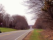
counties, it is narrow, winding and hilly.
State Road 62 overlaps Interstate 64
Interstate 64
Interstate 64 is an Interstate Highway in the Midwestern and Southeastern United States. Its western terminus is at I-70, U.S. 40, and U.S. 61 in Wentzville, Missouri. Its eastern terminus is at an interchange with I-264 and I-664 at Bowers Hill in Chesapeake, Virginia. As I-64 is concurrent with...
, Interstate 265
Interstate 265
Interstate 265 is an Interstate Highway ringing the Louisville, Kentucky metropolitan area, which includes southern Indiana, although the Indiana and Kentucky segments remain separate at the present time. In Kentucky it only runs through Jefferson County, from Interstate 71 in northeastern...
and SR 265, bypassing the cities of New Albany
New Albany, Indiana
New Albany is a city in Floyd County, Indiana, United States, situated along the Ohio River opposite Louisville, Kentucky. In 1900, 20,628 people lived in New Albany; in 1910, 20,629; in 1920, 22,992; and in 1940, 25,414. The population was 36,372 at the 2010 census. The city is the county seat of...
, Clarksville
Clarksville, Indiana
Clarksville is a town in Clark County, Indiana, United States, along the Ohio River as a part of the Louisville Metropolitan area. The population was 21,724 at the 2010 census. The town, once a home site to George Rogers Clark, was founded in 1783 and is the oldest American town in the Northwest...
and Jeffersonville
Jeffersonville, Indiana
Jeffersonville is a city in Clark County, Indiana, along the Ohio River. Locally, the city is often referred to by the abbreviated name Jeff. It is directly across the Ohio River to the north of Louisville, Kentucky along I-65. The population was 44,953 at the 2010 census...
. The highway then turns to the northeast, serving the cities of Charlestown
Charlestown, Indiana
-Demographics:As of the census of 2000, there were 5,993 people, 2,341 households, and 1,615 families residing in the city. The population density was 2,570.0 people per square mile . There were 2,489 housing units at an average density of 1,067.4 per square mile...
, Hanover
Hanover, Indiana
Hanover is a town in Hanover Township, Jefferson County, Indiana, along the Ohio River. The population was 3,546 at the 2010 census. Hanover is the home of Hanover College, a small Presbyterian liberal arts college. Hanover is also the home of Southwestern High School...
and Madison
Madison, Indiana
As of the census of 2000, there were 12,004 people, 5,092 households, and 3,085 families residing in the city. The population density was 1,402.9 people per square mile . There were 5,597 housing units at an average density of 654.1 per square mile...
before ending at State Road 262 just south of U.S. Route 50
U.S. Route 50
U.S. Route 50 is a major east–west route of the U.S. Highway system, stretching just over from Ocean City, Maryland on the Atlantic Ocean to West Sacramento, California. Until 1972, when it was replaced by Interstate Highways west of the Sacramento area, it extended to San Francisco, near...
at Dillsboro
Dillsboro, Indiana
Dillsboro is a town in Clay Township, Dearborn County, Indiana, United States. The population was 1,327 at the 2010 census. It was founded in 1830 and named after James Dill, a general in the war of 1812 who beforehand had achieved limited success as a hotel clerk.-Geography:Dillsboro is located at...
.
Before the extension of Interstate 265, State Road 62 went directly through the cities of New Albany, Clarksville, and Jeffersonville.
History
St. Louis, Missouri
St. Louis is an independent city on the eastern border of Missouri, United States. With a population of 319,294, it was the 58th-largest U.S. city at the 2010 U.S. Census. The Greater St...
and Louisville, Kentucky
Louisville, Kentucky
Louisville is the largest city in the U.S. state of Kentucky, and the county seat of Jefferson County. Since 2003, the city's borders have been coterminous with those of the county because of a city-county merger. The city's population at the 2010 census was 741,096...
before Interstate 64 supplanted it as a through route.
The highway forms part of the Lincoln Heritage Trail
Lincoln Heritage Trail
The Lincoln Heritage Trail is a designation for a series of highways in the U.S. states of Illinois, Indiana and Kentucky that links communities with pre-presidential period historical ties to U.S...
.
Lloyd Expressway
SR 62 is known as the Lloyd ExpresswayLloyd Expressway
The Lloyd Expressway is a major east–west traffic artery in Evansville, Indiana. The road numbering consists of two segments. West of U.S. Route 41 , the road is State Road 62 , and east of US 41 it is SR 66...
within Evansville's city limits. It is named in honor of former Mayor Russell G. Lloyd, Sr.
Russell G. Lloyd, Sr.
Russell G. Lloyd, Sr. served as the Republican mayor of Evansville, Indiana from 1972 to 1980 and was an alternate delegate from Indiana to the 1972 Republican National Convention...
who was assassinated after leaving office in 1980. Evansville residents use the term “expressway” loosely due to the large number of stoplights along the Evansville stretch of the route. It is usually referred to simply as "the Lloyd".
The road was built in various stages and officially opened on July 19, 1988. The west section of the expressway was completed in the 1950s with plans to continue it east at a later date as funding became available.