
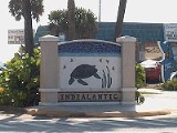
Indialantic, Florida
Encyclopedia
Indialantic is a town in Brevard County
, Florida
, United States
. The name is a portmanteau derived from the town's location between the Indian River Lagoon
and the Atlantic Ocean
.
The population of Indialantic was 3003 at the 2010 census. As of 2005, the population estimated by the U.S. Census Bureau is 3,076. It is part of the Palm Bay
–Melbourne
–Titusville
Metropolitan Statistical Area. The seldom-used official name of the incorporated town is "Indialantic-By-The-Sea."
that separates the Indian River Lagoon from the Atlantic Ocean. This island, approximately 35 miles (56.3 km) in length, stretches south from Cape Canaveral to the Sebastian Inlet (see the Sebastian Inlet State Park
). The Melbourne Causeway
connects Indialantic to Melbourne, Florida
across the Indian River Lagoon. Indialantic is bordered on the south by the town of Melbourne Beach and on the north by unincorporated Brevard County.
According to the United States Census Bureau
, the town has a total area of 1.2 square miles (3.1 km²). 1 square miles (2.6 km²) of it is land and 0.2 square mile (0.517997622 km²) of it (16.13%) is water.
This area starts with the town of Indialantic on the south and extends from the Atlantic ocean to the Indian River north to the Eau Gallie Causeway (SR 518). It includes mostly unincorporated parts of Brevard County but also includes a development that is part of the city of Melbourne, otherwise a mainland community.
Included are these developments:
As of the census
of 2000, there were 2,944 people, 1,330 households, and 848 families residing in the town. The population density
was 2,840.6 inhabitants per square mile (1,093.0/km²). There were 1,467 housing units at an average density of 1,415.5 per square mile (544.6/km²). The racial makeup of the town was 97.32% White, 0.27% African American, 0.14% Native American, 0.71% Asian, 0.58% from other races
, and 0.99% from two or more races. Hispanic or Latino of any race were 2.34% of the population.
There are 1,330 households, out of which 21.6% have children under the age of 18 living with them, 54.2% were married couples
living together, 7.0% had a female householder with no husband present, and 36.2% were non-families. 27.3% of all households were made up of individuals and 12.4% had someone living alone who was 65 years of age or older. The average household size was 2.21 and the average family size was 2.72.
In the town, the population was spread out with 17.6% under the age of 18, 4.7% from 18 to 24, 26.4% from 25 to 44, 27.3% from 45 to 64, and 24.0% who were 65 years of age or older. The median age was 46 years. For every 100 females there were 97.5 males. For every 100 females age 18 and over, there were 97.4 males.
The median income for a household in the town was $62,181, and the median income for a family was $76,109. Males had a median income of $51,830 versus $30,047 for females. The per capita income
for the town was $41,126. About 1.1% of families and 2.3% of the population were below the poverty line, including none of those under age 18 and 1.9% of those age 65 or over.
The per capita income of $41,126 places the town of Indialantic first in Brevard County and 58 in the state (out of 887 places).
Racial characteristics:
Households:
Housing:
Social Characteristics:
Officers are as follows:
The following are all appointed or hired:
In 2008, the town had a taxable real estate base of $367.69 million. The budget for fiscal year 2012 was $4,060,999.
before Christmas when firemen have distributed candy to children from a firetruck, on every street.
In 2005, Hoover contained grades 7 and 8. There were 512 students and 32 teachers, for a ratio of 16:1. 11.3% qualified for free or reduced lunch. Indianlantic Elementary contained grades Pre-kindergarten
though sixth. There were 812 students and 54 teachers for a ratio of 15:1. 13.3% qualified for free or reduced lunch.
See State Roads in Florida
for explanation of numbering system.
Brevard County, Florida
Brevard County is a county located in the U.S. state of Florida, along the coast of the Atlantic Ocean. As of 2007 U.S. Census Bureau estimates, the population is 536,521, making it the 10th most populous county in the state. Influenced by the presence of the John F. Kennedy Space Center, Brevard...
, Florida
Florida
Florida is a state in the southeastern United States, located on the nation's Atlantic and Gulf coasts. It is bordered to the west by the Gulf of Mexico, to the north by Alabama and Georgia and to the east by the Atlantic Ocean. With a population of 18,801,310 as measured by the 2010 census, it...
, United States
United States
The United States of America is a federal constitutional republic comprising fifty states and a federal district...
. The name is a portmanteau derived from the town's location between the Indian River Lagoon
Indian River Lagoon
The Indian River Lagoon is a grouping of three lagoons: Mosquito Lagoon, Banana River, and the Indian River, on the Atlantic Coast of Florida. It was originally named Rio de Ais after the Ais Indian tribe, who lived along the east coast of Florida....
and the Atlantic Ocean
Atlantic Ocean
The Atlantic Ocean is the second-largest of the world's oceanic divisions. With a total area of about , it covers approximately 20% of the Earth's surface and about 26% of its water surface area...
.
The population of Indialantic was 3003 at the 2010 census. As of 2005, the population estimated by the U.S. Census Bureau is 3,076. It is part of the Palm Bay
Palm Bay, Florida
Palm Bay is a city in Brevard County, Florida, United States. The U.S. Census Bureau estimated the city's population as 100,786 on 1 July 2008; it is the most populous city in the county...
–Melbourne
Melbourne, Florida
Melbourne is a city in Brevard County, Florida, United States. As of 2009, the population estimated by the U.S. Census Bureau is 78,323. The municipal area is the second largest by size and by population in the county. Melbourne is a principal city of the Palm Bay – Melbourne – Titusville, Florida...
–Titusville
Titusville, Florida
Titusville is a city in Brevard County, Florida in the United States. It is the county seat of Brevard County. Nicknamed Space City, USA, Titusville is on the Indian River, west of Merritt Island and the Kennedy Space Center and south-southwest of the Canaveral National Seashore...
Metropolitan Statistical Area. The seldom-used official name of the incorporated town is "Indialantic-By-The-Sea."
Geography
Indialantic is situated on the barrier islandBarrier island
Barrier islands, a coastal landform and a type of barrier system, are relatively narrow strips of sand that parallel the mainland coast. They usually occur in chains, consisting of anything from a few islands to more than a dozen...
that separates the Indian River Lagoon from the Atlantic Ocean. This island, approximately 35 miles (56.3 km) in length, stretches south from Cape Canaveral to the Sebastian Inlet (see the Sebastian Inlet State Park
Sebastian Inlet State Park
Sebastian Inlet State Park is a Florida State Park located 10 miles south of Melbourne Beach and 6 miles north of Vero Beach, Florida. The park lies on both sides of the Sebastian Inlet, which forms the boundary between Brevard and Indian River counties. The land for the park was acquired by the...
). The Melbourne Causeway
Melbourne Causeway
The Melbourne Causeway is located entirely within Brevard County, Florida in the United States. It is composed of three bridges and connects the municipalities of Melbourne, Florida and Indialantic, Florida across the Indian River Lagoon in Brevard County. The causeway is part of U.S...
connects Indialantic to Melbourne, Florida
Melbourne, Florida
Melbourne is a city in Brevard County, Florida, United States. As of 2009, the population estimated by the U.S. Census Bureau is 78,323. The municipal area is the second largest by size and by population in the county. Melbourne is a principal city of the Palm Bay – Melbourne – Titusville, Florida...
across the Indian River Lagoon. Indialantic is bordered on the south by the town of Melbourne Beach and on the north by unincorporated Brevard County.
According to the United States Census Bureau
United States Census Bureau
The United States Census Bureau is the government agency that is responsible for the United States Census. It also gathers other national demographic and economic data...
, the town has a total area of 1.2 square miles (3.1 km²). 1 square miles (2.6 km²) of it is land and 0.2 square mile (0.517997622 km²) of it (16.13%) is water.
Indialantic (32903)
Greater Indialantic represents a parallel development of suburban beach homes, which for lack of a stronger identity, has assumed that of the nearest town. The Town of Indialantic is a 1 by community. The areas mentioned below are not in town but share a zip code with Indialantic.This area starts with the town of Indialantic on the south and extends from the Atlantic ocean to the Indian River north to the Eau Gallie Causeway (SR 518). It includes mostly unincorporated parts of Brevard County but also includes a development that is part of the city of Melbourne, otherwise a mainland community.
Included are these developments:
- Cloisters
- Coventry
- Highland Groves
- Indialantic Heights
- North Atlantic by the Sea
- Ocean Park
- Oceanside Village
- Puesta del Sol
- Rio Linda
- Rio Villa
- River Shores
- Riviera
- Sanctuary (part of the City of Melbourne)
- Shady Shores
- Terrace Shores
Demographics
The population of the town dropped 8% from 2000 to 2010.As of the census
Census
A census is the procedure of systematically acquiring and recording information about the members of a given population. It is a regularly occurring and official count of a particular population. The term is used mostly in connection with national population and housing censuses; other common...
of 2000, there were 2,944 people, 1,330 households, and 848 families residing in the town. The population density
Population density
Population density is a measurement of population per unit area or unit volume. It is frequently applied to living organisms, and particularly to humans...
was 2,840.6 inhabitants per square mile (1,093.0/km²). There were 1,467 housing units at an average density of 1,415.5 per square mile (544.6/km²). The racial makeup of the town was 97.32% White, 0.27% African American, 0.14% Native American, 0.71% Asian, 0.58% from other races
Race (United States Census)
Race and ethnicity in the United States Census, as defined by the Federal Office of Management and Budget and the United States Census Bureau, are self-identification data items in which residents choose the race or races with which they most closely identify, and indicate whether or not they are...
, and 0.99% from two or more races. Hispanic or Latino of any race were 2.34% of the population.
There are 1,330 households, out of which 21.6% have children under the age of 18 living with them, 54.2% were married couples
Marriage
Marriage is a social union or legal contract between people that creates kinship. It is an institution in which interpersonal relationships, usually intimate and sexual, are acknowledged in a variety of ways, depending on the culture or subculture in which it is found...
living together, 7.0% had a female householder with no husband present, and 36.2% were non-families. 27.3% of all households were made up of individuals and 12.4% had someone living alone who was 65 years of age or older. The average household size was 2.21 and the average family size was 2.72.
In the town, the population was spread out with 17.6% under the age of 18, 4.7% from 18 to 24, 26.4% from 25 to 44, 27.3% from 45 to 64, and 24.0% who were 65 years of age or older. The median age was 46 years. For every 100 females there were 97.5 males. For every 100 females age 18 and over, there were 97.4 males.
The median income for a household in the town was $62,181, and the median income for a family was $76,109. Males had a median income of $51,830 versus $30,047 for females. The per capita income
Per capita income
Per capita income or income per person is a measure of mean income within an economic aggregate, such as a country or city. It is calculated by taking a measure of all sources of income in the aggregate and dividing it by the total population...
for the town was $41,126. About 1.1% of families and 2.3% of the population were below the poverty line, including none of those under age 18 and 1.9% of those age 65 or over.
The per capita income of $41,126 places the town of Indialantic first in Brevard County and 58 in the state (out of 887 places).
Indialantic (32903)
Here are the figures for the extended area as of the 2000 census- Total population = 12,792
- Male = 6,339 (49.6%)
- Female = 6,453 (50.4%)
- Median Age = 45.2, above US average of 35.3
- Under 5 years = 583 (4.6%) (US ave = 6.8%)
- 18 years and over = 10,361 (81%) (US ave = 74.3%)
- 65 years and over = 2,887 (22.6%) (US ave = 12.4%)
Racial characteristics:
- White - 96.4% (US ave - 75.1%)
- Asian - 1.2% (3.6%)
- Two or more races - 1.1% (2.4%)
- Black or Afro-American - .7% (12.3%)
- Some other race - .5% (5.5%)
Households:
- Size - 2.25 (2.59)
- Family size - 2.74 (3.14)
Housing:
- Owner occupied - 78.5% (66.2%)
- Renter occupied - 21.5% (33.8%)
- Vacant housing units - 11.3% (9.0%)
Social Characteristics:
- High school graduate or higher - 95.2% (80.4%)
- Bachelor's degree or higher - 47.5% (24.4%)
- Veterans - 21.5% (12.7%)
- Disability status (5 years and over) - 15% (19.3%)
- Foreign born - 7.4% (11.1%)
- Male, now married, except separated, (15 years and over) - 61.5% (56.7%)
- Female, now married, except separated, (15 years and over) - 61.1% (52.1%)
- Speak a language other than English at home (5 years and over) - 8.1% (17.9%)
Government
The town publishes a quarterly report to all residents.Officers are as follows:
- Mayor - David Berkman. (term ends 2012)
- Deputy Mayor, Loren Goldfarb (term ends 2012)
- Councilman - Randall Greer (term ends 2011)
- Councilman - Jill Carroll Hoffman (term ends 2013)
- Councilman - Stuart Glass (term ends 2012)
The following are all appointed or hired:
- Town Manager- Christopher Chinault (appointed)
- Police Chief- Troy Morris
- Public Works Director- Ron Cassedy
- Town Attorney- Paul Gougelman
- Town Clerk- Laura Eaton
- Fire Chief- Jon Macdonald
- Building Official- Clifford Stokes
In 2008, the town had a taxable real estate base of $367.69 million. The budget for fiscal year 2012 was $4,060,999.
Public safety
There are seven paid firefighters plus upwards of ten volunteers. Since 1985, residents have lit luminariaLuminaria
A luminaria or a farolito is a small paper lantern which is of significance among New World Hispanics at Christmas time...
before Christmas when firemen have distributed candy to children from a firetruck, on every street.
Past Mayors
| Mayors of Indialantic, Florida |
|---|
|
Personal income (32903)
Economic characteristics, with the expanded town limits (CDP) in parentheses:- In labor force, 16 and over - 57.7% (63.9%)
- Travel time to work, minutes - 19.7 (25.5)
- Median household income in 1999 dollars - $59,773 ($41,994)
- Median family income - $74,188 ($50,046)
- Per capita income - $36,095. The town has the highest per capita incomeFlorida locations by per capita incomeFlorida has the eighteenth highest per capita income in the United States of America, at $21,557 . Its personal per capita income is $30,446 .-Florida Counties Ranked by Per Capita Income:...
in the county. ($21,587) - Families below poverty level - 4.1% (9.2%)
- Individuals below poverty level - 4.7% (12.4%)
Tourism
The following events occur annually:- July craft show, Nance Park
- Witch Way 5-k5000 metresThe 5000 metres is a popular running distance also known as 5 km or 5K in American English. It is one of the track events in the Olympic Games and the World Championships in Athletics. "5000 metres" refers to racing on a track and "5K" usually refers to a roadrace or cross country event...
event in October - Halloween Party, October
History
- 1919-21 - Ernest Kouven-Hoven, who bought the land that ultimately became Indialantic, settled in the area, and built a wooden bridge connecting Indialantic with Melbourne (Bridge #1)
- 1920s - The Indialantic Hotel was built. Its name was later changed to the Tradewinds Hotel. The hotel was on what is now South Shannon Avenue, the current location of Tradewinds Terrace.
- By 1924 The Indialantic Casino was built. Its name was later changed to the Bahama Beach Club. This is the location of Nance Park today.
- 1941-47 - Wooden bridge is replaced with drawbridge, delayed by the war years. (Bridge #2)
- 1952 - Indialantic is incorporated with the name "Indialantic-by-the-sea."
- 1985 - Modern causeway is built with elevated span to avoid boats (Bridge #3)
Education (32903)
There are two local schools under the jurisdiction of the Brevard County School Board: Indialantic Elementary and Hoover Middle School. The state evaluated Hoover "Grade A" from 2000-2008.In 2005, Hoover contained grades 7 and 8. There were 512 students and 32 teachers, for a ratio of 16:1. 11.3% qualified for free or reduced lunch. Indianlantic Elementary contained grades Pre-kindergarten
Pre-Kindergarten
Pre-kindergarten refers to the first formal academic classroom-based learning environment that a child customarily attends in the United States. It begins between the ages of 3-5 depending on the length of the program...
though sixth. There were 812 students and 54 teachers for a ratio of 15:1. 13.3% qualified for free or reduced lunch.
Media
- Florida TodayFlorida TodayFlorida Today is the major daily newspaper serving Brevard County. The Gannett corporation bought the paper in 1966.In addition to its regular daily publication, Florida Today publishes four weekly and eight biweekly community newspapers which are tailored for distinct neighborhoods within Brevard...
published a free bi-weekly paper, The Indialantic Wave, which served Indialantic until about 2009. Then it substituted "The Breeze" which contained all South BeachesSouth BeachesSouth Beaches is an unofficial area in Brevard County, Florida, United States. It includes cities, towns and unincorporated area on the barrier island south of Patrick Air Force Base...
communities. - The Hometown News - a free weekly paper that is distributed to each home
Roads
Travelocity.com named route A1A which runs along the Brevard shore as the "Best Driving Route" in Florida. This runs close to the ocean. A secondary major route, paralleling it, is Riverside, which is close to the Indian River.See State Roads in Florida
State Roads in Florida
Roads maintained by the Florida Department of Transportation or a toll authority are referred to officially as State Roads, abbreviated SR. State Roads are always numbered; in general, the numbers follow a grid. Odd numbered roads run north-south, and even numbered roads run east-west...
for explanation of numbering system.
-
 U.S. Route 192U.S. Route 192U.S. Route 192 is an east–west route of the United States Numbered Highway system in central Florida. It runs 75.04 miles from U.S. Route 27 in Citrus Ridge, Lake County, east past Walt Disney World and through Kissimmee, St. Cloud and Melbourne, to end at State Road A1A in Indialantic, one...
- "Fifth Avenue". Also called Florida State Road 500Florida State Road 500State Road 500 is a major state highway running through Florida as a mostly unsigned route under several US Highways. From Chiefland to Williston it is U.S. Highway 27 Alternate. From Williston to Ocala, it is U.S. Highway 27. From Ocala to Kissimmee, it is U.S. Highway 441. From Kissimmee to...
 -
 SR A1AFlorida State Road A1AState Road A1A is a Florida State Road that runs mostly along the Atlantic Ocean, with sections from Key West at the southern tip of Florida, to Callahan, just south of Georgia. It is the main road through most oceanfront towns. SR A1A is designated the A1A Scenic and Historic Coastal Highway, a...
- Miramar Avenue - Riverside Drive - 10,000 vehicles used this road daily in 2010. It runs throughout the length of Indialantic including "greater Indialantic" in the county.
External links
- Town of Indialantic official site