

Illinois Route 54
Encyclopedia
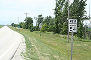
Illinois Route 54 is an east–west highway in east-central Illinois
. It passes through the cities of Clinton
, Gibson City
, and Onarga
. Its western terminus is at Interstate 55
in Springfield
. Its eastern terminus is at U.S. Route 45
at Onarga, one mile (1.6 km) east of Interstate 57
. This is a distance of 109.35 miles (175.98 km).
. U.S. 54 now terminates between Pittsfield
and Griggsville
at mile marker 35 on Interstate 72
/U.S. Route 36
. The U.S. 54 alignment between this point and Illinois 54's current western terminus has since been replaced by the combined Interstate 72/U.S. 36 freeway and Interstate 55. This is a gap of 78 miles (126 km).
Illinois
Illinois is the fifth-most populous state of the United States of America, and is often noted for being a microcosm of the entire country. With Chicago in the northeast, small industrial cities and great agricultural productivity in central and northern Illinois, and natural resources like coal,...
. It passes through the cities of Clinton
Clinton, Illinois
Clinton is the largest city in DeWitt County, Illinois, United States. The population was 7,225 at the 2010 census. It is the county seat of DeWitt County.The city and the county are named for DeWitt Clinton, governor of New York, 1817-1823...
, Gibson City
Gibson City, Illinois
Gibson City is a city in Ford County, Illinois, United States. The population was 3,407 at the 2010 census.-History:The site of Gibson City was purchased and platted by Jonathan B. Lott in 1869. In 1870, Lott built a home and a post office there, and several stores and an a grain elevator were...
, and Onarga
Onarga, Illinois
Onarga is a village in Onarga Township, Iroquois County, Illinois, United States. The population was 1,438 at the 2000 census, and 1,350 in 2009.-Geography:...
. Its western terminus is at Interstate 55
Interstate 55
Interstate 55 is an Interstate Highway in the central United States. Its odd number indicates that it is a north–south Interstate Highway. I-55 goes from LaPlace, Louisiana at Interstate 10 to Chicago at U.S. Route 41 , at McCormick Place. A common nickname for the highway is "double...
in Springfield
Springfield, Illinois
Springfield is the third and current capital of the US state of Illinois and the county seat of Sangamon County with a population of 117,400 , making it the sixth most populated city in the state and the second most populated Illinois city outside of the Chicago Metropolitan Area...
. Its eastern terminus is at U.S. Route 45
U.S. Route 45
U.S. Route 45 is a north–south United States highway. US 45 is a border-to-border route, from Lake Superior to the Gulf of Mexico. A sign at the highway's northern terminus notes the total distance as ....
at Onarga, one mile (1.6 km) east of Interstate 57
Interstate 57
Interstate 57 is an Interstate Highway in Missouri and Illinois that parallels the old Illinois Central rail line for much of its route. It goes from Miner, Missouri, at Interstate 55 to Chicago, Illinois, at Interstate 94. I-57 essentially serves as a shortcut route for travelers headed between...
. This is a distance of 109.35 miles (175.98 km).
Route description
Illinois 54 runs southwest-to-northeast from Springfield. It is now mainly a local road, as Interstates 55 and 57 have become preferred for long distance travel in the region.History
Until 1972, Illinois 54 was signed as U.S. Route 54U.S. Route 54
U.S. Route 54 is an east–west United States highway that runs northeast-southwest for 1,197 miles from western Illinois to El Paso, Texas. It enters and leaves Texas twice...
. U.S. 54 now terminates between Pittsfield
Pittsfield, Illinois
Pittsfield is a city in Pike County, Illinois, United States. The population was 4,211 at the 2000 census.-History:The city was named after Pittsfield, Massachusetts. It is the county seat of Pike County...
and Griggsville
Griggsville, Illinois
Griggsville is a city in Pike County, Illinois, United States. The population was 1,258 at the 2000 census.-Geography:Griggsville is located at ....
at mile marker 35 on Interstate 72
Interstate 72
Interstate 72 is an Interstate Highway in the midwestern United States. Its western terminus is in Hannibal, Missouri, at an intersection with U.S. Route 61; its eastern terminus is at Country Fair Drive in Champaign, Illinois. In 2006, the Illinois General Assembly dedicated all of Interstate 72...
/U.S. Route 36
U.S. Route 36
U.S. Route 36 is an east–west United States highway that runs for from Rocky Mountain National Park, Colorado to Uhrichsville, Ohio. The highway's western terminus is at Deer Ridge Junction, an intersection in Rocky Mountain National Park, Colorado, where it meets U.S. Route 34. Its eastern...
. The U.S. 54 alignment between this point and Illinois 54's current western terminus has since been replaced by the combined Interstate 72/U.S. 36 freeway and Interstate 55. This is a gap of 78 miles (126 km).
Major junctions
| County | City | Route(s) | Notes |
|---|---|---|---|
| Sangamon Sangamon County, Illinois Sangamon County is a county located in the U.S. state of Illinois. According to the 2010 census, it has a population of 197,465, which is an increase of 4.5% from 188,951 in 2000... Mile 0.00-12.43 |
Springfield Springfield, Illinois Springfield is the third and current capital of the US state of Illinois and the county seat of Sangamon County with a population of 117,400 , making it the sixth most populated city in the state and the second most populated Illinois city outside of the Chicago Metropolitan Area... |
 I-55 I-55Interstate 55 in Illinois In the U.S. state of Illinois, Interstate 55 is a major north–south Interstate Highway that connects the St. Louis, Missouri and Chicago metropolitan areas. It runs from the Poplar Street Bridge in East St. Louis to U.S. Route 41 near downtown Chicago... |
|
| Logan Logan County, Illinois Logan County is a county located in the U.S. state of Illinois. According to the 2010 census, it has a population of 30,305, which is a decrease of 2.8% from 31,183 in 2000... Mile 0.00-17.54 |
Mount Pulaski Mount Pulaski, Illinois Mount Pulaski is a city in Logan County, Illinois, United States. The population was 1,701 at the 2000 census, and 1,577 at a 2009 estimate. It is the home of the Mount Pulaski Courthouse State Historic Site... |
 IL 121 IL 121Illinois Route 121 Illinois Route 121 is a major state road in central Illinois. Although it runs from northwest to southeast, it is marked as a north–south road. It runs from Illinois Route 130 in Greenup to Interstate 55 in Lincoln at the intersection of I-55 and Illinois Route 10... |
|
| De Witt Mile 0.00-33.75 |
Clinton Clinton, Illinois Clinton is the largest city in DeWitt County, Illinois, United States. The population was 7,225 at the 2010 census. It is the county seat of DeWitt County.The city and the county are named for DeWitt Clinton, governor of New York, 1817-1823... |
 US 51 US 51 |
|
 IL 10 IL 10Illinois Route 10 Illinois Route 10 is an arterial east–west state road that runs from rural Mason County east to Champaign, a distance of .-Route description:... |
|||
| Farmer City Farmer City, Illinois Farmer City is a city in DeWitt County, Illinois, United States. The population was 2,037 at the 2010 census.Farmer City is part of Blue Ridge Community Unit School District 18 sharing facilities with nearby Mansfield and Bellflower, Illinois. Farmer City facilities include the District Unit... |
 I-74 I-74Interstate 74 in Illinois In the U.S. state of Illinois, Interstate 74 is a major northwest-southeast Interstate Highway that runs across the northern portion of the state. It runs from the Iowa state line at the Mississippi River southeast to the Indiana state line east of Danville, Illinois. This is a distance of 220.34... |
||
 US 150 US 150 |
|||
| McLean McLean County, Illinois McLean County is a county in the U.S. state of Illinois. McLean County is included in the Bloomington–Normal, Illinois Metropolitan Statistical Area. According to the 2010 census, it has a population of 169,572, which is an increase of 12.7% from 150,433 in 2000. Its county seat is... Mile 0.00-11.09 |
5 mi (8 km) NE of Farmer City |  US 136 US 136 |
|
| Champaign Champaign County, Illinois Champaign County is a county located in the U.S. state of Illinois. According to the 2010 census, it has a population of 201,081, which is an increase of 11.9% from 179,669 in 2000.. It is the 10th most populous county in Illinois... Mile 0.00-0.32 |
|||
| Ford Mile 0.00-26.12 |
Gibson City Gibson City, Illinois Gibson City is a city in Ford County, Illinois, United States. The population was 3,407 at the 2010 census.-History:The site of Gibson City was purchased and platted by Jonathan B. Lott in 1869. In 1870, Lott built a home and a post office there, and several stores and an a grain elevator were... |
 IL 47 IL 47Illinois Route 47 Illinois Route 47 is a largely rural north–south state highway that runs from the Wisconsin state border at Highway 120 near Hebron, to Illinois Route 10, just south of Interstate 72 near Seymour. This is a distance of . Even though Route 47 is primarily rural, in several suburbs of Chicago,... |
|
 IL 9 IL 9Illinois Route 9 Illinois Route 9 is a cross-state, east–west rural state highway in central Illinois. It runs from the Fort Madison Toll Bridge over the Mississippi River to Iowa in Niota east to State Road 26 at the Indiana border. This is a distance of .... |
Concurrent for 1 mi (1.6 km) | ||
| Iroquois Iroquois County, Illinois Iroquois County is a county located in the northeast part of the U.S. state of Illinois along the border with Indiana. It is the third largest county in the state in terms of area, covering over . According to the 2010 census, it has a population of 29,718, which is a decrease of 5.2% from 31,334... Mile 0.00-6.43 |
Onarga Onarga, Illinois Onarga is a village in Onarga Township, Iroquois County, Illinois, United States. The population was 1,438 at the 2000 census, and 1,350 in 2009.-Geography:... |
 I-57 I-57Interstate 57 Interstate 57 is an Interstate Highway in Missouri and Illinois that parallels the old Illinois Central rail line for much of its route. It goes from Miner, Missouri, at Interstate 55 to Chicago, Illinois, at Interstate 94. I-57 essentially serves as a shortcut route for travelers headed between... |
|
 US 45 US 45U.S. Route 45 in Illinois In the U.S. state of Illinois, U.S. Route 45 is a major north–south highway that runs from the Irvin S. Cobb Bridge over the Ohio River at Brookport north through rural sections of eastern Illinois and then through the suburbs of Chicago to the Wisconsin border east of Antioch. This is a... |