

Icebreaker Vaygach
Encyclopedia
Vaygach Island
Vaygach Island is an island in the Arctic Sea between the Pechora Sea and the Kara Sea.Vaygach Island is separated from the Yugorsky Peninsula in the mainland by the Yugorsky Strait and from Novaya Zemlya by the Kara Strait...
in the Russian Arctic.
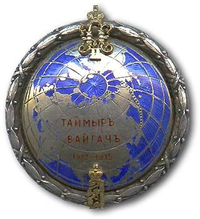
Icebraker Vaygach and her sister ship Taymyr
Icebreaker Taymyr
Icebreaker Taymyr was an icebreaking steamer of 1200 tons built for the Russian Imperial Navy at St. Petersburg in 1909. It was named after the Taymyr Peninsula....
were built for the purpose of thoroughly exploring the uncharted areas of the Northern Sea Route
Northern Sea Route
The Northern Sea Route is a shipping lane officially defined by Russian legislation from the Atlantic Ocean to the Pacific Ocean specifically running along the Russian Arctic coast from Murmansk on the Barents Sea, along Siberia, to the Bering Strait and Far East. The entire route lies in Arctic...
. This venture became known as the Arctic Ocean Hydrographic Expedition.
The first of a series of surveys began in the autumn of 1910, when the Vaygach and the Taymyr left Vladivostok
Vladivostok
The city is located in the southern extremity of Muravyov-Amursky Peninsula, which is about 30 km long and approximately 12 km wide.The highest point is Mount Kholodilnik, the height of which is 257 m...
. They entered the Chukchi Sea
Chukchi Sea
Chukchi Sea is a marginal sea of the Arctic Ocean. It is bounded on the west by the De Long Strait, off Wrangel Island, and in the east by Point Barrow, Alaska, beyond which lies the Beaufort Sea. The Bering Strait forms its southernmost limit and connects it to the Bering Sea and the Pacific...
with scientists on board and began their exploration. For the next five years, these icebreakers went on sounding and carrying on vital surveys during the thaw. Before every winter, when ice conditions became too bad, they returned to Vladivostok and waited for the spring.
In 1911 the scientists and crew aboard the Vaygach and the Taymyr made the first Russian landing on Wrangel Island
Wrangel Island
Wrangel Island is an island in the Arctic Ocean, between the Chukchi Sea and East Siberian Sea. Wrangel Island lies astride the 180° meridian. The International Date Line is displaced eastwards at this latitude to avoid the island as well as the Chukchi Peninsula on the Russian mainland...
.
In 1914, led by Colonel I. Sergeev, the Vaygach sailed together with the Taymyr, whose Captain was Boris Vilkitsky
Boris Vilkitsky
Boris Andreyevich Vilkitsky was a Russian hydrographer and surveyor. He was the son of Andrey Ippolitovich Vilkitsky....
. Togethere, they tried to force the whole Northern Passage in order to reach Archangelsk. Severe weather and ice conditions, however, didn't allow them to cross the Kara Sea
Kara Sea
The Kara Sea is part of the Arctic Ocean north of Siberia. It is separated from the Barents Sea to the west by the Kara Strait and Novaya Zemlya, and the Laptev Sea to the east by the Severnaya Zemlya....
and they were forced to winter at Bukhta Dika, close to the Firnley Islands
Firnley Islands
The Firnley Islands, also spelt Firnleya or Firileya is a group of three small islands covered with tundra vegetation and with scattered stones on their shores. They lie in the Kara Sea, close to the bleak coast of Siberia's Taymyr Peninsula, not far east of the Nordenskjold Archipelago...
. Thus they were able to complete the passage only in 1915.
Some of the biggest successes of the expedition were the accurate charting of the Northern Sea Route and the discovery of Severnaya Zemlya
Severnaya Zemlya
Severnaya Zemlya is an archipelago in the Russian high Arctic at around . It is located off mainland Siberia's Taymyr Peninsula across the Vilkitsky Strait...
in 1913. Icebreakers Taymyr and Vaygach were considered the best icebreakers in the world in their time.
Vaigach struck an underwater rock and sank in 1918 in the Yenisei Bay
Yenisei Gulf
The Yenisei Gulf is a large and long estuary through which the lower Yenisei River flows into the Kara Sea.The Yenisei Gulf is formed by the river widening to an average of 50 km for up to 250 km in a roughly north-south direction, between a latitude of 70° 30' N in the area around...
of the Kara Sea
Kara Sea
The Kara Sea is part of the Arctic Ocean north of Siberia. It is separated from the Barents Sea to the west by the Kara Strait and Novaya Zemlya, and the Laptev Sea to the east by the Severnaya Zemlya....
. A nuclear river-icebreaker of the Soviet Navy, was named Vaygach
Vaygach (nuclear icebreaker)
Vaygach is a shallow-draft nuclear powered icebreaker. She was built in 1989 for the Soviet Union in Finland, at the Helsinki New Shipyard by Wärtsilä, by order of the Murmansk Shipping Co....
in 1989.