Iceberg C-19
Encyclopedia


Iceberg
An iceberg is a large piece of ice from freshwater that has broken off from a snow-formed glacier or ice shelf and is floating in open water. It may subsequently become frozen into pack ice...
that calved
Ice calving
Ice calving, also known as glacier calving or iceberg calving, is a form of ice ablation or ice disruption. It is the sudden release and breaking away of a mass of ice from a glacier, iceberg, ice front, ice shelf, or crevasse...
from the Ross Ice Shelf
Ross Ice Shelf
The Ross Ice Shelf is the largest ice shelf of Antarctica . It is several hundred metres thick. The nearly vertical ice front to the open sea is more than 600 km long, and between 15 and 50 metres high above the water surface...
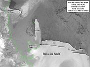
on May 2002 on a fissure scientists had been watching since the 1980s. After that the Ross Ice Shelf returned to the size it was in 1911, when it was mapped by Robert F. Scott’s party. It was the second-largest iceberg to calve in the region in a few years (after B-15
Iceberg B-15
Iceberg B-15 is one of the world's largest recorded icebergs. It measured around 295 km long and 37 km wide , with a surface area of 11,000 km² larger than the island of Jamaica. The mass was estimated around three billion tonnes...
). It had a surface area larger than 5500 km².
During 2002 C-19 prevented sea ice from moving out of the southwestern Ross Sea
Ross Sea
The Ross Sea is a deep bay of the Southern Ocean in Antarctica between Victoria Land and Marie Byrd Land.-Description:The Ross Sea was discovered by James Ross in 1841. In the west of the Ross Sea is Ross Island with the Mt. Erebus volcano, in the east Roosevelt Island. The southern part is covered...
region and this blockage resulted in an unusually high sea ice level during spring and summer, thus provoking a huge reduction in phytoplankton
Phytoplankton
Phytoplankton are the autotrophic component of the plankton community. The name comes from the Greek words φυτόν , meaning "plant", and πλαγκτός , meaning "wanderer" or "drifter". Most phytoplankton are too small to be individually seen with the unaided eye...
production which is at the base of the food chain.
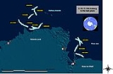
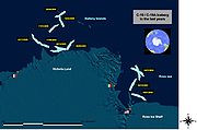
In summer 2003 C-19 moved northward very rapidly, passed Cape Adare
Cape Adare
Cape Adare is the northeastern most peninsula in Victoria Land, East Antarctica. The cape separates the Ross Sea to the east from the Southern Ocean to the west, and is backed by the high Admiralty Mountains...
, and broke in two pieces: C-19A and C-19B.
In September 2005, after a two year stay along the coast of Victoria Land
Victoria Land
Victoria Land is a region of Antarctica bounded on the east by the Ross Ice Shelf and the Ross Sea and on the west by Oates Land and Wilkes Land. It was discovered by Captain James Clark Ross in January 1841 and named after the UK's Queen Victoria...
(west of French station Dumont d'Urville
Dumont d'Urville Station
The Dumont d'Urville Station is a French scientific station located in Antarctica on Île des Pétrels, archipelago of Pointe Géologie in Adélie Land. It is named after explorer Jules Dumont d'Urville...
) C-19A started drifting northward. In March 2006 its location was in the Pacific Ocean, 200 km west of Balleny Islands
Balleny Islands
The Balleny Islands are a series of uninhabited islands in the Southern Ocean extending from 66°15' to 67°35'S and 162°30' to 165°00'E. The group extends for about in a northwest-southeast direction. The islands are heavily glaciated and are of volcanic origin. Glaciers project from their slopes...
.
In 2008, C-19A was renamed Melting Bob as a result of a contest sponsored by the Hay Festival
Hay Festival
The Hay Festival of Literature & Arts is an annual literature festival held in Hay-on-Wye, Powys, Wales for ten days from May to June. Devised by Norman and Peter Florence in 1988, the festival was described by Bill Clinton in 2001 as "The Woodstock of the mind"...
and the Scott Polar Research Institute
Scott Polar Research Institute
The Scott Polar Research Institute is a centre for research into the polar regions and glaciology worldwide. It is a sub-department of the Department of Geography in the University of Cambridge, located on Lensfield Road in the south of Cambridge ....
. As of May 2008, its surface area was approximately 5141 km².
External links
- Huge Antarctic Iceberg Makes a BIG Splash on Sea Life, press release, Goddard Space Flight Center, NASANASAThe National Aeronautics and Space Administration is the agency of the United States government that is responsible for the nation's civilian space program and for aeronautics and aerospace research...
, 1 October 2003 - Antarctic iceberg C19A renamed Melting Bob by Max Dolan, 6, story of how C19A became the first iceberg to be given a proper name, May 31, 2008

