
.gif)
Highway 33 (Ontario)
Encyclopedia
King's Highway 33, commonly referred to as Highway 33, is a provincially maintained highway in the Canadian
province of Ontario
. The route begins at Highway 62 in Bloomfield and travels east to the Collins Bay Road junction at Collins Bay
in the city of Kingston
, a distance of 60.9 kilometres (37.8 mi). The highway continues further east into Kingston as Bath Road (Kingston Road 33), ending at the former Highway 2
, now Princess Street. Highway 33 is divided into two sections by the Bay of Quinte
. The Glenora Ferry service crosses between the two sections just east of Picton
, transporting vehicles and pedestrians for free throughout the year.
Originally, Highway 33 continues northeast through Trenton
to the town of Stirling, ending as a junction with Highway 14. This section was transferred to county governments by the beginning of 1998. In 2009, Highway 33 became the site of the first modern roundabout on a provincial highway west of Picton.
In 1984, Queen Elizabeth commemorated Highway 33 between Trenton and Kingston as the Loyalist Parkway at a ceremony in Amherstview in honour of the settlers that landed there in 1784.
 Highway 33, known as the Loyalist Parkway throughout its length, begins in the west at the southern terminus of Highway 62, west of which the parkway continues as Prince Edward County Road 33 to Trenton. The route begins within the community of Bloomfield. To the east it crosses several creek
s then intersects Prince Edward County Road 1 at the first modern provincially maintained roundabout
. East of this, the highway enters into the city of Picton.
Within Picton, Highway 33 intersects the former Highway 49, now Prince Edward County Road 49. It exits the city and follows the southeastern shoreline of Picton Bay, passing the H.J. McFarland Conservation Area midway between the city and Glenora
.
Highway 33 has two sections, which are joined by the Glenora Ferry, an auto ferry
crossing the Bay of Quinte from Glenora to Adolphustown
. The Ministry of Transportation of Ontario (MTO), which maintains Highway 33, also provides the ferry service free of charge.
The eastern section of the highway begins west of Adolphustown, where it passes by several Loyalist heritage sites. Now in the county of Lennox and Addington
, the route remains close to the shores of the Bay of Quinte for the remainder of its journey towards Kingston. It divides the Greater Napanee communities of Conway, South Fredericksburg, Parma, Sandhurst Shores and Sandhurst, then enters the municipality of Loyalist
opposite Amherst Island. The highway passes through Bath, after which it follows the Bath Road, one of the oldest roads in Ontario, built circa 1785.
At Millhaven, a ferry service provides access to Amherst Island; Highway 33 continues east and passes through Amherstview before crossing the county line into Frontenac County and the City of Kingston.
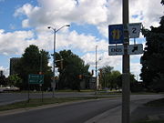
The short section of Highway 33 within Kingston travels as far east as Collins Bay Road (County Road 2), in the community of Collins Bay
. From this point, the road continues east as Bath Road (Kingston City Road 33), ending downtown at Princess Street, formerly Highway 2.
Highway 33 is 60.9 kilometres (37.8 mi) in length, excluding the length of the Glenora Ferry. Traffic volumes vary considerably throughout the length of the route. On an average day, over 5,000 vehicles travel the section between Bloomfield and Picton. Between Picton and the Glenora Ferry, volumes drop to under 2,000. On the opposite shore, traffic volumes grow from over 6,000 near bath to over 11,000 outside of Kingston.
, the United Empire Loyalists
began to arrive in Upper Canada
, hoping to settle the frontier near Cataraqui (now Kingston). With the help of the military, the loyalists blazed a trail west from Cataraqui to Bath, a distance of 25 kilometres (15.5 mi). This trail would become a section of Highway 33 nearly 150 years later.
Ironically, the first section of Highway 33 to be assumed would not be commemorated as part of the Loyalist Parkway. On July 9, 1930, the Department of Highways assumed the Trenton–Stirling Road as King's Highway 33, a distance of approximately 25 kilometres (15.5 mi).
Several years later, as part of depression
-relief work undertaken by the department in the early 1930s, the Carrying Place Trail through Prince Edward County and the United Counties of Lennox and Addington was assumed as an extension of Highway 33. The section between Trenton and Glenora was assumed on July 4, 1934, while the section between Adolphustown and Kingston was assumed several days later on July 11.
In 1984, Queen Elizabeth toured the Kingston area as part of its two hundredth anniversary, attending several events and ceremonies through her visit. On her final day in the region, she dedicated the Loyalist Parkway in honour of the settlers that landed there in 1784. The ceremony was held in Amherstview on September 27, 1984.
In 2009, intersection of Highway 33 and Prince Edward County
Road 1 (Scoharie Road) near Picton saw the introduction of a traffic roundabout
, the first ever constructed on a provincial highway in the province, to replace the at-grade intersection. The MTO felt that the area had reached its operational threshold due to high tourist and recreational activity, particularly during the busy summer months, and so felt a traffic roundabout was needed.
The engineering and consulting firm Morrison Hershfield
was retained to undertake the detail design for the realignment and reconfiguration of the existing intersection at Highway 33 and Country Road 1 into a single lane roundabout with a central island and truck apron. The assignment included highway engineering
, drainage and hydrology engineering, electrical engineering
, public consultation
, and traffic engineering
. The roundabout was officially opened on July 17, 2009.
Canada
Canada is a North American country consisting of ten provinces and three territories. Located in the northern part of the continent, it extends from the Atlantic Ocean in the east to the Pacific Ocean in the west, and northward into the Arctic Ocean...
province of Ontario
Ontario
Ontario is a province of Canada, located in east-central Canada. It is Canada's most populous province and second largest in total area. It is home to the nation's most populous city, Toronto, and the nation's capital, Ottawa....
. The route begins at Highway 62 in Bloomfield and travels east to the Collins Bay Road junction at Collins Bay
Collins Bay, Ontario
Collins Bay is a bay and natural harbour, as well as a community, within the western part of the municipality of Kingston, Ontario, Canada. Collins Bay was at one time a small village, but it became absorbed by the city of Kingston. Now Collins Bay consists mostly of residential subdivisions, a...
in the city of Kingston
Kingston, Ontario
Kingston, Ontario is a Canadian city located in Eastern Ontario where the St. Lawrence River flows out of Lake Ontario. Originally a First Nations settlement called "Katarowki," , growing European exploration in the 17th Century made it an important trading post...
, a distance of 60.9 kilometres (37.8 mi). The highway continues further east into Kingston as Bath Road (Kingston Road 33), ending at the former Highway 2
Ontario Highway 2
King's Highway 2, usually referred to simply as Highway 2 is a provincially maintained highway in Ontario. Once the primary east–west route across the southern end of the province, Highway 2 became mostly redundant in the 1960s following the completion of Highway 401, which more or less...
, now Princess Street. Highway 33 is divided into two sections by the Bay of Quinte
Bay of Quinte
The Bay of Quinte is a long, narrow bay shaped like the letter "Z" on the northern shore of Lake Ontario in the province of Ontario, Canada. It is just west of the head of the Saint Lawrence River that drains the Great Lakes into the Gulf of Saint Lawrence...
. The Glenora Ferry service crosses between the two sections just east of Picton
Picton, Ontario
Picton is an unincorporated community located in Prince Edward County in southern Central Ontario, Canada. It is the county seat and largest community. Picton is located at the south-western end of Picton Bay, a branch of the Bay of Quinte, which is along the northern shoreline of Lake Ontario...
, transporting vehicles and pedestrians for free throughout the year.
Originally, Highway 33 continues northeast through Trenton
Trenton, Ontario
Trenton is a community in Southern Ontario in the municipality of Quinte West, Ontario, Canada. Located on the Bay of Quinte, it is the main population centre in Quinte West....
to the town of Stirling, ending as a junction with Highway 14. This section was transferred to county governments by the beginning of 1998. In 2009, Highway 33 became the site of the first modern roundabout on a provincial highway west of Picton.
In 1984, Queen Elizabeth commemorated Highway 33 between Trenton and Kingston as the Loyalist Parkway at a ceremony in Amherstview in honour of the settlers that landed there in 1784.
Route description
Stream
A stream is a body of water with a current, confined within a bed and stream banks. Depending on its locale or certain characteristics, a stream may be referred to as a branch, brook, beck, burn, creek, "crick", gill , kill, lick, rill, river, syke, bayou, rivulet, streamage, wash, run or...
s then intersects Prince Edward County Road 1 at the first modern provincially maintained roundabout
Roundabout
A roundabout is the name for a road junction in which traffic moves in one direction around a central island. The word dates from the early 20th century. Roundabouts are common in many countries around the world...
. East of this, the highway enters into the city of Picton.
Within Picton, Highway 33 intersects the former Highway 49, now Prince Edward County Road 49. It exits the city and follows the southeastern shoreline of Picton Bay, passing the H.J. McFarland Conservation Area midway between the city and Glenora
Glenora, Ontario
Glenora is a community in the Canadian province of Ontario, on the north shore of the Bay of Quinte.The Bay of Quinte is a long narrow inlet on the north shore of Lake Ontario.A ferry connects the two shores between Glenora and Adolphustown....
.
| Glenora Glenora, Ontario Glenora is a community in the Canadian province of Ontario, on the north shore of the Bay of Quinte.The Bay of Quinte is a long narrow inlet on the north shore of Lake Ontario.A ferry connects the two shores between Glenora and Adolphustown.... –Adolphustown Ferry service |
|
| mid-May – September | |
|---|---|
| 6:00am–10:00am 7:30pm–1:15am |
30 minute service |
| 10:15am–7:30pm | 15 minute service |
| Winter | |
| 6:00am–1:15am | 30 minute service |
Highway 33 has two sections, which are joined by the Glenora Ferry, an auto ferry
Ferry
A ferry is a form of transportation, usually a boat, but sometimes a ship, used to carry primarily passengers, and sometimes vehicles and cargo as well, across a body of water. Most ferries operate on regular, frequent, return services...
crossing the Bay of Quinte from Glenora to Adolphustown
Adolphustown, Ontario
Adolphustown is a geographic area located in Greater Napanee, Ontario, Canada, at on the Adolphus Reach of the Bay of Quinte in Lake Ontario. It was founded in 1784 by United Empire Loyalists. The original Loyalist Landing site is now the U.E.L...
. The Ministry of Transportation of Ontario (MTO), which maintains Highway 33, also provides the ferry service free of charge.
The eastern section of the highway begins west of Adolphustown, where it passes by several Loyalist heritage sites. Now in the county of Lennox and Addington
Lennox and Addington
Lennox and Addington was a federal electoral district represented in the Canadian House of Commons from 1904 to 1925. It was located in the province of Ontario. This riding was first created in 1903 from Addington and Lennox ridings...
, the route remains close to the shores of the Bay of Quinte for the remainder of its journey towards Kingston. It divides the Greater Napanee communities of Conway, South Fredericksburg, Parma, Sandhurst Shores and Sandhurst, then enters the municipality of Loyalist
Loyalist, Ontario
Loyalist is a township in central eastern Ontario, Canada on Lake Ontario. It is in Lennox and Addington County and consists of two parts: the mainland and Amherst Island. It was named for the United Empire Loyalists, who settled in the area after the American Revolution.-Communities:The primary...
opposite Amherst Island. The highway passes through Bath, after which it follows the Bath Road, one of the oldest roads in Ontario, built circa 1785.
At Millhaven, a ferry service provides access to Amherst Island; Highway 33 continues east and passes through Amherstview before crossing the county line into Frontenac County and the City of Kingston.
The short section of Highway 33 within Kingston travels as far east as Collins Bay Road (County Road 2), in the community of Collins Bay
Collins Bay, Ontario
Collins Bay is a bay and natural harbour, as well as a community, within the western part of the municipality of Kingston, Ontario, Canada. Collins Bay was at one time a small village, but it became absorbed by the city of Kingston. Now Collins Bay consists mostly of residential subdivisions, a...
. From this point, the road continues east as Bath Road (Kingston City Road 33), ending downtown at Princess Street, formerly Highway 2.
Highway 33 is 60.9 kilometres (37.8 mi) in length, excluding the length of the Glenora Ferry. Traffic volumes vary considerably throughout the length of the route. On an average day, over 5,000 vehicles travel the section between Bloomfield and Picton. Between Picton and the Glenora Ferry, volumes drop to under 2,000. On the opposite shore, traffic volumes grow from over 6,000 near bath to over 11,000 outside of Kingston.
History
Highway 33 is also known as the Loyalist Parkway, a title it was given in 1984 by Queen Elizabeth to commemorate the role of the route two hundred years prior. The route connects several historical settlement sites in Prince Edward County. In 1784, following the American RevolutionAmerican Revolution
The American Revolution was the political upheaval during the last half of the 18th century in which thirteen colonies in North America joined together to break free from the British Empire, combining to become the United States of America...
, the United Empire Loyalists
United Empire Loyalists
The name United Empire Loyalists is an honorific given after the fact to those American Loyalists who resettled in British North America and other British Colonies as an act of fealty to King George III after the British defeat in the American Revolutionary War and prior to the Treaty of Paris...
began to arrive in Upper Canada
Upper Canada
The Province of Upper Canada was a political division in British Canada established in 1791 by the British Empire to govern the central third of the lands in British North America and to accommodate Loyalist refugees from the United States of America after the American Revolution...
, hoping to settle the frontier near Cataraqui (now Kingston). With the help of the military, the loyalists blazed a trail west from Cataraqui to Bath, a distance of 25 kilometres (15.5 mi). This trail would become a section of Highway 33 nearly 150 years later.
Ironically, the first section of Highway 33 to be assumed would not be commemorated as part of the Loyalist Parkway. On July 9, 1930, the Department of Highways assumed the Trenton–Stirling Road as King's Highway 33, a distance of approximately 25 kilometres (15.5 mi).
Several years later, as part of depression
Great Depression
The Great Depression was a severe worldwide economic depression in the decade preceding World War II. The timing of the Great Depression varied across nations, but in most countries it started in about 1929 and lasted until the late 1930s or early 1940s...
-relief work undertaken by the department in the early 1930s, the Carrying Place Trail through Prince Edward County and the United Counties of Lennox and Addington was assumed as an extension of Highway 33. The section between Trenton and Glenora was assumed on July 4, 1934, while the section between Adolphustown and Kingston was assumed several days later on July 11.
In 1984, Queen Elizabeth toured the Kingston area as part of its two hundredth anniversary, attending several events and ceremonies through her visit. On her final day in the region, she dedicated the Loyalist Parkway in honour of the settlers that landed there in 1784. The ceremony was held in Amherstview on September 27, 1984.
In 2009, intersection of Highway 33 and Prince Edward County
Prince Edward County, Ontario
Prince Edward County is a single-tier municipality and a census division of the Canadian province of Ontario.-Geography:Prince Edward County is located in Southern Ontario on a large irregular headland or littoral at the eastern end of Lake Ontario, just west of the head of the St. Lawrence River...
Road 1 (Scoharie Road) near Picton saw the introduction of a traffic roundabout
Roundabout
A roundabout is the name for a road junction in which traffic moves in one direction around a central island. The word dates from the early 20th century. Roundabouts are common in many countries around the world...
, the first ever constructed on a provincial highway in the province, to replace the at-grade intersection. The MTO felt that the area had reached its operational threshold due to high tourist and recreational activity, particularly during the busy summer months, and so felt a traffic roundabout was needed.
The engineering and consulting firm Morrison Hershfield
Morrison Hershfield
Morrison Hershfield is an employee-owned professional services firm providing engineering and management consulting services in the areas of energy and...
was retained to undertake the detail design for the realignment and reconfiguration of the existing intersection at Highway 33 and Country Road 1 into a single lane roundabout with a central island and truck apron. The assignment included highway engineering
Highway engineering
Highway engineering is an engineering discipline branching from civil engineering which involves the design, construction and maintenance of Highway Systems. Highway Engineering become prominent towards the latter half of the 20th Century after World War 2. Standards of highway engineering are...
, drainage and hydrology engineering, electrical engineering
Electrical engineering
Electrical engineering is a field of engineering that generally deals with the study and application of electricity, electronics and electromagnetism. The field first became an identifiable occupation in the late nineteenth century after commercialization of the electric telegraph and electrical...
, public consultation
Public consultation
Public consultation, or simply consultation, is a regulatory process by which the public's input on matters affecting them is sought. Its main goals are in improving the efficiency, transparency and public involvement in large-scale projects or laws and policies...
, and traffic engineering
Traffic engineering (transportation)
For the engineering of communications and computer networks, see Teletraffic engineering.Traffic engineering is a branch of civil engineering that uses engineering techniques to achieve the safe and efficient movement of people and goods on roadways...
. The roundabout was officially opened on July 17, 2009.
Major intersections
The following table lists major intersections located along Highway 33.| Division | Location | km | Destinations | Notes |
|---|---|---|---|---|
continues west as the Loyalist Parkway  |
||||
| Prince Edward County Prince Edward County, Ontario Prince Edward County is a single-tier municipality and a census division of the Canadian province of Ontario.-Geography:Prince Edward County is located in Southern Ontario on a large irregular headland or littoral at the eastern end of Lake Ontario, just west of the head of the St. Lawrence River... |
Bloomfield | 0.0 | Beginning of Bloomfield Connecting Link agreement | |
| 2.1 | End of Bloomfield Connecting Link agreement | |||
| Warings Corner Warings Corner, Ontario Warings Corner is a community in Ontario.... |
4.8 | Roundabout | ||
| Picton Picton, Ontario Picton is an unincorporated community located in Prince Edward County in southern Central Ontario, Canada. It is the county seat and largest community. Picton is located at the south-western end of Picton Bay, a branch of the Bay of Quinte, which is along the northern shoreline of Lake Ontario... |
6.8 | Mill Street | Picton city limits; beginning of Connecting Link Connecting Link The Connecting Link program is a provincial subsidy provided to municipalities to assist with road construction, maintenance and repairs in the Canadian province of Ontario. Roads which are designated as connecting links form the portions of provincial highways through built-up communities which... agreement |
|
| Formerly Highway 49 | ||||
| 9.5 | Picton city limits; end of Connecting Link agreement | |||
| Glenora Glenora, Ontario Glenora is a community in the Canadian province of Ontario, on the north shore of the Bay of Quinte.The Bay of Quinte is a long narrow inlet on the north shore of Lake Ontario.A ferry connects the two shores between Glenora and Adolphustown.... |
17.0 | Highway 33 crosses Bay of Quinte Bay of Quinte The Bay of Quinte is a long, narrow bay shaped like the letter "Z" on the northern shore of Lake Ontario in the province of Ontario, Canada. It is just west of the head of the Saint Lawrence River that drains the Great Lakes into the Gulf of Saint Lawrence... via Glenora Ferry |
||
| Lennox and Addington Lennox and Addington Lennox and Addington was a federal electoral district represented in the Canadian House of Commons from 1904 to 1925. It was located in the province of Ontario. This riding was first created in 1903 from Addington and Lennox ridings... |
Greater Napanee | 36.6 | ||
| Bath | 43.6–46.4 | Bath Connecting Link agreement | ||
| Millhaven | 48.1 | |||
| Loyalist Loyalist, Ontario Loyalist is a township in central eastern Ontario, Canada on Lake Ontario. It is in Lennox and Addington County and consists of two parts: the mainland and Amherst Island. It was named for the United Empire Loyalists, who settled in the area after the American Revolution.-Communities:The primary... |
55.0 | |||
| Amherstview | 57.0 | Sherwood Avenue | ||
| 58.4 | Lennox & Addington – Frontenac boundary | |||
| Frontenac County | Kingston Kingston, Ontario Kingston, Ontario is a Canadian city located in Eastern Ontario where the St. Lawrence River flows out of Lake Ontario. Originally a First Nations settlement called "Katarowki," , growing European exploration in the 17th Century made it an important trading post... |
|||
| 60.9 | Beginning of former Kingston Connecting Link agreement | |||
| 68.9 | Formerly Highway 2 Ontario Highway 2 King's Highway 2, usually referred to simply as Highway 2 is a provincially maintained highway in Ontario. Once the primary east–west route across the southern end of the province, Highway 2 became mostly redundant in the 1960s following the completion of Highway 401, which more or less... |
|||