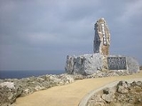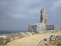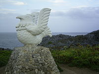
Hedo-misaki
Encyclopedia

Okinawa Island
Okinawa Island is the largest of the Okinawa Islands and the Ryukyu Islands of Japan, and is home to Naha, the capital of Okinawa Prefecture. The island has an area of...
, located within Kunigami Village
Kunigami, Okinawa
is a village located in Kunigami District, Okinawa, Japan.As of 2003, the village has an estimated population of 5,629 and a population density of 28.90 persons per km². The total area is 194.80 km².-External links:*...
. A cape
Headlands and bays
Headlands and bays are two related features of the coastal environment.- Geology and geography :Headlands and bays are often found on the same coastline. A bay is surrounded by land on three sides, whereas a headland is surrounded by water on three sides. Headlands are characterized by high,...
jutting out north from the island, it faces the South China Sea
South China Sea
The South China Sea is a marginal sea that is part of the Pacific Ocean, encompassing an area from the Singapore and Malacca Straits to the Strait of Taiwan of around...
on the west, and the Pacific Ocean
Pacific Ocean
The Pacific Ocean is the largest of the Earth's oceanic divisions. It extends from the Arctic in the north to the Southern Ocean in the south, bounded by Asia and Australia in the west, and the Americas in the east.At 165.2 million square kilometres in area, this largest division of the World...
on the east. On a particularly clear day, the island of Yoronjima
Yoronjima
is one of the Amami Islands of Japan. Yoron lies 22 km north of Hedo Point, the northernmost point on Okinawa Island. Situated along the line between the East China Sea and the Pacific Ocean, it is the southernmost island in Kagoshima Prefecture. It is also informally known as...
(Kagoshima Prefecture
Kagoshima Prefecture
is a prefecture of Japan located on the island of Kyushu. The capital is the city of Kagoshima.- Geography :Kagoshima Prefecture is located at the southwest tip of Kyushu and includes a chain of islands stretching further to the southwest for a few hundred kilometers...
) can be seen on the horizon.

According to legends of Okinawan history, Okinawan king Gihon
Gihon (Ryukyu)
' , also known as Yoshimoto or as Yiben in Chinese, was a king of the Ryūkyū Islands.Gihon was the third and last of the Shunten Lineage. He succeeded his father Shunbajunki at the age of 44, in 1248....
(r. c.1248-1260) fled the capital after abdicating the throne and disappeared into the forest. He is said to have last been seen at Hedo-misaki.

