
Harrison, Ohio
Encyclopedia
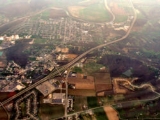
Harrison is a city in Hamilton County
, Ohio
, United States
. The city is located in the Cincinnati-Northern Kentucky metropolitan area. The population was 7,487 as of the 2000 census.
. It was incorporated in 1850, and became a city in 1981.
Harrison Township established 1850, formerly part of Crosby Township. Among the historic site
s in the city's vicinity is the Eighteen Mile House, which was built during the earliest years of the nineteenth century.
It was the home of Ohio's fifth governor Othneil Looker
.
It was one of the few stops in Ohio on the Whitewater Canal. The Whitewater Canal, which was built between 1836 and 1847, spanned a distance of seventy-six miles.
July, 13, 1863, Morgans Raiders invade. The column passes through taking fresh horses and burning the bridge over the Whitewater River near the southwest part of the town.
First train came to Harrison Township in 1864.
1882 Harrison depot was built at W. Broadway and Railroad Avenue. It later burned to the ground.
Harrison Village Park is the final resting place for a small number of veterans of the Revolutionary War. In the center of the park is a bandstand. Prior to it being a bandstand it was a fountain. In the early 1930s the fountain was drained and filled in and made a bandstand. It seems many children came down with cases of impetigo after spending a hot summer swimming in the fountain full of untreated water.
1940 The dog track in West Harrison closed due to pressure from the horse racing circuit. Monkeys in silk jackets had been used as jockeys for the dogs. The track had originally opened in 1932, when parimutuel betting was illegal in Indiana. However, during the Depression, heads were turned as the track attracted revenue to the area and was one of the highest paying local jobs at $12 a week.
The city was devastated on June 2, 1990 by an F4
tornado
, but was quickly rebuilt.
Harrison boasts of Miami Whitewater Forest, the second park to join the Hamilton County Park District in 1949. It now spans 4279 acres (17.3 km²).
Harrison has a city council made up of 7 members (Deborah Acra, Tony Burkart, Judy Kercheval, Matt Hiatt, William Neyer, Jim Robertson and Randy Shank) who are elected to 4 year terms.
Its police department is an accredited department with 21 sworn officers and 4 civilian personnel. It is headed by Col. Charles Lindsey, Chief of Police.
The Fire Department is headed by Chief Rob Hursong. The Harrison Fire Department is a combination department with thirty-three employees, sixteen of which are full-time and seventeen part-time. The Harrison Fire Department coverage areas consist of 44 square miles (114 km²) in Ohio and Indiana resulting in 2100 Fire and EMS details annually.
According to the United States Census Bureau
, the city has a total area of 3.7 square miles (9.6 km²), of which, 3.7 square miles (9.6 km²) of it is land and 0.04 square mile (0.1035995244 km²) of it (0.80%) is water.
of 2000, there were 7,487 people, 2,717 households, and 2,005 families residing in the city. The population density
was 2,024.5 people per square mile (781.3/km²). There were 2,847 housing units at an average density of 769.8 per square mile (297.1/km²). The racial makeup of the city was 98.18% White, 0.17% African American, 0.09% Native American, 0.39% Asian, 0.01% Pacific Islander, 0.20% from other races
, and 0.95% from two or more races. Hispanic or Latino of any race were 0.52% of the population.
There were 2,717 households out of which 41.4% had children under the age of 18 living with them, 57.6% were married couples
living together, 11.7% had a female householder with no husband present, and 26.2% were non-families. 22.3% of all households were made up of individuals and 8.6% had someone living alone who was 65 years of age or older. The average household size was 2.75 and the average family size was 3.26.
In the city the population was spread out with 29.9% under the age of 18, 9.9% from 18 to 24, 31.4% from 25 to 44, 19.4% from 45 to 64, and 9.3% who were 65 years of age or older. The median age was 32 years. For every 100 females there were 93.7 males. For every 100 females age 18 and over, there were 91.3 males.
The median income for a household in the city was $46,107, and the median income for a family was $54,028. Males had a median income of $37,455 versus $27,418 for females. The per capita income
for the city was $17,966. About 4.3% of families and 6.8% of the population were below the poverty line, including 5.6% of those under age 18 and 5.0% of those age 65 or over.
Hamilton County, Ohio
As of 2000, there were 845,303 people, 346,790 households, and 212,582 families residing in the county. The population density was 2,075 people per square mile . There were 373,393 housing units at an average density of 917 per square mile...
, Ohio
Ohio
Ohio is a Midwestern state in the United States. The 34th largest state by area in the U.S.,it is the 7th‑most populous with over 11.5 million residents, containing several major American cities and seven metropolitan areas with populations of 500,000 or more.The state's capital is Columbus...
, United States
United States
The United States of America is a federal constitutional republic comprising fifty states and a federal district...
. The city is located in the Cincinnati-Northern Kentucky metropolitan area. The population was 7,487 as of the 2000 census.
History
Harrison was named after the 9th US President, William Henry HarrisonWilliam Henry Harrison
William Henry Harrison was the ninth President of the United States , an American military officer and politician, and the first president to die in office. He was 68 years, 23 days old when elected, the oldest president elected until Ronald Reagan in 1980, and last President to be born before the...
. It was incorporated in 1850, and became a city in 1981.
Harrison Township established 1850, formerly part of Crosby Township. Among the historic site
Historic site
A historic site is an official location where pieces of political, military or social history have been preserved. Historic sites are usually protected by law, and many have recognized with the official national historic site status...
s in the city's vicinity is the Eighteen Mile House, which was built during the earliest years of the nineteenth century.
It was the home of Ohio's fifth governor Othneil Looker
Othneil Looker
Othniel Looker was a Democratic-Republican politician from Ohio. He served briefly as the fifth Governor of Ohio.- Early life :...
.
It was one of the few stops in Ohio on the Whitewater Canal. The Whitewater Canal, which was built between 1836 and 1847, spanned a distance of seventy-six miles.
July, 13, 1863, Morgans Raiders invade. The column passes through taking fresh horses and burning the bridge over the Whitewater River near the southwest part of the town.
First train came to Harrison Township in 1864.
1882 Harrison depot was built at W. Broadway and Railroad Avenue. It later burned to the ground.
Harrison Village Park is the final resting place for a small number of veterans of the Revolutionary War. In the center of the park is a bandstand. Prior to it being a bandstand it was a fountain. In the early 1930s the fountain was drained and filled in and made a bandstand. It seems many children came down with cases of impetigo after spending a hot summer swimming in the fountain full of untreated water.
1940 The dog track in West Harrison closed due to pressure from the horse racing circuit. Monkeys in silk jackets had been used as jockeys for the dogs. The track had originally opened in 1932, when parimutuel betting was illegal in Indiana. However, during the Depression, heads were turned as the track attracted revenue to the area and was one of the highest paying local jobs at $12 a week.
The city was devastated on June 2, 1990 by an F4
Fujita scale
The Fujita scale , or Fujita-Pearson scale, is a scale for rating tornado intensity, based primarily on the damage tornadoes inflict on human-built structures and vegetation...
tornado
Tornado
A tornado is a violent, dangerous, rotating column of air that is in contact with both the surface of the earth and a cumulonimbus cloud or, in rare cases, the base of a cumulus cloud. They are often referred to as a twister or a cyclone, although the word cyclone is used in meteorology in a wider...
, but was quickly rebuilt.
Harrison boasts of Miami Whitewater Forest, the second park to join the Hamilton County Park District in 1949. It now spans 4279 acres (17.3 km²).
Local government
Harrison's mayor is Joel McGuire, an attorney and former Army Ranger. On November 6, 2007, McGuire (Independent) defeated incumbent mayor Daniel Gieringer (Democrat) by a vote of 58.7% to 41.3%. McGuire is a native of Harrison, Ohio and a former member of the city council.Harrison has a city council made up of 7 members (Deborah Acra, Tony Burkart, Judy Kercheval, Matt Hiatt, William Neyer, Jim Robertson and Randy Shank) who are elected to 4 year terms.
Its police department is an accredited department with 21 sworn officers and 4 civilian personnel. It is headed by Col. Charles Lindsey, Chief of Police.
The Fire Department is headed by Chief Rob Hursong. The Harrison Fire Department is a combination department with thirty-three employees, sixteen of which are full-time and seventeen part-time. The Harrison Fire Department coverage areas consist of 44 square miles (114 km²) in Ohio and Indiana resulting in 2100 Fire and EMS details annually.
Geography
Harrison is located at 39°15′29"N 84°48′16"W (39.257931, -84.804535).According to the United States Census Bureau
United States Census Bureau
The United States Census Bureau is the government agency that is responsible for the United States Census. It also gathers other national demographic and economic data...
, the city has a total area of 3.7 square miles (9.6 km²), of which, 3.7 square miles (9.6 km²) of it is land and 0.04 square mile (0.1035995244 km²) of it (0.80%) is water.
Demographics
As of the censusCensus
A census is the procedure of systematically acquiring and recording information about the members of a given population. It is a regularly occurring and official count of a particular population. The term is used mostly in connection with national population and housing censuses; other common...
of 2000, there were 7,487 people, 2,717 households, and 2,005 families residing in the city. The population density
Population density
Population density is a measurement of population per unit area or unit volume. It is frequently applied to living organisms, and particularly to humans...
was 2,024.5 people per square mile (781.3/km²). There were 2,847 housing units at an average density of 769.8 per square mile (297.1/km²). The racial makeup of the city was 98.18% White, 0.17% African American, 0.09% Native American, 0.39% Asian, 0.01% Pacific Islander, 0.20% from other races
Race (United States Census)
Race and ethnicity in the United States Census, as defined by the Federal Office of Management and Budget and the United States Census Bureau, are self-identification data items in which residents choose the race or races with which they most closely identify, and indicate whether or not they are...
, and 0.95% from two or more races. Hispanic or Latino of any race were 0.52% of the population.
There were 2,717 households out of which 41.4% had children under the age of 18 living with them, 57.6% were married couples
Marriage
Marriage is a social union or legal contract between people that creates kinship. It is an institution in which interpersonal relationships, usually intimate and sexual, are acknowledged in a variety of ways, depending on the culture or subculture in which it is found...
living together, 11.7% had a female householder with no husband present, and 26.2% were non-families. 22.3% of all households were made up of individuals and 8.6% had someone living alone who was 65 years of age or older. The average household size was 2.75 and the average family size was 3.26.
In the city the population was spread out with 29.9% under the age of 18, 9.9% from 18 to 24, 31.4% from 25 to 44, 19.4% from 45 to 64, and 9.3% who were 65 years of age or older. The median age was 32 years. For every 100 females there were 93.7 males. For every 100 females age 18 and over, there were 91.3 males.
The median income for a household in the city was $46,107, and the median income for a family was $54,028. Males had a median income of $37,455 versus $27,418 for females. The per capita income
Per capita income
Per capita income or income per person is a measure of mean income within an economic aggregate, such as a country or city. It is calculated by taking a measure of all sources of income in the aggregate and dividing it by the total population...
for the city was $17,966. About 4.3% of families and 6.8% of the population were below the poverty line, including 5.6% of those under age 18 and 5.0% of those age 65 or over.
Schools
- William Henry Harrison High School is located in Harrison, the school is part of the Southwest Local School Districthttp://www.southwestschools.org/, which encompasses Harrison TownshipHarrison Township, Hamilton County, OhioHarrison Township is one of the twelve townships of Hamilton County, Ohio, United States. The 2000 census found 12,469 people in the township, 4,982 of whom lived in the unincorporated portions of the township.-Geography:...
, Crosby TownshipCrosby Township, Hamilton County, OhioCrosby Township is one of the twelve townships of Hamilton County, Ohio, United States. The 2000 census found 2,748 people in the township.-Geography:Located in the northwestern part of the county, it borders the following townships:...
, and Whitewater TownshipWhitewater Township, Hamilton County, OhioWhitewater Township is one of the twelve townships of Hamilton County, Ohio, United States. The 2000 census found 5,564 people in the township.-Geography:Located in the western part of the county, it borders the following townships:...
in Hamilton County as well as a small section of Morgan TownshipMorgan Township, Butler County, OhioMorgan Township, one of thirteen townships in the county, is located in the southwestern corner of Butler County, Ohio, United States, on the state line with Indiana. It had a population of 5,328 in 2000, up from 4,972 in 1990. There are no incorporated places in the township. Unincorporated...
in southwest Butler CountyButler County, OhioButler County is a county located in the state of Ohio, United States. As of 2010, the population was 368,130. Its county seat is Hamilton. It is named for General Richard Butler, who died in 1791 fighting Indians in northern Ohio. Butler's army marched out of Fort Hamilton, where the city of...
.
- Cincinnati State Technical and Community College West CampusCincinnati State Technical and Community CollegeCincinnati State Technical and Community College is a technical and community college located in Cincinnati, Ohio, United States, at 3520 Central Parkway, near the junction of Interstates 74 and 75. A Cincinnati State West campus is located in Harrison, Ohio...
is located in Harrison. - St. John the Baptist School