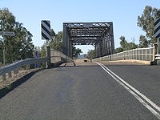
Gwydir Highway
Overview
New South Wales
New South Wales is a state of :Australia, located in the east of the country. It is bordered by Queensland, Victoria and South Australia to the north, south and west respectively. To the east, the state is bordered by the Tasman Sea, which forms part of the Pacific Ocean. New South Wales...
, Australia
Australia
Australia , officially the Commonwealth of Australia, is a country in the Southern Hemisphere comprising the mainland of the Australian continent, the island of Tasmania, and numerous smaller islands in the Indian and Pacific Oceans. It is the world's sixth-largest country by total area...
. It was named after the Gwydir River
Gwydir River
The Gwydir River is a large inland river in the northern part of the Australian state of New South Wales which is part of the Murray-Darling Basin. The river has two main tributaries—the Horton River and the Rocky River...
, which in turn was named for a locale in Wales
Wales
Wales is a country that is part of the United Kingdom and the island of Great Britain, bordered by England to its east and the Atlantic Ocean and Irish Sea to its west. It has a population of three million, and a total area of 20,779 km²...
.
The Gwydir Highway traverses the New England
New England (Australia)
New England or New England North West is the name given to a generally undefined region about 60 kilometres inland, that includes the Northern Tablelands and the North West Slopes regions in the north of the state of New South Wales, Australia.-History:The region has been occupied by Indigenous...
region from the inland plains to the coastal region, linking the Castlereagh Highway
Castlereagh Highway
The Castlereagh Highway is a state highway in New South Wales, Australia, also extending some kilometres into Queensland. It has been given the route number 55. The highway was recently extended past Gilgandra to include state route 86...
, Collarenebri
Collarenebri, New South Wales
Collarenebri is a town with a population of 478 people in north western New South Wales, Australia. It is situated in Walgett Shire, on the Barwon River approximately 75 km northeast of Walgett and south west of Mungindi on the Gwydir Highway. It is from Pokataroo which was the nearest...
, Moree
Morée
Morée is a commune in the Loir-et-Cher department of central France.-See also:*Communes of the Loir-et-Cher department...
, Warialda
Warialda, New South Wales
Warialda is a town in the Northwest Slopes region of New South Wales, Australia, in Gwydir Shire. Situated on the banks of the Warialda Creek, the town’s name means “Place of Wild Honey.” At the 2006 census, Warialda had a population of 1,206.- Transport :...
, Inverell, Glen Innes
Glen Innes, New South Wales
Glen Innes is a parish and town on the Northern Tablelands, in the New England region of New South Wales, Australia. It is the centre of the Glen Innes Severn Shire Council. The town is located at the intersection of the New England Highway and the Gwydir Highway...
and Grafton
Grafton, New South Wales
The city of Grafton is the commercial hub of the Clarence River Valley. Established in 1851, Grafton features many historic buildings and tree-lined streets. Located approximately 630 kilometres north of Sydney and 340 km south of Brisbane, Grafton and the Clarence Valley can be reached...
. The western termination of the highway is at the junction of the Castlereagh Highway, 14 km north of Walgett
Walgett, New South Wales
Walgett is a town in North-West New South Wales, Australia and the seat of Walgett Shire. It is at the junction of the Barwon and Namoi rivers and near the junction of the Kamilaroi and Castlereagh Highways...
.
At Moree it intersects the Newell Highway
Newell Highway
The Newell Highway is the longest highway in New South Wales, Australia. It runs parallel to the eastern coast about 400 kilometres inland, and is the main inland direct road link from Victoria to Queensland, bypassing the more congested coastal areas of New South Wales...
.

