
Green (RTA Rapid Transit station)
Encyclopedia
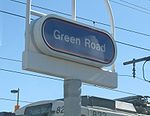
Green Road Station is a station on the Green Line
of the RTA Rapid Transit
in Cleveland, Ohio
, USA. It is the eastern terminus of the Green Line.
 The station is located below street level in the enlarged median of Shaker Boulevard at the intersection of Green Road in Shaker Heights
. The station includes a large open parking area which extends to West Green Station.
in the 1920s, it included a broad median strip with room for four rapid transit tracks as well as a high speed automobile parkway. The rapid transit right-of-way extended along Shaker Boulevard to Brainard Road and from there along Gates Mills Boulevard all the way to near Mayfield Road
, where it ended in a large loop suitable for use as a streetcar yard.
The Shaker Boulevard line of the Shaker Heights Rapid Transit was expanded one mile east from Warrensville Center Road to Green Road in 1936. The extension was originally a single track using rails and poles from a scrapped interurban line.
A loop was provided east of Green Road for the cars to reverse direction. A second track was added to the extension in 1942 when increased ridership during World War II
made single track operation no longer feasible.
RTA
took over operation of the Shaker Rapid Transit from the City of Shaker Heights on September 5, 1975, and in 1978 it adopted the designation Green Line for the Shaker Boulevard line, the color green being selected because the line terminated at Green Road.
There have been various proposals to extend the line east from Green Road. Until 1988, bridges were already in place over the right-of-way at Richmond Road
and Interstate 271
, and poles had been erected along much of the right-of-way decades earlier. One plan, made in 1955 when the line was still owned by the City of Shaker Heights, involved extending it to the Sulgrave Road on the Shaker Heights/Beachwood border or even to Brainard Circle in Pepper Pike, but the city had little money at the time to implement such a proposal.
Another plan proposed by RTA in 1978 called for a 1.5 mile extension of the Green Line east to Interstate 271
along with exit ramps from the interstate highway to a 1,500 car parking garage attached to a new station. The cost of the project was estimated at $29 million. The proposal was assailed almost immediately by various elements in the community. The Northeast Ohio Areawide Coordinating Agency complained that the project would primarily benefit the more affluent parts of the community while its cost would be born by residents of the entire county. There were also arguments that the extension would only serve a low population density area, although the park-and-ride connection with the interstate highway provided a potential for increased ridership from throughout the eastern suburbs. Ultimately, the RTA Board of Trustees voted unanimously that any extension of the Shaker Rapid Transit would be made only after improvements were made in other corridors to the southeast and the southwest and after a downtown distributor system was built. The Board's refusal to commit funds for the extension was undoubtedly made because it had already announced plans to rebuild the entire Shaker Rapid Transit system, and it was unwise to spend too much of its capital resources on just one segment of a county-wide transit system.
As part of the rebuild of the entire Green Line and Blue Lines, the Green Road station was rebuilt in 1980. With the elimination of PCC cars and complete conversion to new LRV cars shortly thereafter, the loop at the end of the Green Line was no longer needed, but it remains and is the only loop in the light rail system.
When Richmond Road was widened in 1988
and the bridge over the extended right-of-way at Richmond Road
needed replacement, it was determined not to replace it, but instead to fill in the right-of-way for the widened Richmond Road. When express lanes were added to Interstate 271 in 1994,
it was decided to replace the extended bridge over the Shaker Boulevard right-of-way with shorter bridges over only the roadway portions. Additional portions of the unused extension right-of-way were sold by RTA to the City of Beachwood
in 2000 for a new recreation and community center.
The completion of Beachwood City Park in 2005 at the former right of way effectively cements the Green Road station as the terminus of the Green Line for the foreseeable future.
Further renovations to the station were made in 2001 adding wheelchair ramps to provide car boarding accessibility.
Blue and Green Lines (Cleveland)
The Blue Line, Green Line, and Waterfront Line are the interurban/light rail component of the RTA Rapid Transit, a rapid transit rail system in greater Cleveland and Shaker Heights, Cuyahoga County, Ohio...
of the RTA Rapid Transit
RTA Rapid Transit
RTA Rapid Transit is a rapid transit and light rail system in Cleveland and Cuyahoga County owned by the Greater Cleveland Regional Transit Authority...
in Cleveland, Ohio
Cleveland, Ohio
Cleveland is a city in the U.S. state of Ohio and is the county seat of Cuyahoga County, the most populous county in the state. The city is located in northeastern Ohio on the southern shore of Lake Erie, approximately west of the Pennsylvania border...
, USA. It is the eastern terminus of the Green Line.
Shaker Heights, Ohio
Shaker Heights is a city in Cuyahoga County, Ohio, United States. As of the 2010 Census, the city population was 28,448. It is an inner-ring streetcar suburb of Cleveland that abuts the city on its eastern side.-Topography:Shaker Heights is located at...
. The station includes a large open parking area which extends to West Green Station.
Notable places nearby
- Maltz Museum of Jewish HeritageMaltz Museum of Jewish HeritageThe Maltz Museum of Jewish Heritage, The Museum of Diversity and Tolerance, is located in Beachwood, Ohio, and opened on October 11, 2005. The Museum's mission is to reach out to people of all cultures, faiths, races and religions to build bridges of understanding between all people...
- Pavilion shopping center
- Laurel SchoolLaurel SchoolLocated in Shaker Heights, a suburb of Cleveland, Ohio,Laurel School is a school for girls Kindergarten through Grade 12, with a coeducational pre-primary program. Laurel’s mission is to “inspire each girl to fulfill her promise and to better the world". While this is their mission statement,...
History
When Shaker Boulevard east of Warrensville Center Road was laid out by the Van Sweringen BrothersVan Sweringen brothers
Oris Paxton Van Sweringen and Mantis James Van Sweringen were brothers who became railroad barons in order to develop Shaker Heights, Ohio. They are better known as O.P. Van Sweringen and M.J. Van Sweringen, or by their collective nickname, the Vans...
in the 1920s, it included a broad median strip with room for four rapid transit tracks as well as a high speed automobile parkway. The rapid transit right-of-way extended along Shaker Boulevard to Brainard Road and from there along Gates Mills Boulevard all the way to near Mayfield Road
U.S. Route 322
U.S. Route 322 is a long, east–west United States Highway, traversing Ohio, Pennsylvania, and New Jersey. The road is a spur of U.S. Route 22 and one of the original highways from 1926...
, where it ended in a large loop suitable for use as a streetcar yard.
The Shaker Boulevard line of the Shaker Heights Rapid Transit was expanded one mile east from Warrensville Center Road to Green Road in 1936. The extension was originally a single track using rails and poles from a scrapped interurban line.
A loop was provided east of Green Road for the cars to reverse direction. A second track was added to the extension in 1942 when increased ridership during World War II
World War II
World War II, or the Second World War , was a global conflict lasting from 1939 to 1945, involving most of the world's nations—including all of the great powers—eventually forming two opposing military alliances: the Allies and the Axis...
made single track operation no longer feasible.
RTA
Greater Cleveland Regional Transit Authority
The Greater Cleveland Regional Transit Authority is the public transit agency for Cleveland, Ohio, United States, and the surrounding suburbs of Cuyahoga County. RTA is the largest transit agency in Ohio, providing over 44 million trips to residents and visitors of the Cleveland area in 2010...
took over operation of the Shaker Rapid Transit from the City of Shaker Heights on September 5, 1975, and in 1978 it adopted the designation Green Line for the Shaker Boulevard line, the color green being selected because the line terminated at Green Road.
There have been various proposals to extend the line east from Green Road. Until 1988, bridges were already in place over the right-of-way at Richmond Road
Ohio State Route 175
State Route 175 is a long north–south state highway in the northeastern part of the U.S. state of Ohio. The southern terminus of SR 175 is at a signalized intersection with SR 43 in Solon...
and Interstate 271
Interstate 271
Interstate 271 is an auxiliary interstate highway in the suburbs of Cleveland and Akron in the U.S. state of Ohio. The highway is officially designated the "Cleveland Outerbelt East", but rarely referred to by that name.-Route description:...
, and poles had been erected along much of the right-of-way decades earlier. One plan, made in 1955 when the line was still owned by the City of Shaker Heights, involved extending it to the Sulgrave Road on the Shaker Heights/Beachwood border or even to Brainard Circle in Pepper Pike, but the city had little money at the time to implement such a proposal.
Another plan proposed by RTA in 1978 called for a 1.5 mile extension of the Green Line east to Interstate 271
Interstate 271
Interstate 271 is an auxiliary interstate highway in the suburbs of Cleveland and Akron in the U.S. state of Ohio. The highway is officially designated the "Cleveland Outerbelt East", but rarely referred to by that name.-Route description:...
along with exit ramps from the interstate highway to a 1,500 car parking garage attached to a new station. The cost of the project was estimated at $29 million. The proposal was assailed almost immediately by various elements in the community. The Northeast Ohio Areawide Coordinating Agency complained that the project would primarily benefit the more affluent parts of the community while its cost would be born by residents of the entire county. There were also arguments that the extension would only serve a low population density area, although the park-and-ride connection with the interstate highway provided a potential for increased ridership from throughout the eastern suburbs. Ultimately, the RTA Board of Trustees voted unanimously that any extension of the Shaker Rapid Transit would be made only after improvements were made in other corridors to the southeast and the southwest and after a downtown distributor system was built. The Board's refusal to commit funds for the extension was undoubtedly made because it had already announced plans to rebuild the entire Shaker Rapid Transit system, and it was unwise to spend too much of its capital resources on just one segment of a county-wide transit system.
As part of the rebuild of the entire Green Line and Blue Lines, the Green Road station was rebuilt in 1980. With the elimination of PCC cars and complete conversion to new LRV cars shortly thereafter, the loop at the end of the Green Line was no longer needed, but it remains and is the only loop in the light rail system.
When Richmond Road was widened in 1988
and the bridge over the extended right-of-way at Richmond Road
Ohio State Route 175
State Route 175 is a long north–south state highway in the northeastern part of the U.S. state of Ohio. The southern terminus of SR 175 is at a signalized intersection with SR 43 in Solon...
needed replacement, it was determined not to replace it, but instead to fill in the right-of-way for the widened Richmond Road. When express lanes were added to Interstate 271 in 1994,
it was decided to replace the extended bridge over the Shaker Boulevard right-of-way with shorter bridges over only the roadway portions. Additional portions of the unused extension right-of-way were sold by RTA to the City of Beachwood
Beachwood, Ohio
-External links:* *...
in 2000 for a new recreation and community center.
The completion of Beachwood City Park in 2005 at the former right of way effectively cements the Green Road station as the terminus of the Green Line for the foreseeable future.
Further renovations to the station were made in 2001 adding wheelchair ramps to provide car boarding accessibility.