
Grasse River
Encyclopedia
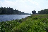
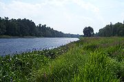
The Grasse River or Grass River (per 1905 decision of the U.S. Board on Geographic Names) is a 73 miles (117.5 km) river
in northern New York
, in the United States
. The river was named after François Joseph Paul de Grasse
, comte de Grasse (1722-1788), a French admiral who assisted American forces during the Battle of Yorktown in the Revolutionary War.
The river mainly flows northeast from the foothills of the Adirondack Mountains
into the St. Lawrence Valley, making up what is known as the greater St. Lawrence River Drainage Basin along with other tributaries such as the Oswegatchie
and Raquette River
.
towns of Russell
, Clare
and Clifton
. Two main branches of streams and ponds, known as the Northern Branch and Southern Branch, lay claim as the ultimate source. The southern branch is the dominant flow of the river, feeding off Moosehead Pond and Little Moosehead Pond, and is located near the hamlet of Degrasse. The weaker northern branch is fed from smaller ponds such as Clear Pond, Bullhead Pond and Horseshoe Pond near the hamlet of Russell, and runs through the Grasse River Wild Forest Reserve. The two branches meet in the town of Russell and form the main branch of the river which slowly grows along its northeasterly track.
This area of New York was first explored in the 1790s as part of the Macomb's Purchase
, in which Alexander Macomb, a wealthy Revolutionary-Era
American merchant purchased 3.6 million acres (15,000 km²) from New York State at 12 cents an acre. This area was divided into counties and townships which were established between 1800 to 1815. The area thrived on thick pine forests, stone quarries
and the mining of various ore
s. On the St. Lawrence Valley floor, the pine forests were razed and the land used for agriculture, and later for industry.
The Grasse River makes it way through many small hamlets and two major towns, Massena
and Canton
. From the town of Russell where its two source branches meet, the river makes it way down into the village of Canton
flowing mostly north away from the Adirondack foothills. It flows past the hamlets of Morley
and Bucks Bridge into the town of Madrid
. The first of two major dams appears just several yards west of New York State Route 345
. Just south of the dam is the Madrid Municipal Park which hosts several large events during the summer season. The Madrid Country Club is located upriver from the park on the northern bank. From this point the river flows northwards to the hamlet of Chase Mills near Coles Creek State Park
on the St. Lawrence River.
From Chase Mills, the river begins its northeasterly path into the town of Louisville
passing through a series of small rapids or waterfalls, depending on the amount of water flowing. The river then flows into the township and village of Massena
, passing by the Massena Rod & Gun Club on the northern bank, in the town of Louisville.
The Grasse River defines the northern edge of Massena's downtown district. At the southern end of the village, the Raquette River was the location of the Massena Health Spa and Health Spring. Located several yards east of the downtown bridge on the Grasse River is the second remaining major dam of the river, known as the Downtown Dam or "weir
", standing only 3–4 feet (1 m) tall. In the late 1990s, the mid-section of the weir was breached and now lies several yards away from the dam.
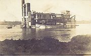
The river continues to cut through the village of Massena to the eastern borders where the old Massena Power Canal connects with the river. This canal was constructed by the Pittsburgh Reduction Company (now Alcoa) in the 1900s. The canal connects the Grasse River with the St. Lawrence River and was used to supply a hydropower dam. The dam was one of the first 10 hydro-dams built in the United States, operating until 1956 when the St. Lawrence River was flooded for the St. Lawrence Seaway Project. The St. Lawrence River end of the canal is blocked off by a massive wall, known as the Massena Intake (the village water supply is also drawn in through this wall). On the Grasse River end, the cement and brick structure of the old powerhouse remains, without any equipment inside the original buildings.
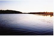
The river from the old powerhouse onwards is calm and level to its mouth in the St. Lawrence River. This section of the river is the only section that can be traversed by motor/power boats, but activity is light as Lake St. Lawrence is the draw for boating in the area (which is behind a pair of shipping locks and two dams if one were trying to travel from the Grasse to the lake). This was only possible during the construction of the old powerhouse, as the river was dredged to 15 feet (4.6 m) along its course to the St. Lawrence. At the mouth of the Grasse River is Snell Lock, part of the St. Lawrence Seaway Shipping System. Several hundred yards upriver from the mouth of the Grasse is a docking area which contains a large floating crane with replacement doors for the locks, and the tugboat Robinson Bay, which is used for icebreaking in the spring.
contamination in the last several miles of the Grasse, the most significant being located near the old powerhouse and at a drainage outlet on the river for the Alcoa plant located north. Alcoa has spent years cleaning this section of river. In an early attempt at cleanup, the company "capped" the river bottom so that the chemicals could not be released. This plan failed due to the weir break in the village of Massena and resulting ice flows. Before its breach, this weir had kept ice upriver longer, allowing it to melt. Since it was breached, larger pieces of ice now flow down this section of river and have breached the river bottom cap. It has also caused major erosion of the shoreline along this section of river, due to the ice gouging it out during the spring ice flows.
, but those plans have met some opposition from local residents. Other ideas have included repairing and/or rebuilding the downtown weir in Massena, but many problems have cropped up, including that the weir is privately owned (by a deed that gives ownership over that section of river down to the bedrock). The most recent idea, proposed by the Massena Electric Company, calls for a small one-turbine hydroelectric dam to be constructed about a half-mile downriver from the old weir.
River
A river is a natural watercourse, usually freshwater, flowing towards an ocean, a lake, a sea, or another river. In a few cases, a river simply flows into the ground or dries up completely before reaching another body of water. Small rivers may also be called by several other names, including...
in northern New York
New York
New York is a state in the Northeastern region of the United States. It is the nation's third most populous state. New York is bordered by New Jersey and Pennsylvania to the south, and by Connecticut, Massachusetts and Vermont to the east...
, in the United States
United States
The United States of America is a federal constitutional republic comprising fifty states and a federal district...
. The river was named after François Joseph Paul de Grasse
François Joseph Paul de Grasse
Lieutenant Général des Armées Navales François-Joseph Paul, marquis de Grasse Tilly, comte de Grasse was a French admiral. He is best known for his command of the French fleet at the Battle of the Chesapeake, which led directly to the British surrender at Yorktown...
, comte de Grasse (1722-1788), a French admiral who assisted American forces during the Battle of Yorktown in the Revolutionary War.
The river mainly flows northeast from the foothills of the Adirondack Mountains
Adirondack Mountains
The Adirondack Mountains are a mountain range located in the northeastern part of New York, that runs through Clinton, Essex, Franklin, Fulton, Hamilton, Herkimer, Lewis, Saint Lawrence, Saratoga, Warren, and Washington counties....
into the St. Lawrence Valley, making up what is known as the greater St. Lawrence River Drainage Basin along with other tributaries such as the Oswegatchie
Oswegatchie River
The Oswegatchie River is a river in northern New York that flows north from the Adirondack Mountains to the Saint Lawrence River at the city of Ogdensburg. The river mouth was the site of a Jesuit mission, Fort de La Présentation, founded in 1749. Also a fur trading post, the village had 3,000...
and Raquette River
Raquette River
The Raquette River, sometimes spelled Racquette, originates at Raquette Lake in the Adirondack Mountains in New York. long, it is the third longest river entirely in the state of New York....
.
The source
The river is created by a series of small ponds, lakes and streams located in the northern New YorkNorth Country, New York
The North Country is a region of the U.S. state of New York that encompasses the state's extreme northern frontier, bordering Lake Ontario on the west, the Saint Lawrence River and the Canadian provinces of Ontario and Quebec on the north and northwest, and Lake Champlain and Vermont on the east...
towns of Russell
Russell, New York
Russell is a town in St. Lawrence County, New York, United States. The population was 1,801 at the 2000 census. The town is named after Russell Attwater, the pioneer land owner....
, Clare
Clare, New York
Clare is a town in St. Lawrence County, New York, United States. The population was 112 at the 2000 census.The Town of Clare is in the south-central part of the county and is south of the Village of Canton, the county seat.-History:...
and Clifton
Clifton, New York
Clifton is a town in St. Lawrence County, New York, United States. The population was 791 at the 2000 census. The town takes its name from a mining company.The Town of Clifton is in the south part of the county, within the Adirondack Park....
. Two main branches of streams and ponds, known as the Northern Branch and Southern Branch, lay claim as the ultimate source. The southern branch is the dominant flow of the river, feeding off Moosehead Pond and Little Moosehead Pond, and is located near the hamlet of Degrasse. The weaker northern branch is fed from smaller ponds such as Clear Pond, Bullhead Pond and Horseshoe Pond near the hamlet of Russell, and runs through the Grasse River Wild Forest Reserve. The two branches meet in the town of Russell and form the main branch of the river which slowly grows along its northeasterly track.
This area of New York was first explored in the 1790s as part of the Macomb's Purchase
Macomb's Purchase
Macomb's Purchase is a large historical area of northern New York, USA purchased from the state in 1791 by Alexander Macomb, who had become rich as a merchant in the American Revolution.-History and geography:...
, in which Alexander Macomb, a wealthy Revolutionary-Era
American Revolution
The American Revolution was the political upheaval during the last half of the 18th century in which thirteen colonies in North America joined together to break free from the British Empire, combining to become the United States of America...
American merchant purchased 3.6 million acres (15,000 km²) from New York State at 12 cents an acre. This area was divided into counties and townships which were established between 1800 to 1815. The area thrived on thick pine forests, stone quarries
Quarry
A quarry is a type of open-pit mine from which rock or minerals are extracted. Quarries are generally used for extracting building materials, such as dimension stone, construction aggregate, riprap, sand, and gravel. They are often collocated with concrete and asphalt plants due to the requirement...
and the mining of various ore
Ore
An ore is a type of rock that contains minerals with important elements including metals. The ores are extracted through mining; these are then refined to extract the valuable element....
s. On the St. Lawrence Valley floor, the pine forests were razed and the land used for agriculture, and later for industry.
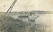
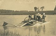
The course
The Grasse River, along with the other tributaries to the St. Lawrence River, served as a water power source for several mills in the towns and hamlets along its course. Virtually none of these mills have survived, but stone foundations, burned out furnaces and other ancient structures can be located along its banks. Several old world dams exist along the path of the Grasse River, while its so called "twin" sister river, the Raquette, contains a series of old and new age hydropower dams.The Grasse River makes it way through many small hamlets and two major towns, Massena
Massena (village), New York
Massena is a village in St. Lawrence County, New York, United States. The population was 13,589 at the 2000 census. The village is named after Andre Massena, one of Napoleon's generals....
and Canton
Canton (town), New York
Canton is a town in St. Lawrence County, New York, USA. The population was 10,334 at the 2000 census. The town contains two villages: one also named Canton, the other named Rensselaer Falls. Canton is located near the center of the county. The town is named after Canton in China. Canton is the...
. From the town of Russell where its two source branches meet, the river makes it way down into the village of Canton
Canton (village), New York
Canton is a village in St. Lawrence County, New York, United States. The village is centrally located in both the town of Canton and the county of St. Lawrence. The population was 5,882 at the 2000 census. It is the county seat of St. Lawrence County...
flowing mostly north away from the Adirondack foothills. It flows past the hamlets of Morley
Morley, New York
-Geography:Morley is on the Grasse River, downstream from the Village of Canton, where the river goes through some rapids. Today, Morley is at the junction of St. Lawrence County Routes 14 and 27.-History:...
and Bucks Bridge into the town of Madrid
Madrid, New York
Madrid is a town in St. Lawrence County, New York, United States. The population was 1,828 at the 2000 census. The town is named after Madrid in Spain.The Town of Madrid is in the northern part of the county, north of Canton....
. The first of two major dams appears just several yards west of New York State Route 345
New York State Route 345
New York State Route 345 is a state highway located entirely within St. Lawrence County in the North Country of New York in the United States. It is a north–south route connecting the towns of Waddington and Potsdam by way of the town of Madrid. The southern terminus of NY 345 is at an...
. Just south of the dam is the Madrid Municipal Park which hosts several large events during the summer season. The Madrid Country Club is located upriver from the park on the northern bank. From this point the river flows northwards to the hamlet of Chase Mills near Coles Creek State Park
Coles Creek State Park
Coles Creek State Park is located on the St. Lawrence River on the west bank of Coles Creek. This state park is in the Town of Waddington in St...
on the St. Lawrence River.
From Chase Mills, the river begins its northeasterly path into the town of Louisville
Louisville, New York
Louisville is a town in St. Lawrence County, New York, United States. The population was 3,195 at the 2000 census. The town is reportedly named after a French king, but it is pronounced as "Lewis-ville."...
passing through a series of small rapids or waterfalls, depending on the amount of water flowing. The river then flows into the township and village of Massena
Massena (village), New York
Massena is a village in St. Lawrence County, New York, United States. The population was 13,589 at the 2000 census. The village is named after Andre Massena, one of Napoleon's generals....
, passing by the Massena Rod & Gun Club on the northern bank, in the town of Louisville.
The Grasse River defines the northern edge of Massena's downtown district. At the southern end of the village, the Raquette River was the location of the Massena Health Spa and Health Spring. Located several yards east of the downtown bridge on the Grasse River is the second remaining major dam of the river, known as the Downtown Dam or "weir
Weir
A weir is a small overflow dam used to alter the flow characteristics of a river or stream. In most cases weirs take the form of a barrier across the river that causes water to pool behind the structure , but allows water to flow over the top...
", standing only 3–4 feet (1 m) tall. In the late 1990s, the mid-section of the weir was breached and now lies several yards away from the dam.
The river continues to cut through the village of Massena to the eastern borders where the old Massena Power Canal connects with the river. This canal was constructed by the Pittsburgh Reduction Company (now Alcoa) in the 1900s. The canal connects the Grasse River with the St. Lawrence River and was used to supply a hydropower dam. The dam was one of the first 10 hydro-dams built in the United States, operating until 1956 when the St. Lawrence River was flooded for the St. Lawrence Seaway Project. The St. Lawrence River end of the canal is blocked off by a massive wall, known as the Massena Intake (the village water supply is also drawn in through this wall). On the Grasse River end, the cement and brick structure of the old powerhouse remains, without any equipment inside the original buildings.
The river from the old powerhouse onwards is calm and level to its mouth in the St. Lawrence River. This section of the river is the only section that can be traversed by motor/power boats, but activity is light as Lake St. Lawrence is the draw for boating in the area (which is behind a pair of shipping locks and two dams if one were trying to travel from the Grasse to the lake). This was only possible during the construction of the old powerhouse, as the river was dredged to 15 feet (4.6 m) along its course to the St. Lawrence. At the mouth of the Grasse River is Snell Lock, part of the St. Lawrence Seaway Shipping System. Several hundred yards upriver from the mouth of the Grasse is a docking area which contains a large floating crane with replacement doors for the locks, and the tugboat Robinson Bay, which is used for icebreaking in the spring.
Pollution and environmental degradation
There are high levels of PCBPolychlorinated biphenyl
Polychlorinated biphenyls are a class of organic compounds with 2 to 10 chlorine atoms attached to biphenyl, which is a molecule composed of two benzene rings. The chemical formula for PCBs is C12H10-xClx...
contamination in the last several miles of the Grasse, the most significant being located near the old powerhouse and at a drainage outlet on the river for the Alcoa plant located north. Alcoa has spent years cleaning this section of river. In an early attempt at cleanup, the company "capped" the river bottom so that the chemicals could not be released. This plan failed due to the weir break in the village of Massena and resulting ice flows. Before its breach, this weir had kept ice upriver longer, allowing it to melt. Since it was breached, larger pieces of ice now flow down this section of river and have breached the river bottom cap. It has also caused major erosion of the shoreline along this section of river, due to the ice gouging it out during the spring ice flows.
Cleanup efforts
In 2005, a company was hired by ALCOA to remove the chemicals from the riverbed near what is known as "Outfall One", one of the factory's water drainages just downriver from the powerhouse. The river bottom was removed and piped into machines where it was cleaned and deposited in a private landfill on ALCOA's property. ALCOA is also working on plans to prevent large chunks of ice from moving down this section of river. Early plans called for large cement barriers to be built in the town of LouisvilleLouisville, New York
Louisville is a town in St. Lawrence County, New York, United States. The population was 3,195 at the 2000 census. The town is reportedly named after a French king, but it is pronounced as "Lewis-ville."...
, but those plans have met some opposition from local residents. Other ideas have included repairing and/or rebuilding the downtown weir in Massena, but many problems have cropped up, including that the weir is privately owned (by a deed that gives ownership over that section of river down to the bedrock). The most recent idea, proposed by the Massena Electric Company, calls for a small one-turbine hydroelectric dam to be constructed about a half-mile downriver from the old weir.