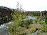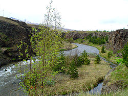
Glerá
Encyclopedia

Iceland
Iceland , described as the Republic of Iceland, is a Nordic and European island country in the North Atlantic Ocean, on the Mid-Atlantic Ridge. Iceland also refers to the main island of the country, which contains almost all the population and almost all the land area. The country has a population...
. It originates from glacier
Glacier
A glacier is a large persistent body of ice that forms where the accumulation of snow exceeds its ablation over many years, often centuries. At least 0.1 km² in area and 50 m thick, but often much larger, a glacier slowly deforms and flows due to stresses induced by its weight...
s in the mountains of Tröllaskagi
Tröllaskagi
Tröllaskagi is a peninsula in northern Iceland between the fjords of Eyjafjörður and Skagafjörður. The peninsula is mountainous with several peaks reaching over 1000 meters above sea level, the tallest is Kerling...
peninsula and also draws water from some fresh water springs on its way down Glerá Valley. It runs through the town of Akureyri
Akureyri
Akureyri is a town in northern Iceland. It is Iceland's second largest urban area and fourth largest municipality ....
before it flows into the sea in Eyjafjörður
Eyjafjörður
Eyjafjörður is the longest fjord in central northern Iceland. It is located in the second most populous region of Iceland.-Physical geography:...
. The river formed the sandbank of Oddeyri where it enters the sea. The river was important in the dawn of the industrial age
Industrial Age
Industrial Age may refer to:*Industrialisation*The Industrial Revolution...
in Akureyri when it was dam
Dam
A dam is a barrier that impounds water or underground streams. Dams generally serve the primary purpose of retaining water, while other structures such as floodgates or levees are used to manage or prevent water flow into specific land regions. Hydropower and pumped-storage hydroelectricity are...
med and used to produce electricity
Electricity
Electricity is a general term encompassing a variety of phenomena resulting from the presence and flow of electric charge. These include many easily recognizable phenomena, such as lightning, static electricity, and the flow of electrical current in an electrical wire...
in the 20th century. The original power station has been demolished now but the dam remains. A new power station has been built to commemorate 100 years of hydroelectric power in Iceland. This 290 kW (rated capacity) power station was opened on August 27th 2005.
The river used to separate Akureyri proper from Glerá Village which was the settlement north of Glerá but it merged with the township of Akureyri in early 20th century. Today the part of Akureyri that is north of Glerá is called Glerárhverfi (Glerá Borough) or Þorpið (The Village) and more than 7000 of the town's 17000 residents live there.

