

Gisborne Region
Encyclopedia
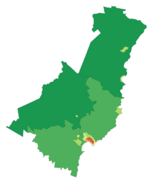
The Gisborne Region is an area of northeastern New Zealand
governed by the Gisborne District Council, a unitary authority
. Its largest settlement, the city also named Gisborne
, is located at the northern end of Poverty Bay
on the east coast.
Gisborne is named for an early Colonial Secretary
William Gisborne
. The council is located in the city of Gisborne.
and is also referred to as the East Cape
or East Coast or Eastland region. It is a sparsely inhabited and isolated region, with small settlements mainly clinging to small bays along the eastern shore including Tokomaru Bay
and Tolaga Bay
. The population of the region is with almost three quarters of those living in the city of Gisborne. No other settlement has a population of over 1000. The largest other settlements are the towns of Tolaga Bay and Ruatoria
, each with populations of over 800 in 2001.
Inland, the land is rough, predominantly forested, hill country. Te Urewera National Park
is located in the west of the region, and the Kaingaroa Forest
is located further west of that. A spine of rough ridges dominates the centre of the region, culminating in the impressive bulk of the 1620 metre Mount Hikurangi
in the region's northeast. This mountain is the fifth highest mountain in the North Island, and the highest that is not a volcano. Regarded as sacred by the Māori, there is some justification to the claims that this is the first mountain to see the sun in summer.
The region's population has higher than the national average proportion of Māori - over 50% in some areas - and still maintains strong ties to both Māori tradition and the iwi
and marae
structure. The predominant iwi in the region are Ngāti Porou
, Rongowhakaata, Ngai Tamanuhiri, Te Aitanga a Mahaki.
At 8.55pm (NZDT) on 20 December 2007, the Gisborne region was hit by an earthquake of Richter Magnitude
6.8, centred in the Hikurangi Trench, 50 km southeast of Gisborne at a depth of 40 km. Intensities
of 7 - 8 were experienced, with three buildings substantially collapsed in the CBD and others experiencing some structural damage. One death was reported (a heart attack of an elderly woman, sustained during the quake) plus minor injuries.
New Zealand
New Zealand is an island country in the south-western Pacific Ocean comprising two main landmasses and numerous smaller islands. The country is situated some east of Australia across the Tasman Sea, and roughly south of the Pacific island nations of New Caledonia, Fiji, and Tonga...
governed by the Gisborne District Council, a unitary authority
Unitary authority
A unitary authority is a type of local authority that has a single tier and is responsible for all local government functions within its area or performs additional functions which elsewhere in the relevant country are usually performed by national government or a higher level of sub-national...
. Its largest settlement, the city also named Gisborne
Gisborne, New Zealand
-Economy:The harbour was host to many ships in the past and had developed as a river port to provide a more secure location for shipping compared with the open roadstead of Poverty Bay which can be exposed to southerly swells. A meat works was sited beside the harbour and meat and wool was shipped...
, is located at the northern end of Poverty Bay
Poverty Bay
Poverty Bay is the largest of several small bays on the east coast of New Zealand's North Island to the north of Hawkes Bay. It stretches for 10 kilometres from Young Nick's Head in the southwest to Tuaheni Point in the northeast. The city of Gisborne is located on the northern shore of the bay...
on the east coast.
Gisborne is named for an early Colonial Secretary
Colonial Secretary (New Zealand)
The Colonial Secretary of New Zealand was an office established in 1840 and abolished in 1907. The position should not be confused with the Colonial Secretary of the former Colonial Office of the United Kingdom....
William Gisborne
William Gisborne
William Gisborne was Colonial Secretary of New Zealand 1869–72 and Minister of Public Works 1870–71. The city of Gisborne is named after him.He was the third son of Thomas John Gisborne of Holme Hall, near Bakewell, Derbyshire...
. The council is located in the city of Gisborne.
Geography
The region is located in the northeastern corner of the North IslandNorth Island
The North Island is one of the two main islands of New Zealand, separated from the much less populous South Island by Cook Strait. The island is in area, making it the world's 14th-largest island...
and is also referred to as the East Cape
East Cape
East Cape is the easternmost point of the main islands of New Zealand. It is located to the north of Gisborne in the northeast of the North Island....
or East Coast or Eastland region. It is a sparsely inhabited and isolated region, with small settlements mainly clinging to small bays along the eastern shore including Tokomaru Bay
Tokomaru Bay
Tokomaru Bay is a small, idyllic beachside community located on the isolated East Coast of New Zealand’s North Island. It is 91 km north of Gisborne, on State Highway 35, and close to Mount Hikurangi. The district was originally known as Toka-a-Namu, which refers to the abundance of sandflies...
and Tolaga Bay
Tolaga Bay
Tolaga Bay is both a bay and small town on the East Coast of New Zealand's North Island located 45 kilometres northeast of Gisborne and 30 kilometres south of Tokomaru Bay.It was named Tolaga Bay by Lt...
. The population of the region is with almost three quarters of those living in the city of Gisborne. No other settlement has a population of over 1000. The largest other settlements are the towns of Tolaga Bay and Ruatoria
Ruatoria
The town of Ruatoria is located in the East Coast region of New Zealand's North Island. It is the second largest centre of population in the sparsely populated region, yet has a population of only 900 .- Geography :...
, each with populations of over 800 in 2001.
Inland, the land is rough, predominantly forested, hill country. Te Urewera National Park
Te Urewera National Park
Te Urewera National Park is one of fourteen national parks within New Zealand and is the largest of the four in the North Island. Covering an area of approximately 2,127 km², it is in the north east of the Hawke's Bay region of the North Island....
is located in the west of the region, and the Kaingaroa Forest
Kaingaroa Forest
Kaingaroa Forest is the largest forest in the North Island of New Zealand, and the largest plantation in the southern hemisphere.The forest covers 2900 km² in the inland East Cape and Bay of Plenty regions, and stretches south past the east coast of Lake Taupo...
is located further west of that. A spine of rough ridges dominates the centre of the region, culminating in the impressive bulk of the 1620 metre Mount Hikurangi
Mount Hikurangi, Gisborne
Mount Hikurangi is a 1754 metre peak in the northeastern corner of New Zealand's North Island, southwest of East Cape...
in the region's northeast. This mountain is the fifth highest mountain in the North Island, and the highest that is not a volcano. Regarded as sacred by the Māori, there is some justification to the claims that this is the first mountain to see the sun in summer.
The region's population has higher than the national average proportion of Māori - over 50% in some areas - and still maintains strong ties to both Māori tradition and the iwi
Iwi
In New Zealand society, iwi form the largest everyday social units in Māori culture. The word iwi means "'peoples' or 'nations'. In "the work of European writers which treat iwi and hapū as parts of a hierarchical structure", it has been used to mean "tribe" , or confederation of tribes,...
and marae
Marae
A marae malae , malae , is a communal or sacred place which serves religious and social purposes in Polynesian societies...
structure. The predominant iwi in the region are Ngāti Porou
Ngati Porou
Ngāti Porou is a Māori iwi traditionally located in the East Cape and Gisborne regions of the North Island of New Zealand. Ngāti Porou has the second-largest affiliation of any iwi in New Zealand, with 71,910 registered members in 2006...
, Rongowhakaata, Ngai Tamanuhiri, Te Aitanga a Mahaki.
Government
The district council includes a mayor, 14 elected councillors, an appointed chief executive officer (CEO), 4 department managers and approximately 250 staff.Economy
The sub-national GDP of the Gisborne region was estimated at US$1.031 billion in 2003, 1% of New Zealand's national GDP.Climate
The Māori name for the Gisborne region is Tai Rāwhiti - coast of the shining sun. The region is sheltered by high country to the west and has a dry, sunny climate. It has a yearly average of 2,200 sunshine hours. The annual rainfall varies from about 1000mm near the coast to over 2500mm in higher inland country.2007 earthquake
At 8.55pm (NZDT) on 20 December 2007, the Gisborne region was hit by an earthquake of Richter Magnitude
Richter magnitude scale
The expression Richter magnitude scale refers to a number of ways to assign a single number to quantify the energy contained in an earthquake....
6.8, centred in the Hikurangi Trench, 50 km southeast of Gisborne at a depth of 40 km. Intensities
Mercalli intensity scale
The Mercalli intensity scale is a seismic scale used for measuring the intensity of an earthquake. It measures the effects of an earthquake, and is distinct from the moment magnitude M_w usually reported for an earthquake , which is a measure of the energy released...
of 7 - 8 were experienced, with three buildings substantially collapsed in the CBD and others experiencing some structural damage. One death was reported (a heart attack of an elderly woman, sustained during the quake) plus minor injuries.
See also
- 2006 Tonga earthquake2006 Tonga earthquakeThe 2006 Tonga earthquake occurred on 4 May 2006 at 04:26 local time . There were no reports of death or injury. With a strength of 7.9 it was the strongest quake since the 28 March 2005 Sumatra earthquake following from the infamous 2004 Indian Ocean earthquake .-Summary:The United States...
- List of marae in the Gisborne Region
- List of schools in the Gisborne Region