
Georgia State Route 234
Encyclopedia
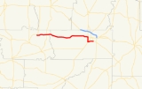
State Route 234 is a west–east state route located in the southwestern part of the U.S. state
of Georgia
. From the route's western terminus at State Route 45
north of Morgan
, the route runs east to U.S. Route 19
/State Route 3
/State Route 133
/State Route 300 in Albany
.
In Downtown Albany was originally known as State Route 91W which Decommissioned in late 1970s,while Georgia State Route 62
took over the place on Slappey Blvd near Albany Technical College.However in 2007 when State Route 62 was Decommissioned east of S.R. 234. when State Route 62 is now Truncated to this Route.
U.S. state
A U.S. state is any one of the 50 federated states of the United States of America that share sovereignty with the federal government. Because of this shared sovereignty, an American is a citizen both of the federal entity and of his or her state of domicile. Four states use the official title of...
of Georgia
Georgia (U.S. state)
Georgia is a state located in the southeastern United States. It was established in 1732, the last of the original Thirteen Colonies. The state is named after King George II of Great Britain. Georgia was the fourth state to ratify the United States Constitution, on January 2, 1788...
. From the route's western terminus at State Route 45
Georgia State Route 45
State Route 45 is a north–south state route located in the southwestern part of the U.S. state of Georgia. The route travels from U.S. Route 84/State Route 38 east of Donalsonville north to U.S. Route 280/State Route 27 in Plains.-Route description:...
north of Morgan
Morgan, Georgia
Morgan is a city in Calhoun County, Georgia, United States. The population was 1,464 at the 2000 census. The city is the county seat of Calhoun County.-Geography:Morgan is located at ....
, the route runs east to U.S. Route 19
U.S. Route 19
U.S. Route 19 is a north–south U.S. Highway. Despite encroaching Interstate Highways, the route has remained a long-haul route, connecting the Gulf of Mexico with Lake Erie....
/State Route 3
Georgia State Route 3
State Route 3 runs in a generally north–south orientation from Georgia's northern border to its southern border. Its northern terminus is at the Tennessee state line just southeast of Chattanooga , and its southern terminus is at the Florida state line about twelve miles south-southeast of...
/State Route 133
Georgia State Route 133
State Route 133 is a north–south state highway in southwestern Georgia. In fact, the actual path taken is more southeast to northwest. The route begins in Valdosta, GA on a northwesterly jaunt through Lowndes County and Brooks County before reaching Moultrie, GA. From here, the route heads...
/State Route 300 in Albany
Albany, Georgia
Albany is a city in and the county seat of Dougherty County, Georgia, United States, in the southwestern part of the state. It is the principal city of the Albany, Georgia metropolitan area and the southwest part of the state. The population was 77,434 at the 2010 U.S. Census, making it the...
.
In Downtown Albany was originally known as State Route 91W which Decommissioned in late 1970s,while Georgia State Route 62
Georgia State Route 62
Georgia State Route 62 is a state route in southwest Georgia that runs from the Georgia-Alabama line near Hilton to State Route 234 in Albany.- Routing :...
took over the place on Slappey Blvd near Albany Technical College.However in 2007 when State Route 62 was Decommissioned east of S.R. 234. when State Route 62 is now Truncated to this Route.