
Fulton County, Ohio
Encyclopedia
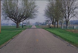
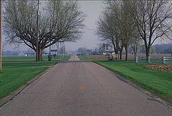
Fulton County is a county located in the U.S. state
of Ohio
. As of 2010, the population was 42,698. http://quickfacts.census.gov/qfd/states/39/39051.html Its county seat
is Wauseon
. Fulton County is named for Robert Fulton
, inventor of the steamboat.
Fulton County is part of the Toledo
Metropolitan Statistical Area
.
, the county has a total area of 407 square miles (1,054.1 km²), of which 0.13% is water.
of 2000, there were 42,084 people, 15,480 households, and 11,687 families residing in the county. The population density
was 104 people per square mile (40/km²). There were 16,232 housing units at an average density of 40 per square mile (15/km²). The racial makeup of the county was 95.65% White
, 0.24% Black
or African American
, 0.26% Native American
, 0.42% Asian
, 0.04% Pacific Islander
, 2.31% from other races
, and 1.08% from two or more races. 5.76% of the population were Hispanic
or Latino
of any race.
 There were 15,480 households out of which 37.10% had children under the age of 18 living with them, 63.20% were married couples
living together, 8.20% had a female householder with no husband present, and 24.50% were non-families. 21.10% of all households were made up of individuals and 9.40% had someone living alone who was 65 years of age or older. The average household size was 2.69 and the average family size was 3.13.
In the county the population was spread out with 28.30% under the age of 18, 7.70% from 18 to 24, 28.70% from 25 to 44, 22.60% from 45 to 64, and 12.70% who were 65 years of age or older. The median age was 36 years. For every 100 females there were 95.60 males. For every 100 females age 18 and over, there were 93.30 males.
The median income for a household in the county was $44,074, and the median income for a family was $50,952. Males had a median income of $36,180 versus $25,137 for females. The per capita income
for the county was $18,999. About 4.00% of families and 5.40% of the population were below the poverty line, including 6.10% of those under age 18 and 4.60% of those age 65 or over.
U.S. state
A U.S. state is any one of the 50 federated states of the United States of America that share sovereignty with the federal government. Because of this shared sovereignty, an American is a citizen both of the federal entity and of his or her state of domicile. Four states use the official title of...
of Ohio
Ohio
Ohio is a Midwestern state in the United States. The 34th largest state by area in the U.S.,it is the 7th‑most populous with over 11.5 million residents, containing several major American cities and seven metropolitan areas with populations of 500,000 or more.The state's capital is Columbus...
. As of 2010, the population was 42,698. http://quickfacts.census.gov/qfd/states/39/39051.html Its county seat
County seat
A county seat is an administrative center, or seat of government, for a county or civil parish. The term is primarily used in the United States....
is Wauseon
Wauseon, Ohio
As of the census of 2000, there were 7,091 people, 2,706 households, and 1,875 families residing in the city. The population density was 1,437.6 people per square mile . There were 2,851 housing units at an average density of 578.0 per square mile...
. Fulton County is named for Robert Fulton
Robert Fulton
Robert Fulton was an American engineer and inventor who is widely credited with developing the first commercially successful steamboat...
, inventor of the steamboat.
Fulton County is part of the Toledo
Toledo, Ohio
Toledo is the fourth most populous city in the U.S. state of Ohio and is the county seat of Lucas County. Toledo is in northwest Ohio, on the western end of Lake Erie, and borders the State of Michigan...
Metropolitan Statistical Area
Toledo metropolitan area
The Toledo Metropolitan Area is a metropolitan area centered in the American city of Toledo, Ohio. As of the 2010 census, the MSA had a population of 651,429.According to the U.S...
.
Geography
According to the U.S. Census BureauUnited States Census Bureau
The United States Census Bureau is the government agency that is responsible for the United States Census. It also gathers other national demographic and economic data...
, the county has a total area of 407 square miles (1,054.1 km²), of which 0.13% is water.
Adjacent counties
- Lenawee County, MichiganLenawee County, Michigan-Demographics:As of the census of 2000, there were 98,890 people, 35,930 households, and 26,049 families residing in the county. The population density was 132 people per square mile . There were 39,769 housing units at an average density of 53 per square mile...
(north) - Lucas CountyLucas County, Ohio----...
(east) - Henry CountyHenry County, OhioHenry County is a county located in the state of Ohio, United States. As of the 2010 census, the population was 28,215. Its county seat is Napoleon and is named for Patrick Henry, the Virginian famous for his "give me liberty or give me death" speech....
(south) - Williams CountyWilliams County, OhioWilliams County is a county located in the U.S. state of Ohio. As of 2010, the population was 37,642. Its county seat is Bryan and is named for David Williams, one of the captors of John André in the American Revolutionary War.-Geography:According to the U.S...
(west) - Hillsdale County, MichiganHillsdale County, Michigan-Demographics:As of the census of 2000, there were 46,527 people, 17,335 households, and 12,550 families residing in the county. The population density was 78 people per square mile . There were 20,189 housing units at an average density of 34 per square mile...
(northwest)
Demographics
As of the censusCensus
A census is the procedure of systematically acquiring and recording information about the members of a given population. It is a regularly occurring and official count of a particular population. The term is used mostly in connection with national population and housing censuses; other common...
of 2000, there were 42,084 people, 15,480 households, and 11,687 families residing in the county. The population density
Population density
Population density is a measurement of population per unit area or unit volume. It is frequently applied to living organisms, and particularly to humans...
was 104 people per square mile (40/km²). There were 16,232 housing units at an average density of 40 per square mile (15/km²). The racial makeup of the county was 95.65% White
Race (United States Census)
Race and ethnicity in the United States Census, as defined by the Federal Office of Management and Budget and the United States Census Bureau, are self-identification data items in which residents choose the race or races with which they most closely identify, and indicate whether or not they are...
, 0.24% Black
Race (United States Census)
Race and ethnicity in the United States Census, as defined by the Federal Office of Management and Budget and the United States Census Bureau, are self-identification data items in which residents choose the race or races with which they most closely identify, and indicate whether or not they are...
or African American
Race (United States Census)
Race and ethnicity in the United States Census, as defined by the Federal Office of Management and Budget and the United States Census Bureau, are self-identification data items in which residents choose the race or races with which they most closely identify, and indicate whether or not they are...
, 0.26% Native American
Race (United States Census)
Race and ethnicity in the United States Census, as defined by the Federal Office of Management and Budget and the United States Census Bureau, are self-identification data items in which residents choose the race or races with which they most closely identify, and indicate whether or not they are...
, 0.42% Asian
Race (United States Census)
Race and ethnicity in the United States Census, as defined by the Federal Office of Management and Budget and the United States Census Bureau, are self-identification data items in which residents choose the race or races with which they most closely identify, and indicate whether or not they are...
, 0.04% Pacific Islander
Race (United States Census)
Race and ethnicity in the United States Census, as defined by the Federal Office of Management and Budget and the United States Census Bureau, are self-identification data items in which residents choose the race or races with which they most closely identify, and indicate whether or not they are...
, 2.31% from other races
Race (United States Census)
Race and ethnicity in the United States Census, as defined by the Federal Office of Management and Budget and the United States Census Bureau, are self-identification data items in which residents choose the race or races with which they most closely identify, and indicate whether or not they are...
, and 1.08% from two or more races. 5.76% of the population were Hispanic
Race (United States Census)
Race and ethnicity in the United States Census, as defined by the Federal Office of Management and Budget and the United States Census Bureau, are self-identification data items in which residents choose the race or races with which they most closely identify, and indicate whether or not they are...
or Latino
Race (United States Census)
Race and ethnicity in the United States Census, as defined by the Federal Office of Management and Budget and the United States Census Bureau, are self-identification data items in which residents choose the race or races with which they most closely identify, and indicate whether or not they are...
of any race.
Marriage
Marriage is a social union or legal contract between people that creates kinship. It is an institution in which interpersonal relationships, usually intimate and sexual, are acknowledged in a variety of ways, depending on the culture or subculture in which it is found...
living together, 8.20% had a female householder with no husband present, and 24.50% were non-families. 21.10% of all households were made up of individuals and 9.40% had someone living alone who was 65 years of age or older. The average household size was 2.69 and the average family size was 3.13.
In the county the population was spread out with 28.30% under the age of 18, 7.70% from 18 to 24, 28.70% from 25 to 44, 22.60% from 45 to 64, and 12.70% who were 65 years of age or older. The median age was 36 years. For every 100 females there were 95.60 males. For every 100 females age 18 and over, there were 93.30 males.
The median income for a household in the county was $44,074, and the median income for a family was $50,952. Males had a median income of $36,180 versus $25,137 for females. The per capita income
Per capita income
Per capita income or income per person is a measure of mean income within an economic aggregate, such as a country or city. It is calculated by taking a measure of all sources of income in the aggregate and dividing it by the total population...
for the county was $18,999. About 4.00% of families and 5.40% of the population were below the poverty line, including 6.10% of those under age 18 and 4.60% of those age 65 or over.
Government
Communities
Villages
|
Fayette, Ohio Fayette is a village in Fulton County, Ohio, United States. The population was 1,340 at the 2000 census.- Geography :Fayette is located at .... Lyons, Ohio Lyons is a village in Fulton County, Ohio, United States. The population was 559 at the 2000 census.-Geography:Lyons is located at .According to the United States Census Bureau, the village has a total area of , all of it land.... |
Metamora, Ohio Metamora is a village in Fulton County, Ohio, United States. The population was 563 at the 2000 census.-Geography:Metamora is located at .... Swanton, Ohio Swanton is a village in Fulton and Lucas counties in the U.S. state of Ohio. The population was 3,690 at the 2010 census.-History:A.D. Baker, a steam engine inventor, ran a machine shop in Swanton from 1901 to 1953.-Geography:... |
Townships
|
Franklin Township, Fulton County, Ohio Franklin Township is one of the twelve townships of Fulton County, Ohio, United States. The 2000 census found 739 people in the township.-Geography:Located in the western part of the county, it borders the following townships:*Gorham Township - north... Fulton Township, Fulton County, Ohio Fulton Township is one of the twelve townships of Fulton County, Ohio, United States. The 2000 census found 3,261 people in the township, 1,618 of whom lived in the unincorporated portions of the township.-Geography:... German Township, Fulton County, Ohio German Township is one of the twelve townships of Fulton County, Ohio, United States. The 2000 census found 6,458 people in the township, 2,168 of whom lived in the unincorporated portions of the township.-Geography:... Gorham Township, Fulton County, Ohio Gorham Township is one of the twelve townships of Fulton County, Ohio, United States. The 2000 census found 2,372 people in the township, 1,032 of whom lived in the unincorporated portions of the township.-Geography:... |
Pike Township, Fulton County, Ohio Pike Township is one of the twelve townships of Fulton County, Ohio, United States. The 2000 census found 1,738 people in the township.-Geography:Located in the central part of the county, it borders the following townships:*Royalton Township - north... Royalton Township, Fulton County, Ohio Royalton Township is one of the twelve townships of Fulton County, Ohio, United States. The 2000 census found 1,502 people in the township, 943 of whom lived in the unincorporated portions of the township.-Geography:... Swan Creek Township, Fulton County, Ohio Swan Creek Township is one of the twelve townships of Fulton County, Ohio, United States. The 2000 census found 8,461 people in the township, 6,306 of whom lived in the unincorporated portions of the township.-Geography:... York Township, Fulton County, Ohio York Township is one of the twelve townships of Fulton County, Ohio, United States. The 2000 census found 4,203 people in the township, 1,788 of whom lived in the unincorporated portions of the township.-Geography:... |
Unincorporated communities
|
Pettisville, Ohio Pettisville is a census-designated place in western Clinton Township, Fulton County, Ohio, United States. Located at the intersection of 19 Road and D Road, its elevation is 755 feet . The 2000 Census estimated that the Pettisville Local School District was home to 2,134 people.-External... |
Tedrow, Ohio Tedrow is an unincorporated community in southwestern Dover Township, Fulton County, Ohio, United States. It lies at the intersection of the east-west County Road J with the north-south County Roads 17-2 and 17-3, 3 miles north and 3½ miles west of the northern edge of the city of Wauseon, the... |