

Fronteira, Minas Gerais
Encyclopedia
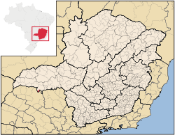
Minas Gerais
Minas Gerais is one of the 26 states of Brazil, of which it is the second most populous, the third richest, and the fourth largest in area. Minas Gerais is the Brazilian state with the largest number of Presidents of Brazil, the current one, Dilma Rousseff, being one of them. The capital is the...
. As of 2007 the population was 13,983 in a total area of 200 km². It became a municipality in 1943.
Location
Fronteira is located at an elevation of 458 meters in the west of the area known as the Triângulo MineiroTriângulo Mineiro
The Triangle Mineiro Portuguese pronunciation: [tɾiɐɡulu minejru] is an officer in the region west of the state of Minas Gerais, Brazil. The area is 93.500 km ² and is limited by the Serra da Canastra and Marcela, east, south of Sao Paulo, Goias in the north and west of the junction of the rivers...
, on the Transbrasiliana highway—Br-153. The Rio Grande River, a tributary of the Paraná River
Paraná River
The Paraná River is a river in south Central South America, running through Brazil, Paraguay and Argentina for some . It is second in length only to the Amazon River among South American rivers. The name Paraná is an abbreviation of the phrase "para rehe onáva", which comes from the Tupi language...
forms its southern boundary. The Marimbondo Dam
Marimbondo Dam
The Marimbondo Dam is an embankment dam on the Grande River near Fronteira in Minas Gerais, Brazil. The dam serves an associated hydroelectric power plant with a 1,440 MW installed capacity.-Background:...
and hydroelectric station is on the southern boundary of the municipal area. It belongs to the statistical microregion of Frutal
Frutal
Frutal is a municipality in the west of the Brazilian state of Minas Gerais. The population, measured in 2010 by the IBGE, is of 53,468 inhabitants. The city has an area of 2,427 km²...
. Neighboring municipalities are:
- North: FrutalFrutalFrutal is a municipality in the west of the Brazilian state of Minas Gerais. The population, measured in 2010 by the IBGE, is of 53,468 inhabitants. The city has an area of 2,427 km²...
- East: GuaraciGuaraciGuaraci is a municipality in the northwestern area of the state of São Paulo in Brazil. The population in 2004 is 9,376 and the area is 640.72 km². The elevation is 481 meters. This place name comes from the Tupi language....
state of São PauloSão PauloSão Paulo is the largest city in Brazil, the largest city in the southern hemisphere and South America, and the world's seventh largest city by population. The metropolis is anchor to the São Paulo metropolitan area, ranked as the second-most populous metropolitan area in the Americas and among... - West: Orindiúva state of São PauloSão PauloSão Paulo is the largest city in Brazil, the largest city in the southern hemisphere and South America, and the world's seventh largest city by population. The metropolis is anchor to the São Paulo metropolitan area, ranked as the second-most populous metropolitan area in the Americas and among...
- South: IcémIcémIcém is a municipality in the northern part of the state of São Paulo in Brazil. It is also known as Princesa do Vale, or "Princess of the Valley." Icem is situated near the important urban centers of .-Transportation:Icém is served by two important highways, the BR-153, and SP-322...
, São Paulo
Distances
- Belo HorizonteBelo HorizonteBelo Horizonte is the capital of and largest city in the state of Minas Gerais, located in the southeastern region of Brazil. It is the third largest metropolitan area in the country...
: 645 km. - FrutalFrutalFrutal is a municipality in the west of the Brazilian state of Minas Gerais. The population, measured in 2010 by the IBGE, is of 53,468 inhabitants. The city has an area of 2,427 km²...
: 44 km. - UberabaUberabaUberaba is a city and municipality in the west of the state of Minas Gerais in Brazil. Its population is 296.000 with an area of 4529.7 km², giving a density of 60.71 people per km². It is located on a plateau at an elevation of 785 meters and is in the Uberaba River floodplain...
: 189 km. - UberlândiaUberlândiaUberlândia is the main town in the Triangle region, west of the state of Minas Gerais, Brazil. With a population of 604,013 inhabitants, according to 2010 estimates, the city is the second largest in the state second only to Belo Horizonte...
: 218 km - São José do Rio PretoSão José do Rio PretoSão José do Rio Preto is a city and municipality in the state of São Paulo, Brazil. Is located at the north/northwest portion of the state, 450 km from the city of São Paulo and 700 km from Brasília....
: 65 km. - São PauloSão PauloSão Paulo is the largest city in Brazil, the largest city in the southern hemisphere and South America, and the world's seventh largest city by population. The metropolis is anchor to the São Paulo metropolitan area, ranked as the second-most populous metropolitan area in the Americas and among...
: 477 km
Economic activities
The most important economic activities are cattle raising, royalties from the hydroelectric station on the Rio Grande, commerce, and agriculture. The GDP in 2005 was R$ 1,035,952, with R$716,164 from industry; R$102,776 from services; and R$18,221 from agriculture. Fronteira is in the top tier of municipalities in the state with regard to economic and social development. As of 2007 there was one banking agency in the town. There was a well-developed retail infrastructure serving the surrounding area of cattle and agricultural lands. In the rural area there were 141 establishments occupying about 1,000 persons. 48 of the farms had tractors, a ratio of one in three. There were 1,889 automobiles in all of the municipality, about one for every 6 inhabitants—a high ratio for Brazil.Fronteira is an important agricultural producer. There were 7,000 head of cattle in 2006, of which 4,000 head were dairy cows. In permanent crops there are 633 ha. planted, while in perennial crops 12,500 ha. were planted.
The crops with a planted area of more than 100 hectares were pineapple, sugarcane, corn, and soybeans.
Health and education
In the health sector there were 07 health clinics and no hospitals. In the educational sector there were 02 primary schools and 01 middle school.- Municipal Human Development IndexHuman Development IndexThe Human Development Index is a composite statistic used to rank countries by level of "human development" and separate "very high human development", "high human development", "medium human development", and "low human development" countries...
: 0.794 (2000) - State ranking: 61 out of 853 municipalities as of 2000
- National ranking: 705 out of 5,138 municipalities as of 2000
- Literacy rate: 89%
- Life expectancy: 74 (average of males and females)
The highest ranking municipality in Minas Gerais in 2000 was Poços de Caldas
Poços de Caldas
Poços de Caldas is a city and municipality in south-western Minas Gerais state, Brazil, in the microregion of the same name. Its estimated population in 2009 was 151,449 inhabitants...
with 0.841, while the lowest was Setubinha
Setubinha
Setubinha is a municipality in the northeast of the Brazilian state of Minas Gerais. As of 2007 the population was 10,834 in a total area of 536 km². The elevation is 729 metres. It is part of the IBGE statistical microregion of Teófilo Otoni...
with 0.568. Nationally the highest was São Caetano do Sul
São Caetano do Sul
São Caetano do Sul is a city in São Paulo state in Brazil, located in the Greater São Paulo Metropolitan Area. It is the city with the highest per capita income in Brazil and it also has the highest Human Development Index .-Geography:São Caetano do Sul is located on a plateau that is part of the...
in São Paulo with 0.919, while the lowest was Setubinha. In more recent statistics (considering 5,507 municipalities) Manari in the state of Pernambuco
Pernambuco
Pernambuco is a state of Brazil, located in the Northeast region of the country. To the north are the states of Paraíba and Ceará, to the west is Piauí, to the south are Alagoas and Bahia, and to the east is the Atlantic Ocean. There are about of beaches, some of the most beautiful in the...
has the lowest rating in the country—0,467—putting it in last place.