
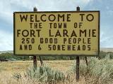
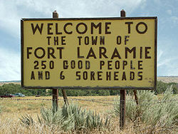
Fort Laramie, Wyoming
Encyclopedia
Wyoming
Wyoming is a state in the mountain region of the Western United States. The western two thirds of the state is covered mostly with the mountain ranges and rangelands in the foothills of the Eastern Rocky Mountains, while the eastern third of the state is high elevation prairie known as the High...
, United States
United States
The United States of America is a federal constitutional republic comprising fifty states and a federal district...
. The population was 243 at the 2000 census. The town is named after historic Fort Laramie, an important stop on the Oregon
Oregon Trail
The Oregon Trail is a historic east-west wagon route that connected the Missouri River to valleys in Oregon and locations in between.After 1840 steam-powered riverboats and steamboats traversing up and down the Ohio, Mississippi and Missouri rivers sped settlement and development in the flat...
, California
California Trail
The California Trail was an emigrant trail of about across the western half of the North American continent from Missouri River towns to what is now the state of California...
and Mormon
Mormon Trail
The Mormon Trail or Mormon Pioneer Trail is the 1,300 mile route that members of The Church of Jesus Christ of Latter-day Saints traveled from 1846 to 1868...
trails as well as a staging point for various military excursions. The fort was located across the North Platte River
North Platte River
The North Platte River is a major tributary of the Platte River and is approximately long counting its many curves, It travels about distance. Its course lies in the U.S...
from the current town, at the mouth of the Laramie River
Laramie River
The Laramie River is a tributary of the North Platte River, approximately long, in the U.S. states of Colorado and Wyoming.It rises in northern Colorado, in the Roosevelt National Forest in the Front Range, in western Larimer County...
.
Geography
Fort Laramie is located at 42°12′48"N 104°31′2"W (42.213233, -104.517123).According to the United States Census Bureau
United States Census Bureau
The United States Census Bureau is the government agency that is responsible for the United States Census. It also gathers other national demographic and economic data...
, the town has a total area of 0.3 square miles (0.7 km²), all of it land.
Demographics
As of the censusCensus
A census is the procedure of systematically acquiring and recording information about the members of a given population. It is a regularly occurring and official count of a particular population. The term is used mostly in connection with national population and housing censuses; other common...
of 2000, there were 243 people, 119 households, and 59 families residing in the town. The population density
Population density
Population density is a measurement of population per unit area or unit volume. It is frequently applied to living organisms, and particularly to humans...
was 916.7 people per square mile (347.5/km²). There were 149 housing units at an average density of 562.1 per square mile (213.1/km²). The racial makeup of the town was 94.65% White, 1.23% Native American, 2.06% from other races
Race (United States Census)
Race and ethnicity in the United States Census, as defined by the Federal Office of Management and Budget and the United States Census Bureau, are self-identification data items in which residents choose the race or races with which they most closely identify, and indicate whether or not they are...
, and 2.06% from two or more races. Hispanic or Latino of any race were 4.53% of the population.
There were 119 households out of which 20.2% had children under the age of 18 living with them, 39.5% were married couples
Marriage
Marriage is a social union or legal contract between people that creates kinship. It is an institution in which interpersonal relationships, usually intimate and sexual, are acknowledged in a variety of ways, depending on the culture or subculture in which it is found...
living together, 6.7% had a female householder with no husband present, and 50.4% were non-families. 42.0% of all households were made up of individuals and 21.0% had someone living alone who was 65 years of age or older. The average household size was 2.04 and the average family size was 2.86.
In the town the population was spread out with 21.8% under the age of 18, 4.5% from 18 to 24, 24.3% from 25 to 44, 25.9% from 45 to 64, and 23.5% who were 65 years of age or older. The median age was 45 years. For every 100 females there were 91.3 males. For every 100 females age 18 and over, there were 84.5 males.
The median income for a household in the town was $22,500, and the median income for a family was $32,917. Males had a median income of $28,929 versus $13,125 for females. The per capita income
Per capita income
Per capita income or income per person is a measure of mean income within an economic aggregate, such as a country or city. It is calculated by taking a measure of all sources of income in the aggregate and dividing it by the total population...
for the town was $13,236. About 18.9% of families and 20.5% of the population were below the poverty line, including 23.3% of those under the age of eighteen and 12.5% of those sixty five or over.
Education
Public education in the town of Fort Laramie is provided by Goshen County School District #1Goshen County School District Number 1
Goshen County School District #1 is a public school district based in Torrington, Wyoming, United States.-Geography:Goshen County School District #1 is the only school district based in Goshen County. It serves most of Goshen County and also extends into a small portion of southeastern Platte County...
.